- The Petals thus far
- Part 6 ~ The Petal of the Rabbit
- Across and Above
- The Place
- Soyensee Skirting
- Into the Infamous Inntal
- The Retrospective
- Hilly Havoc
- The Road Ahead
Last chapter, I declared that I finally wanted to revive my petal project, after having taken a work-necessitated break from it for over a year. Now, I make good on that announcement. However, since it has been quite some time since the last Petal Ride, and some new readers may not be familiar with the concept, let us first have a short recap of...
The Petals thus far
After "finishing" my travels around the world in 2019, I decided to get to know my own home country a bit better. To do so, I initiated a project inspired by the eastern zodiac which would have me do multi-day cycling tours in all 12 cardinal directions around Munich. The first of these "Petal Rides" was the Snake Petal in Jun-2019, taking me to the southeast to the Thalhäusl, an annual board game meeting (see Book III ~ Chapter 8 ~ Project Petal Part 1 ~ To The Thalhäusl).

The second such ride was the Petal of the Tiger, where I visited my Grandmother living quite a bit outside the city in a little village known as Ruprechtsberg. That was on the occasion of All Saint's Day in 2019 (see Book III ~ Chapter 11 ~ Project Petal Part 2 ~ The Ruprechtsberg Ride).

Following a winter break in which the world broke, the next big tour I made was technically not a Petal Ride, but more of a Disk Ride, cycling all around the Munich highway ring on 11-Mar-2020, I covered a total of 127km in an epic 13.25 hour tour that I am not going to beat, ever™. With that, I ended up covering the innermost segments of all twelve petals in one fell swoop... well, maybe with a bit of an offset anyway (see Book III ~ Chapter 13 ~ Corona and the Century Circadian Circuit).

In May-2020, I should proceed to visit a vulpine friend of mine, who conveniently lives at the terminus of the Goat Petal. My tour there should lead me around the Starnberger See and the Ammersee, two of Munich's great lakes (see Book III ~ Chapter 14 ~ Project Petal Part 3 ~ A Verily Vulpine Voyage).

One year after the start of the project, in Jun-2020, there should be a slight paradigm shift to the Petal Rides. Up until now, I always did those to get to some place that I wanted to be, but from here on out, I would do them for the sake of getting out there, seeing the landscape and getting some exercise. Thus, from here on out I would be staying in Airbnbs and also use the "rest days" at the termini for another "short" ride around the area. The first of these new kind of Petal Rides should take me east towards the Lech river valley as part of the Rooster Petal (see Interlude ~ Project Petal Part 4 ~ Lechtal Liveliness).

The last petal before the "big break" was in Aug-2020, when I established my three-day-record of 214km for all the rides of the Boar Petal. I should also almost reach the great river Donau. Almost, but not quite (see Interlude ~ Project Petal Part 5 ~ The Tri-day Two-hundred Tour).

After that, things happened. I got my two cats, Jamie and Toledo. Work got kinda busy too. The Green Shnolz had its next big stage entries that pretty much laid waste to all of 2021... and thus, I didn't get around to do any Petal Rides at all in all of 2021. I did quite a number of day trips in the meantime, but none that did not end up with me back in the Fox Loft at night. However, that ends now, because now it is finally time for...
Part 6 ~ The Petal of the Rabbit
13-Apr-2022 - 15-Apr-2022
Up until now, all of the petals were spaced-out from one another, and formed a nice five-petaled flower pattern around Munich. However, with this ride, I have to break that pattern. Four petals are available that are not immediately between two already covered petals, so I resolve to do one of those. And in an amazing conjuncture of fate that was totally not planned, I should end up making my ride over the Easter holidays this year towards the east to cover the Rabbit Petal. With this being my first multi-day in over one-and-a-half years, I should be quite excited and also a bit anxious as I set out towards the eastern landscape, and rightly so, because even just the trip there should end up taking me...
Across and Above
13-Apr-2022Distance: 75.0km
Ascents: 350m
Duration: 7.75h
6/12🎁︎
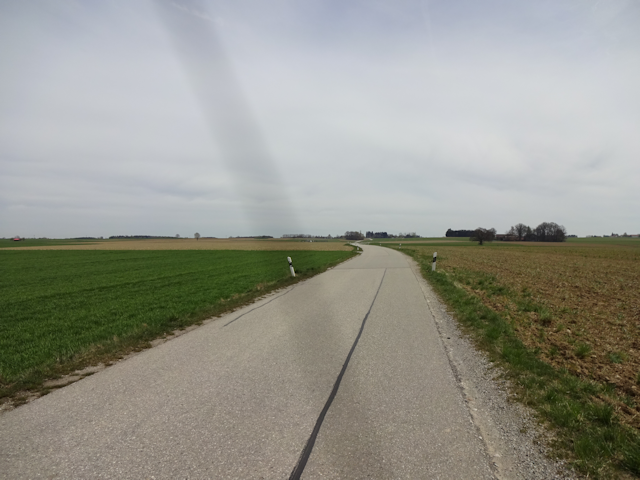
My ultimate destination for this ride is the city of Wasserburg ("Water Castle"). However, that is only my goal for tomorrow. Today, I am only going as far as the town of Soyen, where I've found a nice Airbnb to stay at. To get there, I first have to make my way east out of Munich. I pass north of the Speichersee ("Reservoir Lake"), and then further to the east across the remainder of the Munich gravel plains. After crossing THE BOUNDARY, my progress slows significantly as I have to deal with quite some ups and downs. Simultaneously, my bearing turns more towards southeast, and after a few more hours of that I reach Soyen. Also, along the way I pass through a total of six counties: Munich is a gimme, and then there's Munich County, which is actually a different county than the city of Munich. Afterwards, there's quite a bit of Erding ("Earthing"), and I graze the northern edge of Ebersberg ("Boar Mountain") ever-so-slightly, travelling about 1.5km within it. Following that, I make my way through the southwestern appendage of Mühldorf ("Mill Village") before finally crossing over into Rosenheim ("Rose Home") near the very end.

It is 7:30 by the time I finally get going, which is actually kinda late by my standards. As such, the sun has already risen, and for the next hour or so, my way should lead more or less directly into the sunrise.

As I pass through the park south of the railway yard, I come across an interesting streamlined electric trike going the same way as me.

And just a little bit later, as I make my way along the Frankfurter Ring, another trike of similar build passes me by. Must be trike day today.

Not long after that, I pass the RamBar-ZamBar...

...and soon enough I find myself in that massive belt of green that is the English Garden of Munich. Well, okay, since the trees are not yet in bloom, there's not all that much green just yet, but give it another month and the whole belt will be filled with lush foliage. As an old folk song says, May is typically the month when the trees come into leaf here in Germany.

It is also there that I cross the Isar by means of the Isarsteg Unterföhring ("Isar Footbridge Lower Leading").

With that, I am finally out of the city - after about an hour and a half - and start cycling past the first few fields.

Feeling a bit daring, I decide to make my way through an interesting looking underpass and see if I can take a shortcut that way.

Turns out the answer to that is "Very No". Now, I might have a reputation for being stubborn and forcing my way, but this thicket is clearly to much for my trusty bike Jycily to handle no matter how much Fury I throw at it.

So, I end up going another way, following the Isar Channel to the Speichersee and passing beneath the Highway Circle of Munich at the site of an underpass-channel-bridge of quite interesting design.

After that, I end up on the road running parallel to the northern edge of the Speichersee, though I don't really get to see anything of the lake for now.

The reason for this is a quite extensive BMW test facility, where I really, really, really hope they're only testing electric vehicles in this day and age. The whole thing is over three kilometres long, and although there technically is a path running between the facility and the lake, that path is presently closed because of reasons.

As such, it is not until I reach the causeway dividing the western and eastern basins of the Speichersee that I finally get to see the lake.

However, once I finally get there, I am rewarded with a beautiful sight: Apparently, today the weather is dry enough that I can see all the way to the alps from here.

Now, this is actually the second time I've been to the Speichersee now. The first time was when I cycled along the southern edge on my way to Ruprechtsberg in the Tiger Petal, and it was then that I already crossed the causeway partway. However, by now I do not know anymore just how far in I've crossed it, and since I really do want to connect the two rides here, I end up riding all the way to the other shore across the causeway, and then back again. That's another 2km on the clock.

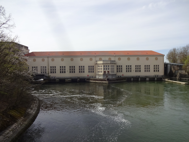
After that, I proceed to cycle along the north shore of the lake all the way to the town of Neufinsing ("New Fin Sing"). This time around, there fortunately is a scenic shoreline path available.

It is in Neufinsing - specifically short after crossing the bridge in front of the hydroelectric power plant, which the Speichersee serves as a reservoir for - that I cross paths with the Tiger Petal again, and thus finally leave the area circumscribed by it. From now on, I am in (for me) unexplored territory.
Unexplored territory is always particularly fun. You never know what you might find. For example, on a farm along the way, I come across a horse bearing a cutie mark. How swell.

And a little bit further on, I come across a quite expertly disguised Geocache at the bank of a stream.

South of Ottenhofen ("Otting Farming"), I come across a curious signpost leading the way to Osterhasenhausen ("Easter Bunny Housing").

Fueled by my natural curiosity, I stop there and try follow the trail it points though for a bit. However, before long, the trail becomes increasingly haphazard and riddled with thorns, so with no clear goal in sight, I eventually turn back and proceed on my way further east.

By now, I have reached aforementioned short segment where I graze the Landkreis Ebersberg. This is also the one segment where I have to cycle along a big Landstraße ("Country Road"). Fortunately, there's not all that many cars on it right now.

I follow that road until I reach the town of Pastetten ("Pasttries")...

...which is also where I sit down to have my lunch on a bench in the relative shade of a wayside cross in a field near the town. Lunch, that is a cream cheese sandwich and a Müsli bar for today.

As a point of curiosity: This particular wayside cross is dedicated to the memory of the Flurbereinigung ("Floor Cleaning" = "Land Consolidation") of 1959-68. Apparently, that was quite a harrowing process, if they built a cross for it, and while the basic premise of land consolidation - namely re-arranging owned land so that fragmented property is re-combined - is valid, it also tends to have a number of averse effects, such as the loss of hedgerows, straightening of brooks, loss of fallow areas, and a general loss of biodiversity. As such, memorials such as these, while not common, still can be found in a few places here and there.

The next town down the road is Reithofen ("Ride Farming")...

...which is slightly unusual in that it only has 3/11 of a Maibaum ("May Pole"). Now, I know of the traditional custom of Maibaumstehlen ("May Pole Stealing"), where neighboring villages try to steal one another's Maibäume before they are erected on the 1st of May, but I haven't heard of anyone stealing half trees. Also, isn't it only just April?

After Reithofen, I realize that I have reached THE BOUNDARY. Now, there might not be any steep hills around just yet, and the road may look flat, but riding my bike, I can clearly feel that the road starts sloping upwards.
The upside of that is that I'm getting great views again. The Alps are still in sight, and if I'm not entirely mistaken, then that might be the Wendelstein ("Coil Stone"), at the foot of which lies the Thalhäusl, to which my very first Petal Ride led me.

It is also on that particular elevation that I come across a quartet of deer grazing peacefully in the middle of a field. quite some distance away from the nearest cover.

After that, I first arrive in Mitterbuch ("Middle Book"), which belongs to the community of Buch am Buchrain ("Book at the Book In")...

...and subsequently have to work my way up to Oberbuch ("Upper Book"), which as the name suggests is quite a few meters above Mitterbuch, making me use the lower gears of Jycily for the first time on this ride.

There, I take a left turn and unexpectedly find myself on the trail of the historic Schlacht von Hohenlinden ("Battle of High Limetrees"), which took place on 3-Dec-1800 during the Napoleonic Wars in this very area. I'm literally cycling through history here! The French forces were coming from the direction of Pastetten, while the allied Bavarian and Austrian forces were trying to hold them off in the area of Maitenbeth ("Maid Bed") and Marsmeier ("Mars Dairy Farmer").

Befittingly of such a historic battleground, the going starts getting just a little bit tougher too, taking me first across a shallow ford.

And then through a forest where it is not only the incline that does become considerable, but also the path that is poorly maintained and littered with broken-off branches and other obstacles. As such, I end up having to get off and push Jycily up the 500m long 10% steep slope.

As you can imagine, that act slows down my progress considerably, and by the time I reach the top, my lunacy-meter has drained considerably.

Immediately afterwards, I realize that I made a very typical mistake when planning my tour: Instead of going with the flow (aka, following the river valleys), this part of my ride takes me perpendicular to the valleys, meaning that just now I get a nice downhill ride to Burgrain ("Castle Into"), but immediately afterwards have to pay the price by cycling up the hill on the other side of the valley. Fortunately, this time around the roads are well-paved, so even though I have to switch to the absolutely lowest gear, I am still able to pedal my way up this steep beast of a slope.

Fortunately, for today it's only those two hills that serve as major slowdown points, and after I reach Buchschachen ("Book Chessing"), the road is mostly level or even sloping downwards. Makes sense, considering that what I've just crossed was the drainage divide between the Isar and the Inn.

Now, I don't know if I am only now noticing this, or if this is a recent development that happened in the last two years, but I do now note that quite an impressive number of farmers seem to have gone solar panel galore on the roofs of their buildings.

The next village I pass through ends up being quite Dull ("Oed")...

...but fortunately it's not Oberöd ("Totally Dull").

Shortly thereafter, I pass through aforementioned historic Maitenbeth, where feral placarding is prohibited in the entire municipal area.

Not only was Maitenbeth one of the central strategic points in the Schlacht von Hohenlinden, it also is located on a hill that makes life miserable for bicyclists to this very day.

As I cycle through the next historic town of Marsmeier at the foot of the hill, I wonder how this area might have looked back when the battle was ongoing.

Here's how that might have played out: At roughly 12:50, Kira Resari broke through the French lines of General Moreau in Oberbuch, leading a commando of one bike. In a daring maneuver, he circumvented the allied Austrian and Bavarian troops under the command of Erzherzog Johann stationed at Isen by cutting directly through the forest to arrive at Burgrain at roughly 13:20. From there, he managed to stay behind the allied Austrian and Bavarian lines and reached Maitenbeth by 14:15, shortly before the French divisions Decaen and Richepanse seized the town. Narrowly avoiding capture, Kira completed his daring breakthrough by heading further east...

...at which point I finally spot a sign pointing to this petal's pivotal place: The city of Wasserburg.

A bit further down the road, I come across an interesting bus stop along the way. You see, for while thinking is strictly forbidden at most bus stops in Germany, at this one, you're explicitly free to think.

By now, I am already getting quite close to today's destination. I pass by the hamlets of Luxstätt ("Lynx Place") and Brandstätt ("Fire Place")...

...and then come past a dummy cyclist at the turnoff to Bräustett ("Brew Place"). The speed limit it proposes is something that I, being a cyclist myself, can fully identify with and support.

After that, I pass through some Wooden Stuff ("Holzkram")...

...before spotting some unusual non-wooden stuff in the vicinity of Rechtmehring ("Right Amassing") arranged in the shape of a modern totem pole or something.

The last village I pass before reaching my destination for today is Brunnthal ("Well Valley")...

...and then I enter the northern outskirts of the Landkreis Rosenheim. Come to think of it, I think this is the only border sign I've seen today. I must have crossed those other borders on smuggling routes or something.

Clearing the top of the last little hill along the way, the Soyensee finally comes into sight...

...and one short downhill ride later, I arrive at the town of Soyen, which is my destination for the day.

As I mentioned before, I have booked an Airbnb in this town, which brings us to...
The Place
Here in Soyen, I am staying at a cottage not far from the Soyensee. It's a building of rustic style yet modern make...

...the owner of which clearly has a good sense of humor.

In there, I get a room in the corner of the house, which is outfitted with floor heating,

One thing that is quite important for my personal taste is that there's a kitchen for me to use...

...and the fact that there's feline company to go around is an added bonus.

If cats ain't your thing, this place got geese too. Not live ones, though.

I've also got a bathroom all to myself. The shower in there is kinda funky though, allowing yourself to get wet from eight sides at once.

The toilet is kinda unusual too, featuring a seat that's tall instead of flat, elevating the seating surface by about 10cm.

Finally, the place features a deck from which you can watch the sun set over the Soyensee.

However, that is then. Now, I still have a supply run to make, and that one should end up with me doing some...
Soyensee Skirting
13-Apr-2022Distance: 5.5km
Ascents: 70m
Duration: 1.0h
Now, before I can rest today, there's still one thing that I need to do, and that is go shopping. And since Soyen seems to be more of a village than a town, it doesn't have its own grocery store. Fortunately, there's one such store a little bit outside the village that I can use, but doing so should end up being another little tour on its own. And since I apparently still seem to have a bit of Lunacy left for today, I decide to extend that trip just a bit to cycle once around the Soyensee.

As I set out again, I soon enough come past a meadow in the centre of Soyen, which is blooming for more biodiversity - at least according to a sign planted there.

Soon enough, I come past a signpost directing me towards the store that I seek, which is called the Laden im Thal ("Store in the Vahlley").

As the name suggest, the next bit of the path leads me... uphill??? I should have grown suspicious of the fact that the road was named Kitzbergstraße ("Fawn Mountain Road").

It's quite an ascent again. But fortunately, going up on the one side means that I get to ride down on the other side of the Kitzberg thereafter.

As such, I can let my bike roll out almost all the way to the Laden im Thal, where I find that bicyclists like me are quite welcome. There's even a little shed for parking bikes specifically. And the store itself, while not big, still carries everything I need.

On my way back I give the Kitzberg a wide berth, and instead turn west towards the hamlet of Seeburg ("Lake Castle"), thus passing south of the Soyensee.

Once in Seeburg, I leave the road behind and proceed on a gravel road leading by the west shore of the Soyensee.

Though very soon, the road degrades to what wins field path of the day by default, even if compared to some other rides this is pretty tame. And yet, I can imagine that in mid-summer, when the grass is at it's highest, this path might become quite challenging.

And after that, it's not long before I'm back at my stay place again. There, I cook myself up some dinner in the form of spaghetti with tomato sauce. However, for once, this seemingly simple feat should become quite a challenge. You see, my host has a gas-stove, and the gas should go off mid-cooking of the spaghetti, forcing us to get a new gas tank from the garage. Also, the pot I ended up using was kinda funky: A tall and narrow put with an integrated strainer. Add all of this together and you get a clump of spaghetti that is more a solid mass than individual pasta. It's still edible, but... weird. Also, on top of it all, these were spelt spaghetti, making this meal even more of a curio.

But oh well, at least they fill me up, and that's all I need. Some energy to help me rebuild my stamina over night, because I sure should need it as tomorrow would lead me...
Into the Infamous Inntal
14-Apr-2022Distance: 46.0km
Ascents: 450m
Duration: 6.5h
4/11🎁︎
The next morning, I get up just in time to see the sun rise in the east, which is usually considered a good sign by many cultures.

Breakfast consists of a Käsestange ("Cheese Straw") and a Dinkelbreze ("Spelt Pretzel") plus some tea. Enough to get me started for another day of cycling.

Today's route should lead me first south into Wasserburg, and then across the Inn. From there, I should head east until I am this close to the county of Traunstein ("Marry-a-Stone"), and then instead turn north into the county of Mühldorf. I cross back over the Inn at Gars ("Nas"), and soon thereafter head back south towards Soyen again.

It's roughly 8:30 by the time I finally set out into a sunny morning. Naturally, I've applied plenty of sunscreen. The leaves may not be on the trees just yet, but still... being a half-vampire or something, my skin pretty much combusts the second a single UV-ray hits it, so better be on the safe side.

Having learned from yesterday, I avoid the Kitzberg on my way out and consequently find myself on a very well-maintained and flat road that even features a bike path.

Going that way, the first place that I come across is the hamlet of Lamsöd ("Lamb's Dull")...

...and soon thereafter, I leave the paved road behind and embark on a gravel road, which is still basically okay.

The weather today is good, but it seems to be a bit more humid than yesterday, because while I can still see the Alps in the distance, they are distinctively more obscured than before.

Following that path, I approach the hamlet of Kirchreit ("Church Ride"), and the view I get turns out to be the perfect panorama of a rural idyll.

After that, my way leads me down the Ditch ("Graben")...

...which is quite fitting, considering that this is where the road descends into the Inntal with truly astounding steepness. I already shudder in anticipation of the fact that I'll have to ascend this not only once, but twice again today, considering the opposing bank of the Inn is just as steep.

But anyway, here it is, the Inn, one of the six great rivers of Bavaria, along with the Iller, Lech, Isar, Main, and naturally the mighty Donau into which almost all the rivers in southern Bavaria do flow. Also, the Inn is Bavaria's second-biggest river, carrying almost, but not quite as much water as the Donau does before it merges with the Inn at Passau ("Pass Sow"). From my current vantage point, the Inn is still shyly hiding in the shade of aforementioned steep opposing bank, but I should get closer quite soon.

But before that, I still need to make my way south through some of the occasional Inn floodplains. Those are, as a matter of fact, not the rule. For much of its course, the Inn has carved out a narrow valley with steep hills or even cliffs on both sides, so even narrow fluvial plains like these are the exception. As a result of this, the Inntal is infamous among cyclists.

Soon enough, I find myself inside an Innside forest on a narrow bank between the Inn and the steep hillside...

...where I come across the very daring Inn Trails, or as I'd call it, the Death Death Biking Suicide Jump Parcours, which is located squat beneath the Inn bridge of the 304 federal highway. You wouldn't be able to pay me enough to make me dare those, and yet I bet there's people who are even willing to pay for a chance to break their necks here.

Just a little bit past that, I finally get a full, clear view of the majestic Inn in all its glory, and can even see the towers of Wasserburg in the distance.

But before that, I still pass an old coal adit, or rather, a memorial re-construction of an adit entrance. You see, between 1890 and 1920, this area was used for brown coal mining. While not particularly plentiful, these relatively meager veins were still a welcome and much-needed relief in the dire times during and after the first World War.

The last thing I come across before finally reaching Wasserburg is a polyreligious prayer station. Reading the central prayers of Judaism, Islam, Hinduism, Christianity and Buddhism side by side is quite an experience. I've already had a feeling that the three monotheistic religions might be having a problem, but reading their authoritarian prayers in contrast to the really harmonious prayers of Hinduism ("Let there be peace, peace, peace") and Buddhism ("May they spend their life in happiness!") really drives home the point. Basically, the three prayers of the Monotheistic religions are all about praising their god, while the prayers of Hinduism and Buddhism are about making the world a better place.

After that, I finally arrive at Wasserburg, and I say at because I decided to stay on the shore of the Inn for now rather than cycling straight through the old town.

Doing so should allow me to follow the Skulpturenweg ("Sculpture Path") on the bank of the river, and while the sculptures are pretty much modern art all the way, they still promise to be quite amusing.

Many of them simply make me go "Woo, that sure is geometry!", though frankly, I don't even know if names exist for half of the things that I see here.

And of those that are not abstract in nature, many are humanoid. Sadly, there doesn't seem to be a single non-human animal-sculpture around.

The next bigger group is the stone sculptures, featuring things like a molten stone as well as an... uh... crucified stone.

Now here's something of which I'm not sure whether it is a sculpture or not, but regardless, the limestone cliffs on the far side of the Inn are equally imposing and intimidating.

Moving on, there's this memorial erected in memory of a young, promising, now regrettably deceased artist who was slain on this very spot by a stray NASA re-entry capsule.

Then, there's this kinda unusual subterranean sculpture, suggesting a sublime sublimation of subconscious subterfuge...

...and just gimme a minute to recall what you call this thing.

After that, I cross over the Inn at the traditional Wasserburger Innbrücke, which to this date still leads through a city gate.

Immediately after the bridge, I become subject to the dreaded ascent up the far side of the Inntal. Fortunately, it turns out that at this particular position, the ascent is long, yet not all that steep, so I manage to make my way up the slope with relative ease.

Even so, by the time I reach the top, I am quite beat. However, in exchange, I am rewarded with a great view on the historic old town of Wasserburg sitting in the loop of the meandering Inn.

For the next part, my route takes me along a busy road. Fortunately, there's a separate small cycling road a short distance off the car road.

Yet soon enough I should get a chance to turn off that big main road and continue through smaller towns nearby, such as Neudeck ("New Deck")...

...and the village of Penzing am Penzinger See ("Penzing at the Penzing Lake").

My next big milestone for today is the town of Gars, which is where the next cyclist-navigable bridge across the Inn is located. Now, I could just follow the main road to get there, but I believe by now you all know me well enough to guess that the path I choose looks more like this:

As such, I soon enough end up in a forested area again...

...and when I emerge from them, I find myself in a quite idyllic back-country area.

The terrain here is quite hilly, and as a result of that, there's a number of really nice downhill rides...

...but as a direct consequence of that, there's naturally also quite a number of ascents, like the one up to Gumpertsham ("Puddle Have").

It is only here that I finally spy the first windmills I see on this ride, right next to the Fernsehturm Schneitsee ("TV Tower Snows Lake"). Those are actually already all the way over in Traunstein.

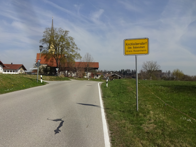
My closest approach to Traunstein on this ride should be in the village of Kirchloibersdorf ("Church Wombs Village"), where I'm only 600m away from the border. Had I realized I was this close, I likely would have extended my ride a bit, possibly all the way to the windmills, in order to connect that county as well. But as it is, I cycle by blissfully ignorant of that opportunity.
Instead, I proceed further north, and before long cross the border to Mühldorf county instead.

Shortly thereafter, a motorized trike passes me by. Apparently, this is a good week for trikes of all kinds.

The next challenge I face is the climb to Oberreit ("Upper Ride"). As the name suggests, it is on the top of a hill, and whereas the climb up the Inntal was long but basically okay, the climb up here is short and brutal.

One local attraction that I pass by is the Wildfreizeitpark Oberreit ("Wildlife Amusement Park Upper Ride"). It's quite busy today on account of all the kids having Easter holidays right now. Fortunately, I'm only passing through.

Subsequently, I slowly start heading back towards the Inn again, passing through the village of Wang ("Cheek") along the way, which is one of those typical rural villages that not only serve as a crossroads for cycling roads but also prohibit the use of cooling units at night.

It is around here that I finally find a suitable spot for taking my lunch break. With the sun shining down quite intensely, I am naturally intent on searching some shady shelter, and I do finally find it in the shape of an rustic rural bus stop house. There, I sit down, cool off and consume my lunch in the shape of another Dinkelbreze and Käsestange (regrettably, the Laden im Thal did not have that much of a selection of baked goods).

From there on, I pass by the hamlets of Eckstall ("Corner Stable")...

...as well as another Brandstätt. Seems that is a popular name for hamlets in these parts. Incidentally, the distance between this one and the Brandstätt of yesterday is pretty much exactly 11.11km. I wonder if I'll pass through a third Brandstätt on my ride back to Munich tomorrow.

And then, there's a sign that I like to see, heralding my immediate and easy descent back down into the Inn valley.

One rapid ride downhill, and I am back at the level of the Inn again, which I cross via the bridge near Gars.

It comes as no surprise that the road goes up again on the other side. However, what comes as quite a shock is the dreadful number on that sign (for reference, 10%=pain).

Thus, I end up having to fight my way up the most gruesome ascent yet, and somehow, through sheer force of will, I actually manage to make it all the way to the top of the short but steep slope without having to get off.

At the top, it takes me approximately 5 minutes to catch my breath. While doing so, I do note the rare "20 Zone" sign at the entrance to the old town of Gars. This is highly unusual, and I didn't even know they made signs like this. Usually, what you see is "30 Zone" signs all over the place.

Exploring that little old town for a bit, I come across a bakery decorated with nice murals, and knowing that the bakery back in Soyen is only open in the morning and as such has already closed by now, I take the opportunity to buy tomorrow's breakfast and lunch right there and then. It is only when I walk out of the bakery again that I realize I forgot to don my Shnolz mask and no one complained about it. Apparently, here in the countryside, the Green Shnolz is already over.

Now, if you believe that the short 14% incline in Gars was already all of the ascent back on this side of the Inn, then you are sorely mistaken. It is only a little bit after leaving Gars behind that I find myself in a road through a bit of woodland that again features quite a challenging incline of maybe 10% or so... and this one actually goes on for quite a bit, so I end up having to get off and catch my breath midway through. By the way, the speed limit here is 70 km/h, and if I had any breath left whatsoever, I would laugh about this. At this steep of a gradient, I'm not even managing a measly 7 km/h.

Once I finally reach the top, I soon enough pass through the hamlet of Huttenstätt ("Huts Place"), where a pair of storks have apparently recently blessed the locals with offspring...

...and it is in Reichhut ("Rich Hat") that I come across a house that features a room with a balcony made just for the mother-in-law.

In this area, I somehow end up passing through a great number of hamlets in quick succession, and each of them features a name that is interesting in one way or another. There's Hörwart ("Listen Attendant"), Schafleiten ("Sheep Guiding"), Bobenstätt ("Boddom Place") and finally Bachenöd ("Streaming Dull").

There, I turn off the main road for the last time today, and as a direct consequence of that end up finding myself on an Alpaca farm.

Afterwards, I have to make my way through a somewhat adventurous forest path once again. I suppose that's gonna be a thing on this ride, isn't it?

Adventurous though that path might have been, the Field Path of the Day that follows is relatively tame. But then again, I don't want to know what this path is going to look like in the growth season that is about to follow.

Back at the main road, I come across what I can only describe as a Bus Stop++. This one features not only cushioned turning chairs, but a massive table as well. Perfect for a game of cards while waiting long hours in the rain for the bus to arrive.

Moving on along the paved road from now on, the next place I come through is the village of Lengmoos ("Length Moss")...

...which is home to yet another partial my pole. Come to think of it, I've heard that if a may pole is stolen, and the negotiation attempts to buy it back fail, the thieves may end up cutting it up. Maybe that's what happened here?

The final ascent for today should be just past the hamlet of Bachmühle ("Brook Mill"), which is also where I re-enter Rosenheim county...

...and after that, it's downhill almost all the way...

...until I arrive back in Soyen again, this time from the north.

The day is not quite over yet, though my legs are quite weary and I still have the ride back tomorrow to consider. Fortunately, there's a quite opportune option for spending the remainder of the afternoon in the form of a conveniently located hairdressing place only 4 STEPs away from my stay place.

I've been meaning to get my yearly hair cut this month, yet somehow, I
never found the time... until just now. As such, this is finally the house
where I go in with long hair, and come out with short hair.

After that, there's not much to be done for the day, and so I help myself to the leftovers of yesterday's spaghettoid paste dinner...

...and then head to bed. Tomorrow is the day when I head back to Munich
again. But before that, let's talk about...
The Retrospective
As usual these days, I had my own room, and though the bed was kinda hard, it was a nice enough place to stay. Some food supplies were included, and the atmosphere was nice and familiar, and I had a couple of nice chats over meals with my host Andrea and her daughter, which made me feel right at home. The bathroom was just outside my room, yet the shower, while certainly imposing, turned out to be kinda crappy, with many of the nozzles being furred up. It was quite a little ride to get my shopping done, but the area generally was really nice. The free WiFi worked most of the time, I had a kitchen, and the temperature was comfortable. It was a bit expensive for my taste, but not too much so. Overall, that adds up to a place that was good, but not great.

So much for that. Now all that's left is to head back home. Unbeknownst to me, however, I should end up facing some...
Hilly Havoc
15-Apr-2022Distance: 91.0km
Ascents: 500m
Duration: 9.75h
7/9🎁︎
Since I've been able to hit a proper bakery with a variation of goods yesterday in Gars, the breakfast today is a little bit more diverse. For starters, I've got a whole grain croissant, and an apple turnover to go with it.

Afterwards, I quickly clear out my room...
...and then set out again. Today, the weather doesn't look quite as nice, but I'm sure it'll be alright. Maybe. If I'm lucky.

As a matter of fact, it did already rain during the night, so there's a chance that all the water has already come down. Fortunately, I had the foresight to park Jycily in just the right spot.

Today's ride should end up becoming the main event of this petal, reaching a length of 91km, and with that tying out with the Plucky Paparoa Pilgrimage in New Zealand (see Book I ~ Chapter 29 ~ Mangapai Mania). Due to a combination of local geography and available Geocaches, I should first head a bit south and then turn west, maintaining that general direction all the way to Munich (though there should be some unforeseen complications, resulting in a painful, painful detour). It is only once I'm well into Munich that I start heading north and back home. Interestingly, on my way back I only pass through a total of four counties, the main one being Ebersberg.

But one thing at a time. For starters, I need to make my way out of Soyen. Taking care to avoid a certain mountain, I pass by the city hall, and take note of its lovingly designed facade that also bears practical value: Should this building ever get randomly displaced to another city, one would instantly know which city it belongs into, and which purpose it serves. That also bears value in case the village gets hit by an amnesia-ray.

The same practical principle also is applied to the elementary school of Soyen, which stands strongly in tune with nature...

...which in turn may or may not be related to the Soyen bio mass heating plant next door.

After that, I finally leave Soyen behind and find myself on a rain-stained road. Since by now I know my immediate surroundings well enough, I have wisely chosen a flat route for the first part of my return ride.

The first places I come by are the hamlet of Wetterstett ("Weather Place") and the village of Strohreit ("Straw Ride"). There's quite a few places in the vicinity ending with -stett and -reit, isn't there?

I also get one last look into the Inn valley, but due to the clouds/fog, there's not really much to see beyond the line where the land sharply drops off.

As I head south, the weather keeps me on edge. Occasionally, it looks like Radian is just about to break through the clouds...
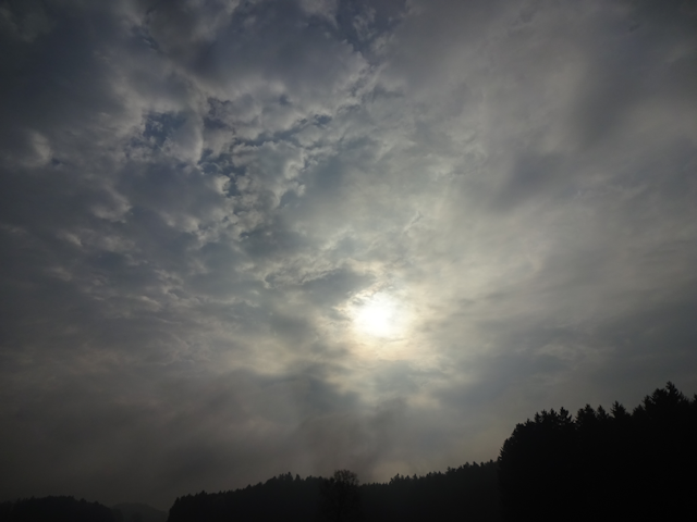
...but for the most part, the weather stays kinda gloomy.

Cycling past the rain-wet fields, I am lucky enough to espy a falcon (or is it a kestrel?) swooping low across the meadow...

And then I pass by this kinda unusual traffic sign. It may seem intuitive at first until you stop to think about it: An upside-down yield-triangle with a frog annotation sign. Does that mean "don't yield for frogs"?

I figure this must be a good area for strange signs, because just a little bit further, at the border of Rottmoos ("Rotting Moss"), I come across the next one, and while it's meaning seems intuitive to me (I'm guessing "Caution, hearing-impaired people are around"), this is not a sign that I can recall ever having seen anywhere before.

Next, I solve the mystery of why there are so many places ending on -reit in this area as I reach the town Reitmehring ("Ride Amassing").

This town is also known for being the seat of the great factory of Meggle, which not only produces my favorite brand of locally produced herbed butter, but also a wide range of other dairy products.

That, and it also features a pair of Japanese Torii in front of the factory, which makes this the second and third Torii I have randomly come across on rides around Munich. Though just like the one I encountered on my return tour from the Lechtal during the Rooster Petal, the concept of what a Torii is appears to have eluded the people who put it there. A Torii is a gate that leads to a sacred place such as a shrine. As such, putting it in front of a wall is quite wrong, as is putting a picnic table beneath it. But then again, the Japanese also serve pretzels gratinated with cheese, tomatoes and potatoes as typical German food, so I guess we're even.

Going from there, the going is good and quick. The threatening sky holds its water, and the route is mostly flat, so I pass through Viehhausen ("Livestock Housing") and Edling ("Noblen").

Today it also seems to be a good day to spot birds of prey, for it is just beyond there that I spot a hawk who obviously has been successful on its hunt.

The road remains mostly flat and straight for quite some time as I pass through the Wolfrain forest...

...and all the way to the hamlet of Nederndorf ("Lower Village").

However, after that, things start getting more interesting (as in, qualified to drain my Lunacy-meter). It starts as I turn off the main road on a side road that is paved and reasonably well-maintained at first...

...then turns into a New Zealand style well-maintained dirt road...

...which in turn becomes a field track that is still basically okay...

...right up until the point where it turns into an are-you-sure-this-is-a-path?

Since for once I am not sure this is a path, I have a look at my map, and then backtrack to the point where I figure I must have lost my intended route. Turns out the fork where I should have turned left was yet another are-you-sure-this-is-a-path?

However, this time around, I am sure, and certainly enough, after crossing this... uhh... "stealth road field"... I find a proper path continuing through the next bit of woodland.

Fittingly, the village following the forest is named Forsting ("Foresten"), and it notably also contains another of the rare 20-Zones that I last saw in Gars.

It also contains a bench for really slim people.

The next village I pas through is Springlbach ("Jump-let Brook")...

...and it is about there that I reach the eastern edge of THE BORDER, and that means the terrain gradually becomes more and more hilly again. For the moment it's only small humps, but they should soon scale in size.

But before it starts getting really bad, I first have to cross Tulling, a village which such an obscure name that I can't think of an even remotely plausible translation for once.

It is here that I could have taken the easy road to Ebersberg along the busy main road, but instead, I decide to try my luck with a little detour south through the woodlands. I mean, how bad can it possibly be?

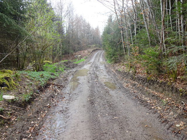
Quite bad, as it turns out. For once, while it is not raining anymore, and it does look like I'll be able to get home in the dry, the forest ground is not only wet, but outright muddy with huge puddles, which makes cycling through it not enjoyable at all.
But that's not even the worst, because it turns out that the path I had intended to take is so steep and muddy that I decide not to cycle up there after all. Instead, I end up heading further and further south on a path that is still steep and muddy, but at least managably so.

One quite torturous segment later, I emerge rather far up a hill and a good bit further to the south than intended.

Thankfully, this marks the end of both the uphill and muddy forest trail segment. The downside is that the road down is rather rough, and so I can only ride it down at reduced speed while constantly braking.

It is only at the bottom that I reach a proper road again, which comes as only a small relief, since this marks the beginning of what I like to call the Doom Doom Hilltop Climb. On the plus side, the road is paved and straight, but on the minus side it goes straight up at a steep gradient all the way.

And with "all the way" I do mean all the way. Unlike other climbs up until now which had some downs in between, this one pretty much goes up at various gradients, some worse than others. This should be my longest climb today, and quite possibly in all of my rides up until now, and the fact that I already suffered through some harrowing climbs in the Inntal yesterday probably doesn't make it any better.

By the time I reach the hamlet of Pollmoos ("Bitt Moss"), I am so beat that I have to push my bike for the last ascent and then rest for several minutes to catch my breath. This should not be the last climb for today, but it was definitely the worst.

After that, the ride grows a bit more relaxed, thankfully. After all, I am up at the crest of the highlands now, and should stay up there all the way until shortly after Traxl.

After that, I ride down into the nearby valley, passing Oberndorf ("Waiter Village") and Langwied ("Long Meadow") on the way down. Interestingly, there's a Langwied much closer to my home too, but that one is still about 42km away as the spaceship flies.

Shortly thereafter, I reach Ebersberg, and with it, the terminus of one of Munich's S-Bahn lines. I still remember it as the final stop of the S5 from my youth, though currently it's actually the terminus of the S4 and S6. As the name implies, the place is rather hilly, and so it comes as little surprise that I am soon confronted with more ascents.

Near the top of the town, I come across a garden featuring a cute little decorative windmill with a little mannequin turning the handle to produce wind... or is it the other way around?

It is also there that I come across an interesting way of how to cancel a one-way-road sign. I mean sure, we could simply, you know, take it off. But hey, why would we do that if we can instead just cross it out with specifically designed metal elements?

And then, there's also a mighty old tree here: The Friedenseiche ("Peace Oak"), which was planted in 1871 to commemorate the end of the German-French war. Since then, this tree has managed to survive quite a number of harrowing wars. Maybe I should make a note to hide out here when the next war reaches us. Considering recent developments, that time may actually be dreadfully close.

But for now, let's not think about that. For the moment, I enjoy having little other on my mind than the road ahead and the landscape around me. Presently, I am leaving Ebersberg behind by means of a field road, passing south of the Egglburger See ("Corner Castle Lake").

Once again, I end up on a rather modest path, but fortunately this time around the path is neither hilly nor muddy, and I can see where the route continues.

You might already have noticed how the weather has started to clear up since leaving Ebersberg, and true enough, before long Radian breaks through, and I get to see the first shadows of the day.

For starters, this means I gotta put on sunscreen right away. Also, since it's now just past noon anyway and I just so happen to come across a suitable resting place there and then, I figure the timing for a lunch break doesn't get any better than this. And neither does the content of said lunch break, because back at the bakery of Gars, I was able to get not only a Nussschnecke ("Nut Snail"), but also a Nussecke ("Nut Corner"), which are easily my two favorite kinds of baked goods (you may wanna write this down, this will be on the test). My Müsli bar is quite nutty too, by the way. How nuts is that?

Next, I pass by one of those places that always remind me of the Eeveelutions: Kirchseeon ("Church-Lakeon"). I suppose that one would be a Fairy/Water type. Incidentally, a second such place - namely Bergseeon ("Mountain-Lakeon") - is also just nearby. I'm going for Rock/Water for that one and would totally add it to my party, despite the x4 weakness to Grass.

It is also here that I pass the official halfway point of my ride. Using the big main roads, it would only be 26km either way from here. But then again, where would be the fun in that?

On the other side of Kirchseeon, I follow the Fuchsweg ("Fox Way") to the forested Dachsberg ("Badger Mountain"), at which point I leave the urban 30km/h zone. Note that I would reach a speed even remotely close to that, not unless I'm riding downhill.

On the other side, I reach the village of Ilching, and with it another place that I can't translate for the love of Dragon.

Aaaand, with that, I have crossed the western edge of THE BORDER. The Dachsberg was my last big climb for today, and as a matter of fact also the highest point of today's ride, with an altitude of only a few meters short of 600. From here on, it's more or less down, which is for the better since I've still got a ways to go before I reach my home. As a matter of fact, due to me living on the far side of Munich, I have not even reached the halfway point of my ride yet despite having crossed over half of the distance between Munich and Wasserburg.

However, from here on out, the going should be much faster since the paths are usually level or even slightly going downhill. As such, I make good progress and before I know it have already skirted the whole of the fields surrounding Zorneding ("Angry Thing").

After that, there's the first stretch of a relaxed, straight and level forest path since I passed Wolfrain earlier today.

And soon thereafter, I pass the fork to Baldham ("Soon Have"), which would be where my best friend Robert is living.

As usual, I have been looking for Geocaches all along the way, and I have actually also found each and every last one up until now, but they were all pretty generic and as thus not noteworthy. Unlike this one! Not only does it take some effort to find, but even after I found it I still need some patience to figure out under which cap the log hides... well, not really. Turns out I get lucky and manage it on my second try. But just to make things more interesting for the next guy, I also put a Canadian coin under one of the duds. Incidentally, this should also be the final Geocache I find for today. All remaining ones would be ether DNFs or passes, for one reason or another.

Cutting across the fields from there, I soon reach the town of Grasbrunn ("Grass Well")...

...which is where I first espy the landmark of Munich that is closest to my home: The Olympiaturm ("Olympic Tower"). Standing pretty much exactly 5555m away from the Fox Loft, right now it is still roughly 18km from my current location, and I definitely won't be able to make a beeline for it anyway.

The last place I pass through before entering the city of Munich again is Solalinden ("Solar Lime Trees")...

...and after that, I enter the final forest passage for the day.

Figuring that this will be my last chance for a while to drain my Lunacy Meter, I decide on a somewhat more adventurous path...

...and am promptly rewarded for my bold choice with more muddy terrain. I think that will be enough for today then.

Ummm, I said "that will be enough", thank you???

Fortunately, this final challenge path does not last for very long, and yet, when I emerge, I am quite grateful to be able to ride on a nicely paved cycling path for the next bit. I think my Lunacy Meter is properly drained now.

From here on out, the remainder of the ride takes me right through the city. Along the way, I come past a kindergarten where THEY bring their kids...

...as well as another interesting trike. And here I thought that this would be the one day on this tour where I wouldn't encounter one of those.

Though I'm technically already long inside the city of Munich at this point, the border here is kinda fuzzy, and so I eventually come across the city sign of Munich near the terminus of the A995 highway.

This is an interesting part of Munich all on itself. For one, there's the Death Star Trench, also known as the Tegernseer Landstraße ("Tea Glad Lake Country Road")...

...and then, there's the upside down glass ship that marks the St.Quirin Platz ("Saint Quirin Square") subway station... or maybe that's just the protective covering of the Achilles chute at the end of the trench.

From there, I proced through a series of conveniently chained parks...

...which eventually take me all the way to the district of Thalkirchen ("Valley Churches"), where I cross back over the Isar near the Munich zoo.

In a park on the other side, I come across what appears to be a prehistoric telephone of sorts...

...and also take note of how the first trees - the cherry trees in particular - are just starting to go into bloom.

By now, I am already deep within my familiar territory, and yet, I still keep discovering new details, like this house facade that is painted in such an artful way that it almost looks real until you take a closer look.

The Road Ahead
Though I am not looking to beat that record again, new rides will surely
follow. However, before that, there's yet one more change in my life that
quite directly affects what is yet to come. But that is a story for
another time, and will be told in the next chapter of the Travelling Fox
Blog.