- Part 11 ~ The Petal of the Monkey
- Ammer Access
- The Place
- Vulpine Valley
- The Retrospective
- Kaltenberg Keep
- The Road Ahead
With nine-and-a-half petals already down, I don't have a lot of options
left for where to go. By now, I already know most of the surroundings of
Munich. However, in one of the two Petals that I have yet to
explore lies a place that I just absolutely have got to go and
see. And thus, my next ride leads me to the east-southeast, straight
into...
Part 11 ~ The Petal of the Monkey
19-July-2023 - 21-July-2023
My main destination for this ride is a place called Fuchstal ("Fox Valley"), which I naturally just have got to visit, if only for the name. Unfortunately, I didn't manage to secure a stay place in there, so instead I am staying over in a village by the name of Reichling ("Rich-ler") just on this side of the Lech. On the next day, I should then cross over into Fuchstal, traverse the entire length of the valley, and then go a good bit further still. But one thing after the other. First, my ride to Reichling should take advantage of the...
Ammer Access
19-July-2023Distance: 80.0km
Ascents: 500m
Duration: 9.5h
6/12🎁︎
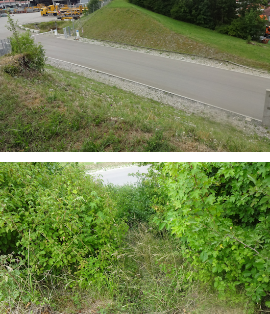
The terrain between the Fox Loft and Reichling is, in one word, rugged, and an imprudently improvised route would almost inevitably rack up ascents like there's no tomorrow. Fortunately, by now I am experienced enough to take the terrain into consideration, and plan my route by taking advantage of the lay of the land as much as possible. As such, I first head southwest towards Herrsching ("Ruling"), following the run of a "quasi valley", a fold between two parallel lines of hills that did not form around a stream, and is also occasionally interrupted, but all in all keeps ups and downs to a minimum. From there, I follow the eastern coast of the Ammersee ("At Sea Lake") south until the town of Fischen ("Fishing"), and then take advantage of the relatively flat Ammertal ("At Sea Valley"), making my way through a side valley to the little Zellsee ("Cell Lake"). It is there that the most gentle slope up to the highlands between the Ammersee and the Lech can be found, and it is there that I finally turn east, and eventually northeast, making my way towards Reichling.

In terms of altitude, most of this ride should be an uphill battle, and yet there are only a handful of truly awful stretches, with most ascents being relatively gentle. The first little spike happens near Gilching, where I prefer the hilly forest paths over the sunny cycling road next to the highway. Afterwards, I'm on something like the saddle-region of the quasi-valley until I reach Weßling ("Whose-ler"). From there, it's downhill almost all the way until Herrsching and the Ammersee, and from there it's flat not only until I depart the Ammertal near Raisting ("Rice Sting"), but also through most of the side valley that I follow to the Zellsee, with the slight exception of when I cycle partway up the side of the valley and down again in search of a cache. However, after that, the true ascent into the highlands begins, and I have to scale a massive slope all the way up to Wessobrunn ("Westerly Well"), and even a little bit beyond. And even approaching Reichling, I yet have to face a few (thankfully shorter) climbs. The peak of today's ride should be just after Wessobrunn at 743m ,while the lowest point is actually the Fox Loft at 511m.

Fore once, this should be a sunny ride, right from the set-out...

...although a number of quite majestic cloud formations are still floating through the sky.

At first, the going is relatively slow as I must make my way through the maze of roads that makes up most of Munich's western part.

As I do, I pass by the Schloss Blutenburg ("Petal Castle Palace"), which interestingly seems to have a foxy folk tale exhibition going on right now.

Moving on from there, I next pass through the district of Freiham ("Free Have"), where Munich's largest construction project is currently ongoing. Unfortunately, I am afraid that all these buildings are going to be rather boring 20th-century apartment blocks, unlike the modern 21st-century apartment blocks that I was privy to behold during my trip to Canada (see Book V ~ Chapter 2 ~ Trecking Through Toronto ~ The Flair).

Since Freiham is the outermost growth layer of Munich, that means I'm at the city border now and finally get to relax a bit as I continue to cycle across open fields...

...as well as lush forests.

However, it is in this first forest already that I come across an obstacle: Not only does the path I was planning to take lead across railroad tracks, but those railroad tracks are also quite occupied.

Fortunately, I do not have to backtrack for long until I find a much more agreeable point to cross the tracks.

After that, I pass straight through Germering ("Yeast Sea Ring"), which features interesting bike lanes on the sidewalks...

...before returning to the forest, opting to take the slightly more scenic route through the woods rather than cycling next to the highway.

A daring move, as it turns out, for just a week ago a powerful storm crossed the area, and the aftermaths of which are still to be found all over the place. In my case, that means a number of fallen trees, but fortunately nothing that I can't either lift my bike across or duck beneath.

Eventually, I come across a familiar feature: The Römerstraße to Augsburg, another part of which which I traversed on my return ride from Rosenheim (see Mangy Mangfall Malaise).

Following that road out into the open, I am promptly passed by a cute little yellow electro-trike. Barely larger than my bike trailer, this feels like a feasible future for personal transportation, unlike those giant SUV street tanks that for some strange reason seem to be becoming more commonplace these days.

Passing the Gut Hüll ("Estate Hull"), I continue my way across this serene landscape along a quiet country road...

...before passing by the Sonderflughafen Pfaffenhofen ("Special Airport Priest's Farmyard"), which is operated by the Deutsche Aircraft ("German Flugzeug").

Afterwards, my way takes me along a more busy road for a bit, but fortunately, that one features a separate cycling path.
Next, I pass through Weßling, where I last visited Ellen and her woofs two years ago (see Book IV ~ Final Chapter ~ Catty Company). Unfortunately, they are all out right now so I can't say hi. However, I do pass the very nicely decorated store where I imagine Ellen must be getting the chow for Sherlock and Makani.

Following Weßling, I cross over a little ledge...

...and subsequently cover a lot of ground very quickly as the downhill segment that follows is not only paved, but also straight and open, allowing me to make the most of my momentum.

It is here that I finally feel that I've fully left the big city behind and am now officially in the countryside. Wide, open fields cover the valley, interrupted by occasional copses and forest, as well as a few villages, each marked by a single bell tower. This is the Bavarian countryside idyll.

Next, I cycle past the Pilsensee ("Mushroom Lake")...

...before proceeding along the final stretch of the local S-Bahn line leading to Herrsching. In fact, unlike many other final S-Bahn stations which are simply arbitrary stops on existing lines, with regional trains continuing past them, Herrsching is actually a true terminus with no rails beyond.
At the end of that line lies Herrsching at the coast of the Ammersee, the second-largest lake that still falls within Munich's public transit network.

In addition to being sunny, the weather today is also pleasantly windy, a fact that is nicely reflected on the lake's surface.

From here, I follow the shore of the Ammersee south, and soon I see that the storm also left its marks here: Although the fallen tree has already taken care of, the sizable dent in the nearby fence still marks its impact.

The path i also kinda adventurous, featuring a number of ford segments that are actually a bit tricky to traverse by bike, but I manage.

Less of an obstacle and more of a curiosity are the chain-lift railroad regularly crossing the path. Those connect the boat sheds of the well-to-do homes with the nearby lake.

It is on this lakeside path that I find a nice little bench to sit down and have my lunch on. As usual, this consists of a cream cheese sandwich, Müsli bars and water. However, as an added new twist, I actually baked the bread for this sandwich myself this time around. Using a whole-grain dough with added sunflower and pumpkin seeds, it turned out quite tasty. Baking seems to be a thing that I'm good at.

As such, I enjoy a relaxed lunch break here with a nice view on the Ammersee. Incidentally, by now it's windy enough that the lake has proper cresting waves near the shore.

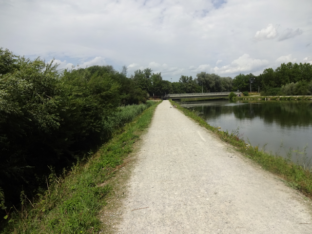
Afterwards, I follow the lakeside path all the way to the southern end of the Ammersee...

...and after leaving the lake behind, I am now officially in the Ammertal, the valley named after the river from which the whole lake gets its name.

It is from here on out that things start getting decidedly birdy. For starers, here's a bird of prey that I spot soaring in the skies above. It might be a Sparrow Hawk, but I'm not sure.

I just barely graze the village of Fischen...

...before continuing along the riverbank of the Ammer for a bit. This is actually only the second time that I have encountered and crossed this particular river - and the progenitor of the Amper - on my rides thus far, the other time having been on my trip to visit Vulparion on the Goat Petal (see Book III ~ Chapter 14 ~ Project Petal Part 3 ~ A Verily Vulpine Voyage).

Incidentally, hazy though the weather might be today, from here I can finally see all the way to the alps in the distance, and I should get closer still over the course of this ride.

Crossing through the sunny Ammertal, I enjoy the last bits of flat terrain...

...on which I am also amazed to see a colony of storks. Incidentally, the last time I've seen a stork was also right here in the Ammertal, on my return trip from visiting Vulparion three years ago, so it would seem that this area has a stable stork population, and late spring to summer seems to be a good time to encounter them here.

Speaking of which, it is only as I narrowly pass by Raisting that I cross over said return ride's route. Six hours into today's right, and only now do I finally enter unexplored territory!

From here on, I follow the valley of a stream called Rott ("Redd"), which is still reasonably flat, yet simultaneously already features a notable incline, which should take me uphill the first few dozen meters over the next few kilometres.

That sort of is a compromise with the land all around me. The main issue is that being a glacial trough valley, the Ammertal features stupidly steep inclines on either side, and while I will have to make my way up said sides one way or another, I did pick up a route that mitigates the gradient by stretching the ascent over as long a distance as possible. That means that I am making a bit of a detour here, but by now I know that this is still far preferable over trying to force my way up a slope where' I'll end up having to push my bike.

By the way, it is also here that I find what is clearly the most difficult cache for today. Hidden at the end of a heavily overgrown path near a derelict redoubt some distance up the side of the valley, this cache is not hard to find, but getting to where it lies hidden is a real challenge, warranting a 4-star terrain rating. On the plus side, this time around no angry human with a SUV stops by to holler at me, and since I manage to find it after going through all that trouble, it's actually really satisfying.

A short bit later, I cycle through the hamlet of Stillern ("Learning Quietly")...

...before reaching the forested upper part of the Rotttal, which features an almost New Zealand style well-maintained dirt road.
 47
47
The reason for why this road is so well-maintained becomes apparent as I encounter a toll barrier at it's upper end. Fortunately, this barrier only applies to cars, and there's a free bypass for bicyclists to use.

Beyond that, there's the Zellsee, which is also a place that I last drew near on my return ride from Vulparion. Back that time, I passed just southeast of that lake, crossing an airfield as I did, while this time around, I am at the lake's northern end and proceeding to head west up the steep slope that awaits.

Reasonably steep, I have to add, for it features a gradient of "only" 5%.

However, combining that with the fact that I have to deal with that ascent for 2km without any respite in between and also with my heavy backpack in tow still means that I am in for the ordeal of the day now. As such, I gradually make my way up the slope, repeatedly stopping in the sparse shade of the trees to catch my breath before continuing.

That bit about the shade is actually kinda important, because while today is not exceedingly hot, it is still a hot summer day, as becomes apparent by the mirages dancing on the roads. And while the temperatures are okay for cycling through open land when it's flat, on a slope like this I heat up pretty quickly and need to cool down regularly. Naturally, this also means that by the time I reach the top, my water canteen is almost empty.

However, once I reach the top - and with it the town border of Wessobrunn - it is actually quite satisfying to look back down on the land below from which I just struggled to make my way up.

A triumphant feeling that this guy - who simply road his E-bike up the slope, zooming past me as if it was nothing - is clearly missing out on.

However, unfortunately, that is not quite the end of the ascents today. For starers, immediately after the little ledge of Wessobrunn, I have to face yet another pretty steep climb.

However, upon scaling that, I have finally reached the highest point of today's ride, on the crest of a high hill that doesn't even have a name.

I do get a great view from here, however. For instance, I can clearly see both the radio tower and the pilgrimage church atop the Hohenpeißenberg ("High Biting Mountain"), though not the alps beyond, possibly due to an increase in humidity. This brings back memories, since there's also a restaurant over there, and when I was younger both my grandfather and my father used to take me on day trips there, since that place has a stunning view of the alps... on dry days at least.

What follows is a pleasant downhill segment, the first one since Weßling. And once again it's a nice one, with paved roads and a clear view of what's ahead.

Rushing down the hill, I cycle past a freshly harvested field, where a pair of black kites are eagerly hunting for flushed-out rodents.

The road I have taken eventually takes me to the town of Rott, which bears the same name as the stream I followed up the valley earlier, yet is completely unrelated to it. In fact, while the stream Rott flows into the Ammersee and thus is part of the Amper-Isar watershed, the town of Rott that I now reach is already across the drainage divide and belongs to the Lech watershed.

It is here that I encounter yet another stork, though this one is of the statuary kind.

Knowing that Reichling does not feature all that good shopping options, I make one final detour to drop by the supermarket at the northern end of Rott, purchasing my supplies for tomorrow...

...and then - now almost at my destination for today - I embark on one last daring quest that takes me up a narrow footpath...

...all the way to a hilltop, from which I get a scenic view of my surroundings.

From there, I only have a little bit of ground yet to cover...

...during which I can actually see all the way over to Fuchstal on the other side of the Lech. You see, Fuchstal is one of those few communities in the entire countries that are taking renewable energies seriously, and as such can easily be picked out at a distance by its many windmills. Also, here's another bird of prey, although this one is definitely too far away to make out the species of.

Right at the very end, there is one final climb up the hill on which Reichling is located, and while that last climb by itself might not be very challenging, the heat today combined with all the previous climbs still somehow makes this final push seem the hardest of them all. At this point, my canteen is completely empty, and I am very much looking forward to a drink when I arrive.
However, after that final push, I finally reach the village of Reichling...

...and within it, it does not take me very long to arrive at my Airbnb for these next two nights.

With that, the first push is complete. Now, let me tell you a bit about...
The Place
As usually, I am staying in an Airbnb, and as usually, it is of the type where I have a room for myself, yet share common areas with other guests. Also, as usually, there are no other guests since it's the middle of the week, so I have the whole place to myself. For starters, that includes a modern kitchen...

...which shares a big, open space with an eating area...

...as well as a living room.

However, there's also a little trap: For some strange reason, the floor in the kitchen area is raised two centimeters above that of the dining/living area, and I should end up bumping my toes on that little ledge quite a few times before getting used to it.

The bathroom is not quite as big, but still features everything I could ask for...

...on top of which the shower features a really interesting headpiece with a transparent handle containing small orbs that move around when the water runs through them. On top of that, somehow the shower head manages to disperse the water in a very pleasant, rain-like manner. Once my present shower head at home needs replacing, I'm definitely looking into getting one of these.

As for my room, it is a cozy little room right under beneath the roof...

...which unfortunately doesn't get a very strong WiFi signal, so I end up setting up my laptop in the dining area. The sitting options are also better there.

Also, as an additional nice touch, there's a pack of complimentary biscuits as well as a bottle of mineral water waiting for me. It's only an inexpensive little gesture, and yet it makes me feel much more welcome.

Later that night, I make good use of the kitchen by preparing my customary two-day-dinner of Naleiayafero...

...half of which does not survive the evening. Filling and plentiful though it may be, after today's tour I'm hungry enough to wolf it right down. I'm a fox though!
After dinner, I still have to learn a bit of Japanese, and since it's warm enough outside today I make use of the patio for that.

Sitting/lying down in a curious hanging garden chair, I take care of my learning, and as I do a curious little cat walks by, takes a look at me, and runs right off again. Still, that was a nice little encounter to complete the day.

After that, I soon go to bed in preparation for tomorrow's ride through the...
Vulpine Valley
20-July-2023
The next day starts with my usual combination of tea and baked goods. This time that features a pair of baked goods that alliterate much better in English, namely a Pfefferbretze ("Pepper Pretzel") and a Käsehörnchen ("Cheese Crescent").

The weather today starts out on an interesting note: It rained during the night, and the ground is still wet. The air is pretty cool in the morning, though it's supposed to get warm and sunny later on. With these circumstances in mind, I set out wearing my trusty coat Krevyasz, intending to unequip it as soon as the temperatures start rising.

Ascents: 570m
Duration: 10h
9/12🎁︎
As I said, my primary goal for today is crossing back and forth past Fuchstal, while the turning point I aim for is the town of Kaufbeuren ("Buy Farmers"). To do so, I first cross over the Lech near Reichling, and then head west and a little bit north until I reach Fuchstal. Then I turn southwest to follow the eponymous valley uphill to where it terminates, at which point I turn west towards Kaufbeuren, making my way down and up a couple of perpendicular valleys along the way. Having reached that town, I follow the run of the river Wertach ("Value Stream") north for a while, and then eventually turn east as soon as I reach a point where aforementioned perpendicular valley are no longer going to be that much of a climb. Eventually, I return back to Fuchstal and cross through it once again, passing over the Lech at Mundraching ("Mouth Maw-en"). Once back on this side of the Lech, I head a bit further east, hitting the supermarket near Issing before heading back south to Reichling.

Sounds pretty straightforward, right? However, in terms of altitude, this ride is even more harrowing than yesterday's. At first it goes down all the way to the lech, only to be followed by a short but steep climb at the other side. After that, it continues relatively tame for a while until I get near the village of Leeder ("Leeather"), which also marks my first time entering Fuchstal. After that, I climb the valley at a steady rate, which is peaked off by a pretty steep ascent just after leaving Fuchstal, which eventually takes me all the way up to today's climax at 800m. After that, I have to cross the valley of the Hühnerbach ("Chicken Stream") at Osterzell ("Easter Cell"), which would have been a really, really great place for a bridge. Albeit, there is none, leaving me with this ride's one unmanageable ascent on the other side. Another down-and-up follows at the valley of the stream Gemach ("Slowly"), only this one is not quite as bad. I get another enjoyable downhill ride as I reach Kaufbeuren, followed by a near-zero descent as I follow the Wertach all the way to Pforzen ("Gateways"), and a near-zero incline as I head back east again, at least until I reach Untergermaringen ("Lower Yeast Sea Ring"), where the first ledge of the return ride awaits. The next ledge is after Oberostendorf ("Upper East Village"), but that is immediately followed by an enjoyable descent into Fuchstal, and the Lech valley thereafter, which is also my lowest point at 612m. Considerably less enjoyable, however, is the climb of Mundraching, where I have to scale an incline with a gradient of over 10%. There's a bunch more ups and downs after that, but they all pale in comparison to this last hurrah.

Starting from Reichling, I first have a little last ledge to clear before I can ride down into the Lech valley. Fortunately, since I'm well-rested that's not a problem.

From atop said ledge, I get my first view of the Lech valley, part of which already belongs to Fuchstal.

I don't get to enjoy it for very long though, as a motorcyclist comes up behind me, and manages to slip and fall as he tries to pass me standing at the very edge of the road. I for my part promptly move to assist even while a van driver on the other side of the road stops, lowers his window and starts railing at me for stopping there, blocking the traffic himself in the process. Fortunately the motorcyclist is unhurt and we can move on shortly, but with my own psychological disposition still being at a low point the angry van driver's valiciousness manages to ruin my ride right from the very start.

As a result, I can't really enjoy the downhill ride, and not finding the cache here doesn't help either. Anyway, pretty soon I reach the bridge across the Lech, which is watched over by St. Lorenz, patron saint of Archives, Armories, Barbecues, Brewers, Butchers, Comedians, Cooks, Cutlers, and a whole bunch of other professions. According to the plaque, the bridge is also named after him, but that's the only proof I can find.

On the other side, I pass through the town of Epfach ("Apstream"), which is also where I need to scale the first little ledge of today's ride to get out of the immediate Lech valley.

After that, I am within the extended Lech valley, where I make my way across sprawling fields and lush forests, both of which are reasonably flat.

Once I'm through the first bit of forest, I get a view on the first few windmills of Fuchstal. Fuchstal is actually somewhat famous for taking the initiative to locally spearhead regenerative energies with collective private investments instead of waiting for the government to act. In fact, it is only due to this collective engagement that they were able to overcome the obstruction that the Bavarian government placed on windmills: The highly controversial 10H-rule, stating that there needs to be a minimum distance between windmills and residential areas equal to their height times 10, unless the community explicitly agrees to make an exception. As a result, Bavaria is mostly windmill free, and we happily get to choke on coal, apart from little commendable communities like this.

Things get a bit uncomfortable as I approach Denklingen ("Them Blades"), since the B17 state road that I cross is partly out of commission for some reason, and all the traffic is being re-routed over the normally quiet country roads. As such, I have to deal with quite a bit of traffic here.

Naturally, that does not make the ride any better, so I take the next chance to evade that traffic by turning onto a significantly less busy field road.

Unfortunately, that one has its obstacles as well, and this time it is, in fact, one that I have not encountered before: The sign warns of sticky glue!

Since that is the only parallel road to the busy main road, though, I chose to brave it anyway... carefully. At worst, I figure I can always just evade onto the field. But all is well. It turns out that this road is currently being re-paved, and though I have to dodge the construction machines near the end, I get through without getting stuck. Afterwards, I am already in Fuchstal, and jsut starting to cycle up the valley, which at this point is still pretty wide and flat.

Eventually, I get back on the paved main road running lengthwise through the valley...

...and it is from there that I can see the ecological engagement of the people of this place in action, as I espy not one but two new windmills currently in the process of construction. All that's missing are the sorta essential turbines on top.

On top of the already existing windmills (a number of which I am by now rapidly approaching), that would bring the windmill count for Fuchstal & vicinity up to 13, if I counted correctly. That's over twice as much than Munich & vicinity has to offer, and Fuchstal is much smaller!

Unfortunately, I should not get to see any of those windmills up close, for the upper Fuchstal is completely covered in woods, so although I pass with a few hundred meters of the windmills, I do not actually get so much as a glimpse. Fun fact: I don't even hear them over the natural sounds of the forest! So much for noise pollution!

The path through the forest actually goes on and on for quite some while, making for another relaxing straight forest ride. It is, however, also a steady incline all the way: From the point I entered the mouth of Fuchstal to when I reach it's upper end, I have scaled almost a full 100m of altitude, but since that climb was stretched over 7km, that's actually quite manageable.

At the upper end of Fuchstal, I come across an old acquaintance: The Römerstraße! Only this time it is not the one leading to Augsburg, but the one for Kempten ("Camped"). As a matter of fact, the run of that particular ancient road did somewhat mirror my ride to Reichling, and is going to run parallel to my route to Kaufbeuren too.

By now, I have more or less circumcycled the telltale match-4 windmill line of southern Fuchstal, and as I emerge from the forest on this side, I can see three of them from another angle.

Just a little bit further, and I reach the climax of today's ride at 800m. However, since this is still only saddle between two forested hills and plenty of woods towards all the sides, I don't get much of a view. Even so, the landscape up here is quite beautiful, and also blissfully devoid of the usual noises of civilization. Not even the noise from distant state roads or highways can be heard right here, right now.

Suddenly, I spot something orange slinking through the fields, and my heart skips a beat. Could this be a fox? But no, it turns out to only be an orange-colored cat.

Shortly thereafter, I reach a sign where I'm definitely glad to be on the right side of. It also warns of black ice, but I am reasonably confident that with today's temperatures exceeding 25°C, the chance of me encountering any is negligibly small.

One downhill rush later, I reach the village of Osterzell at the bottom of the valley...

...on the dreadfully close far side of which looms the hillside that I'll have to climb to get out again.

Not wanting to cycle up the main road, I pick a side path, which immediately rewards me for my choice since I come across a hidden little gem: An Mariengrotte carved into the side of the hill, complete with a little open air chapel and all. Unfortunately, capturing it in all its serene beauty proves to be a bit too much for my camera.

The fun ends after that, however, as the path becomes simultaneously steep and unpaved, forcing me to dismount and push Jycily up the slope since my tires simply do not get enough traction in the loose soil.

However, eventually I manage to make my way to the top of that hill...

...from where I not only get a nice view of Osterzell, but also the match-4 windmills of Fuchstal.

Afterwards, I continue my way across the crest of that particular chain of hills...

...along which I am saddened to see how much garbage people leave lying near the road even all the way out here. As for what I find, discarded cans and cup holders are pretty standard, but the laminated "Ladies" sign is definitely a new one.

Next up is the village of Stöttwang ("Stutt Cheek"), where I cycle past an artistically carved cow bench overlooking a field...

...followed by Thalhofen ("Vhalley Farmyarding"), where I cross the leisurely flowing stream Gemach for the first time today.

After that, there's a little ascent out of the valley of the Gemach, and after that it's downhill all the way to Kaufbeuren. With the temperature at pleasant levels, the skies slightly overcast, and the road free of cars, these are perfect bicycling conditions.

Next, I pass the hamlet of Ziegelstadel ("Brick Grange"), where I suppose they produced the bricks to build the next village of Mauerstetten ("Wall Places")...

...and then I continue along a cycling highway build on the embankment of an abandoned railroad line...

...which quickly lets me cover the remaining distance into Kaufbeuren, until I end up at The Gap.

Here, the access road to a commercial area has brutally cut right through the embankment, leaving me with very limited options of how to get down. The slope itself is a 100% incline of loose rocks, and the path through the bushes also doesn't look very promising.
I briefly consider turning back and making my way back uphill to the last intersection, but one failed lunacy roll later I find myself frantically navigating my way down The Gap by sticking to the fence, where a "where's a will, there's a way" exists.

It takes me several minutes of careful yet determined maneuvering, but amazingly, I do manage to make my way all the way to the bottom, carrying Jycily part of the last few meters as a bush blocks my progress near the fence. Good thing I left all my heavy luggage back at the Airbnb.

So, with that I am now officially in Kaufbeuren, which does not look all that different from back home, though the expert observer will quickly spot that the sidewalks here are simply paved instead of tiled with the classic grey square tiles of Munich.

Following that, it's time for me to cross over the Wertach for the first time today, but not the first time ever. In fact, I did already cross it not once, not twice, but thrice, during my first visit to the Lechtal (see Interlude ~ Project Petal Part 4 ~ Lechtal Liveliness) as well as my ride to Augsburg (see Book V ~ Chapter 15 ~ Project Petal Part 9 ~ Augsburg and Around ~ Approaching Adelsried). It ended up being an uneven numbers of crossings since that last ride took me around the confluence of the Wertach and the Lech, so while the waters were still partly the same on my crossing back then, technically it was already part of the Lech by then.

On the other side, I come across a very artistically designed house. Part of what you see is painted on, but part of it is actual substance. Can you tell which is which?

Since the Wertach is meandering around quite a bit here in Kaufbeuren, I end up crossing over it a second time within minutes of the first despite going straight and perpendicular to the river.

Back on the the east bank again, I pass through a patch of town forest...

...before I end up back on the shore of the Wertach once more. There, I have a strange encounter with an esotericist of the present world. Part of what he says rings true, like how we live in a world of change and instability, and must learn to deal with that least we be torn apart. However, when he starts going on about his beliefs that global warming is caused by the internet, since all the satellites are gradually frying the earth with their radiation, I decide I've just about heard the last of this occultism, and continue on my way, leaving this urban legend in limbo.

From there, I continue along a nice and shady riverside path for a little longer...

...before crossing the Wertach for the third time in not even half an hour (and less than that, had it not been for my chance meeting with the river sage).

On the other side, I follow the Wertach further north by means of a serene path through the shrubbery...

...next to which I spot a place that I am simply going to refer to as the BBR Max ("Bouldering Bouldering Revolution").

And now guess which river I'm gonna cross for the fourth time today! This one's the last time, promise!

By this point you might have guessed that one of the themes for today's ride is "let's follow the run of the Wertach north". This has several advantages. For one, there's many nice paths along the river, but it also neatly lets me avoid having to scale the horrible, horrible incline on the western side, since the Wertach also serves as the terminator for the greater Lech valley.

As I make my way north on the east bank of the river, I have yet another interesting encounter, this time of the tiny kind. A little brown blur darts across the meadow and hides in a nearby thicket. I stop to look just in time to see a little ermine (recognizable by the telltale black tail tip) dart out of the ticket towards the nearby river, stop to look at me, and then dart right back in. The little creature repeats this behavior a number of times - darting halfway across the open expanse, stopping to look at me, and then darting back into the thicket - thus allowing me to take a few pictures of the rare little cute critter. Eventually, it takes heart and runs all the way across the expanse and down the river embankment, and that's the last I see of it.

It is right next to there that I have another little adventure in search of a cache. Much like yesterday, this one is hidden at the end of a road that I must walk, not cycle, and it probably takes me right through the ermine's territory. Fallen trees block my way more than once, but at the end I manage to find the cache.

After that, it's finally time to leave the Wertach behind and head east. I do that just north of the plateau containing the town of Neugablonz ("New Apple Tree"). That one is in itself a place with an interesting history. It is named after the city of Jablonec ("Apple Tree") in Czechia, which at one point in history was part of Germany and carried the germanized name of Gablonz. A major center of jewelry production, the Germans who lived there were displaced after WW2, and one of the settlements they founded as a new home is Neugablonz. I for my part take advantage of the flat stretch of terrain north of it to make good progress on the first stretch of the return trip.

By now, it's time for lunch, so I am looking for a good place to sit down and find a rest. Unfortunately, I should end up cycling through all of Pforzen without finding a single bench or other suitable resting spot.

In fact, the first bench that I finally find lies halfway between Pforzen and the next village of Zellerberg ("Cell Mountain"), which seems like a curious place for a bench, but maybe it's intended as a resting place for old people who have to walk that distance (that used to be a thing before everyone had cars, by the way). Regardless of its intended purpose, I am grateful that it is there, and I gladly sit down to eat my lunch, consisting today of a sesame loop and a Käsesemmel ("Cheese Bread Roll").

Thus, I am able to enjoy a nice lunch sitting here in the shade, and I get an enjoyable look across the fields all the while... at least when there's no car zooming past in front of me.

Moving on, I cross over the railway line at Zellerberg, and afterwards I get my first view f the alps today. Strange how can only see them now that I'm actually further away than I was all morning. Also, some windmills.

Next, I proceed along a strategically unsound avenue leading across the fields. Looking at the growth of the crops north of the road, I can clearly see the "footprints" left behind by the large trees' shadows.

Soon thereafter, I reach Untergermaringen, where the fun starts stopping, since this marks the first serious ascent in over 23km, the first foothill of the ledge that divides the valleys of Wertach and Lech at this point.

The plus of that is that once I'm on top of that ledge, I get a fairly fine view of the area all around (though it's more of a flatlands panorama than a hilltop view).

More notably, however, this is the one point from where you can see all of the 11 windmills of Fuchstal and vicinity all at once.

Continuing from there, the next village I pass on my way east is Westendorf ("West Village"), where I cross back over the Gemach again.

At the top of the ledge, the land is flat again for a good while and a trip between two ripe fields of contrasting colors follows.

Eventually, I reach Oberostendorf, where I pass by the brightly colored church Maria Himmelfahrt ("Mary Ascension").

Flat though the terrain may be, not all is well. In fact, today I have a problem, ever since this morning actually. Maybe it was the heat yesterday, or something wrong with dinner, or possibly even the water (which might explain the free mineral water, though not why my host would not caution me against drinking tap water), but I've got diarrhea. Which is basically okay so long as you're anywhere near a toilet, but right here, right now, I'm about as far from a toilet that I can actually use as possible. I was hoping it was only in the morning, but ever since around Untergermaringen, I've felt the pressure building again. I've been on the lookout for some sort of public toilet ever since, but in vain. By now, I've reached condition critical, so with no better option I relieve myself in a little patch of trees near the fields, using leaves for paper. Not very dignified or pleasant, but it sure beats soiling my pants.

Having handled that little crisis for better or for worse, I proceed by the edge of a little wooded hill, heading for my next major waypoint: One of the 11 windmills.

Getting up close to it means climbing the remainder of the ledge between the valleys, but I am rewarded for it with the majestic sight of the 100m-tall windmill towering before me, and although I am quite close by now and the windmill is turning pretty quickly, I can't really hear much. If I were standing this close to a highway, the noise level would be quite considerable. By the way, this windmill alone can generate enough energy for about 800 families, and saves almost 3000 tons of CO² from being emitted each year.

After that, it's back into Fuchstal as I pass through the hamlet of Engratshofen ("Tight Council's Farmyard")...

...from where I can see something that used to be a military installation in the past, and today serves as a battery station for Fuchstal.

Another steep descent ensues, and I make quick progress as I rush down the straight road into the Lech valley, and before I know it I have reached the village of Asch ("Ash"), one of the two major settlements of Fuchstal, the other being Leeder.

One last open stretch through Fuchstal remains...

...and then I'm back at the immediate Lechtal again. I am still on a ledge approximately 35m above the river, however.

On my way down to the river, I pass a number of fish ponds...

...and then I cross the 3rd Lech bridge, which comes complete with a memorial to the raftsmen who used to ferry people across the river before the bridge was built, as well as a view on the ledge from where I just looked down.

Having crossed the bridge, I reach the village of Mundraching, which is where the fun really stops. Not only does the main road through town already sport a considerable incline...

...but the specifically designated cycling bypass is even worse. Clearly designated as such by some kind of sadist, this slope is without a doubt the steepest and worst ascent of this entire ride, and I have to stop multiple times on my way up. Well, thankfully at least part of it is in the shade, and since the road is paved I can actually ride up instead of having to push. I sincerely wonder if a continuous push would have been faster than cycling with all those breaks, though.

Fortunately, once I'm up, I'm up, and level fields await.

Well, more or less level. There's still a bunch of ascents, such as in Stadl ("Grange"), but after clearing the Mundraching malady, those are actually quite manageable. Although I have to admit that by now I am getting close to my limit, and my uphill speed on even these slopes has slowed significantly.

Next up is the village of Pflugdorf ("Plow Village")...

...followed by more blissfully flat overland segments.

What with a motorcycle accident, windmills, a cat, The Gap, the river sage, an ermine, as well as some diarrhea, this sure has been an eventful ride already today, and the events just don't stop. Next, I come across a firefighter's truck that has cordoned off the very road I'm coming from (with me having ended up on that road by means of a field path). I have no idea what's going on, and at this point I'm really too exhausted to care. As I carefully ride by the firefighters, one asks me if everything is okay, which I affirm. Earlier that same day, I might have stopped and asked what's going on, but by now I really just want to wrap up this ride and get back to my Airbnb.

One of the things this ride notably did not feature, however, was a bakery. And so, when I spy a supermarket nearby I stop over to get tomorrow's breakfast and lunch from the obligatory integrated bakery. It is also here that I drain the last drop of my canteen, so the next opportunity to get something to drink will be back in Reichling.

As I get back on my bike, I notice a police helicopter flying overhead quite close to the ground, and heading north. I can only guess that it might be related to whatever in the name of Dragon those firefighters closed the road for, but I'm afraid I'll never know for sure.

Anyway, from here on out, all I have to do is head more or less south to reach Reichling. Unfortunately, that means going uphill again. Fortunately, however, the roads here are well-paved, and the incline is quite manageable as well.

Okay, never mind, scratch the former... and on second thought, scratch the latter as well. The last bit takes me across a hilly gravel path road again.

But on the upside, I do get a nice last view from up here, including the alp panorama that I've been missing most of the time. Naming all those mountains would get confusing, and I'd probably get half of them wrong too, but I'm at least reasonably sure that the terminator mountain at the western end is the Säuling ("Sow-let"), which stands at the border to Austria, and near the foot of which the famous Schloss Neuschwanstein ("New Swan Stone Palace") lies.

One last push, and I'm finally back at Reichling, and not much later back at the Airbnb.

There, my first order of business is draining the tap dry. I am wary about the possibility that the water might be the cause for my diarrhea - just like it has been back in the Philippines (see Book V ~ Chapter 9 ~ Davao Downtime ~ The Food) - but I still think my host would - or should - have warned me if that was the case, and the water does taste perfectly fine, and Germany is generally known for its high water quality, so I hope I'll be fine.

After the tap, the complimentary biscuits are the next to bite the dust. I feel so famished and exhausted that these sugar-garnished goodies really hit the spot.
Later on, I have some of the Naleiayafero from yesterday night for dinner. Another possible candidate for my diarrhea, I decide not to eat quite all of it, and leave the rest for whoever else would have it. Again, I don't think that this could be the case, but maybe the minced meat that they sold me at the Edeka in Rott was past its use-by date or something.

With that, this eventful day is finally coming to an end. Tomorrow is (hopefully) going to be more enjoyable, but before we get to that, let us cover...
The Retrospective
Though it was technically only a private room, thanks to the circumstances I had the whole big place all to myself. Food was as usually not included, but I had basic cooking supplies for use in the kitchen, as well as complimentary mineral water and biscuits, which is more than in any other Airbnb thus far. The bed was comfy, and the atmosphere was very familiar and welcoming. Owing to the auspicious circumstances, the bathroom was effectively part of my private area as well, and the free WiFi was basically okay. The place is a bit remote though, and despite having a great view, it's a bit of a downside that there's no shopping options or public transport nearby. Also, the place was just a little bit too hot for my taste. The biggest downside, however, was the price, which was quite steep. At 67€ a night, this was easily the most expensive Airbnb that I've ever stayed in, and in fact more expensive than several hotels I stayed at in Japan. It was also the sixth-most expensive place I ever stayed in since starting my travels, earning it an abysmal price-value ratio despite all the perks. However, even with the steep price factored into the equation, this was still a pretty good place to stay at, but only because having the big place all for myself at least somehow justified the price.

And that's it for the retrospective. Now, let's embark onto the ride home, where I should make sure to visit the...
Kaltenberg Keep
21-July-2023Getting up the next morning, I look out of the dining area's windows to behold a number of horses and cattle peacefully grazing on the meadows behind the house.

Meanwhile, I eat my own breakfast, this time composed of a Käsestange ("Cheese Stick") and a simple Croissant, plus some tea, of course.

I also take the time to write a message in the guest book, making sure to visualize my most memorable experience from this ride.

After that, I pack up, leaving another empty room behind...
...and then I'm out on the road again, which once again is wet from the nightly rains.

Distance: 81.0km
Ascents: 380m
Duration: 9.5
7/12🎁︎
My route today takes me north, following the ledge separating the Lech from the Ammersee. My first major destination is the town of Kaltenberg ("Cold Mountain"), where I am headed for two reasons that I will reveal in due time (though locals will probably be able to guess at least one of them). After that, I turn east, following the lay of the land until I get back home. Also, looking at that map now, I realize that this petal has actually taken me further west than the Rooster Petal, much like how the Dragon Petal took me further east than the Rabbit Petal.

As for the height profile of this ride, now there's something pleasant: With exception of a couple of bumps, this ride is almost entirely downhill, paying out the effort I put in cycling all the way up here. The first somewhat considerable bump is when I have to cross a forested ledge near Westerschondorf ("Western Already Village"), and it is only shortly before Kaltenberg when I reach the level of the Lech near Mundraching, where yesterday's gruesome final ascent began. After that, there's a little relatively tame hill as I pass through the northern outskirts of Geltendorf ("Apply Village"), and another one just past Moorenweis ("Bog White"). After that, it's a gradual descent all the while passing Buchenau ("Beech Meadow"), after which I voluntarily decide to tackle the Emmeringer Leite ("Nanny Ring Guide") as a final challenge, thus adding another 50 or so meters of altitude to my ride that I could have easily avoided, had I chosen to do so. However, since the entire ride up until that point was quite time, I figured something like this would make for a nice touch near the end.

Small though Reichling might be, I have now already entered it from two different directions and left it through a third, and now I am adding a fourth to that list. As a result, I come across another part of the village that I was not aware existed until now: A little pond that lies serenely in the morning light.

My departure from Reichling marks the beginning of the longest downhill ride. The going on this part of the ride is extremely quick since the roads are paved and empty, and since I'm finally headed down again, I can cycle at full speed for a long, long time.

The landscape mostly stays the same all the while: Fields and pastures, occasionally broken up by pieces of forests, with nothing that really stands out, making this into a tranquil downhill journey during which the grey of dawn gradually transitions into the bright of day.

This uneventful and blissfully relaxing downhill journey continues for over a dozen kilometres, just past the town of Hofstetten ("Farmyard Places")...

...at which point the paved roads give way to gravel roads as I dive straight into the heart of the forests here.

Though made of gravel, the forest road is reasonably smooth, and so apart from dodging pothole-puddles, I am also able to proceed at something near my top speed.

Another avenue awaits as an ascent approaches at a hamlet by the name of Westerschondorf, which is the "growth node" around which this particular clearing in the middle of the forest was cut.

The following forest marks the first true impediment to my up until now pretty unparalleled speedy progress. Not only are there some ascents that are made more tricky by the gravelly ground, but the path through the forest is also not exactly straight (or rather, the straight path would not take me to where I want to go), so I have to stop and navigate a couple of times.

In the end, however, I manage to make my way through this a bid convoluted piece of woods and emerge on the fields and hills on the other side...

...not far from the town of Schöffelding ("Amass Thing"), where the odd troll can still be found crawling out from beneath the roots of trees.

Moving on from there, I take to the field paths again...

...while also occasionally looking back over my shoulder with worry. Whereas the last two days were mostly hot and sunny, today carries the promise of rain, and looking back south I'd say that rain has already engulfed Reichling, and is slowly creeping north. I wonder if I'll get home dry, or if I'll suffer a repeat of what happened during the return ride of the Dragon Petal.

Moving on to the north, I come across a very strong contender for today's "Field Path of the Day"...

...which quickly gets some competition as I make my way through another bit of forest. This path is definitely less passable, yet it's inside a forest, so I don't know which one of those two should take the price.

Exiting the forest a little bit to early, I come across contender #3 as I emerge in the middle of a field with no path in sight. The upside here is that the field is nice and open, so I can just ride squat across it to the shed near the bridge across the brook which leads to the road.

It is now just a little over 3 hours into the ride, and I have already reached the crossover point with my return ride from the Rooster Petal at the train line extending past Geltendorf and to Landsberg am Lech ("Land's Mountain at the Lech"). In fact, this railway underpass actually marks a triple crossover point, as not only did I come through here on my way back from the Rooster Petal, but both Robert and I also rode the train across that bridge on our way to the southernmost point of Germany (see Book IV ~ Extra Chapter ~ The Heroic Haldenwang Hike), also passing through Kaufbeuren in the process. In fact, here's one such train now.

After that, it's only a little bit further...

...before I reach the village of Kaltenberg, which is locally famous for its annual medieval market and knight tournament. And naturally, I timed my ride just right so that I pass through here while one of those is ongoing. This fair is only slightly older than I am - having first started in 1980 - and yet it is one of the largest medieval fairs in all of Germany.

However, before I get there, I first have to pass through the village of Kaltenberg...

...something that does sound simple, yet is complicated by road planners who were apparently intent on luring cyclists such as myself into dead ends.

After scaling the hill after which Kaltenberg was named, I find myself in front of the entrance gates. However, since it's still only around 11:00, there's not much going on yet, since the fair only opens up in the evening. Even so, at the very least I can see the highly thematic entrance area, complete with medieval ticket gates fashioned from secret elven technology.

Unfortunately, since the gates are guarded, there's no way for me inside that way. So instead, I loop around, take a few back roads, and eventually manage to emerge behind the great arena, also fashioned in medieval style, complete with a medieval wheelchair sign!

Beyond that, I manage to make my way deeper into the fair site, where lots of thematic tents stand side by side with magical metal carriages, the latter will almost surely disappear before the fair opens its gates tonight.

Oh, and let us also not forget the castle of Kaltenberg, around which this event is centeressd. Now this edifice is truly medieval, originating in the year 1292 and being destroyed and rebuilt a couple of times over the century. It's present form dates back to the year 1854 when it was rebuilt in its current Gothic style.

Coming down from the hill again, I take the opportunity to take a shot of the surrounding landscape, knowing that from here on out the terrain will become progressively flatter. As I do, I also worriedly acknowledge that the sky to the south has once again grown darker still.

Before I leave Kaltenberg behind, however, there is yet one more thing to do, and doing it involves the winner of today's "Field Path of the Day", which wins by virtue of the ground being in such a state that despite it being even, I still have to get off and push my bike through it.

In fact, this "path" is so unofficial that it doesn't even appear on bikerouter. And instead of going somewhere, it's just a back and forth trip of a few dozen meters. What for, you ask? Well, that's the second reason why I came to Kaltenberg: You see, because it is here, at the foot of the hill, that the spring of the Paar is located. That's right! That very curious little river that almost flows into the Lech, then goes "nope", turns northeast and flows straight into the Donau instead, and which I by now have crossed a total of nine times during my Petal Rides finds its humble beginnings right here and now. And humble indeed they are. As far from a sputtering wellspring as it can be, the Paar emerges in a ditch under a bush and takes the form of something that is only barely recognizable as a brook. In fact, with all the growth in the way, I can't even see any water flowing within, yet the brook clearly makes its way north from here, past Brunnen ("Well"), Mering ("Sea Ring"), Dasing ("There Sing"), Hörzhausen ("Hears Housing"), and all the other places where I've crossed this curious little river.

Anyway, that's enough of Kaltenberg now. It may not even be lunchtime yet, but with the sky growing progressively more threatening, I am kinda anxious to get home. On the minus side, I am still less than halfway there and the major downhill segments are already behind me. But on the plus side, I am now cycling parallel to the route of the S4, so if worst comes to worst I figure I can always just wimp out and take the S-Bahn home. But for now, I proceed across the fields using blissfully paved roads.

Next, I graze the very northern edge of Geltendorf...

...from where I follow a major road (that is fortunately not too busy) all the way into the Landkreis Fürstenfeldbruck ("Lords Field Bridge County"). One notable thing is that the temperatures keep rising the closer to Munich I get, to the point where they're starting to become just a bit too hot for my taste.

That situation intensifies as I reach the town of Moorenweis, where Radian unexpectedly breaks through the clouds and showers me with his intense radiation - a situation that is not made better by the fact that my route from here on out takes me through a field with little to no shade, and the time is also nearing noon by now.

Eventually, I reach a sort of mini-avenue, but unfortunately the trees are planted on the wrong side of the cycling road and as such do not offer any shade.

As such, I am glade when my planned route takes me into the lush shade of a nearby forest... only to be immediately disappointed that the swathe cut through the forest by the road is so wide that the trees offer little to no shade at all.

So, screw the straight scorched street, I say, and settle for a nice and shady - if somewhat - roundabout route following gravel roads through the surrounding forest.

This forest should cover my advance for the next hour or so, which is fortuitous, considering that we're having the zenith hour right now, and since it's still July that means it's not only hot, but there's also a significant risk of both sunburn and sunstroke if you're out in the open during noon. As such, I am doubly grateful to have made it into the forest just in time.

Oh, and speaking of noon, it's naturally also about lunchtime, so I keep on the lookout for a shady spot where I can sit down and have my lunch. And eventually I do find one, albeit of an unusual kind: A tree stand by the side of the road shall serve as my lunch rest spot for today.

And thus it happens that I eat my lunch slightly above ground level today, happily nomming away at a Nusshörnchen ("Nut Crescent"), a Butterbretze and a Müsli bar.

Moving on after lunch, I ride past the pleasant side of a sign denoting a 12% gradient up ahead...

...before continuing through the forest for quite a bit longer.

Eventually, I emerge from the forest at Buchenau, and with it the urban area of Fürstenfeldbruck, where illicit placarding is explicitly forbidden.

It is here that I encounter the first and only major river of today, and another old acquaintance of mine: The Amper.
Cycling along the promenade, I get to witness a rare breed of Jesus Geese walking on the water...

...as well as their less blessed but more chilled brethren sitting calmly at the side of the path as I cycle past.

I cross the Amper shortly thereafter, and since I cycled south of the Ammersee on the way there, this is in fact my one and only Amper crossing during this entire petal. However, since I also did the same thing during the Goat Petal, this now makes my total count of Amper crossings even again (though I still have two more east-to-west crossings than west-to-east crossings).

Following a roadside cycling path through Fürstenfeldbruck, it finally feels like I am back from the boonies and within the metropolitan area of Munich again - for better or for worse.

However, this far out, there's still plenty of green stretches, such as the Emmeringer Leite. Now, when following this elongated forested hill chain, there are pretty much two options. Either you can go alongside it, such as between the hill and the railroad tracks...

...or you can go up the 50m or so incline, which is what I choose to do on account of today having clearly been lacking in terms of ascents thus far. As such, I consider this one the optional bonus boss of this ride. Fittingly, the route up that I chose features one of them lovely 10%+ gradients, but fortunately only over a reasonably short distance that is way less brutal than yesterday's murderous Mundraching malaise.

Once I made my way to the top, however, the going is pretty smooth and relaxed as I can simply continue lengthwise along the forested ridge. Relaxed, that is, until I hear the rumbling of thunder heralding the approach of a storm. Now, with all the trees blocking my view it's hard to judge how much time I have left, so I make haste and try to at least get down from the Emmeringer Leite as quickly as possible, for I am reasonably certain that a forested ridge ranks pretty low on the list of places where you'd want to be caught at by a storm.

However, even with all that haste I still take the time to take a picture of this weird... mushroom altar (?) that I pass along the way.

Further on, my speed is naturally limited by the path turning into a bumpy stone trail...

...but fortunately I soon emerge in an open area atop the Emmeringer Leite, where I am much relived to see that I am not in any immediate danger of being caught in a storm.

In fact, as I finally make my way down the eastern end of the Emmeringer Leite and proceed along the nearest road, Radian breaks through the clouds once again...

...even while the source of the thunder that I've heard is ominously looming at the southeastern horizon, and far too close for comfort too.

At this point, I am more or less on the home stretch. I still have 15km to go, but I am approaching the core of my territory, and thus would be able to find my way home reliably without any further navigation. Thus, I make haste, hoping I'll stay reasonably dry even as I make my way straight for what looks like the exact border between Clearance and Storm.

Following the final fields for today, I make my way through a park in Puchheim ("Book Home")...

...where I come across an interesting formation of three obelisks, which apparently stand there as a memorial for the territories that Germany lost as a result of WW2. As far as I know, all of these are part of Poland and Czechia now, and my very own grandfather actually came as a refugee from Schlesien when the Germans were displaced from there at the end of the war. He was only a child back then, and now, he's already been dead for over a decade.

He was also a mighty bicycler, and apparently I got the genes from him. Anyway, once outside of the park, I cycle down the straight streets of Puchheim...

...and in quick succession make it first to Gröbenzell and then München from there.

I am still within the rural outskirts of Munich though. As such, I pass the Hofreiter ("Farmyard Rider"), which is a sort of agricultural event venue. Right now, there seems to be some sort of hay bale labyrinth for kids, but one of the locally famous attractions that annually happens there is the maize field labyrinth.

At that point, I am pretty much on the victory road, and a good thing too, for the sky grows gradually more threatening.

However, before I manage to make it home, I unexpectedly get eaten by a dinosaur. The end.

Just kidding, as you were surely be able to tell by the absence of feathers, that's not a real dinosaur, but an old-fashioned prop. As thus, I get to continue on my way home past some brave bicyclers who audaciously claim the road as their parking space. My kudos to them!

And more Kudos go to the owners of this house, who are evidently serious about using solar energy. From now on, I am going to refer to this as the Solar Solar Revolution MAX (SSR MAX).

Returning to the fox loft, I find a heavy minivan straining the walkway, but at this point I don't much care for that. More importantly, I am Dragon-bent on getting inside before the sky breaks loose.

...which is a thing that happens literally 5 minutes after I'm inside. A thunderstorm of extraordinary magnitude starts outside, complete with lightning and thunder, and I am quite glad I'm not outside (again) when it's raining cats and dogs like this.

Oh, and speaking of cats, naturally Jamie and Toledo are happy to see me too, and for once, they did manage to not damage anything while I was away.

And thus ends my ride to Fuchstal, and with it the second-to-last petal (and the Broken Horse Petal is still, like, 50% open). So much for that, and now a few words about...
The Road Ahead
So, after this my travels are going to "escalate" a little bit. My big vacation this year is coming up, and I've got suitably big plans for it. For one, I am going to Hamburg to attend the Eurofurence this year. And for another... I'm going to keep that a secret for yet. Wanna find out about it? Then make sure you're around for the next chapter of the Travelling Fox Blog!