GDPR Privacy Statement

By the new GDPR law, I am required to make you read the Silly Privacy Statement. That statement doesn't really contain anything unexpected or surprising to people used to the internet, but by accessing and reading this blog you agree that you've read these statements and agree to how this blog uses your data.

On a related topic: If you say something to somebody else, the brain of that person might store the information you told him/her not anonymized and without your explicit consent and use it against you at a later time, and if you leave your house people just might see where you go and what you do.

Thursday 16 March 2017

Chapter 16 ~ A West Trip Story

Dawn breaks over Rakiura on my final day on this island, and it heralds the beginning of my trip to the West Coast.


This trip is subdivided into four segments: First, I take the plane from Rakiura to Invercargill, next, I catch a bus from there to Queenstown, where I'll stay for a night. From there, I take a second bus through the Southern Alps, spending the next night in Fox Glacier, before finally moving on to Hokitika on the third day.

Straight across the strait


Since I've already taken the ferry on my way here, I decide to take the plane for the return trip.


We depart from the post and flight centre in Oban, from where a small shuttle bus takes us up to the islands little airfield...


...which literally is just that: An open field with a runway and some small airplanes, no buildings whatsoever.


The plane that is to take us back to Invercargill is yet on its way over from the mainland, and emerges on the horizon momentarily, and as it lands on the relatively short runway I have my doubts about whether it will be able to come to a stop before the end of the plateau.


It really is a small plane. Why, in addition to the seats for pilot and co-pilot, it only has eight seats for passengers, making it by far the smallest plane I've ever flown with, and I get a place with a view directly into the "cockpit".


Check-in and security is a lot more lax on these small planes than on the big liners, so it doesn't take long until we're all aboard, and ready for take-off, flying right above the track to Valia Voe Bay which I've walked just a few days earlier, and finally leaving Rakiura airspace across Garden Mound and Lee Bay, which I visited as well. As we fly across the Foveaux Strait, the ride gets a bit bumpy, but I also manage to catch a glimpse of Mt. Anglem on the horizon, Rakiura's highest mountain at 979m.


And then, we're above the strait, where the ocean below is briefly swallowed up by a sea of clouds.


As we reach the mainland, I see a divine sign that renewable energy is the way to go. Ye who believe, spread the word through the world!


It barely takes us fifteen minutes to cross the strait, and before I know it we're already approaching Invercargill.


I intentionally took the early train so I could transfer directly to the bus from here, so all that's left to do is sharing a taxi with some lovely local ladies to get from the airport to the city, and I'm all set for the next leg of my trip, which will commence shortly.

Town hail the Queen


The second leg of my journey takes me up the Oreti River, and into the heart of the Southern Alps, where the resort town of Queenstown lies nested on the shore of Lake Harry Potter Lake Wakatipu.


Whereas all of my long-distance bus journeys have been with InterCity so far, this route is operated by a company named TrackNet, and their buses are a lot smaller.


At the town of Mossburn, we take a short break to switch buses and have some lunch in the local café known as Bracken Hall, where I get myself a yummy Venison Pie...


...before we continue our journey, over the hill, through the mountains, an onwards to Queenstown.


Queenstown - also known as Tāhuna in the Māori-language (meaning "Shallow Bay") - was founded in 1860, although Māori had naturally settled by the shores of Lake Wakatipu much earlier. Originally little more than a small hamlet, Queenstown eventually evolved into the resort town of today, housing a total of 14,300permanent residents, as well as a good number of tourists. In fact, the streets are flooded with tourists, which is a sharp contrast to the pristine calmness of Rakiura.

Lake Wakatipu is New Zealands longest lake, boasting a length of 80km along its peculiar lightning bolt shape. The meaning of its name is unclear, since slight alterations in accent or spelling could give it a variety of different meanings such as "Growing Canoe", "Bay of Spirits" or "Hollow Bay".
After arriving here,I check into the Flaming Kiwi Backpackers...


...and embark on a trip around town...


...on a bike, which the hostel did kindly provide.


My first stop is the local watch repair shop, since my watch had the grace to run out of battery on Rakiura, with no place to get it replaced on the entire landmass. Well, I guess of all the electronic devices I own this one was the least annoying to go out of service at that point.


After that has been taken care of, I continue on my tour around town. My first stop are the Queenstown Gardens, which were founded in 1867 when the Queenstown Borough Council planted two English Oaks on the peninsula, which was originally a patch of treeless scrubland. One of these two trees endures up until today. From the gardens you have a great view across the bay onto the town.


Scattered through the gardens are a number of peculiar devices, the purpose of which is not immediately discernible. Take a good look at them and try to figure out what they might be used for (hint: you're wrong).


Are you done guessing?

Good.

Then here's the solution to this conundrum:

These devices are targets for the peculiar sport of Frisbee Golf. Basically, you throw a Frisbee from a nearby base, try to avoid the trees and land it in the basket in as few throws as possible. And just like with normal golf or mini golf, there are 18 courses scattered around the gardens.


Walking around the perimeter of the peninsula, I eventually get a great view of the surrounding mountains as well. I can see why people would pay to stay in a place such as this.


Subsequently, I make my way up the slopes of the hills - painfully, since my free bicycle has only a single gear - and capture a number of panorama shots of the city...


...as well as the Queenstown Gardens.


Returning to the heart of the town I come across a statue of a moa, an species of ground bird that was hunted to extinction by the Māori, which in turn caused the extinction of its primary predator, the giant Haast Eagle.


Also, there's a team of live ducks who are remarkably unperturbed by the commotion all around them.


Eventually, it gets late, and I begin looking for a place to eat. Now, while this place may look promising at first glance...


...a single glance at the grossly overpriced menu quickly makes me re-evaluate my options.


So in the end, I go with what I know is affordable...


...and even though Domino's is a little bit more expensive here than elsewhere, it's still five times as affordable as most of the other places around here (and tasty too!).


After that, I retire to my dorm. After all, I have to get up early tomorrow again to catch the bus that will take me from here. The last thing I take notice of before I lie down is the colourful evening sky which is painted in bands of blazing hues.


The Glacier, the Fox and the Towers


The third part of my trip is the longest one, taking me all the way from Queenstown through the Southern Alps and to Fox Glacier. It's an over 300km long journey that should take just short of eight hours to complete.


Once again, the InterCity services don't operate in this area, so I'm travelling with Newmans Coach Lines this time, and am positively surprised that these buses offer a bit more legroom than the InterCity coaches.


And then, we are on our way just as the first rays of the sun begin to peek across the eastern mountaintops.


This time, we stop for lunch at the small Makarora Country Café, where I allow myself an absolutely delicious mushroom and beef steak pie. I can already tell that I'm going to miss these handy baked meals when I return back home.They just make for the perfect quick meal when you're on the road.


The journey from Queenstown to Fox Glacier is - as already mentioned - a long one, and an incredibly scenic one to boot! Passing by the shore of the great lakes Dunstan, Hawea and Wanaka, the road eventually winds up into the untamed wilderness of the Southern Alps, through Mt. Aspiring National Park, across the pass, and subsequently down the valley of the mighty Haast River, which it crosses near the settlement of the same name. After that, we more or less follow the shoreline, and eventually turn landward again towards the township of Fox Glacier.


Fox Glacier was named after Sir William Fox - the second Premier Minister of New Zealand - in 1872, and the nearby township was only founded in the 20th century, housing less than 400 permanent residents (but plenty of tourists).


It's almost 4pm by the time I arrive there, so I waste no time checking into the Ivory Towers Backpackers, dropping off my luggage, and venturing out again, for I have a goal: Going to visit the actual Fox Glacier, which is several kilometres away from the township.


To do so, I follow the Te Weheka Walkway...


...which is an idyllic path through the native brush, and even though it rains a little bit, the walk is still quite refreshing after sitting in a bus for over seven hours.


Eventually, I arrive at a rope bridge spanning across the Fox River, which is mostly fed by melt water from Fox Glacier. Unfortunately, the path beyond to the scenic outlook is closed because of the rain, but I still get a good look of the gushing waters below.


Fortunately, I can still follow the other way along the glacier access road, which takes me up the Fox Glacier Valley...


...and up to a car park, where the less walkative types (read: everyone but me, for I didn't encounter anyone on the walkway here from town, nor should I on my way back) have temporarily deposited their vehicles.


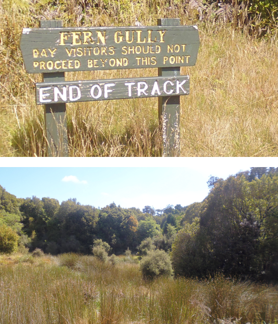
From here, it's still quite a walk to get to the view point, and along the way I come across another few curious signs.


When I finally arrive on the scenic view point, I am rather disappointed. Fox Glacier is nothing but a nondescript mass of dirty ice in the far distance, and doesn't strike me as particularly beautiful are awe-inspiring...


...quite unlike the glacial lake just outside the car park, which features the most tranquil combinations of my second-favourite colour. And the best part is: While all these tourists zoom by this beautiful lake in their cars and buses to stair at dirty ice, I get to admire the splendour of this picturesque lake as I wander back downhill along its shore.


On my way back to the township I take a small detour along the slightly ridiculous Minnehaha Walk...


...and return back to the centre of Fox Glacier. Looking for an affordable place to eat, I check the prices of the local bars and restaurants...


...before eventually deciding to cook myself a less expensive dinner in the well-equipped kitchen of the Ivory Towers Backpackers.


And then, it's already time to go to bed again. Once more, my bus departs early tomorrow, and after my hike to Fox Glacier and back, which took me the better part of four hours, I'm more than ready to call it a night.

Onward to Hokitika


The morning is grey like the evening was when I depart early the next day, and I should soon learn that people here on the West Coast often refer to it as the Wet Coast instead, and for a good reason too: Worse than Taranaki, and the complete opposite of Marlborough, this is the single most rainy region of New Zealand, what with it being located directly on the windward side of the Southern Alps, with the next major landmass directly to the west being either Tasmania after almost 2000km of water, or South America more than halfway around the globe, depending on where on the We(s)t Coast you're standing.


The final segment of my journey to Hokitika takes me mostly through mountainous terrain a good distance from the coast, and takes three-and-a-half hours to complete. Latitude-wise I start out on a level with Christchurch, pass the latitude of Castle Hill, which is located about halfway on the Arthur's Pass road, connecting Greymouth to Christchurch, and end up at about the same latitude as the Island Hills Station.


Incidentally, our bus driver today is the same as yesterday, even though I'm now travelling on an InterCity bus again, and even though the bus driver drove the Normans coach all the way up to Franz Joseph Glacier yesterday. Well, okay, so Franz Joseph Glacier is basically just the next town over, so its feasible that he simply drove an InterCity bus back in the morning, yet nevertheless, I still find it a curious occasion.

Before long, we're off, winding our way through the forested valleys, along the shores of melt water lakes, and over countless small and big melt water rivers, until we eventually cross the great bridge across the Hokitika River, on the far side of which my destination awaits.


It was quite a journey to get here. Almost as long, in fact, as my journey from Germany (see To Singapore, and Beyond!), but now I'm finally here.


I don't have to wait long for one of my hosts to show up and take me to my next HelpX place, the Woodstock Royal Mail Hotel...


...where I settle into my little room, looking forward to the exciting adventures that await me here on the West Coast.

Sunday 12 March 2017

Chapter 15 ~ Restless in Rakiura

After a good night's sleep, I wake to my first morning on Stewart Island, ready to begin my adventures here in...


Southland, as the name suggest, is New Zealand's southernmost region, and consists mostly of untamed wilderness. With barely 100,000 people living on the 34,347km² of land here, that amounts for an average population density of 2.9 people/km². In reality, however, there are some areas, like the town of Invercargill, which have a much higher population density, while other places like Stewart Island or Fjordland are all but devoid of permanent residents. In exchange, however, Southland can boast an amazing coastline of over 3,400km. That's 200km longer than the coastline of Sweden!


I am staying on Stewart Island, which is also known as Rakiura in the Māori language - meaning "Glowing Lights". Originally, however, Rakiura was known by another name: Te Punga o Te Waka a Maui, which translates into "Anchor Stone of Maui's Canoe". Do you remember my post from Wellington, where I told you that according to Māori mythology, the South Island of New Zealand is the canoe of Maui, while the North Island is a huge fish he pulled up. Well, Stewart Island also has a place in that mythology: Before Maui began fishing, he pulled up Rakiura from the depths of the ocean to tie his canoe onto it. Hence "Anchor Stone of Maui's Canoe". It's also the third-biggest island of New Zealand, although it naturally pales in comparison with the North and South Islands. At approximately 1,800km², it's halfway between Gran Canaria and Tenerife in size.


There's only one town on Rakiura: The small village of Halfmoon Bay, which is also known as Oban. For once, this isn't a Māori name, but rather the name of a place in Scotland. Almost all of the 400 permanent residents of Rakiura live in this idyllic coastal village, stretching from bay to bay and up into the forested valleys.


It is in one of the houses here that I begin the next episode of my trip:

Steward of the Island


My host this time is a Liz, a single mom of three energetic children. And since she works hard all day cleaning houses to keep her family fed, she can need all the help she can get in order to keep her household together. Naturally, I'm more than willing to lend a paw.


Her children are twelve year old Iain, who is presently entering his teenage phase...


...energetic Zachary, aka Zachie, who, like me, is hyperactive...


...and moody Victoria, aka Vicki, who absolutely hates everything I cook. Except cookies. Everyone loves cookies.


The Place


Liz and her kids live in a nice little house on one of the many hills surrounding the Halfmoon Bay, close to the pass over to the nearby Golden Bay.


Apart from the humans, this place is also home to two fuzzy guinea pigs, which are normally kept in a pen in the garden, but are occasionally invited into the house as well.


Much to my delight, the place also comes equipped with its own fully functional fireplace, which certainly comes in handy this close to Antarctica.


Needless to mention that with three active kids who sometimes bring their friends over and a hard-working single mother, the place can get ore than just a bit homely, but that's what I'm here to help with.


As for the township of Oban, it's a veritable jewel box stretching along the shore of Halfmoon Bay, as well as various of the surrounding bays.


And even the immediate surroundings are quite idyllic, featuring serene walkways...


...and scenic lookout points, all mere minutes away from Liz's place.


Of course, it's not all sunshine and rainbows. More often than not, the weather is quite rainy and stormy here, providing a good incentive for me to stay inside and work on my blog or the Chronicles of Ceal.


And don't let yourself be fooled by the "tropical island" flair of some of these pictures. Down here it's cold enough that I don't even think about wearing anything short of a sweater.


With the Antarctic circumpolar current running literally just south of Rakiura, the temperatures here usually don't climb above 18°C even during the summer months, with the absolute record high of 40 years being a whooping 29°C. So even though Rakiura is geographically almost directly opposite of Brittany, it's still a whole lot colder.


The Job


As I already mentioned before, part of my job is cleaning up after the three munchkins every day...


...and after that, I get to tackle the mountain of dishes which they miraculously seem to produce. Regrettably, Liz' dishwasher recently exploded (now why does that sound familiar?), so I have to do them all by hand.


Next, there's the vault of unrelenting laundry, which needs to be cleaned...


...and subsequently hung out in the garden while its sunny (or at the very least not raining). Hanging up huge baskets of laundry, subsequently taking them in, and finally folding them and pputting them away sure takes a lot of time, and makes me appreciate how much time I save using my dryer back home.


I also manage some of Liz' shopping for her, and while the store is close enough to walk to on fine days, I'm grateful that Liz lets me use her Jeep Cherokee when its pouring down rain again.


Finally, I also take over cooking duty on some of the evenings, and while the kids (who mostly look after themselves despite their young age) rarely appreciate my dinners, at the very least Liz is happy that she doesn't have to spend time in the kitchen after a long day at work.


Interlude: Acker's Point


During my stay on Rakiura, I should eventually complete three strays, exploring quite a good part of the unnamed peninsula on which Oban is located. The first of these strays should take me along the southern coast of Halfmoon Bay all the way to Acker's Point, and back along the coasts of Deep Bay and Golden Bay.


My way there leads me past the Scollay Rocks, which are a favourite resting spot for some of the sea birds here...


...up the road, past some houses with very creative name signs...


...and eventually down a picturesque path through the unspoiled wilderness.


Arriving at Acker's Point, I can see all the way to Ruapuke Island, which is located approximately 20km away from Rakiura.


My next stop is Wohler's Rest, the final resting place of a Christian missionary who lived among the Māori in the 19th century.


I have to say, they picked a nice spot for him on the hill next to Deep Bay, from which you have a marvellous view of nearby Native Island.


From there, I take a stairy track through the bush...


...along the coast of Deep Bay...


...all the way over to Golden Bay, from where it's only a short walk back to Liz' place.


The Food


It would appear I've taken a sincere liking to müsli with yoghurt by now, since that's how I generally start my days off at Liz' place.


And while I usually contend myself with warmed up meals from last night's leftovers or bread with jam for lunch, dinner consist of a varied diet of Liz' home-made meals...


...my home-made meals...


... or something from Kai Kart, the one local resource for take-out food. Incidentally, Kai Kart was also one of the places looking for helpers, but Liz replied to my query before I could even contact them.


Sometimes we also have dinner on the beach, eating exotic food such as deep-fried hot-dogs on a stick.


Much to the children's delight, I eventually find the time to bake a big batch of chocolate chip cookies...


...which are gone faster than you can say "Hey, I wanted some too!"


Finally, even though it's not exactly food, I am positively delighted to find a device here, which I haven't seen for half a year now. Using this I can make myself all the sparkling water I need, which is a nice change from drinking tap water all the time.


Interlude: Garden Mound


My second stray takes me past Butterfield Beach, onto Horseshoe Point, along the coast of Horseshoe Bay, all the way up to the northern Lee Bay, up Garden Mound, and finally back via the Back Track.


It's a long, yet beautiful walk that takes me past a number of idyllic beaches...


...and allows me to glimpse some pointy-beaked birds.


On the way, I also come past a hidden, overgrown cemetery...


...not far from Dead Man Beach.


There's also some arcadian inlets...


...and almost perfect ferns to be found on the way. Did you know that the fern is one of the national symbols of New Zealand? Looking at its fractal elegance, I can understand why.


As I approach Horseshoe Point, I get a great view of Acker's Point, which is just across the bay. If you look closely, you can even see the lighthouse erected there to guide ships.


This all-but untouched wilderness seems like the perfect spot for a holiday retreat, and true enough, as I wander down the track I eventually come across a house in the middle of nowhere, far off from the rush of modern life.


Eventually, I hear the song of the synthesizer bird, and looking around, I can actually make it out in the branches close to the path, singing its peculiar song.


And then, I arrive at Horseshoe Point, from where I get a wonderful panorama view of Halfmoon Bay to my right and Horseshoe Bay to my left.


From here, it's a walk along the shore under some spectacular tree branches...


...and along the kilometer-long beach of Horseshoe Bay.


It's still some time until I reach Lee Bay...


...and after arriving there, I find myself walking through a giant chain erected to represent the anchorstone from Māroi legend, and into the Rakiura National Park.


A stiff breeze blows inwards from the Foveaux Strait here - which separates Rakiura from the mainland - and judging by the shape of the trees, this northerly wind is probably typical for this area.


What follows is a short walk along the coast, followed by the ascent up Garden Mound along paths which more often than not are a happy, slippery mud-slide party.


But I prevail, and eventually reach the summit of Garden Mount at 162m above sea level...


...from where I can see all the way over to the mainland. The mountain on the right marks the Bluff peninsula, from whence I departed a week ago.


The view to the south is also quite remarkable, since a band of clouds drapes the island in ribbons of light and dark just as I watch.


As I make my way down the mound again, I notice a plane flying overhead. Landing on a small airfield not far from town, this little plane is the single alternative to the ferry for reaching Rakiura.


Also, I come across some wild bamboo, and find that unlike the common notion existing in people's heads, the tell-tale segmented shafts of the bamboo plants here grow in a jumbled heap in all directions, and are not even remotely green.


Fittingly, the way back home takes me along the back track, which is marked as a valid road in some maps, although I really wouldn't recommend driving a vehicle down this overgrown route.


Along that track, I come across a bush populated by laughing birds that are really good at hiding...


...the mysterious cascade of bathroom sinks at the feet of the mound of toilet bowls turned flowerpots...


...a sword in a stone in a swamp (King Arthur: "So that's where I left the thing!")...


...the gate with idols spelling certain death to anyone who enters (probably proto-Germanic in origin)...


...followed by the gate with the sign spelling certain death to anyone who enters (probably pro-American in origin).


With that, my bizarreness-buffer is official full, so all that's left for me from there is to scurry back to Liz' place, and prepare for another busy day on Rakiura.

The Flair


Even (or maybe especially) on a small island such as Rakiura, there are a number of things that are quite curious, droll, or otherwise interesting (we already covered bizarre). For example, the garbage collection trucks around here are outright cute.


Well, I suppose for a small village such as Oban, that's really all you need. And speaking of which, with nobody using their cars much in this small community, the township has only a single gas station, with a single pump.


Continuing my series of unusual road signs, this is probably one of the few places on earth where you can see this particular warning sign...


...or this other sign, for that matter.


By the way, what's there better to put on your bread than a scoop of good old "No Added Sugar or Salt"?


Looks like we're one step closer to Randall's vision of all-adjective foods.


Also, why do I get the impression that the guy making this guidepost was drunk?


Now, here's a deep metal plate I found in one of the walks at Lee Bay.


By the way, I don't think I've yet shown you one of New Zealand's colourful police cars yet. Normally, you don't see a lot of them outside the big cities since the population density is just so low, but here on Rakiura, the one police car of the island is a frequent sight since the place doesn't have a lot of roads where it can hide away to avoid detection.


I also purchase a Stewart Island passport for $3, which goes towards a fundraiser to expand the island's medical centre. Does that make me an official Stewart Islander?


And regrettably, even Rakiura has been invaded by neozoons such as deer and possums. One time, I even encounter a young fawn on my walks only a few meters ahead of me, but the lithe creature disappears into the bushes before I can even reach for my camera. As for the possums... they and the rodents are the main reason for the traps that can be found all over the island.


And finally, one evening as Zacchie and I head down to the beach for dinner, I find a kākā bird prancing around on the Jeep, completely unafraid of me and letting me approach up to a few centimetres. The kākā is an endangered species of parrots whose name comes from the Māori language, where "kā" means "to screech". The kākās suffered greatly from the introduction of predatory mammals such as stoats, possums and even rats, but curiously also from competition from introduced bees and wasp, which compete with the kākā for its primary source of nutrition: Honeydew.


Interlude: Kaipipi Bay


My final long stray on Rakiura should take me all the way to the Fern Gully, Kaipipi Bay, and from there on back over Vaila Voe Bay to Golden Bay.


It starts off along the Main Road, which used to run all the way to Kaipipi Bay, where a large lumberjack industry was located. However, these times are long past, and as such the track nowadays is only used by hikers like me, the only reminder of the olden times being the subtle lack of large trees on either side of the road.


Along the road, a slightly more precarious side track branches of to the Fern Gully, which is one of my goals for the day.


It leads me over narrow bridges...


...and green canyons...


...right to the Fern Gully at the end of the track.


From there, I have to backtrack all the way to the Kaipipi track, and continue on my way. The track leads me past the hill on which the island's airfield is located, traversing miles and miles of forested woodland, until I eventually arrive at the scenic Kaipipi Bay.


However, I can't enjoy the scenery for to long, since I'm assaulted by a swarm of sandflies. What are sandflies? Imagine mosquitoes the size of fruit flies which are active during the day and assault you in swarms, not caring how much you try to get rid of them, or how many of their numbers die by your hand. I've first encountered these pests in Oakura, and have continued to run into them all over New Zealand. According to Māori legend, they were created by the goddess Hine-nui-te-pō who was outraged because after the god Tu-te-raki-whanoa had finished creating the landscape of Fjordland, the people would just stand around all day marvelling at its splendour. So, Hine-nui-te-pō created sandflies to bite people and get them moving again. Damn you, Hine-nui-te-pō, damn you!


After that, I am on my way back to Oban. However, soon enough, I have to make a decision.


Well, I believe you all know me well enough by now to know which one of these I chose. This new track is significantly smaller than the old Main Road, and leads me through the green bush...


...all the way back to the coast, with all its idyllic islands...


...until I eventually arrive at Vaila Voe Bay, the southeasternmost outskirt of Oban.


From here, it's only a short walk back to Liz' house, along which a friendly local cat welcomes me back.


The Retrospective


I'm really grateful to Liz for letting me stay with her and her kids on this Island she loves so much. Her place was a little bit cold for my taste, but I had my own bedroom inside the house with snuggly warm blankets. The food was okay, and having kids around was nice - even if they could get noisy now and then. Taking care of the housework (after the kids were at school and thus out of the way) was a relaxing change of pace - especially since the workload was not too taxing - and the facilities were acceptable as well, even though the internet out here is understandably a bit lacking. Overall, I'd say this is as good a place to stay in as any, and Liz sure appreciated my help.


As is tradition by now, I also prepared a gift artwork for Liz and her three munchkins, featuring Liz as a patient elephant, Iain as a snake, hyperactive Zacchie as a fox, and Vickie as a rat, and as usualy, they are quite happy to receive it.


Unexpectedly, however, this time I also get something back. It may not be quite as artisan, yet it still touches my heart.


The Road Ahead


My next destination is a place on the West Coast by the name of Hokitika...


...which is a mega-freacking LONG trip. It's so long that it takes not one, not two, but three days to complete (and even that is only possible through skilful planning). Hence, I shall not compress this amazing journey to fit into this sub-section, but rather dedicate a full chapter to it so that I might fully elaborate on all the individual trips and places I visit along the way, so stay tuned for more tales from the Once & Future Travelling Fox!