Due to the Green Shnolz, Eurofurence 26 – which was planned for August – already got cancelled this year. A pity, really, especially considering how I met a nice fox there last year. Fortunately, said fox lives relatively nearby, and with the governmental restrictions lifted to the point that solitary visits are permissible, I take this as an incentive to make the home of said vulpine the target point of the next part of Project Petal:
Part 3 ~ The Petal of the Goat

(Well, there simply is no fox in the Chinese zodiac after all…)
Once again, this should be one mighty tour, this time centred around Munich's two big lakes: The Starnberger See ("Starling Mountain Lake") and the Ammersee ("At Sea Lake"). Each of the two legs of this journey should take me directly along one of these two lakes, beginning with…
The Starnberg Stratagem
21-May-2020Distance: 75km
Ascents: 480m
Duration: 8.75h
8/11🎁︎
Since by now it's only a month from the Night of Long Shadows and the days are reasonably long, I for once don't have to get up at first light. Hence, it's already pretty bright outside by the time I depart.

However, since it's still only 7:00 – and on a public holiday to boot – there's barely a human outside, and at least for a while it should feel like I have the world all to myself.
My route today should first take me to the little stream Würm ("Worm") that passes not a mile from my home. That little stream conveniently originates at the Starnberger See – which was, in fact, named Würmsee ("Worm Lake") before it was renamed to "Starnberger See" in 1962 for publicity reasons, causing real estate prices around the lake to skyrocket. Hence, I should follow the Würm more or less closely to the Starnberger See, then cycle down south along its eastern coast, and finally turn west at its southernmost tip, making my way through woods and across hills until I reach my ultimate destination for today, the town of Peißenberg ("Peiß Mountain").

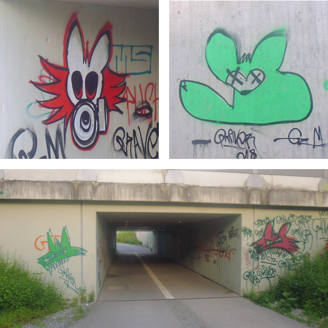
Since I'm visiting a fellow vulpine, I am looking forward for some vulpinity. However, I should, in fact, get more of that and sooner than expected, namely in the form of fox graffiti as I cross beneath the Untermenzing station.
After that, all I have to do is cycle past one of the remaining fields of Untermenzing…

…and then I am already at the Würm, which will guide my way over the next three hours or so.

Even though I have lived here for the better part of my life, I soon find that there are still many little places to be discovered, such as the Menzinger Mühle ("Menzing Mill"), which has stood here since at least 1397. Having been repeatedly renovated, this rustic building stands strong until today.

The latter can also be said about the Blutenburg ("Blossom Castle"), which is also located right next to the Würm. This one is significantly less of a new discovery and much more of a well-known local landmark though.

Even though I'm pretty much cutting straight through Munich, the route I take is quite green thanks to an abundance of parks along the Würm.

In fact, this stretch is part of Munich's outer bicycling ring, and it's not long before I espy a sign pointing towards the one of my two major milestones today: The city of Starnberg, which resides at the northern end of the Starnberger See and will be where the ride along the Würm ends, and the ride along the lake begins. Right now, I still have over 20km to go though.

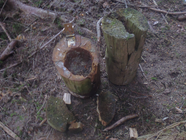
Geocaching fail of the day, by the way, goes to this one. The hint here is "beneath the ivy".

Still in the midst of Munich, I enter the first forest of the ride in form of the Pasing city park…

…and not much later, I leave Munich behind, crossing first through Gräfelfing ("Count-en Caught") and then Planegg ("Plan Corner")…

…where I happen to pass directly by the famous Blue Tower of Planegg.

The Würm is still my constant companion, although out here there are houses built to either side of it, so I have to follow it at a distance, crossing over occasionally.

My ride continues through the streets of Stockdorf ("Stick Village"), where the houses are much more solidly built than its name would imply. Also, this place is already part of Starnberg County.

Past Stockdorf, I enter the first "proper" forest of this ride, which stretches all the way from there to Gauting ("Geat-ham").

There, I am surrounded by a veritable orchestra of birds that sing a merry melody which floods the forest.
A Geocache is also hidden around here… or maybe I should rather say, it was hidden here, for I find that the hide appears to have been recently ransacked.
Leaving the forest, I find myself in the fields of Gauting…

…where I apparently follow the course of an old Roman road for a short bit…

…on which apparently today dogs cycle their humans for a walk.

Even here on these peaceful fields, however, signs remind of the ongoing severity of the Green Shnolz ravaging the land.

One might think there wouldn't be much notable out here, but alas, after the Roman road I should come across the Karlseiche ("Carl's Oak"), a memorial tree planted in AD 2000 in celebration of the 1,200-year anniversary of the coronation of emperor Carl the Great, who is said to have been born in the rice mill of Gauting.

Said mill, by the way, is also still standing. In fact, it's right over there.

Past Gauting, I reach the edge of the Munich Gravel Plain. Past here is the reason why the Starnberger See is where it is, which happens to come in the form of forested hills formed by moraines from the last ice age. First of all this means more forest for me, and the path is slowly getting more adventurous as well.

The Würm flows through a valley between two individual moraines, and out here you can really witness it in its original, primal beauty.

Secondly, it means that the flat part of the ride ends here, and so I soon find myself struggling to climb a rather steep dirt path up the forested hills.

Now, I know I could have stayed near the Würm and taken the easy path, but then I would have never reached this lovely alpine pasture on top of the hill.

It is from here that I can catch the first glimpse of the Starnberger See off in the distance.

It is also up here that I come across the most skillfully disguised Geocache of the ride.
Driving down the hill on the other side, I end up at the Schloßgaststätte Leutstetten ("Castle Inn People Place-ton"), where I find a steampunk Alien statue, because what else would be standing in front of a traditional Bavarian countryside restaurant?

From there, things get somewhat adventurous. For one, I end up balancing across a pond on a mossy tree stump in search of another Geocache…

…and then the way continues in the form of a gangplank walkway across the Leutstettener Moos ("People Place-ton Wetlands").

It is here that I bit the Würm farewell. The little stream drains from aforementioned wetlands, and since those are a nature preserve, I can only make it out by the line of bordering trees in the distance.

With that, the first milestone is reached. Now, I don't actually cross Starnberg, but instead decide to go for the place with the more simplistic name of Berg ("Mountain") on the eastern edge of the lake instead. I should soon learn that many ways lead to Berg.

The one that I end up taking ends up leading me through a place with the very interesting name of Kempfenhausen ("Fighting House-ing").

Not long afterwards, I enter the town of Berg, and ironically end up right next to the Starnberger See.

However, as if to justify its name, Berg soon enough punishes me with what must be the most brutal ascent of the day with a whopping 14% gradient. And yet somehow I still manage to fight my way to the top.

Fortunately, following that is a nice, relatively flat and shady stretch through the woods…

…which turn out to hide a little secret place in the form of a Mega Freaking HUGE chapel.

Turns out that this is the Votivkapelle ("Votive Chapel") erected in memory of King Louie II, which was built at the shore where his dead body was found washed up at 13-June-1886. Also, it is here that I am able to help out a group of fellow cyclists path up their bike by letting them borrow the multi-tool that I always carry around.

Afterwards, I make progress relatively fast as I follow the road by the lakeside, which is straight, flat, shady, and also pretty idyllic.

It is here on this remote end of the lake that I come across a little place that still stands testimony of the time when the Starnberger See was called Würmsee: A fish breeding house with a plaque that apparently was not changed in the last 50 years.

As I make my way south along the lakeshore, I pass a number of places with interesting aquatic names, be they Ammerland ("At Sea Land"), Seeheim ("Lake Home") or Ambach ("At Brook"). Also, I take note that I have now entered the county of Bad Tölz ("Bath Tölz") and Wolfratshausen ("Wolf Council House-ing") now.

By now, I am far enough south to see the Alps on the horizon, even in today's somewhat humid conditions…

…and since it's just about noon around now, I decide to take this chance on the shore with a bank and a view on the lake and the Alps to go sit and eat lunch, which consists of some bread topped with cheese and some meat plus a few Müsli bars and a gulp of water.

Moving on, I pass by a horde of people who are apparently significantly less concerned about the Green Shnolz than I am. Sure, it's not as crowded as it gets, but I for my part already feel uncomfortable sharing the road with a number of other bicyclists, and would never dream of spending an extended amount of time in the park or at a beach like these people.

It's not much longer now before I reach the second big milestone of today's ride: The city of Seeshaupt ("Lake's Head"), which is located at the southern end of the Starnberger See. There, I get a good look on the coast I cycled along these last few hours. Now, from here on out I'll be leaving the lake behind, and with the Alps this close, you know what this means. Yes, it's going to be hills and mountains all the way from here on out.

At first, the landscape is pretty tame, and contains only a little bit of up and down.

However, before long, I have to make my way across a high mountain (Hohenberg = "High Mountain").

It is at a crossroads in the forested hills that I pass the haunted Red Chapel…

…and shortly thereafter I pass through the town of Eberfing ("Boar Caught").

A bit further, not long after a motorcyclist nearly startles me to death, I come across a pasture where a herd of notably long-haired bovines are seeking shelter in the shade.

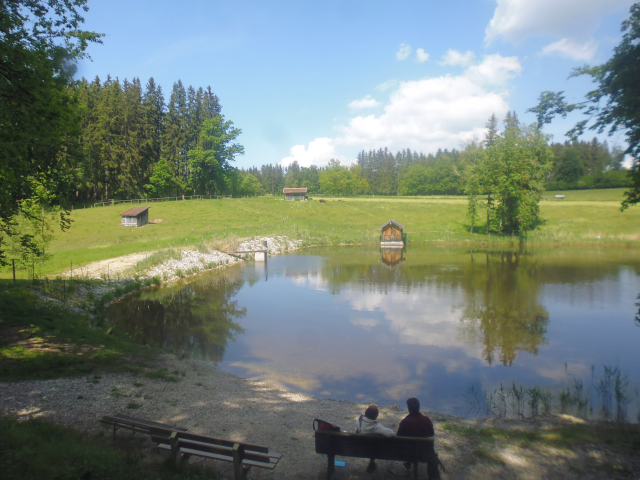
I actually come across another lake here, though this little pond – which nourishes the Rettenbach ("Save Brook") – though this little pond is only about 1/10.000 as big as the Starnberger See.
Afterwards, I have to fight my way up the final notable ascent of the day, cycling up a (thankfully shady) dirt path through the woods that is significantly steeper than the pictures make it look for some reason.

Oh, and here's why. Come to think of it, wasn't there another place named Berg just near Starnberg?

At 656m of altitude, this is the climax of my ride today. Already, I'm pretty close to the Alps now, and the view is fantastic.

What logically follows is a downhill rush, and afterwards I finally read the name of my destination for today on a roadside sign for the first time. It's not far now!

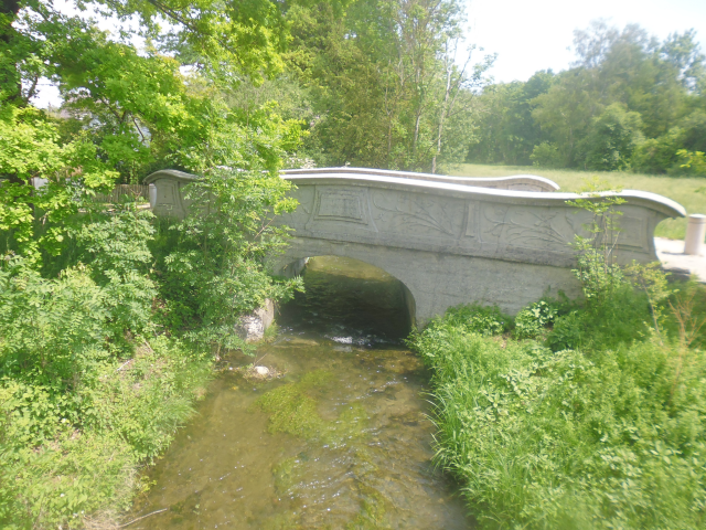
But before that, I cross the Ammer ("At Sea"), the river nourishing the Ammersee, which should play a dominant role on my return ride. Interestingly, even at its closest point, the Ammer is over 10km away from Ammerland, through which I passed earlier.

An then, I finally arrive at Peißenberg, which is already part of Weilheim-Schöngau ("Because Home Beautiful District") county…

…and also home of The Fair Milk (in contrast with The Unfair Yoghurt).

It is truly a wonderful place, where cats layzily cross the bridge…

…aaaaaand naturally the place where I'll be staying is up a hill. Just great. Oh well. One last push it is.

But after that, I finally arrive, and now have a day to relax here in…
Peaceful Peißenberg
The place I'm staying at is a lovely little house on top of aforementioned hill… or rather at the highest point of a road running along the side of a much higher hill.

The friend I'm staying with is a fellow vulpine by the name of Vulparion, who is only too happy to provide shelter to a fellow fox.

Not much remains to be said about my time here. I have a relaxing day playing games such as Stellaris and The Long Journey Home (not to be confused with The Longest Journey, The Journey Home, The Longest Journey Home, or The Longer Home Journey), and in the evening I prepare my Legendary tri-Tail Pizza for Vulparion and his family. Once again, it is well received, and before long it is all gone.

Just like that, I relax the day away, and before I know it my time here is already over again, and I have to depart on the return ride where I should find that…
Animals Abound at Ammer, Amper and Ammersee
23-May-2020Distance: 80km
Ascents: 200m
Duration: 8.5h
6/10🎁︎
Today's ride should be a race against the rain. A massive thunderstorm is oncoming, and I want to reach the safe shelter of my home before it arrives. As such, I get up at 5:00 in the morning, and by 6:00, I'm already up and on the road again.

My route should take me north through the middle of nowhere until I reach the Ammersee, and then along said lake. The Ammersee is most famously known for upgrading the Ammer into the Amper, which is the river I follow from there until Fürstenfeldbruck ("Lord Field Bridge"). After that, I turn east and make my way back home more or less directly (actually, in absence of a true direct route from there, that last bit should be particularly "squiggely"). My three designated milestones for today are the southern tip of the Ammersee, the northern tip of the Ammersee, and Fürstenfeldbruck, which serve to divide this ride into four segments of roughly equal length.

Since the last leg ended with an uphill segment, today starts with a relaxing ride down the hillside. In fact, most of today should be going downhill since I'm mostly following the flow of the rivers. However, there should eventually be a few uphill segments to it as well.

Not long after that initial downhill segment, I find myself in the middle of the countryside already, cycling across gravel paths once again.

And then, I start meeting animals. Maybe it's the time. Maybe it's the place. But either way, I don't think I've seen this many cats stalking the fields on any of my other rides.

After that, my route takes me across an airfield… as in across across. This is a little rural airfield probably used for recreation, and there's a field path running, like, directly across the runway. Fortunately, at this time of the day I don't have to be afraid of getting run over by a plane, but I make sure to look both ways anyway.

It's here that I start entering an area that can really be best described as "the middle of nowhere", since there's pretty much no permanent residences around here, only mostly unpaved roads running through fields. It's also kinda hilly here, but thankfully nowhere near as hilly as on my ride from Munich.

However, in the place of human homes, a pack of radio telescopes seems to have made this area its home, quite possibly because they shy the light of human civilization. This particular array belongs to the German centre for air- and spaceflight.

Following that is another comfortable downhill ride from the ridge that I climbed and down into the Ammer valley. I should not actually approach the river, but instead turn north afterwards, following the forest's edge, and subsequently passing an entire flock of birds of prey, at least half a dozen animals strong, though it's difficult to get them all into one picture. Once again, I don't think I've ever seen this many fully grown individuals in one place.

This place also features a nice view on the Alps despite the low visibility today, with nothing in sight but fields, forests, mountains, and a few little tool sheds.

And then I should run into the absolute highlight of today's ride! There's a saying in German to describe these sort of remote locations, namely "Wo sich Fuchs und Has gute Nacht sagen", which translates to "Where fox and hare bid each other good night". Now, I should not come across a hare around these parts but… sitting in one of these fields, I spot a little shy young fox. This one is a lot more timid than the one I saw on the Century Circadian Circuit, and dashes off into the forest before I can ready my camera. However, the memory of this little young fox on the meadow should follow me all the way home, and quite possibly all my life. After all, this is only the eight wild fox that I've seen in my entire life. I really should go cycling south of Munich more often.

Continuing, I pass through a piece of forest that is totally off-limits for four-wheel vehicles of all kinds…

…before emerging within sight of the next pack of radio telescopes, this one belonging to the terrestrial communications centre of Raisting.

Incidentally, it is here that I find a winner for "field path of the ride". This one is several hundred metres long and certainly manages to slow down my advance, but eventually I make it to the other side.

On said other side, I continue along the Brennerstraße ("Burner Road") for some time. This is another old Roman road that led across the Alps and was constructed in the 2nd century AD. I, however, am not following it to the Brenner, but rather down to the north today.

I also pass quite close by the aforementioned radio telescopes. In fact, the Brennerstraße leads right through the middle of the pack…

…and some local farmers have apparently made use of the fact that they look like upside-down umbrellas by depositing their goats near them to give the animals a place to stay dry in the rain.

Speaking of which, what does the weather say?

Meh, it looks like I'm going to get wet. But that's okay. I have mentally prepared myself for some light rain during the morning hours. The important part is going to be getting home before the big storm in the afternoon hits.
Anyway, now is when I leave the middle of nowhere, and enter somewhere again, somewhere in this case being the town of Raisting, which is notable for having a name so abstract that I can't even think of a far-fetched funny translation.

After leaving Raisting, I come across an animal that I've seen even less often in the wild than foxes, and that is a stork! A real stork! Once common all over the place and famous for roosting on chimneys, the populations of these big birds have been declining over the course of the 20th century. In 1980, an all-time low of less than 3000 couples was recorded in Germany. However, ever since then the numbers have been gradually improving, so maybe we'll soon be able to see more of these elegant birds all over the country again.

By the way, thus far I was not able to find a single Geocache – the three in the middle of nowhere having been either missing or too well-hidden. However, that should change in the city of Dießen ("This"), where I finally find one again, and subsequently pass through a really, really narrow alley that would be perfect for an ambush.

It is also here that I finally reach the Ammersee, which should dominate the next leg of my ride. I suppose that means that I've now passed the first major milestone of today's ride, and somehow I'm still dry. The next leg, however, should end up with me getting just a little bit wet.

For the next 10 km or so, the path I take should oscillate between the lakeshore and the single-track railroad line that runs along the shore. Interestingly, following that track I soon come across a peculiar pedestrian's crossing that is somehow both old and new at the same time.

A nice part of the ride takes me through the Naturschutzgebiet Seeholz ("Nature Preserve Lake Wood")…

…which is also where the expected first rain sets in. Fortunately, it's only a light (yet persistent) shower, so I can push on through it.

Also, it works out in my advantage that the path I take is rimmed with trees, providing a sort of natural umbrella to keep away the worst of the rain.

It is not until Utting (another of these places with a name that's impossible to translate even with generous amounts fantasy) that I finally find a place where I can actually go all the way down to the shore of the Ammersee…

…and it is also there that I come across the next critter. This time it's a relatively common one, namely a red squirrel – though even these particular arboreal fuzzballs are getting less common as they are gradually being displaced by their North American cousins, the grey squirrels.

Moving on, I happen to follow the Miteinander-Weg ("Together Way") of Schondorf ("Already Village") for a bit, where you have to be considerate of one another. Makes me wonder if there's a Gegeneinander-Weg ("Against Each Other Way") in a place called Nochstadt ("Still City"), where you have to be particularly inconsiderate.

Ironically, there's this very intuitive and graphical billboard right next to the Miteinander Weg of Schondorf illustrating the mandate of apartness to be upheld during the Green Shnolz.

Subsequently, I enter another forest. However, this is not just any old forest. For starters, due to the weather, it's nice and dark…

…and it also has a place with the most amazing view on the Ammersee thus far…

…right next to whatever the hell that is.

Also, for some strange reason, someone seems to have deposited 7d12 right in the middle of the forest.

Moving on, I reach the northern end of the Ammersee, and cross a very-under-construction-y bridge across the Amper, which I guess means that I have reached the second major milestone for today. Also, it is on this bridge that a little rabbit crosses my path, adding yet another animal to the list. Just like the fox, however, it darts out of sight before I can reach for my camera.

By now the rain has mostly let up, but there should still be the occasional little shower every now and then. However, there are certain advantages to this weather. For one, unlike on my ride from Munich, I have the road pretty much all to myself, despite being on the Ammer-Amper cycleway.

And that, in turn, means not having any E-Bikes around, despite there being infrastructure available for them. You've got to hand it to the tourism-industry though: Offering free E-Bike recharge stations is probably a clever move.

You can say what you want, but E-Bikes still feel like cheating to me. But then again, I suppose I cheat too, being a fox and all. Like with this one Geocache where I make clever use of my bicycle lock in order to access a cache that is just outside of my reach on a wet and slippery lamp post. The truly tricky part is getting it back up again, but with my daily use of Vulpine Prowess, I manage to get that done as well.

From there on, I make good progress as I can follow a major cycleway running more or less parallel to the Amper north, past another untranslatable place by the name of Arzla and all the way to the town of Grafrath ("Count Council"), which is already in Fürstenfeldbruck county.

It is around here that the rain finally lets up for good (or at the very least, until the big storm that's still a-coming).

And it is also around here that I cross the Amper once more – this time using a less-under-construction bridge – putting me on the "far side" once again. Not that even though the Ammersee is a good bit smaller than the Starnberger See drained by the Würm, the Amper draining the Ammersee is significantly bigger than the Würm which I followed at the beginning of this tour.

It is in the middle of the forest between Grafrath and Schöngeising ("Pretty-Goat-ton") that I come across a cache that is a new kind of inaccessible: I manage to find it, I can reach it… but I can't open it up, not even with my toolkit. This particular cache was apparently last screwed shut by Vikings, and without the use of heavy tools, I don't see a way for me to open it. Oh well.

Within the town of Schöngeising, at the shore of the Amper, I come across what must have been the prototype for modern waterslides, just downstream what I assume is an old hydroelectric power plant.

Subsequently, I cross over the Amper once more, and enter the Amperauen ("Amper Meadows")…

…a place where the people are obviously in good humour, as this particular art installation proves. The sign says "During the hay harvest, sex in the high grass is forbidden! Mortal Danger!"

And it continues with this sign that reads "Starting from here it's the salad dish of my cow and not the toilet of your dog."

Interestingly, there are neither cows nor dogs around this particular meadow. Instead, I spot a kind of hawk sitting in the field, and taking off momentarily.

What follows is a relaxing ride across the lush green Amperauen…

…and also the beginning of the first of today's short segments of sunshine.

The Amperauen stretch all the way from Schöngeising to Fürstenfeldbruck - the final major milestone of today - and eventually I enter the city through what can probably best be described as a side entry.

There, I come across a Geocache that can probably best be described as "Hahah! No!". Mounted about 6m or so above the ground on a tree across from a bridge, this one apparently needs to be fished with some sort of stick from said bridge, but I naturally don't have a suitable implement with me, and I'd rather not risk trying one of the presumably brittle branches lying around on the ground. Besides, I already used my Vulpine Prowess for the day, so I let it be.

By now, it's already about noon, and I've already come three quarters of the way. For a moment, I ponder just skipping lunch and heading straight home… but no. My body needs a break, and since I know I'm more of a sprinting type – that is, I don't have a lot of stamina reserves, but instead I recover stamina quickly during breaks – I figure it's a good idea to have that break now after all. As such, and because the sky is already threatening again, I take shelter in a roofed square across from the train station, at the terminus of aforementioned bridge from where the Geocache could not be reached…

…and in absence of a bench I sit down at some stairs and devour my trail lunch consisting of the usual mix of sandwiches, Müsli bars and some good old water.

After my break, I leave the Amper behind and streak out east towards home, cycling partly across fields…

…but also through the odd residential development area.

Then, in a little piece of forest north of Eichenau ("Oak Meadow"), I come across an abandoned old bridge.

As in, really really abandoned. Not only does this bridge not cross anything, but also its end pieces are missing.

Once, this was apparently a road bridge across an old railroad line, both of which no longer exist now. In fact, I have actually already been at another bridge of that former line further to the northeast, now that I think about it. Anyway, nowadays, this bridge is very out of commission, and only serves as a climbing yard for adventurous people.

Moving on, I pass through a place called Roggenstein ("Rye Stone")…

…and soon find myself on a pretty bumpy forest path, just as today's second segment of sunshine should begin.

An just at the right time, for it is only thanks to Radian that I notice I took a wrong turn upon entering the city of Puchheim.

At one point, I get annoyed about me heading straight towards the sun, and then I go "Waaaaait a minute… If I'm headed for the sun, and it's the zenith hour right now… then I'm headed significantly less east and significantly more south than my intended route specifies. And thus, I end up with a neat little swerve in today's route.

Frome here on out, however, I'm in familiar territory. For one, I come across the Russenbrücke ("Russian Bridge") spanning the Gröbenbach ("Rough Stream") again that I already visited on a minor ride last year, and which despite its name was actually build by Frenchmen serving as war prisoners during World War I.
And before long I cross the first major highway near Langwied. Interestingly, parallel to the highway, there's an ongoing ecological project, a bee highway, in progress to counteract the bees dying out.

Looking to the east, the weather looks still fine. However, from the western horizon, I can already see the gathering storm approaching fast. It is not far now, but I must hurry.

I pass the Langwieder and Lußsee, where only a few people are still on the beach and in the water in the yet-enduring sunshine…

…as well as a very interesting children's camp and/or adventure playground that exudes a very Peter Pan-esque feeling.

Not soon after, I cross the Autobahnring ("Highway Circle"). Home is getting closer… but so is the storm behind me. Will I make it in time?

By the time I cross the city boundary of Munich, the sky has already closed up…

…and as I make my way through Allach, the wind picks up, shaking the trees, and darkening the heavens.

I know it's only a matter of minutes now till the deluge begins, and so I mobilize the last of my reserves, and make a mad dash home, going as fast as I can and dare, racing through the familiar streets of Untermenzing. And amazingly, I make it. After a fantastic final sprint, I arrive back at home, exhausted, but thankfully without getting wet again.

And not a moment too soon! For just a few short minutes later, the storm hits us with all its might, including gusts of wind, rain and thunder. I am so happy that I managed to avoid getting caught in that.

With that, this amazing and thankfully only a little bit wet ride comes to an end. Three petals are now complete, and more are yet to follow. But for now, this is it. And yet, you can already look forward to the next chapter of the Travelling Fox Blog. So stay tuned, everyone, and be of great cheer!
No comments:
Post a Comment