26-Sep-2021 – 29-Sep-2021
On our big trip all around Germany, we visited a whole number of different states. However, not among them was the one we have arrived in now, namely…
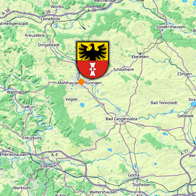
Thüringen (“Door Wrestling”) is one of the three great inner states of Germany – that is, the three non-city-states that do not share a border with a neighbouring country – the others being Sachsen Anhalt to the north and Hessen to the west. With a population of a little over 2 million people, it has about as many inhabitants as Gabon, and its land area of roughly 16,000 km², it is the rough equivalent of Estwani. Both of those are on the lower part of the range for Germany, and so naturally Thüringen’s population density of about 132 people/km² – which comes close to Denmark – is also below average. Its coat of arms displays the colourful Ludovingian Lion, striped in silver and red, on a field of blue, wearing a golden crown and surrounded by silver stars.

Within Thüringen, we are currently located in the Wartburgkreis (“Wait Castle Area”). I say “currently”, because we should eventually cross over into the next county on our stray, but more about that when we come to it. The coat of arms of the Wartburgkreis is divided into four quarters, with the colourful Ludovingian Lion on the top left and bottom right, a black hen standing on three green hills on a field of yellow – for the Grafschaft Henneberg (“Hen Mountain County”) – on the top right, and black cross on a field of silver – for the Bistum Fulda (“Fulda Dicese”), which used to own lands to the south – on the bottom left.

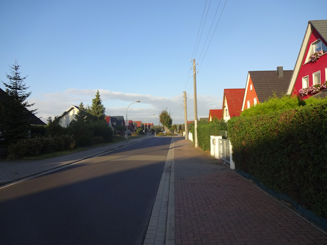
And within Thuringia, we are now, momentarily, in Eisenach, a town with 42,000 inhabitants and a history. It’s coat of arms depicts, on a field of blue, the dragon-slayer St. Georg in silver chain armour and with a coat, holding in his right a spear, the flag of which depicts a red cross on a field of silver. In his left, he holds a silver shield with a red cross pattée, as well as a golden palm twig. And since that’s clearly not enough detail yet, there’s also another silver cross pattée to the right of good old George.
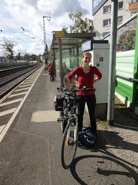
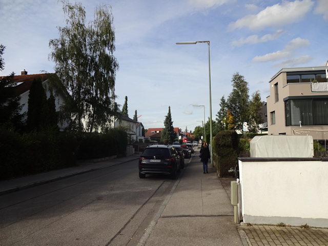
Finally, our stay place for tonight is located to the west of downtown Eisenach, a little bit up the mountainside, about 8 STEPs away from the station.
Having just arrived in Eisenach after an 8-hour train ride plus half an hour hiking with baggage, we use the remainder of the day to do what any other reasonably loopy person would do: Drop off our luggage at the pension and use the rest of the day for another hike. After all, the first centre of Germany is barely another 10 STEPs away even if we do take a scenic approach. And so, we promptly embark and make for…
The Protestant Palace
26-Sep-2021
Distance: 9.0km
Ascents: 300m
Duration: 3.5h
7/10🎁︎
The first centre of Germany that we are going to visit is located on the Wartburg (“Wait Castle”)… yes,
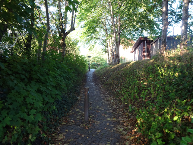
the Wartburg. Our way there should lead us along the flank of the Siechenberg (“Wasting Mountain”), most of the way up the Mädelstein (“Girlie Stone”), and then up the nameless mountain upon which the Wartburg is located. After that, we proceed down the eastern flank of the mountain and pass through the Kartausgarten (“Card Off Garden”) and the city park of Eisenach before making our way through the downtown. We go for a bit of a bonus loop there, but eventually make our way to a restaurant, before finally returning back to our stay place for the night.
Since the first part of the way is already leading us up a steep hillside, we quickly get a nice view not only on the town below…
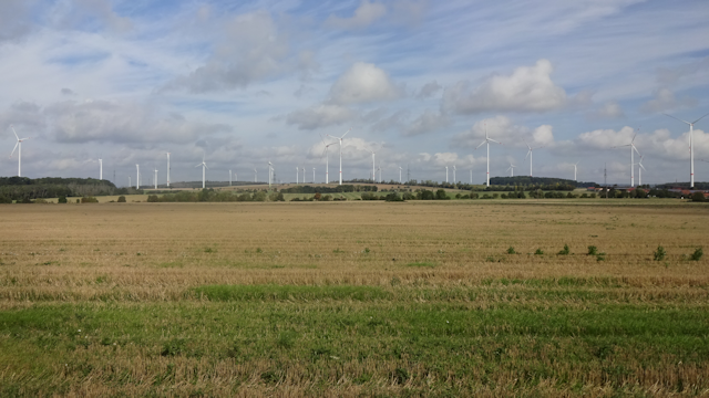
…but also on the many, many windmills decorating the distant hills.
Soon thereafter, we face our first trial as I lead Robert down an are-you-sure-this-is-a-path. Somehow, I seem to have a talent for finding these.
However, we eventually manage to pull through, but not without passing by a house where a fearsome Chihuahua lies in wait.
After passing by some houses in the valley, we soon enough make our way up the hillside again, and while this time around the path starts out looking pretty acceptable…
…it soon enough degrades into a steep forest trail that while already exhausting to me, is outright harrowing for Robert, and both of us are glad that we did not take any luggage on this particular tour.
Soon enough, the two of us have a good idea as to why this place is called the Siechenberg. Not only is the way narrow with ascents as steep as 45° - partially on rather loose earth – but it also goes up and down several times, and past quite adventurous twists and turns along the way.
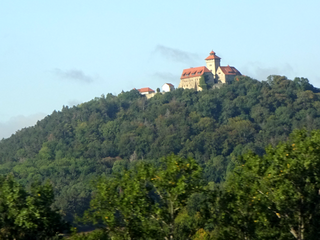
After what feels like an hour or so, we finally arrive on a vista partway up the Mädelstein, from which we get a great view on the Wartburg on the opposing peak, standing sublimely among the trees, and beneath a sky that painfully reminds me that I neglected to bring any sort of rain-proof equipment on this particular stray.
As such, we decide to scramble, and instead of making our way all the way up the Mädelstein, we proceed towards the Wartburg. Fortunately, the paths on this side of the mountain are considerably more agreeable than those on the flank of the Siechenberg.
On the saddle between the two peaks, we pass by the bus- and donkey station. I also note that there’s a roofed waiting area here. Should it start to rain too strongly, this is going to be our exit strategy.
Climbing the stairs to the Wartburg, I once again get to marvel at the plenitude of windmills standing in the area. In Bavaria, we can only dream of having this much wind power available.
Also, we can naturally see over to the slightly smaller Mädelstein, as well as the vista point from which we looked over to the Wartburg maybe 15 minutes ago.
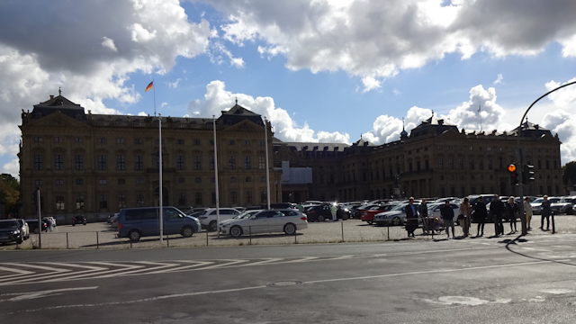
As for the Wartburg, we are now standing right in front of it. A small bridge – barely 3m wide – is the only major entrance to the castle, though I’m sure they have smaller back doors hidden somewhere around the perimeter as well.
The Wartburg is remarkable for a number of different things, not only is the entire castle under video surveillance – which used to be really cutting-edge technology when the castle was first built in 1067 – but it is also a certified bat-friendly castle.
Another notable thing is that it was here that Martin Luther took refuge in 1521/22, during which time he also translated the New Testament into the German language – and that in a record time of only 11 weeks. Incidentally, since he was here more or less incognito, he assumed the guise of “Junker Jörg” for the duration of his stay.
And finally, this is also the first center of Germany that we should reach… well, more or less. This one is actually a replacement spot for the less accessible center point on Gut Landstreit (“Estate Country Strife”) pretty much exactly 5km to the north-northwest from here. Be that as it may, this is definitely a nice spot to have visited.
Afterwards, we leave the Wartburg behind, and despite Robert’s very insistent requests, do
not proceed along the 2,696km long international mountain hiking path of friendship from Eisenach to Budapest via Czechia, Poland, Slovakia and Hungary.
Instead, we take a left and walk down the “Dangerous Hillside Path”, where a sign explicitly warns that the path is not secured and sure-footedness is required. My tail! Our earlier climb up the Siechenberg (where no such sign was present) was
way more perilous than this walk in the path! The paths are several meters wide, and the incline maxes out at 20° tops! See,
this is why I generally don’t let such signs stop me.
On our way down, we also pass by the Cranach Memorial – yes,
the Cranach Memorial – erected in memory of the legendary Cranach. What? You don’t know the legendary Cranach?
You sincerely do not know the legendary Cranach??? Well… to be honest, neither do I, but I’m sure Cranach was a great person. After all, not everyone gets a winged, crowned snake Memorial erected in his/her honour this close to the centre of Germany.
Anyway, we continue along the ineffably hazardous forest hillside path for a little bit longer…
…and then we reach the city of Eisenach proper again. Every now and then, a few drops of rain are falling from the threatening sky above, enough to have me somewhat worried, but not enough for me to cancel the remainder of the stray and scramble for shelter.
Among other things, we still make our way through the Kartausgarten…
…as well as the city park of Eisenach, which honestly is more of a city forest.
We eventually enter the old town of Eisenach at the Karlsplatz (“Carl’s Square”) near the Nikolaitor (“Nikolai Gate”), the only remaining the formerly five city gates of Eisenach. Incidentally, right next to the gate, there’s the eponymous Nikolaikirche (“Nikolai Church”). And we pick a really good time for it too, since it is just there and then that the rays of the evening sun break through a gap in the clouds and illuminate the gate and church for us.
We then proceed through the Karlstraße (“Carl Street”), a pedestrian zone which is quite devoid of pedestrians…
…and eventually end up on the market place of Eisenach, the historic centre of the town, with the protestant Georgenkirche (“George’s Church”) located prominently on one side. Originally built sometime in the 12th century, this used to be a catholic church… and the Martin Luther happened. As it is, this is now one of the oldest protestant churches in the entire world.
Since the weather is yet fair, and it’s still not all-that-late just yet, we proceed to stray around the town some more in search of Geocaches, but eventually Radian announces the end of the day…
…and so, we soon make our way to a restaurant that caught our eye along the way: The Lutherstuben (“Luther Parlour”).
Originally, we were lured by the promise of chanterelles being on the menu, but as it turns out, that should only be a minor highlight compared to what else the restaurant has in store. Turns out this is actually a genuine medieval-themed restaurant, where not only the waitress speaks in ye olde tongue, but furthermore, ye menue looketh and feeleth like propere parchemente, and harboureth drinkes and dishes such as Teufelszeug (“Devil’s Brew” (Coke)), Ratsherrenspies (“Alderman Skewer” (meat skewer with mushrooms and potatoes)) und Herzkasper (“Heart Attack” (Espresso)).
Then, the special seasonal chanterelle menu comes in the form of an old-style chalkboard…
…and the drinks are served in round-bottomed chalices, which come with special wooden holders to put them in. Some of the desks even have holes cut out especially for the chalices.
Originally, we sit outside, but as we wait for our food, the gaseous water vapour that makes up the clouds above spontaneously decides it wants to have a closer look at our drinks, and so we and all the other guests end up scrambling for the interior after all. A good turn of events, as it turns out, for this way we get to see that the inside is also decorated in ye olde style all over the place.
But now, it’s finally time for our dinner to arrive, with me having venison with chanterelles and Robert a big chanterelle salad. Also, the both of us get traditional home-baked “Pater Noster” bread in the old style.
After a tasty and filling meal, and after the hostess sees us off in charming old German, we leave the restaurant. Fortunately, by now the rain has stopped again (there aren’t any more interesting chalices outside anymore after all), and so we stay dry as we return to our stay place for tonight, which is…
The Pension Metilstein
For tonight, we have a little room in a little local pension. It is not much, but it is enough for one night.
Just like on my previous journeys, I have one of my foxes accompany me. This time, it is Emilious, the grey fox, who keeps me company.
With not much else to do, we go to bed pretty early, which turns out to be a good thing because the next morning we get woken up equally early by first one tractor, then another, and then an entire school class trip passing noisily beneath our window.
On a related note, aforementioned window also has a 100% ecological insect catching mechanism in place, and although my new camera stubbornly refuses to focus on minor details like that, my cell phone promptly focuses on the arachnid.
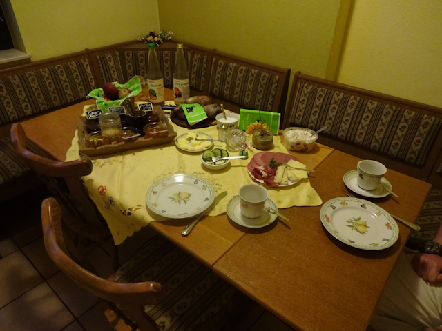
After fully rousing ourselves, we head down to the breakfast buffet, where we are still the first guests to arrive. Even so, we still compliantly wear our masks when helping ourselves to something from the buffet… even if for me that feel a little bit silly, seeing as how my chair is right next to the buffet, so I could theoretically even help myself without getting up. For today, we should mostly get bread with cheese, though there’s also one egg each on the side. This time, they are medium-hard-boiled, much to Robert’s delight, while I personally prefer them entirely soft-boiled, with the yolk still liquid.
And that’s already the entirety of our stay here. We had a private room with its own little bathroom, the temperature was okay, the beds were okay, and a tasty and plentiful breakfast was included in the price. The staff was friendly, the WiFi worked, and the location was at the same time idyllic and reasonably central (if somewhat noisy in the morning). The price-value-ratio was still okay-ish, though clearly below average for the places I stayed in on my travels.
We make several sincere attempts to pay, but after the one staff person on premise insists not only once but twice that my bill had already been paid, my conscience is appeased and so we simply take our leave (I should get the bill a few days later by mail though). Now, our first big hiking day begins, and with it…
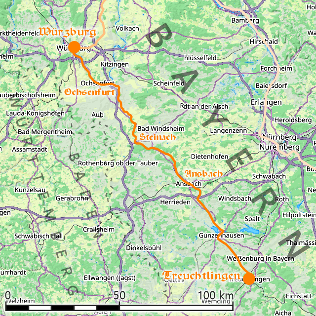
A Way with Woods, Windmills and the Werra
27-Sep-2021
Distance: 21.0km
Ascents: 230m
Duration: 7h
8/9🎁︎
The first of the three major hikes this tour consists of should also be the longest one, taking us from Eisenach across the hills to Mihla, and past two centres of Germany along the way. In order to avoid getting subjected to infrasonic, we take a scenic detour around the windmill park – not because of the windmills, of course, but because of the very busy country road that we’d have to walk along, the cars on which not only generate much more infrasonic than the windmills, but also exude poisonous fumes as a bonus (if the car would only have be invented in this day and age – can you imagine how many protest movements would form because of it?). Instead, the route we take takes us along a forested hillcrest, which has ups and downs. On the upside, it means a scenic view and cleaner air, but on the downside… well, it
literally has ups and downs. Also, this hike should be somewhat unusual in that it has long segments at the beginning and the end that don’t have any geocaches nearby, while near the middle they come up one right after another, like pearls on a string.
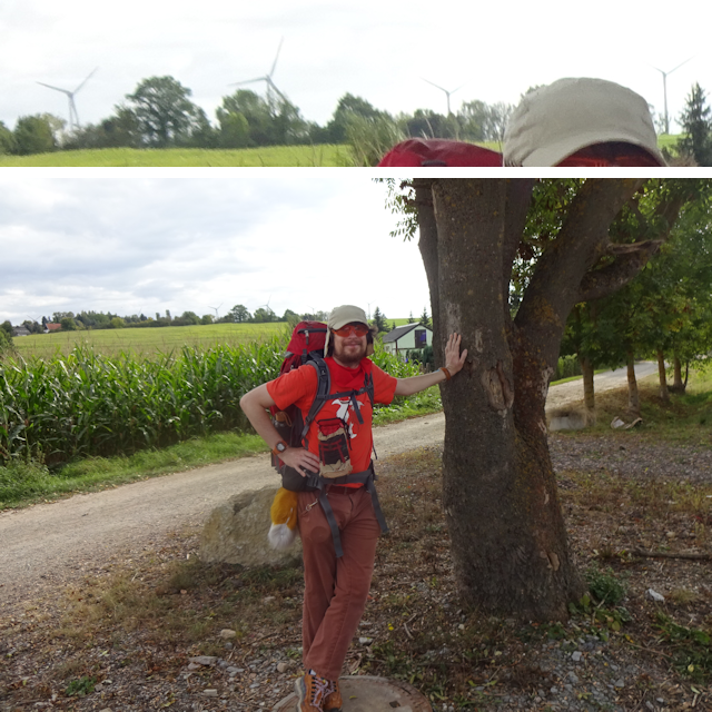
Now, normally, a distance like this would be pretty straightforward for us by now. However, as an added difficulty, this time we are making a linear hike, without returning to our starting point, and so we additionally need to carry all of our luggage on our backs. It’s not as much as I was lugging back in Japan, but then again, back then I never had to walk anywhere
near as far as today with this much luggage.
Anyway, first thing we need to cross to the far side of Eisenach.
Along the way, we come across a very… interesting way to construct an artificial dead end. I am actually surprised that the railing doesn’t feature a few decorative dents already.
But that’s not all! This spot (which for those of you who are interested, is the underpass of the Hospitalstraße (“Hospital Road”) beneath the railroad tracks) also features a very interesting pedestrian crossing: Unlike on normal roads, where the lights and crossing would be just in front of the actual crossroads, here they are squat in the centre of the underpass.
A little bit later, we cross the Hörsel (“Hear-let”), which is Eisenach’s primary river. This river actually flows into the Werra roughly 8km downstream from here, and since the Werra eventually flows through Mihla, we could theoretically throw a rubber ducky in here and race it to Mihla (the ducky would pretty likely win though).
Further down the way, we pass by the Straße der Solidarität (“Road of Solidarity”)…
…and shortly thereafter, we reach the outskirts of Eisenach, where three separate things occur simultaneously:
- The paved street turns into a dirt road
- The gradient increases to roughly 10%
- The typical German houses give way to typical German Schrebergärten
Incidentally, this particular Schrebergartenverein is called “Wartburgblick” (“Wait Castle View”), and true enough, from here, we once again get a nice enough view on the Wartburg, which by now is pretty much 3km away as the artillery shell flies.
It is also in here that we come across a very colourful grove of trees, featuring red, green and yellow leaves right next to each other. Here’s hoping this is a good omen for the currently ongoing coalition talks in Germany, where with the election result that we have a red-green-yellow coalition still seems like the best possible combination.
We continue along the Schrebergärten for a bit longer, until we finally find a hidden green underpass that takes us beneath the federal road, which would otherwise prove to be a pretty insurmountable obstacle to pedestrians like us. That’s the age of cars for you.
This underpass sort of also marks the boundary between Eisenach and the countryside, for on the other side we face – for the first time on this trip – rolling open fields.
Out here, nature still adamantly works to reclaim what was taken from it, including this sign that goes for all except agricultural traffic.
Confounded by strange pavement, we almost walk too far across the hillcrests here…
…but fortunately, I notice my navigational mistake in time, and so we can quickly backtrack and make our way along a pretty green field road.
Incidentally, beyond the green field road, there’s an entire green energy park, complete with solar farms and windmills. I really wish I could see such things in my home of Bavaria.
Subsequently, we make our way into a little wooded area…
…at the heart of which lies the Gut Landstreit, which appears to be a logging venture of sorts.
Now, you may recall that name, and if so, then it is because I dropped it once before, for this now is one of the genuine centres of Germany. Specifically, this is the centre that was determined by calculating the centre of mass for Germany, without the coastal 12-mile zone.
After that, our way continues into a bit a of woodlands…
…where the path soon degrades into another are-you-sure-this-is-a-path.
However, every now and then there are open areas, from which we get a great view on the sprawling windmill fields beyond.
Eventually, we get out onto open fields again…
…and soon thereafter reach the village of Neukirchen (“New Churches”)…
…which lies at the southern edge of the biggest windmill field I’ve seen ever since returning from Sylt (see
Book IV ~ Chapter 9 ~ Waves of Wind and Water).
As mentioned before, we should skirt around the western edge of the windmill field, and stick to the forests instead of going along the busy country road.
It is here, near a little pond, that we sit down and have a short lunch break. Since breakfast was plentiful, all I need are a few Müsli Bars.
Continuing through the woods, we come across a rare sight these days: A tiny snake slithers through the stones, quickly making its way into the underbrush as we approach. Come to think of it, out in the wild I’ve actually seen more wild foxes than snakes.
We proceed through a remote landscape mixed with fields and forests, as well as the windmills, which are always somewhere on the horizon as we skirt around them. Incidentally, we still can’t hear anything of the windmills, but we can still hear the nearby highway, although it’s over one kilometre away.
We also hear a triad of helicopters as it passes by. If my information is correct, these are Boeing CH-47 Chinook, and since Germany doesn’t have any of those as far as I know, these must likely be from a nearby US base.
Next, we proceed along a windy hillcrest path…
…from where we get another view on the Wartburg… though by now it is already in the far distance. 6.66km separate us, as the Dragon breathes.
The way we are on now takes us along the Langer Enspel (“Long Enspel”) and towards the Runder Enspel (“Round Enspel”), where we cross another bit of woods.
As we approach the village of Ütteroda (and for once, I have
no idea what that name might mean), we get an interesting view on one of the nearby windmills. Lining up
precisely with the hillcrest, it looks like half of the windmill is actually below ground.
We also spot a bird nearby. Based on the shape of the wings and the distinct V-shaped tail, I think it might be a kite.
It is also here that we get our final view on the Wartburg. At this point, we are about 7.5km away, as the thunder resounds. After this, hills should quite terminally place themselves strategically between us and the Wartburg, blocking any direct axis of sight.
Next up, we pass through the aforementioned village of Ütteroda with it’s legendary fancy fowl pond, featuring colourful geese and ducks.
Ütteroda should also be the last civilization we should see for a while, for after that we enter a forested area known as Bornfichten (“Spring Spruces”), and it is not until about 6km later that we finally reach the outskirts of civilization again.
As we make our way through this area, we also come across the rare and very unusual dark cloud floating in the sky. Standing out conspicuously among its lighter brethren, we wonder what sort of phenomenon we are observing here.
After cresting over the last hill, we finally get to see the Hainich (“Grove Corner”), which we are to traverse tomorrow. Incidentally we can also see the tower of the Haineck (also “Grove Corner”, but with less dialect) castle ruins standing out in bright white and red against the green of the forest.
The first sign of civilization that we come across (apart from the roads) is a pasture where a small herd of horses eagerly welcomes our company, however short-lived it might be.
And as we step further out from the shade of the trees, we can see that we have left the field of windmills behind us by now.
By now, the two of us are already quite spent. Fortunately, we can now already see our destination of Mihla in the distance, and that gives us the strength for the final push. Also, it’s all downhill now.
On our way down to Mihla, we come across another snake, this one of a beautiful copper colour. But wait, turns out that this is no snake at all! It’s a Blindschleiche (“Blind Sneaker” = Slow Worm), and as such not a snake, but rather a legless lizard. What’s the difference, you ask? Well, for once, Blindschleichen, like other lizards, can detach their tails in the face of imminent danger.
As we reach the outskirts of Mihla, we come across an interesting bridge, which also features a dry ford as alternative for people with gephyrophobia.
After that, it’s not much longer until we reach the official town border of Mihla.
A little bit further, we come across the third centre of Germany, again, without a sign, but at least with windmills in the background. This one is the centre as calculated by squaring, which means that the area of Germany was subdivided into about 314,000 squares of 1km² each, and for each of these squares, the distance to the centres of all other squares was determined. The square with the lowest such sum was deemed the centre, and the centre of that square is right here.
It’s not much further now, but first, we have to cross the Werra by means of a conveniently placed bridge.
Okay, so maybe not that bridge, but fortunately, Mihla also has an extra bridge, and as we cross
that one, we notice that the Werra is now already notably wider than when we last crossed it during our train ride. The fact that there’s a weir here might be related to that, but even beyond that the river is already more than twice as wide as before.
After crossing the river, we are glad to finally see a sign pointing to our stay place of today (“Kläranlage” = “Cleaning Plant” = “Sewage Treatment Plant”).
No! Not
that sign of course! The slightly washed-out sign next to it, which leads us to the Sandgut Mihla (“Sand Estate Mihla”).
However, there, we find ourselves standing in front of locked doors. Despite it being 16:15 already, there’s no one there yet. We call, but they tell us they will only arrive later, and so we have no choice but to sit down beneath the nearby pergola and wait for our host to arrive.
Roughly one hour later, someone finally shows up, and we can finally check into…
The Sandgut Mihla
We are now within the town of Mihla, which has a little more than 2,000 inhabitants. It’s coat of arms depicts green scales on a field of white above a golden sword with white wings on a field of red.
This place is a sorta special place. Something between an inn and an Airbnb, this is actually an agricultural venture that also rents out rooms for guests as a side business, hence why no one was here until now. Either way, we are quartered in a pretty spacious room, and soon make ourselves comfortable.
A little bit later, we go down to have dinner and sit down in the dining room, which also features a table with integrated whetstone.
Turns out we’re the only guests today, and as such we get chatting with our elderly hostess for a bit, who also tells us a bit about the Sandgut Mihla. When we see the menu, however, we notice a slight problem: There’s not a single vegetarian dish on it. Fortunately, our hostess has no problem with whipping up an impromptu special order for my vegetarian friend, and so the evening is saved. Meanwhile, I have some Schnitzel with mushrooms and fries, as well as some tea to warm myself up – even after a stray this long and gruesome, sitting out there in the cold for one hour, waiting, was quite enough to cool me down… and then some.
The next morning, we have another wholesome breakfast much like the one before. Regrettably, I missed out taking a picture, but just imagine bread with cheese and marmalade, as well as soft-boiled eggs. As if to keep the balance, today the eggs are the way
I like them best, with still-liquid yolk.
And that already concludes our overnight stay in the Sandgut Mihla. Again, we had a nice private room with a bath, the beds were comfortable, and the temperature was nice and warm. This time around, both breakfast and dinner were included, and the fact that Robert got a special order for his dinner counts extra! The place was nice and quiet, if a little remote, which probably also explains why it didn’t have any WiFi whatsoever. Also, the check-in wait gives a few deductions, but that gets compensated with the friendly and familiar atmosphere here. In the end, this place was definitely worth most of its money, and should even end up becoming the best place we stayed at on this hike.
After breakfast, we set out for what could have been a relaxing short stroll through the Hainich. However, because of me failing an insanity check, it should instead escalate and become…
The Haughty Hainich Hike
28-Sep-2021
Distance: 17.0km
Ascents: 490m
Duration: 6.75h
12/12🎁︎
Our second big hiking day should feature us crossing the Hainich, and with it the border from the Wartburgkreis to the Unstrut-Hainich-Kreis. Today, we should note come across any centres of Germany. Instead, we follow a long trail of Geocaches through the forest, and then, with our destination just within reach, we should end up deliberately taking a rather scenic detour…
with all of our luggage. The Hainich is notably also located on a ridge that is a little over 200m high, and which we should consequently end up scaling not only once, but twice today.
We depart with a light fog still blanketing the area. However, despite the weather seeming a bit uncertain right now, I am still confident that it will clear up over the course of the day.
Before anything else, we have to cross the town of Mihla itself. It’s still early in the morning, but the first horses are already out on the roads.
Our first challenge awaits us at the far end of the town, where a steep road marks the beginning of our ascent up the Hainich.
After that initial ascent, we soon find ourselves on a sort of lower ridgeway, where we can literally watch the remainder of the fog dissipate as we proceed towards the Hainich.
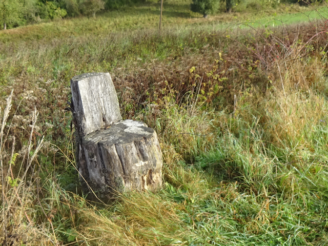
One interesting feature along the way are the wooden chairs carved from tree stumps, inviting you to sit down. However, thus far we are still fresh and don’t need the rest.
For the next part, we follow the way up the Mihlaer Tal (“Mihla Valley”), where the forest gradually closes in upon us from all the sides.
Near the upper end of the valley, we come across a row where exemplars of the tree of the year are planted, going from 2005 to 2013, though not necessary without gaps or in chronological order. Anyway, I suppose this could be quite handy for learning how to recognize different types of trees from quire a long way away. Among the trees on display here are:
- The Larch
- The Bird Cherry
- The Checker Tree
- The Chestnut
- The Apple Tree
- The Walnut
From there, it is only a little bit further until we finally enter the forest proper, and are consequently surrounded by trees on all the sides.
It is from here that the main ascent begins, as the way now leads us up about 200km over the next 3km or so. At about 2/3 of that way, we come across an interesting fork in the road.
Turns out that this is used to be where a toll station used to be located in the olden days, when you still had these every few kilometres whenever you would pass from one Duchy to another, can you imagine that? Anyway, for us this only means that this is where we now cross over from the Wartburgkreis to the Unstrut-Hainich-Kreis, and that without any formalities whatsoever.

The Unstrut-Hainich Kreis is, as its name implies, mostly defined by the river Unstrut – which flows through its centre – and the Hainich at its southwestern border. It’s coat of arms depicts a black eagle with red beak and talons and a golden crown as well as two white millstones on a field of gold on the top left for the formerly free city of Mühlhausen, the colourful Ludovingian Lion to the top right, a white wheel on a field of red on the bottom left for the city of Mainz, which is quite a ways off, but “contributed” the area of Eichsfeld (“Oak Field”) to the north of Mühlhausen, and finally red twelve-ended stag antlers on a field of whit on the bottom right for the municipalities formerly belonging to the principality of Schwarzburg-Rudolstadt (“Black Castle – Pack Town”).
As we proceed, we come across a bit of a curiosity in form of a tombstone placed here for a man named Ludwig Ritter (“Louie Knight”), who was slain here in 1868… by a tree. Forests sure a dangerous places.
From there, our way continues yet a little bit further, and then, we finally reach the top of the hill, where the road levels out.
Up here, there’s a moderately-sized clearing…
…next to which a treetop climbing park is located. We can even hear the noisy clamour of approximately three school classes, but they currently seem to be off having lunch rather than climbing in the trees – after all, it’s just after noon right now.
And just in case you were wondering where all the different languages of the world are being grown, there’s one of them language farms right here. It has neat and orderly rows where German is being grown in a hops-like manner, a vineyard for French, beets of English, and that what’s proliferating there in the distance, that would be Japanese.
Moving on, we come across a cross, again! This one is for someone named Curt Schüze (“Curt Gunner”), who was shot here in 1640. The Unstrut-Hainich-Kreis seems to be a dangerous area.
After that, we follow a very straightforward road gradually out of the Hainich. This road is also gently sloped downwards at just the right angle so you get a bit of free acceleration, but don’t have to spend any energy to actively slow down.
Along the way, we also come across a number of Omega Death Thistles growing by the wayside. If we ever needed a reason not to stray off the path, this would be it. These things grow to be over a meter in height.
Soon enough, we are out of the Hainich again, and now find ourselves overlooking the wide and relatively flat Unstrut Valley. Also, there’s another fork near the road, this one serving as a sign post for hiking routes.
It is also here that we come across a very inviting bench, where a sign invites us to sit down and have a rest, which is exactly what we do. Again, a few Müsli Bars and some water is all I need to keep going after today’s supple breakfast.
While sitting there, one thing that we notice is that here, too, there’s ample of windmills. Standing on the ridge at the far end pf the Unstrut valley, they cover a good segment of the horizon. Again, I wish we could have this many windmills in Bavaria.
After we finish our rest, we continue towards our destination for today along the woodside.
There, we soon come across a little open-air stage in the forest. However, for some reason the stage itself is blocked off with construction site fences. I wonder if this is to prevent animals using it as a stable.
A little further, we pass the first house on this side of the Hainich. This one features a tree with spectacularly red leaves. I wonder what kind this is.
And only a short ways off from there, there’s a small orchard where you can learn about the names of trees.
It is now not much further before we reach our decision point… or rather, not wanting to risk running into another are-you-sure-this-is-a-path, I take a straight where a left would have led us to our destination, and then, after realizing it, we both agree to keep on going since the day is yet far from over, and we don’t just want to hang around the inn for the rest of the day. At this point, this seems like a genuinely good idea. After all, both of us are not all that exhausted yet.
However, I soon re-evaluate that logic as I realize that means we are going to be climbing all the way up that ridge again by means of a straight, peaceful, yet ultimately unremarkable forest path. However, at this point it is a mixture of stubbornness and a desire to get some exercise that keeps me going. Also, I may be influenced a little bit by my favourite Tanuki, who I just know would never let me live it down if I were to turn back now.
When we finally reach the top of the ridge again about 45 minutes later, I am
very glad to find a little storm shelter there, where I can just collapse and catch my breath for five minutes or so.
That
could have been the worst part of our detour, for the next segment is a pretty level ridgetop path.
And yet, in an act that is
totally not vengeance, I eventually lead us down a path that
looks okay at first…
…but soon enough turns into a bona fide are-you-sure-this-is-a-path…
…and
then it further degrades into a where-there’s-a-will-there’s-a-way.
Eventually, however, we manage to find our way back to a proper way, and as it turns out, taking that way from the start would only have been a minor detour compared to what we just went through. Oh well, this way was definitely more
interesting.
Soon enough, we come across a reliable way that takes us back down from the ridge. Incidentally, this part of the forest is not part of the Hainich national park, so there’s some logging going on.
Back at the bottom, we find a good road by the forest’s edge, which we can follow all the way to our stay place for the night.
…or so we think, because before long, the road becomes a somewhat overgrown forest road again…
…and eventually degrades into a narrow field path by the forest side. Fortunately, by now the parking lot of our stay place is already within sight, so if worst comes to worst, we know we can just force our way across the field.
Fortunately, it doesn’t come to that, and after just a little bit longer, we finally reach out destination for today.
With that, we have now finally completed this segment, and I look forward to spend the rest of the day relaxing at…
The Heinich Haus
Although we are not currently in a village – or even a hamlet – this place still formally belongs to the next municipality over, which would be the village of Kammerforst (“Chamber Forest”). This little village with almost 800 inhabitants bears a green spruce tree on a field of silver as its coat of arms.
Our stay place for tonight is the Waldgasthof “Hainich Haus” (“Forest Inn ‘Grove Corner House’”), which just as the name implies is a house on the edge of the forest.
There, we have a nice big room…
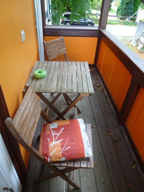
…which even features a shared balcony (not that we would make use of that).
As we head down for dinner, we notice that apparently we have made a good choice in staying here, for it turns out in doing so we have come across a bonus-centre of Germany, that I did not have on my list. Well… more or less. I am reasonably certain that this is once again a “replacement” centre for the first centre point we should come across tomorrow, but more about that then.
Now, it is time for dinner, and dinner in my case means a hearty portion of Wildgulasch mit Semmelknödeln und Blaukraut (“Venison Goulash with Bread Dumplings and Red Cabbage”), while Robert orders a plate of Zanderfilet mit Schwenkkartoffeln (“Zander Filet with Potatoes Tossed in Butter”).
While we eat, we also get a good view out of the window, and can once again marvel at the several dozen windmills standing progressively at the far side of the Unstrut valley.
And speaking of progressive, our room also features a nifty little gadget known as the Insekten Schrotter (“Insect Fragger”). Naturally, I should only find that
after pouncing on two mosquitoes with my bare paws.
After a good night’s sleep, we wake up the following morning to find the landscape in a similarly gloomy state as the day before.
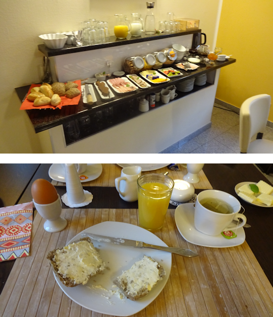
The breakfast is pretty much the same as in the last two places (which, I suppose, is why it’s called a traditional German breakfast), consisting of bread with a selection of spreads, cheese and sausages (we both go for the cheese), as well as eggs. As a little cute twist, however, the eggs are painted with little faces today. Also, this time around the yolk is hard again, just the way Robert likes it.
And that’s it for our night at
this place. Again, we had our own room with a bathroom and beds that were okay (though I had some trouble sleeping for some reason). The tasty and plentiful breakfast was included, though we had to pay for the dinner separately, which is why I am not including it in this evaluation. The staff was very friendly, and one youngster even positively commented on my tails, which resulted in us having a nice chat. Location-wise, this is definitely in a nice area, through quite remote. The temperature was comfortable, and the WiFi worked… but only on my phone and not on my laptop, for some strange reason. As for the price, this was the most expensive place we stayed in during our trip, and personally I’d say it’s already marginally too expensive for what it offers. Altogether, this is still a good place, though.
Now, next up is the final part of our trip, where we end up…
Marching for Marshes, Mühlhausen and the Main Middle Monument
29-Sep-2021
Distance: 18.0km
Ascents: 60m
Duration: 6.25h
3/10🎁︎
Today, we should reach our final destination of Mühlhausen, and along the way also hit the remaining two centres of Germany that we planned to visit on this tour. By now, we are also already quite beat, but fortunately, terrain-wise, this should also be the easiest of our three major hikes. For the most part, the way is either even or slightly declining, and over the entire duration of today’s stray, we should almost go 150m downhill, all in all. Also, in stark contrast to yesterday’s “mostly forest” hike, today’s hike features mostly fields.
As we embark down the Unstrut valley, the weather is still nicely overcast and cool, again with a slight threat of rain that we hope will not come to pass.
Before long, we already reach the next centre point of Germany, which is just a little bit invisible, but I can assure you it is
totally there. This one is now calculated after the balance point that results from cutting out a shape in the form of Germany and balancing it on a small point, say, a needle or so. Though to be honest, I am not entirely sure what the difference between this and the one we visited two days ago on Gut Landstreit is to be (though I think it has to do with weather to factor in territory waters or something like that). Anyway, we now got them both, just to be sure.
Moving on, we hike over plenty of more bare fields…
…before eventually coming across another unusual monument. Now, I would like to say that for once this one is
not about a dead person, but considering this one is dedicated to the local men’s choir of 1881 to 1956, I’m afraid I would be lying. At least these guys did (probably) not die of a violent death in the forest.
On a slightly less macabre topic, we also appear to have found – by total chance – the Lutherweg (“Luther Way”), which is actually a non-linear network of eight pilgrimage paths in and around Thuringia, and which I assume is in some way related to the important stations in the life of Martin Luther.
It is also here that the sun comes out, so not wanting to risk a sunburn we use this opportunity to put on some sunscreen before we proceed along the Lutherweg towards the nearby town of Langula (“Longoula”).
As we pass by the outskirts of that town, we walk by an impressive selection of all possible combinations of bridge, stairs and gate along a ditch. Lined up one after another are:
- A gate with no stairs and no bridge
- A gate with stairs but no bridge
- A gate with a bridge but no stairs
- A bridge with no gate and no stairs
Also, some people are creatively using their portion of the ditch as a goose pen.
The last thing we see of Langula is this house, which features a very interesting design element at what I figure must be the staircase. What is it you see? Eyes or fishes?
Once we leave Langula behind, we spend an impressive amount of time walking through maize fields.
After some time, we cross the border of Niderdorla (“Lower Dorla”), which is the town where the final centre is located…
…but if you think that would mean we would leave the maize fields behind, then think again. It’s maize all the way down.
However, eventually we turn north, and now head straight for the final centre. Quite literally, because from where the maize fields took us, it’s now pretty much a straight line to our last landmark.
Along the way we come across the very unusual low-capacity bridge: This one can only hold up to 3 tons, which means that most trucks would not be able to pass over it. Not that they would fit across it anyways.
A little further down the path, we finally leave the fields behind and enter the town of Niderdorla proper.
From there on, the centre is pretty much unmissable. First, we come across the Landhotel am Mittelpunkt (“Country Hotel at the Centre”)…
…and after that, we run into a veritable forest of signpost pointing not only towards the next centre of Germany, but also to the nearby Opfermoor Vogtei (“Sacrificial Marsh Bailwick”), which was used a ceremonial and sacrificial site from the late bronze age until all the way into the medieval period.
But that’s not why we’re here.
Our destination is the next centre of Germany, and as signposting suggested, this is the most magnificent of them all.
Not only is it surrounded by a proper little garden, it also has several stone monuments and plaques all over the place.
So, here we are, at the final centre point that we should reach on this trip. This one is quite pragmatically calculated by taking the centre of the smallest possible rectangle formed by meridians and parallels around Germany. However, this is not to be confused with the intersection point of the lines between the four cardinal points. That one is a good 75km to the west of here in Hessen. As it is, of the four cardinal points of Germany, we are actually closest to the easternmost point near Görlitz right now (see
Book IV ~ Chapter 4 ~ Görlitz Gaiety ~ Eastern Escapades), at a distance of 320km.
And across from the centre point, there’s the Opfermoor, which to be honest looks just like any old lake. Still, it’s probably good to remember where this is, just in case you should ever feel the intense need to ritually sacrifice something or someone.
Moving on from there, we head towards the town of Oberdorla (“Upper Dorla”), which together with Niederdorla and Langula forms a remarkably equilateral triangle of 2km on each side.
It is pretty exactly halfway between Nieder- and Oberdorla that we run into the Mailinden (“May Lime Trees”), a pair of really ancient trees that probably date back to the time when the first people were being thrown into the Opfermoor.
The next part should be a bit unpleasant, because we have to go along a car-car happy road where the planners clearly thought: “Huh? What did you say about sidewalks? Sorry, but I couldn’t hear you over the sound of my CAR!!!”
However, before long we should be able to leave the road behind and get onto a scenic and rural pedestrians’ and cyclists’ highway.
There, we come across a rare sight, the likes of which I have never seen even once on all of my travels around the world: A lone cycle rack! These creatures are usually highly gregarious and normally occur in herds of at least three and up to several hundred individuals. This specimen here before us can only be a young male who, after losing a fight for dominance, was chased off by the alpha rack and now has to fend for itself.
And speaking of unusual sights, we also pass by a pasture of petite ponies. These ones are really tiny, to the point where they are notably smaller than the omega death thistles on their pasture.
Over the course of all these little distractions, however, we do not notice until now that the sky has turned from “shine” too “doom”, and since we are as of yet still over 7km away from our destination, we can only hope that it won’t rain too strongly.
However, luck seems to be on our sides, for the darkest clouds pass us by without us receiving more than a few drops each, and from then on, the sky should be mostly cloudy, with even occasional patches of sunshine in between.
It is during one such burst of sunshine that we come across a field in which two mailboxes appear to be standing. Maybe the local field mice formed a union demanding better postal service?
As we keep continuing down the straight and well-paved path, it gradually becomes apparent that this is yet another decommissioned railway line. The thing that makes it obvious are those regular “railway crossings” that only have fields on either side. Back in the day, this is where tractors would be able to cross the line, but now those are only a relic from a better age when railway lines were still connecting even smaller towns and villages with one another.
Eventually, we branch off onto a less-paved field path…
…and before we know it, that one has turned into a mostly grassy trail. Still, this is nothing compared to all those are-you-sure-this-is-a-paths that we traversed these last few days.
As we pass by the outskirts of the village of Flechta (“Weava”), we notice that the sky has become more threatening again, and this time around the wind is picking up too. And, we are now still about 5km away from our destination.
However, this time around, it is at the very least encouraging that the city of Mühlhausen is already within sight. However, this time around, we’re running into a short Lv2 rain shower. That’s still okay though. My gear can take Lv2 rain indefinitely. However, anything stronger than this would eventually become a problem. I know my trusty jacket Krevyasz can only take about 30 minutes or so of Lv3 rain before experiencing a breach, and Lv4 rain can cause a breach in as little as a few short minutes.
But anyway, we get into Mühlhausen having suffered only marginal levels of wetness, and promptly get confounded by the august beauty of the Deutsche Fachwerk Straße (“German Timber-Framed Road”) of the historic old town.
Meanwhile, the weather continues to remain a colorful mix of threatening clouds and sunshine even as we continue making our way deeper into Mühlhausen along the Deutsche Fachwerk Straße.
And speaking of colorful, we also come by a rather unique car…
…as well as another group of Ampel-Koalitionsbäume (“Traffic Light Coalition Trees”).
Soon after that, we enter the
actual old city of Mühlhausen, with all its rustic style buildings…
…and then complete our final descent down towards the valley floor. The weather, by the way, has by now become all nice and clear and sunny again.
We reach the station of Mühlhausen around 15:00, which would have been early enough to catch a southbound train and still arrive in Munich still on the same day. Barely. If nothing goes wrong. And most of the journey would have been by night, not leaving me with much to capture out of the window. Also, I already booked our stay place for the night, so despite my favourite Tanuki’s insistent attempts to make me jump the gun here, we leave the station behind for today and proceed with the original plan.
Now, since the weather ended up being nice again and we still have time and energy left, we take a little scenic route to our stay place that takes us across the Unstrut, which is only a little stream much smaller than the Werra at this point.
On the other side, we finally get to pass by some proper historic Fachwerkhäuser…
…and then we come across the closest thing to an are-you-sure-this-is-a-path that I could find for today. Not that I run into these on purpose or anything, mind you. The very idea is absurd.
As a part of that path, we also cross back over the Unstrut again (or actually, this is a mill channel)…
…which we do by means of a shabby old concrete bridge that notably lacks a railing on one of its two sides.
On the other side of that bridge, there’s a 9-acre-big open field located on a fluvial island between the Unstrut and the mill channel which we crossed earlier.
And on the far side of that 9-acre-clearing, we cross the Unstrut one last time. Technically, this is the proper river, though actually the mill channel on the far side looked much more natural.
We also notice a very creative bike-installation-commercial-thingy by the roadside, which is apparently used to advertise a local company.
By now, we are already quite close to our destination. However, before we get there, we pass by a house with a humorous doggie sign at the door. This one reads:
Welcome to my home
- Sniffing is mandatory.
- If you don’t want dog hair on your clothes then don’t sit down anywhere.
- If you’re nice to me, then I’m nice to you.
- It’s a fact that my humans like me more than you!
I live here. You don’t.
After that, we finally reach the last stay place of our trip, which is…
The Pension Erika
We are now in Mühlhausen, a city of almost 36.000 inhabitants, and also home of Johan Sebastian Bach in 1707-08. Its coat of arms bears a black eagle with a red beak on a field of gold to the top, and a silver millrind on a field of red on the bottom.
This area is also notable for bearing the highest postal codes of all of Germany. Mühlhausen has 99974, and we actually passed within only a few kilometre’s of Germany’s highest postal code, 99998. But where’s 99999? Only the darkness knows…
Anyway, our stay place here is a lovely little house known as the Pension Erika…
…which manages to win me over with its catty flair right from the very doorstep.
A flair that is continued in the staircase…
…as well as within our room. Makes me think back on Jamie and Toledo, whom I left in the care of a friend of the family. I hope they’re doing alright, but then, I’ll see them again tomorrow.
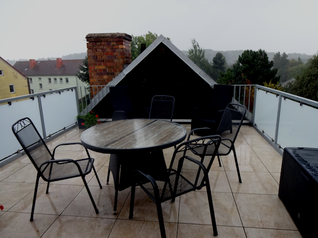
Our room here is right under the roof, which means we need to lug our heavy backpacks up another two flights of stairs. But it’s definitely a nice room. I make a mental note of taking care when getting up in the morning though.
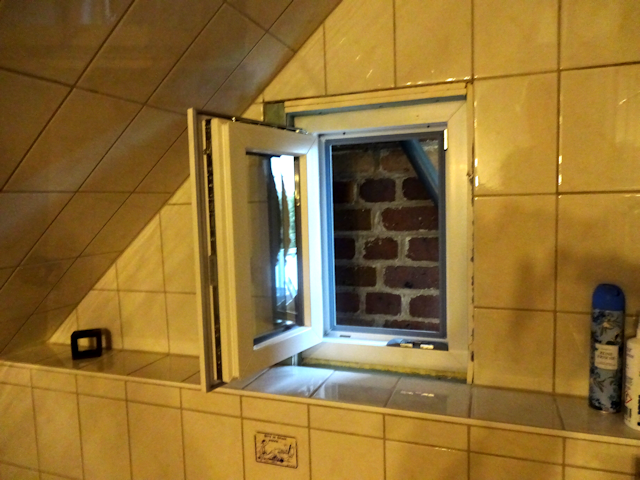
The bathroom window is a bit… interesting… though, especially considering that there’s a visible gap between the frame and the wall, which should aversely affect the temperatures at night.
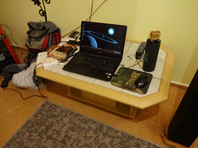
I for my part am thoroughly whacked, racked, battered, beaten and broken for the day, yet while I set myself up on the closest thing to a laptop-friendly workspace that this room has to offer, Robert makes preparations for going on another walk through the city.
However, Wotan says no, and in the face of a sudden and persistent Lv4 rain that somehow managed to come out of the blue, Robert reconsiders and stays inside after all. Oh, did I mention that this room also comes with a deck that we can’t use because it’s
raining?
Fortunately, the rain lasts for only one hour, which is particularly convenient since we need to go out if we want to have dinner. And so, in the evening, we head out on what is really just a little walk around the neighbourhood to get to the nearest restaurant, and then not quite the same route back again.
The restaurant of our choice is an Italian place with the name of “Mo’s Zum Berg” (“Mo’s At The Mountain”).
Our host suggested we call in advance to make a reservation, and it is a good thing that we did, or else we might not have been able to grab a seat in the bustling full restaurant.
And so, we have our last dinner on this trip here in this Italian place. Me, feeling a bit adventurous, trying out the Pasta Cardinale (which turn out to be quite tasty), while Robert goes for the Pasta Spinacci.
Afterwards, we return back via a roundabout route that just so happens to take us past a solar power plant, right there at the outskirts of the city. Have I yet mentioned that I am going to
miss these levels of progressiveness when returning back into the Bavarithal?
Oh, and there’s also another old cross here. This is one is the Görmarsche Kreuz, a stone cross fashioned from limestone 1.60m by 1.20, with a weight of approximately 20 centners, as a nearby plaque informs me. Apparently erected here around 1347 as a murder- or repentance-cross, legend has it that a headless horseman appears here during the ghost hour to startle passersby.
Fortunately, that hour is yet a long ways off, for it is pretty much exactly sunset right now, and while the street already lies in the shade, the tips of the trees and houses still receive a few last rays of sunshine.
Unfortunately, that means we are just a few minutes too late to witness the sunset as we cross the Unstrut once again. Oh well.
After that, all that’s left to do for the day is follow a long street back to the Pension Erika (“Lange Straße” = “Long Street”).
The next morning, we are the first guests to get up for breakfast, and as such have the little breakfast room all to ourselves.
Breakfast is the usual, but with a twist. In addition to the usual bread and cheese, there’s also home-made marmalade, the highlight of which in turn is the Querbeet-Marmelade (“Cross-Patch-Marmalade”), which as the name implies contains leftover vegetables of all kinds. We should also later get served some eggs, and as if fate wanted to keep the balance, these last ones are again the way I like them most, with the yolk still liquid.
Another highlight is the tea, which is served in very interesting flower-strainers that afterwards are put in special little buckets once the tea is ready. Especially Robert’s fruit tea is quite impressive.
As we finish up breakfast, we see the sun rise through the window, which is – I think – a first on this trip. In Eisenach we slept in, and the next two days the mornings were always overcast.

With that, we now leave our final stay place for this trip behind. Once again, we had our own room with bath, and the beds were comfortable. Only breakfast was included, but that was tasty and plentiful. The atmosphere was good, and the place was reasonably close to the station and had restaurants nearby. Also, for the first time since Eisenach, the WiFi worked on both my phone and laptop. The flair was good too, what with the nice, catty atmosphere and the stylish tea strainers. However, on account of the uninsulated bathroom window, it got a bit cold at night, and the room had the rather fatal architectural flaw of having a window to the staircase, so whenever someone would switch on the light in there at night, it would lighten up our room as well. Curtains were in place, but they were nowhere near heavy enough as to properly block out the light. As a result, I should wake up several times during the night whenever someone switched on the light in the staircase. Finally, the price-value ratio was… okay, I guess. I’d still say we paid more than what it was worth, but oh well. All in all, this was still one of the better places I stayed at.

After packing and paying up, we depart for the station, where we should commence our exciting return trip to Munich. However, that is a wholly different story, and shall be told in the next chapter of the Travelling Fox Blog, so stay tuned, and be of great cheer!