Table of Contents
- The Shriny Southern Station Stray
- South to Sakurai
- The Stitchy Sakurai Stopover
- Through the Mountains
- Beside the Bay
- Ice in Ise
Our schedule for this particular Japan journey is tightly packed, and so it is that after only two short days in Nara and Kyoto, we already have to depart towards our next destination. That destination is the historic city of Ise (伊勢 "That One Energy"), and our trip there will take us across the Ki'i-Sanchi (紀伊山地 "Chronicle That One Mountainous Region") and close to the Ise-Wan (伊勢湾 "That One Energy Bay"). Along the way, we have to change trains twice, first in Sakurai (桜井 "Cherry Well"), and then again in Ise-Nakagawa (伊勢中川 "That One Energy Middle River").

Here's the breakdown of our trip today:
- From Kyoubate to Sakurai with the JR Sakurai Line
- From Sakurai to Ise-Nakagawa with the Kintetsu Osaka Line Express
- From Ise-Nakagawa to Ise with the Kintetsu Yamada Line Express
But before we leave, we enjoy yet one more amazing Ryokan breakfast...

...and then we're off, leaving the Ryokan behind, and facing our first sunny day in Japan. Regrettably, that also means it's gonna be even hotter today.

First off, we have to reach the station, and since we've all already been
to the Nara station a couple of times now, I figure, hey, why not do
something different this time around? As such, I take the opportunity to
make even this obligatory trip a little bit more exciting and fruitful,
which brings us to...
The Shriny Southern Station Stray
Distance: 1.9kmAscents: 10m
Duration: 1.25h
12⛩ (3🦊); 9卍
Instead of the Nara station, we're heading to the Kyoubate (京終 "Capital End") station, which is located to the south, and only a little bit further from the Ryokan than the Nara station. This has the advantage that we get to see a little bit more of Nara, and naturally I already checked the map so I know there's gonna be a bunch of temples and shrines along the way, which should prove culturally interesting.

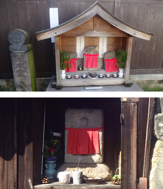
For starters, just on the far side of Saursawa-Ike, we already come across a curiosity in the form of the Isagawa Jizouson ("Ratio River Jizo"), which is a little boat full of Jizo sitting in the middle of a little stream under a bridge.

From there, we proceed south through quiet and idyllic back roads...

...and before long pass by a good number of shrines...

...a couple of more temples...

...as well as a few more Jizo.
One that is particularly unusual is the Mannaoshi Jizouson (まんなおし地蔵尊 "Mannaoshi Jizo"). For starters, the main part of its name is written in Hiragana instead of Kanji, so its meaning is is unclear. For example, it could mean 万直し ("Ten-Thousand Repairs") or 満直衣 ("Full Everyday Robes"), or something else entirely (cuz Japanese is full of homonyms). Then, it is located behind a green parking lot, features a pair of Tanuki statues, and as I approach it I am welcomed by a cat who looks like Jamie's long-lost brother who was abducted to China as a kitten and had to live a tough life on the roads of Shanghai until he was taken in by a travelling Buddhist monk from Japan who took him to Nara and taught him the ways of peace and harmony, which ultimately led to him watching over this little Jizo in anticipation of my eventual arrival as revealed to him by the higher powers of karma... or not.

While continuing on southwards, we come past a block of apartments the owner of which apparently forgot to run spellcheck before registering the final name of the building...

...and also a Bento shop, which I had originally looked up on the map for us to buy a Bento each for the ride. However, as we arrive it seems like this might not be a place where you can just walk in and buy stuff. I mean, it does say "Bento" on the store front, but there's no menu or price list outside, or any of the characteristic "open for business" flags or signs that Japanese stores traditionally feature. Inside, there's a person shifting goods, and he doesn't take any note of us, so I figure that whatever the reason, we're not going to get any Bento here. Oh well.

Anyway, by now we have reached the Kyoubate station, where I take some time to get Bea and Brett acquainted with the intricacies of the Japanese railway system.

We don't have to wait long before a train arrives, and just like that we're bound...
South to Sakurai
Ride Duration: 30minApproximate Distance: 18km
Average Speed: 36km/h
The ride to Sakurai takes us almost exactly south the Nara valley past the stations of Obitoke (帯解 "Unraveled Belt"), Ichinomoto (櫟本 "Charcoal Oak Origin"), Tenri (天理 "Rule of Heaven"), Nagara (長柄 "Long Handle"), Yanagimoto (柳本 "Willow Origin"), Makimuku (巻向 "Scroll Direction") and Miwa (三輪 "Three Wheels"), the list of which already nicely demonstrates the tendency of Japanese place names to be both picturesque and consisting of two Kanji, which at over 2000 Kanji makes for upwards of 5 million possible unique place names. Also note that parallel and about 5km to the west of the JR line that we are taking runs the Kintetsu line, which is a private railway company in these parts.

The train to Sakurai is a typical JR local train with lengthwise seats and a driver's compartment that one can look into from behind, which makes this a perfect example of the typical Japanese local train, the likes of which I have used through much of my earlier travels in Japan. There's also not many people riding it, which is also typical for these more rural lines.

And yet another typical thing is the fare display, which falls into the "logical, but hard to get without an explanation"-category. Basically, this displays the fare that you have to pay if you get off at the next station, based on the station where you got in. So if you got in on the first stop, you have to pay the fare in the first panel, if you got in at the second stop, you have to pay the fare in the second panel, and so on. That means the display changes with each stop, another panel appearing at the end, and the prices in the previous panels increase accordingly. Nowadays, this is mostly unnecessary, since most people travel by using IC-cards, where you tag on at the station you get on and tag off at the station you get off, and the correct fare is automatically deducted. However, in some trains (so called Wanman ( ワンマン "One Man") trains) that operate in remote rural parts of Japan, as well as rural buses, people actually have to queue at the front door and pay the driver before getting off, showing them a slip with the number of the station they got in which is dispensed by little machines near the door. Easy if you're used to it, but kinda tricky to understand otherwise.

As for the ride itself, apart from taking us through aforementioned towns and cities, it also passes through quite a few rural stretches which gradually become more common the further south we ride. And since this is Japan, "rural stretches" translates to "mostly rice fields, with maybe a few bushes and forests in between". For the most part, though, the Japanese flatlands are rice fields all the way, with shrubbery and forests being confined to hills and mountains. Soil erosion is not a problem since the rice fields are typically all covered with water. As a matter of fact, the harvest season is pretty much upon us, so I wouldn't be surprised to see some of them cute little rice harvesting machines at work at some point during our travels. Also, looking out front you can clearly see that the Japanese regional trains use narrow gauge tracks.
(Click here to view the video if the website fails to load it)
One short trip later, we arrive at Sakurai, which is where we transfer over from the JR network to the Kintetsu network.

It is also here that a little interlude takes place, which I am going to
remember as...
The Stitchy Sakurai Stopover
With how much my trusty backpack has been through, it was only a matter of time until it suffered a critical malfunction. That time finally arrived on the train to Sakurai.

Fortunately, we're in Japan, which means two things:
- There's a Konbini at every crossover station
- The Konbini sells all sorts of things, including sewing supplies
As such, I have no problem acquiring an emergency sewing kit right here and now in Sakurai.

And so, with a bit of skill and effort I am able to utilize the layover time here in Sakurai to get my backpack's strap back from "quite broken" to maybe not "good as new" but still definitely "good enough".

Also, since we've still not had lunch yet, our collective trip to the Konbini also included one Bento for each. Naturally, I go for one that features tasty Inari Sushi. Cheap though it may be, it's still better than most Sushi you can get in Germany.

Curiously, there's also an unusual Jidouhanbaiki (自動販売機 "Autonomous Trading Machine" = "Vending Machine") nearby, and while drink vending machines are a very, very common sight in Japan, this one is of a much rarer type, selling Gyoza.

Anyway, after a layover of 45 minutes, which was just enough to fix my backpack, eat lunch and have a bit of a look around, our connecting train arrives.

This one should subsequently take us...
Through the Mountains
Ride Duration: 1.25hApproximate Distance: 68km
Average Speed: 54km/h
This next leg is clearly the longest of today's trip, and also the most scenic. This is where we cross from the Nara valley over the Ki'i-Sanchi and into the plains surrounding the Ise bay. Along the way there are a total of 16 stops, among which are Haibara (榛原 "Hazelnut Meadow"), Murouguchi Oono (室生口大野 "near Room Life Great Field"), Nabari (名張 "Famous Stretch"), Mihata (美旗 "Beautiful Flag"), Nishi Aoyama (西青山 "Blue Mountain West"), Higashi Aoyama (東青山 "Blue Mountain East") and finally Sakakibara Onsenguchi (榊原温泉口 "Sakaki Tree Meadow near Hot Springs"). One thing that stands out among these names is the "Guchi" (口) part, which is something that can be found in several train stations. Literally, that translates into "mouth", but in the context of locations it is used to convey proximity, such as "near" or "in front of". Also, while most of the track is above ground, there's also a segment where the train passes through a tunnel under Aoyama (青山 "Blue Mountain"), I'll let you guess where that is. Finally, while for the most part of the track, there's a station roughly every 4km or so, the train only stops two more times after exiting the tunnel, with Sakakibara Onsenguchi being the last stop before it covers the last 14km to Ise-Nakagawa in one big go. I suppose since this is an express train the stops in between must be served by a local train.

Though its from a different company, the interior design of this train is almost identical to the last one, which is why I'm going to refer as this type of train as a local standard train from now on. There's also not many people inside, but it's also not exactly empty.

Now, remember how I said that Japan had two major land terrains, with one being sprawling cities surrounded by rice fields on the plains and the other being forested hills? Well, this part of the ride takes us almost exclusively through the second type of terrain, with a valleys in between that follow the "town surrounded by rice fields" schema. Apart from that, there's also the roughly 7km long tunnel beneath Aoyama, and at one point we also pass a Tokkyu (特急 "Limited Express"), which is a more expensive high-speed long distance train that bridges the gap between the local trains and the Shinkansen, kinda like the Intercity trains in Germany. Also take note that unlike the JR line, the Kintetsu line is double-tracked on its entire length.
(Click here to view the video if the website fails to load it)
While within the Nabari valley, we also get a good view of the countless windmills atop the Aoyama mountain range. These seem to be something of a landmark, since they are also displayed on the cute illustrated network map hanging here in the train. Also take note of just how lost you are on that map if you can't read Japanese.

Eventually, we reach the Ise-Nakagawa station...

...and after a layover of roughly 15 minutes, we already board our next and final train for the day. Also, take note how this is one of those rare stations where there's a platform on both sides of each track.

Now we're almost at our destination for today, and this final train
segment should take us across the plains...
Beside the Bay
Ride Duration: 20minApproximate Distance: 28km
Average Speed: 76km/h
If the previous leg was the longest, this one is definitely the fastest. This time around, our train really puts the "express" in its name to work, stopping only at the sole station of Matsusaka (松阪 "Pine Slope") on the way to Ise, and speeding across the bayside plains in between. Unfortunately, the track keeps a respectable distance to the bay, so we don't actually get to see the water.

Apart from the speed, the train is also remarkable in that it features those fancy crosswise flipping seats again instead of the lengthwise wall seats more typical for local trains. As for the amount of people, its roughly the same as on all our other trains today, not too many, but also not too few.

This last leg of today's trip should once again take us to populated territory, which means mostly rice fields (along with a few different types of fields) and towns against a backdrop of the mountains we just crossed in the distance. We also pass over some rivers such as Kushidagawa (櫛田川 "Comb Field River"), and pass through some areas where it apparently rained recently. The sky also grows more cloudy as we approach Ise, so I wonder if we'll end up getting wet before the day is over.
(Click here to view the video if the website fails to load it)
However, as we arrive in Ise, Radian is shining down from above again, which given the unusually hot temperatures for the season (above 30°C) is not necessarily preferable.

As such, it might not come entirely as a surprise that one of our first orders of business is to get some...
Ice in Ise
Distance: 1.7kmAscents: 5m
Duration: 1.5h
2⛩ (1🦊)
It is now about 14:00, and our host only expects us at 15:00, so we decide to get some ice cream in the meanwhile. That should cause us to take a little bit of a detour to the south before heading west to our stay place.

Now, the reason why I picked out Ise of all the places is that it is sort of a sacred Shinto city, and true enough, there's a big Torii standing right outside the station on the square...

...as well as a Shrine named Seki Jinja (世木神社 "Public Tree Shrine") right there on the left in the middle of an extended roundabout, featuring plenty of trees and beckoning cool shade.

Since all of "Shrine", "cool" and "shade" sound good right now, the four of us decide to drop by there first, and much to my delight we find that this shrine also features a little Inari side Shrine by the name of Mitsukichi Inari Jinja (三吉稲荷神社 "Three Joys Inari Shrine"), which features a total of 15 little foxes inside.

After that, we walk down the central road of Ise, which may or may not be a pedestrian street, looking for a nice place to sit and chill...

...passing a stylish wooden Jidouhanbaiki selling drinks along the way.

Eventually, we reach an interestingly looking place called 21 o'clock ice, and fortunately it's open 7 hours early. The menu also looks really interesting, featuring such items as the Koohii Zerii ("Coffee ?"), the Hotto Kustaado ("Hot Custard") the Kiui to Natadekoko ("Kiwi and Coconut Gel") or the Aaru Gurei Chokohoippu ("Earl Grey Choco Whip").

Now, in Japan, people take their jobs very seriously, and food is also considered an art. Also, this place is kinda popular, so we don't get a place inside and have to wait on the road... for a whopping 20 minutes before our ice cream is ready. Eventually, I get my Choko Kukkii ("Choco Cookie") and Bea her Mango to Natadekoko ("Kiwi and Coconut Gel"), and I have to admit, it both looks and tastes pretty great. Probably not worth waiting 20 minutes in this heat though.

The plus side of this wait is that now we're definitely not too early anymore, so we head west along the main road, taking the most direct way to our stay place and passing a well-organized roadwork project, as well as a nice old house along the way. Naturally, we also try to stick to the shade as much as possible to escape the heat.

As we approach the place, it gets a little bit tricky, because it is hidden in the back roads. As such, our host has provided us with very detailed instructions which read like this:
"Turn your back to Ise City Station, turn right, “Full Boat House Mansenya”, which is diagonally to the right, about 20 meters straight to the right of the "Full Boat House Mansenya" and the 1005 bank signboard building. Cross the traffic light on the right side of the moon and night view (on the left hand side is Welfare Elementary School), cross the signal and go straight there. Takayanagi Parking Lot on your right, a cultural inn on your left.Take your left hand 3 doors up the Wen Ryokan. Passing through two parking lots, the third house from the parking lot, the white fence house on the right hand side, There is a Ito ITO sign. There is also a bicycle.
Ring the right intercom towards you."

Regardless, we still manage to find the place, in no small part due to me being reasonably accustomed with Japanese cities, but mostly due to me having looked up the address and marked it down on my map in advance.

And with that, we now have officially arrived here in Ise. There's much
to see and do for us here, but that is a tale for another day, so look
forward to the next chapter of the Travelling Fox Blog!