Book V ~ Chapter 6 ~ Project Petal Part 7 ~ Into Ingolstadt
Table of Contents
After heading east to Wasserburg in the last petal ride (see Book
V ~ Chapter 4 ~ Project Petal Part 6 ~ The Easterly Expedition),
there's now only one two-petal gap remaining, and since I like to spread
out my petal rides, it makes sense that I should go straight north for
this one, thus choosing...
↑ to top
Part 7 ~ The Petal of the Rat
24-May-2022 - 26-May-2022
This should finally direct me towards Ingolstadt ("In Gold City"), which
I've set my sights on for quite some time. It's actually quite some
distance away, so my goal is to compensate for the fact that the to and
fro is going to be long and tough by making my on-premise day a short and
relaxing one. However, this ride should end up testing me in ways yet
unprecedented. For example, alone the way there should already turn out to
be...
↑ to top
A Song of Rain and Sunburn
24-May-2022
Distance: 86.0km
Ascents: 420m
Duration: 8.75h
4/7🎁︎
You might call it my own fault for departing on a ride when the outside
looks like this, and the weather forecast predicts a 100% chance of rain,
but on the other hand, the weather for the next two days looks fine, so I
decide to go for it and break through as needed, having at least a rough
idea of what the weather has in store for me.
My route today takes me generally north, with a slight drift towards the
east. In fact, most of it takes me straight through the petal of the Boar,
and I actually pass within only 4km of Aresing, where I made my home base
during that petal ride (see Interlude
~ Project Petal Part 5 ~ The Tri-day Two-hundred Tour). I also
should regularly get drenched by rain of various intensity and have to
adjust my route to keep of impassable muddy field paths, thus forfeiting a
total of 5 Geocaches along the route. In place of those, however, rain
shelters should become important waypoints and offer me temporary relief
from the worst deluges.
But more about all of that at its own time. Presently, I am cycling in
level 1 rain (a tolerable drizzle) through the familiar cycleways of
Untermenzing and Allach on my way out of the city.
Since this is the direction where the city border is the closest, it
doesn't take me long to be out on the open fields on my way headed for
Dachau.
It turns out it's been too long since I've been to this area, because I
end up getting just a little bit lost twice around the Waldschwaigsee
("Forest Hush Lake"), but fortunately I quickly manage to correct my
course each time. Also, by now the rain has temporarily ceased altogether.
As such, I soon enough reach the outskirts of Dachau, where I follow the
course of the Gröbenbach ("Rough Stream") further into town.
Eventually, I pass through the very heart of Dachau, where I also cross
the Amper...
...and then go out of Dachau towards the north, heading towards the two
local windmills.
As I climb the hills here through tunnels of green, I come across an
abandoned E-Scooter lying in the shrubbery...
...before reaching the very foot of one of the two windmills.
It is from there that I get to behold a most amazing panorama view of
Munich and the alps, and it is this view that already makes my ride at
this point.
Now, the good news is that after climbing this hill, the road now goes
downwards for quite a bit. The bad news is, said road looks like this:
To make it worse, as the path starts sloping down even more steeply, it
gradually turns into the field path of the day!
Eventually, the road becomes paved again, but naturally only after it has
started sloping back up towards Goppertshofen ("Gophers' Farmyard").
After that, the roads - or more precisely the path I have chosen - turns
out to be a wild mix of ups and downs, as well as paved and unpaved
sections.
By the time I reach Röhrmoos ("Pipe Moss"), rain has started falling
again, and this time around its level 2 rain, which is already a good bit
more annoying.
This time around, the rain doesn't grow weaker over time though. If
anything, it becomes more intense, and there's absolutely no shelter
anywhere in sight.
By the time I reach Pasenbach ("Fit Brook"), the rain has intensified all
the way to level 3, which is a proper rainshower, and would easily be
enough for me to interrupt my ride and wait it out, yet there's still
no shelter anywhere in sight.
It is at this point that I re-evaluate and decide to forget about the
next few caches which were hidden in fields and forests. Furthermore, with
the rain being to strong now for me to navigate by phone, I have to
temporarily abandon my planned route and instead rely on my natural
navigation skills to further my progress towards Ingolstadt. Even as I do
all that, the rain further intensifies to level 4, which is a proper
downpour, and the last level before a tropical deluge.
As such, my trusty coat Krevyasz quickly breaches, and my pants quickly
become drenched to the point where any further rain just bounces off of
them. I still remember the last time this happened. It was on my way back
from school in 12th grade, and back then I had only 10 minutes left to be
in the dry. This time around, I don't have that luxury.
Instead, I have to press on through the rain, crossing the Daxberg
("Badger Mountain") as I do...
...and eventually reaching the hamlet of Breitenwiesen ("Broad Meadows").
It is there, that my wetness-ratio finally reaches the point where I'm
willing to take shelter in some farmer's cow barn just to get dry, and boy
are the cows not happy to see me. You should have heard them mooing at me.
Such indignant mooing I've never heard before! Anyway, this respite
finally allows me to have a look at my map again,and re-plan my route in
accordance with the fact that I will not be attempting any
Geocaches while it is raining like this, and that I will certainly
not attempt to cross any field or forest paths in or after weather
like this. The consequence of this is that I pick out a "village hopping"
route that should lead me along paved roads.

After that, I decide to continue on my path in spite of the rain still
falling. The intensity of the rain is now somewhere between 2 and 3,but I
know I have to continue since there's no telling how long the rain will
last, and thus I make myself go on, all the way to the town of Weichs
("Softs"), where I find temporary shelter under a roof.
As should become habit for a while now, I once again allow the worst of
the wetness to drip off there and then continue on to the next village of
Aufhausen ("Up Housing")...
...where I take cover in a conveniently located bus shelter.
There, I wait until the rain weakens to something between level 1 and 2
before continuing left past Edenpfaffenhofen ("Eden Puffing
Courtyarding")...
....however, eventually the rain starts becoming stronger again, and so I
end up taking shelter at another bus stop in Eglersried ("Leecher's
Reed"), beneath a brand-new, yet-unpainted may pole.
This time around, the rain stops completely while I wait, and so for the
next small segment, I get to enjoy a bit of a dry spell.
But there's another issue that becomes apparent as I cross the border to
the Landkreis Pfaffenhofen an der Ilm ("County Puffing Courtyarding at the
Ilm"): My bike's brakes aren't working properly, so I stop by the side of
the road and try to adjust them... with limited success.
I dare not stop too long though, lest I waste valuable time of this dry
spell, so I eventually settle on "good enough" for the brakes and continue
down into a valley where there's a village now ("Jetzendorf" = "Now a
Village").
Naturally, when I said "down into a valley", that implied having to go up
the other side again. And yet, I didn't expect an ascent this steep.
Fortunately, it's not very long, and since I'm still drenched and cold
from all the rain, this is actually a welcome opportunity to warm back up.
By the way I reach the hamlet of Kremshof ("Creme's Farmyard"), the rain
has started to pick up again, however.
It intensifies to level 2 by the timee I reach the village of Eck
("Corner")...
...where there's one of these age-poles typical for the area. This is the
first one I get to see on this ride.
As I continue onwards, the rain gets stronger and stronger still, and by
the time I reach the village of Lichthausen ("Light Housing"), it has
reached and surpassed level 3, and is on its way to level 4 again.
Fortunately, salvation awaits just after the village entrance, where a
small farm-sales shed for eggs, honey and similar produce provides shelter
for both me and my bike, and with it raining cats and dogs outside, I
figure this is the ideal chance for me to have a closer look at my bike's
brakes. By the time the rain has weakened enough for me to continue, I
have manged to adjust them to a level that I figure will achieve a good
braking effect when I actually do want to brake while not slowing me down
too much when I don't. It has become apparent at this point, however, that
I clearly need new brakes for my bike.
Continuing through rain that is somewhere between level 2 and level 3, I
pass a herd of tamed deer grazing on a nearby field, and do manage to take
a nice picture of both the deer, and the rain.
Eventually, the rain stops entirely once more, and as it does, I realize
that I remember this area: Though it has been close to two years, I still
remember this formation of three windmills from my ride to Aresing.
What follows next is a relatively nice and dry segment as I pass by
Riedern ("Reeding"), Labersberg ("Chatter Mountain"), Kreuth ("Herb") and
Gröben ("Roughing").
Along that way, I also spot an uncommon variant of the age pole: The
marriage pole (and extension).
And then, in Strobenried ("Strobing Reed"), I finally reach the crossover
point, where my path crosses with that of the Boar Petal. It is only from
here on out that I am actually outside my "territory".
Approaching Waizenried ("Wheat Reed"), I notice how the sky is turning
dark and threatening once again, and so I keep my eyes peeled for some
shelter.
It is in the middle of town that I fortunately find such a shelter in the
shape of yet another bus stop, and quickly move my bike inside just before
the rain starts again.
The timing could not have been much better, because it is only seconds
later that the rain comes in, and quite intensely at that.
(Click here to view the video if the website fails to
load it)
With this forced break falling right into lunchtime, I figure this is a
good enough place for my usual lunch break. Granted, there's no place to
sit, and the only surface is the top of a trash bin, but it'll do.
Once again, I only sit out the worst of the rain and continue on my path
once it has weakened to level 1 or 2. Doing so, I come across a
wonderfully synergistic farm where both sheep and solar energy are farmed
side-by-side.
Incidentally, this is precisely the spot where I first catch a
slight glimpse of Radian beyond the clouds today. I wonder if that means
that raintime is over now?
The next places I pass through on my way are Diepoltshofen ("Dual Poles
Farmyarding")...
...followed by Rachelsbach ("Revenge's Brook"), which is also very into
solar power.
Now there I run into a little bit of a problem: Originally I was planning
to head a bit east here, but it turns out that the road I thought I could
take is for cars exclusively, and for reasons which I fail to comprehend
there's not a single foot- and/or cycling path to be found nearby.
So instead, I have to re-evaluate and pick another route, the direct
consequence of which is me passing by the Maria Reinigung ("Mary
Cleansing") church, which is elegantly reflected in the pond before it.
Next, I come across an old acquaintance: The Paar, which I already
crossed repeatedly during the Boar Petal and the Rooster Petal (see Interlude
~ Project Petal Part 4 ~ Lechtal Liveliness). And I should, in fact,
cross it a few more times during today's ride, owing to both the Paar's
and my own routes meandering nature.
After the first crossing, I pass the hamlet of Mergertsmühle ("More
Ferments Mill")...
...where apparently a local farmer is of the opinion, that despite all
the rain his fields are still not getting enough water.
Next, I pass through Wangen ("Cheeks") and Markt Hohenwart ("Market High
Wait")...
...and then, on account of me very much wanting to avoid having to climb
the rather intimidating Klosterberg ("Cloister Mountain"), I pass across
the Paar a second time, this time on a bridge adorned with a bunch of
lovely flower boxes.
Turns out the zig-zag course was well worth it, for it is as a direct
consequence of this that I arrive at the quaint little town gate of Markt
Hohenwart, barely wide enough for a cart to pass through... or a car for
that manner. In fact, I am not entirely sure that most modern SUVs would
fit through.
After that, I pass over the Paar for the third and final time for today -
this time highly official...
...and then I cross over into the Landkreis Neuburg-Schrobenhausen ("New
Castle - Cranky Housing County").
There, I befittingly have my last ascent for the day towards the town of
Hohenried ("High Reed"), which apparently won the nation-wide 1987
"Beautify our village"-contest by opting to slay all their dragons with
axes. I suppose that would take care of the scorch marks, cattle corpses
and giant dung piles.
That was the last hurrah. After that, it's downhill all the way into the
Donauebene ("Danube Valley"), and while I can't see the river itself from
my vantage points on account of trees being in the way, I can,
in fact, see all the way to the other side of the valley and just make out
about a dozen windmills on the distant opposing ridge.
Next, I pass another few places with interesting names, such as
Hönighausen ("Höney Housing"), Pobenhausen ("Reheasal Housing"), Probfeld
("Rehearse Field") and Lichtenheim ("Lighten Home"). Incidentally, it is
along the route passing these four places that rain sets in again, so I
end up skipping a few more Geocaches.
Fortunately, by now my goal is not far off anymore. Incidentally, just
like Munich, Ingolstadt has its own county, and as I enter it, the rain
lets up again.
Incidentally, Ingolstadt turns out to be the partner city of a very
impressive array of other cities. And yet, I still haven't been to any one
of them.
Anyway, since I've already come a long way from Munich, I have naturally
booked my stay place in one of the southernmost districts of Ingolstadt,
namely Knoglersfreude ("Dunkler's Joy"), which I am presently entering.
There, I quickly find the Airbnb that I booked in a row house...
...and settle into the room that I booked, already noting positively that
the bed is a nice shade of orange, and the wall is painted in the
complementary color of turquoise, which just so happens to be my
second-favorite color.
The first thing I do there is hang up my clothes to dry. Interestingly
said clothes don't happen to be the ones that I'm wearing - those have
mostly dried during the ride - but the extra clothes that I brought for
the days to come and which I stored in my backpack. Regrettably, it turns
out that my backpack is not sustained-level-4-rain-proof, but then again,
I know of few materials outright of sheer plastic that fulfill that
requirement.
Now: Awards! The "Dead Weight of the Day"-award goes to this lovely
limited-edition Chronicles of Ceal bottle, filled to the brim with fresh,
cool water, which for some strange reason I did not end up touching once
during the entire ride.
And the "Surprise Hazard"-award goes to Radian, which somehow
managed to give me a sunburn despite the fact that it was either rainy or
cloudy literally all day. As such, I did not even consider
putting on any sunscreen at any point of the ride. And now the moral of
the story: Forget sunscreen while it's raining and you'll be sorry!
That's it for my ride to Ingolstadt. Next, let me tell you a bit about...
↑ to top
The Place
As mentioned before, the place I'm staying in is one in a row of houses.
However, it is also much more than a simple Airbnb: It's a professional
scrapbooking venue with the melodious name of Scrapmemories. There's
ribbons, stencil punchers, markers and more different types of paper than
you can shake a stick at! Since I like to do a bit of papercraft myself,
my heart leaps in delight at all the material.
In addition to all there material, there's also quite a bunch of very
professional-looking sample pieces lying around, including styled-up
photographs, albums and small cardboard boxes.
Moving on to the rest of the house: The bathroom here is pretty modern,
featuring most noteworthily a smart toilet with fancy swirl flush
technology and a digital flush panel that often intelligently recognizes
when you get up and flushes automatically.
Also, it has a neat kitchen which is perfect for preparing my meals...
...as well as some lovely feline company to boot.
Now, the room I'm staying in has its own flair too. It was obviously just
vacated by my host's daughter, and still features quite a few interesting
relics, such as Hermione Granger's wand, a rather recent certificate from
the Informatikbiber ("Computer Science Beavers"), as well as the same
model of triangular alarm clock that I also have at home myself.
Finally, the room also features a proper laptop-friendly workspace, which
is a great boon for tracking my route and logging geocaches.
So much for the place. Let us now move on to do a bit of...
↑ to top
Somewhat Sunny Shopping
24-May-2022
Distance: 6.0km
Ascents: 5m
Duration: 1.0h
As usual, cooking for myself naturally means that I have to secure my own
supplies, so after checking in, I quickly get on my bike again and embark
on a route that should take me pas; not one, but a total of two different
supermarkets for reasons that are yet to become apparent.
The closest supermarket is located in the next district over, which goes
by the name of Hundszell ("Dog's Cell").
That one is a penny, and while I do manage to get most of the
stuff I want here, the selection in the bakery is somewhat unsatisfying.
So, I decide to head yet one district further to the next supermarket in
line, which has me cross over a small field and causes me to end up in
Haunwöhr ("Hit a Weir").
There, I am in luck, as the Backstube Wünsche ("Bakery Wishes") that is
integrated within the supermarket building befittingly manages to fulfill
all my wishes.
By the way, the weather by now has cleared up considerably, and I can
actually see some specks of clear sky between the clouds now, though
Radian is still in hiding.
Not wanting to return by the exact same route, I improvise a return route
that first takes me through a well-paved park...
...then a not-so-well-paved park...
...and finally through a spectacularly unpaved park.
After that last short stretch, I emerge out onto a field path beneath a
sky that is almost, but not quite sunny just yet.
Next, I pass a house where someone has parked his TIE-Fighter on top of
the garbage containers...
...and it is only then that Radian finally breaks through the clouds and
shows the full brilliance of its face.
Following that, there's some more field path...
...and after that I'm already back at the Airbnb, where I soon prepare
myself a healthy heap of Naleiayafero for dinner.
With that, today comes to an end. However, this ride is far from over,
for next I have to prepare for...
↑ to top
An Afternoon in Ingolstadt
25-May-2022
Now, today should be a slightly unusual stopover day. For starters, the
weather forecast is rainy before noon, and the facts do match the
forecast.
Also, with yesterday's two rides combine already amounting to 92km, I am
actually quite exhausted. As mentioned before, I naturally anticipated
this and have thus planned only a relatively short tour that should easily
fit within the afternoon. Thus, this turns out to be a lazy morning,
starting with a bit of breakfast in the shape of a Schinken-Käsestange
("Ham-Cheese Roll") and a Nussschnecke ("Nut Snail") with a bit of tea.
Oh, and speaking of tea, my host really does offer a quite fantastic
selection, including this one that I find quite fitting and thematic.
Seeing me enjoy aforementioned baked goods, my host also asks me if I'd
like to have some leftover baked goods that have just been taking up space
in her freezer ever since some tea party. The goods in question turn out
to be a pair of Beeren-Süßfladen ("Berry Sweet Flats"), and while I'm not
entirely sure whether I'll like those, I sure enough am happy
enough to take her up on that offer- With that, half my provisions for
tomorrow are already secured.
I spend the remaining time until lunch learning Japanese and then
finishing updating my maps, before cooking myself up some tasty
Linseneintopf ("Lentil Stew") for lunch.
Of course, there's a strategy behind that, because it is no sooner that I
have finished eating my stew like a good boy that Radian starts shining
outside.
With that, I am now ready and rearing to go on today's admittedly
somewhat short ride, naturally not without applying copious amounts of
sunscreen first.
Distance: 25.0km
Ascents: 40m
Duration: 4h
8/12🎁︎
The first goal of said ride is the river Donau, which I should
subsequently also cross. After that, I make for the old town of
Ingolstadt, circle it via the city wall park, and then head south across
the Donau once again. From there, I take the scenic route through some of
the more remote districts of Ingolstadt, gathering up some Geocaches along
the way, and eventually loop back west to my stay place.
First, I have to get out of Knoglersfreude though, which I do by means of
what should unexpectedly end up becoming my favorite back alley,
Afterwards, I soon find myself on an open stretch of land, headed
straight for the Donau.
However, it turns out that I can't quite get there yet, for
inside the treeline, there's a parallel channel impeding on my advance.
Instead, I have to turn right and follow the parallel channel through the
trees for some while, hoping for a chance to get close to the mighty
river.
Fortunately, I don't have to wait long for that chance, because soon
enough the forest clears up, and the channel flows into the Donau, which I
subsequently get to approach. The mightiest river in Bavaria, and one of
the biggest and longest in all of Europe, it is a majestic sight to
behold, especially here where it is extra-wide on account of a weir
forming a reservoir.
From there, I follow the run of the Donau until I reach aforementioned
weir, which also houses a hydroelectric power plant.
Using that weir, I cross over the Donau, which at this point is about
500m wide above the weir, and 150m wide below.
On the other side, I follow a path on top of a damway straight towards
the old town.
Now, you might recall that most old European cities used to have city
walls, and when those were eventually torn down, some cities replaced them
with nice parks. Ingolstadt was one such city, and the park in place of
the old fortifications actually has the feel of a small forest.
Though some of those fortifications till remain, such as this combination
of moat and fortifications.
Moving on, I cross a road where they apparently felt generous with
bicyclist's signals.
Following that, I pass by the local headquarters of the red cross... and
the red halfmoon, and the red diamond. Here's a thought though: Why not
make it something culture-independent like the red bandage or something?
A little further along the way I pass the most confusing arrangement of
bicycle signs ever, all of them temporary. Their meaning is, left to
right: "Bicycling forbidden", "exclusive bicycling path in both
directions" and "shared bicycling and footpath in both directions". Your
guess is as good as mine as to what this is supposed to signify.
Back in the park again, I pass by a massive climbing monument erected by
the DAV ("Deutscher Alpensport Verein" = "German Alps Sport Club"),
possibly to compensate for the fact that the alps are a good ways further
off from here.
I also find a quite expertly disguised Geocache here.
Leaving the park behind, I make my way through a bit of the city proper
of Ingolstadt...
...and then cross back over the Donau by means of the literally last
bike-passable bridge in several dozen kilometers.
Following that, things start getting a little bit more adventurous.
First, I make my way through a reasonably navigable park way...
...followed by a pretty tight field path...
...which then seamlessly turns into a bumpy narrow forest path...
...and finally turns into a contender for Field Path of the Day.
After this little adventure, I am quite glad when I finally emerge onto
the streets of Kothau ("Dung Hit").
There, I seize the moment as I happen to pass by the Backhaus Hackner
("Baking House Hacker") to cover my remaining supply of baked good for tomorrow.
Next, I pass through the famous Graffiti Underpass. Now, you may have
seen graffiti in underpasses before, but this one is special. For, you
see, this one is officially sanctioned graffiti. Once every few years, the
underpass is completely re-painted to be a blank canvas, and than on a
day-long event graffiti artists from all over the map can come here and
show off their skill.
Moving on from there, I pass through the district of Unterbrunnenreuth
("Lower Well Regret")...
...where I find a garden corner with an acute angle of ducks.
Subsequently, I next enter the district of Seehof ("Lake Court")...
...and bravely leave the paved roads behind to enter a
Landschaftsschutzgebiet ("Landscape Protection Area"). And yes, just
because I'm on a bike that doesn't mean that I'm gonna let some stupid
stairs stop me.
You may have noticed how I merely declared the earlier grassy path to be
a candidate for Field Path of the Day. Well, that is because the
clear winner of the Field Path of the Day is definitely this one, with
grass growing well past the handlebars of my trusty bike Jycily on both
sides.
Fortunately, that is only a temporary stretch. My actual goal for the
time being is the Zucheringer Wald ("Zearching Ring Forest").
There, after about 6 years of Geocaching, I finally manage to find my
1000th cache. That's an average of roughly one cache every two or three
days. Befittingly, it's a fox-themed cache.
After that, I take the bridge to Oberbrunnenreuth ("Upper Well Regret")
out of the forest...
...and then pass by the Bauerngeräte Museum ("Farmers' Tools Museum"),
where you can marvel at farmers' tools through the ages.
By now I'm already quite close to my stay place again, but somehow I end
up taking a wrong turn and thus unintentionally end up approaching it from
behind by means of my favorite back alley.
And now for a surprise: This still wasn't all for today. For you see, a
good time ago I've met a nice dragon named Razurac back at a Furmeet in
Munich, and it just so happens that he's actually from Ingolstadt, so I've
been trying to arrange my ride in such a way that I could meet up with him
while I'm here.
Said and done, we agree to meet in a nearby park, and since I figured
I've done enough cycling for today, I decide to walk there for a change.
Distance: 5.5km
Ascents: 5m
Duration: 2.25h
This should be similar in shape and distance to yesterday's shopping
ride, and I did, in fact, already ride through the very park that we
decided to meet up in. In fact, there's not many options to vary the
direct, diagonal path to the northeast to get there, but I try my best to
keep it from overlapping too much with yesterday's shopping return ride.
As such, I wave my way through the back roads of Hundszell...
...and then once again cross the field between Hundszell and Haunwöhr.
After that, I reach the Spielpark Fort Peyerl ("Play Park Fort Peyerl"),
where I meet up with Razurac, find a quiet park bench up a hill, and get
in some much-deserved cuddle time that makes up for me getting both
drenched and sunburned yesterday.
We stay snuggled up for roughly an hour before Razurac has to move on to
get his shopping done, and so we say our goodbyes, and I set out to head
back to my stay place by yet another route, first heading just a little
bit further east through some houses...
...and then south through some typical German Schebergärten...
...as well as the logical continuation of the field between Hundszell and
Haunwöhr.
On the other side, I come across what at first seems to be a grave, but
actually turns out to be a memorial marker celebrating the 800 year
anniversary of the founding of Hundszell.
From there, I have little other options than to follow the general route
of my earlier bike ride back, but still I can some slight variations, one
of which ends up with me passing by this chilled-out caravan. The phrase
on the back reads:
My caravan doesn't accelerate
It slowly gets faster
Finally, I pass by an arrangement of multinational waste baskets, which
interestingly are labeled in German, Turkish and Ukrainian (I suppose).
And as expected, I should once again take a turn too early and end up
having to return to the stay place by means of my favorite back alley.
So much for today. As I wrap up the day with the leftovers of yesterday's
Naleiayafero...
...let's take a short moment to talk about...
↑ to top
The Retrospective
I had a nice single room with a comfortable bed. Food was generally not
included, but there were some basic cooking supplies that I could use, and
I also got the equivalent of one free breakfast in baked goods. The
atmosphere was familiar, the nights nice and quiet, and I really, really
loved the scrapbooking flair all around. The bathroom was outside of the
room, and free WiFi was available (though it was maybe a bit slow). I had
a proper kitchen to cook in, and the temperature was good too. There were
supermarkets within acceptable distance, as well as a bus stop outside,
and the surrounding area was quite nice. The price was a little bit too
high for my taste though, but then, that's Germany for you.
Now, all that's left is the way back home, during which I would end up...
↑ to top
Hailing High from the Holledau
26-May-2022
My next day begins with a cup of tea, a Käsebretze ("Cheese Pretzel"),
and one of aforementioned two Beeren-Süßfladen.
After that, I pack up my things, leaving behind yet another empty room.
Well, actually, this time around it's actually not all that empty, but you
know what I mean.
Having gotten up kinda early, I am on the road by the time at which the
sun clears the rooftops, which happens to be around 6:45.
And then I'm on the road again, on a ride that should almost, but not
quite breach the 100km mark. Naturally, I put on plenty of sunscreen
before I embark, since today is forecast to be an entirely sunny day, and
I already got enough of a sunburn as it is.
Distance: 97.0km
Ascents: 560m
Duration: 9.75h
10/12🎁︎
My route first leads me east for a bit until I cross the A9, and then
more or less south. Before long, I enter the Holledau, which I should
cycle through for the next few hours (okay, so technically, I also did
that on the way to Ingolstadt near the western outskirts of the Holledau,
but this time I am going more or less through the core). Near the end, my
heading should then turn towards the southwest to close the petal.
But one thing after the other. first, I leave Knoglersfreude by means of
one of its many crescent-roads...
...and then I follow the length of the field separating Hundszell form
Haunwöhr, heading straight into the sunrise.
Along the way, I pass by the famous invisible protestant cross standing
in the middle of the field...
...before befittingly entering the district of Unsernherrn ("Our Lord").
There, I come across a very elaborate marriage tree that has even been
updated to include the couple's children.
I cross over yesterday's route at the Graffiti Underpass...
...and afterwards head out into the countryside again, following the run
of the little stream Sandrach ("Sand Maw") for a while.
When I finally cross over it, that is also when I leave Ingolstadt county
behind and enter the county of Pfaffenhofen an der Ilm again.
Shortly thereafter, I pass beneath the A9, and subsequently turn south.
From here on out, my route should lead me generally south more or less in
parallel to the A9 for the next 50 or 60km or so.
The next town I enter is Manching ("Somen")...
...which is also where I cross the Paar for the last time of this ride.
That one is actually flowing into the Donau approximately 10km to the
northeast of here, which, while relatively close, is still clearly
out-of-bounds for this already long-enough ride.
Following Manching, I soon enough arrive within the day's - and in fact
this entire tour's - first proper forest segment (what with me actively
having avoided forest paths during the rainy ride to Ingolstadt). And
while on the first day, the forests were active hazards to my progress,
today they are priceless sanctuaries providing a range of distinct
advantages:
- They're shady, thus reducing the risk of my sunburn worsening.
- They're cool, and today is already getting kinda hot.
- It's allergy season for me, and the pollen is always worst on sunny
days following rainfall just like today, and since I'm
allergic to grasses and rye, forests are always precious places that
allow me to breathe freely.
Knowing as much from experience, I did my best to plan today's tour to
include as many forest segments as possible, but naturally, I also need to
cross fields from time to time. So when I do, I always try to get across
the poisonous pollen fields as quickly as possible, and take my breaks
during the forest segments. Incidentally, today my drinking bottle should
see quite a lot of use.
Next, I pass by the Fuchsbauweiher ("Fox Den Pond")...
...followed by the very thematic Gaststätte-Pension zum Fuchsbau ("Inn at
the Fox Den"). It's a shame it's only 8:10 now, or otherwise I might feel
tempted to stop here for lunch and keep my baked goods for another day.
Incidentally, this entire area around here - which is also known as
Feilenmoos ("File Moss") seems to have a thing with foxes. I might like it
here.
Case in point, next I pass on a thin strip of land between the
Fuchsbausee Ost ("Fox Den Lake East") and the Fuchsbausee West ("Fox Den
Lake West").
That causeway of sorts goes on for a bit, passing between various lakes
that are probably artificial quarry lakes, and even afterwards, the road
proceeds between lovely rows of trees on either side...
...and eventually, I turn off the main road and set out on a proper
forest road. Incidentally, this is also where I leave the Donauebene, and
that means the ups and downs are about to start again.
It also means that I have entered the Holledau ("Forest-Hidden Meadow"),
which at 178km² is the world's largest contiguous hop-planting area, and
the source of roughly 25% of the global production of hops. As such, the
striking hops-racks are pretty much ubiquitous throughout the place.
The first villages I enter here is Hög ("Hump"), which is also the
location of a local ghost story: Apparently, up until the 1930s, the
Bahnmanderln ("Train Manikin") - a shadowy figure - used to occasionally
accompany lone people walking along the railroad embankment at night,
silent as a ghost and without saying a word, between Hög and the nearby
village of Dörfl ("Village-let").
after passing through Hög, I set out into the forest again. This time
around, the ride is not quite as pleasant, since the ground is
quite muddy.
It doesn't get better when the path shifts to follow the forest's edge.
Indeed, this might just be the worst of both worlds: Slippery and partly
muddy ground ironically out there in the sun, and pollen!
Fortunately, that ordeal is only of limited duration, and soon enough I
get to ride on a proper forest road again...
...which would qualify as an overall improvement, if not for the fact
that the way actually turns out to be quite steep!
Fortunately, every hill has a top, and I eventually reach the climax of
this one too.
One of the advantages of cycling up a hill is that sometimes you get a
really nice view, like this one...
...and another is that the ride down is much, much more pleasant an
relaxing than the way up. In this case, I can just let my bike roll for
roughly 400m on a slope taking me down about 45m.
It is also here that I see the first lone windmill of today of in the
distance. I hope with the looming energy crisis that it will soon get
ample company.
The next town that I enter is Rohrbach ("Pipe Stream"), where I end up in
front of the palace (which admittedly has seen better times).
On my way through Rohrbach, I pass over the little river Ilm, which is
the very same that the eponymous Pfaffenhofen an der Ilm of the county is
located on (though that is still roughly 10km upstream from here).
Leaving Rohrbach behind, I come across quite an assortment of hops fields
as I cross over another ridge of hills...
...and once on the other side, I find myself entering the town of
Wolnzach ("Want a Stingy").
This town is named after the river of the same name, which I am about to
cross by means of a rustic bridge. Come to think of it, I could probably
gotten there faster by cycling down stream near the Ilm to the place where
the Wolnzach joins it, which would have only been a little bit of a
detour, but would have saved my climbing that ridge. As a general rule of
thumb, each meter of altitude is about worth 10 meters of level ground.
There's also a very nice piece of glass shard artwork in front of the
local firefighters' station, which I am simply going to guess is made from
smashed beer bottles (what with Wolnzach also housing the German Hops
Museum and all).
From here on out, I should for some time follow what appears to be a
local biking highway, for I would encounter a lot of other bicyclists
along the way (many of them zooming past me effortlessly on e-bikes).
Along the way, I spot a windmill that may or may not be the same as
before... or is it actually a toy windmill that's very close?
Moving on, I pass by Rinnermaierhof ("Gully Dairy Farmyard")...
...as well as the very tautological Haushausen ("House Housing"). By the
way, is it just me, or are all those signs kinda skewed?
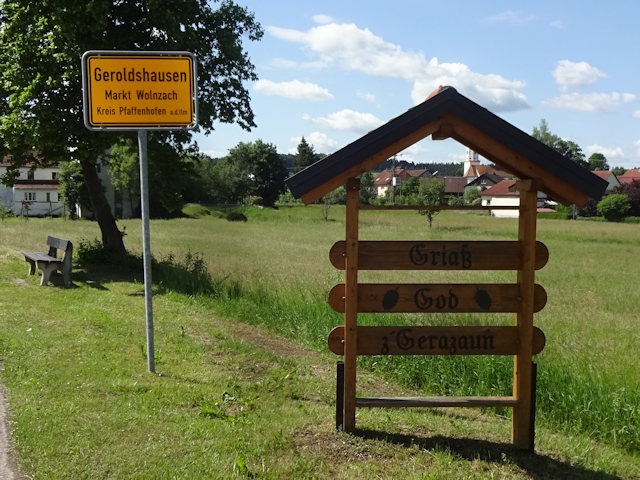
I get off the cyclist's highway at Geroldshausen ("Rolled Housing")...
...where I pass by a Bixnmacherei ("Can Makery"). This is closely related
to a Lumpenmacherei ("Rag Makery"), where a Lumpenmacherei is used to
denote houses where a boy was born, whereas the term Bixnmacherei is used
for homes with female offspring.
It is also here that a Porsche rally passes me by. Personally, I could
never see much point in something like that. Not only does it harm the
environment, but it is also expensive and nowhere near as healthy and
interesting as traversing the landscape by bike.
I mean, seriously, there may occasionally be challenges, such as rain,
sunburn and ups and downs, but right here, right now? I couldn't be
happier. The landscape is wonderful, the weather is clear, the ground is
only very gently sloping upwards so the going is good, and I have
absolutely no pressure whatsoever, nor do I have to worry about gas or
harming the environment with what I'm doing. What more could I ask for?
Anyway, moving on. The next places I pass are Geisenhausen ("Nanny Goat
Housing")...
...followed by Preinerszell ("Purer Cell"), where we are proud to present
you some more Alpacas. Those are actually quite uncommon animals for
Germany, which is the reason why unlike cows, sheep, pigs and chickens -
which you see all over the place - I like to point them out wherever I
spot them. It's kind of like a little treasure hunt in its own right.
By now, the cycling path near the road has ended. Not that it really
matters, because I pretty much got the whole road all to myself.
Next, I pass through the hamlet of Bettermacher ("Bedder Maker")...
...and then the village of Schmiedhausen ("Smith Housing"), where I am
already starting to feel the first harbingers of the ordeal hat is yet to
come.
For you see, I unwittingly routed my trip straight across the most brutal
ascent in the entire area. Up until now, the gradient was acceptable, but
ever since Schmiedhausen it has gradually been increasing, until it
reaches a brutal 10% that just goes on and on for about a kilometer or so.
Add to that the fact that my legs are already somewhat worn out from all
the cycling in the last few days, and it should not come as a surprise
that I have to take a break halfway up, which I should use to re-apply
sunscreen to my already burned hands. I figure since I've been outside of
the cover of the forest for quite a while now, it's about time too.
Be it because all my cycling training has paid off, or through sheer fore
of will, I eventually reach the town border of Schweitenkirchen ("Rample
Churching") without having to get off to push...
...and not long thereafter I finally reach the climax of this gruesome
ascent.
After that, it's relaxation time. With this being the highest point of
today' ride at 530m above sea level, the only way to go from here is down
for quite a while. As such, I reach the village of Güntersdorf ("Battle
Host's Village") without too much of an effort.
The next place I pass is Aufham ("Open Have")...
...and not long after that, I enter the Landkreis Freising ("Free Sing
County"), which is the last one before Munich.
By now, I have almost traversed the entirety of the Holledau in a
north-south direction (it is at its widest in southwest-northeast
direction, where I would have had to cover approximately three times as
much ground to cross it), and with Nörting ("Northen"), I pass through the
last village of this ride that is still contained within its borders.
There, I spy in the far distance the Biomasseheizkraftwerk Zolling
("Biomass Heat and Power Station Tolling"), towering above the landscape
like a mighty castle the great chimney of which even exceeds the height of
the nearby power poles. It doesn't currently appear to be currently
operating, however.
For the moment, I get to enjoy the last moments of relaxation before the
next ordeal begins, as I cycle through the valley of the Amper towards
said river, and whereas I am used to the Amper being the border between
the Munich gravel plain and the hills beyond, I can already see from my
current position that this doesn't seem to apply here, and that another
ascent will await me on the other side. Also, by now there's quite a few
clouds in the sky occasionally providing blissful shade.
I cross over the Amper on a remarkably wide bridge, considering that I'm
coming from a field path in the middle of nowhere.
On the other side, I enter the village of Tünzhausen ("Dance Housing"),
which not only features a remarkably dirty village name sign, but also has
the "left yields to right" rule enforced in the entire municipality, as
opposed to the rest of Germany, which follows the "left yields to right"
rule.
Much as feared, I face another challenging ascent on this side of the
Amper. In fact, the slope is so steep that if you build your house with
one side on the ground floor, that same story will be the first floor on
the other side of the house.
Roughly halfway up I find a very welcome sight: A sunproof shelter that
allows me to not only sit down and recover, but also happens to be right
in time for lunch. As such, I happily make myself comfortable in there and
eat the remaining Beeren-Süßfladen, as well as a Chocolate Croissant and a
Müsli Bar. Incidentally, my ultimate judgement on the Beeren-Süßfladen is
that for my taste they are at that very interesting crossover point where
I'm happy to eat them if they're offered freely, but wouldn't buy them for
myself.
After that refreshing break, I master the remainder of the climb with new
energy, and soon find myself in the very beautiful highlands of this area,
cycling across a wonderful field path. The only problem that I have at
this point are the pollen, which clog up my nose and make my eyes itch.
But let's be honest, even with that little drawback, it's still wonderful
to be here. After all, what can possibly surpass the serene beauty like
that of a lone tree standing at the crest of a low hill with a field path
running beneath it?
Up here, I am so bold as to make my way through the middle of Kühnhausen
("Bold Housing")...
...and then go right across a field by means of a path that is barely
discernible as such.
It is also here that I come across what appears to be either an
experimental or a display field, with many different crops growing in
small patches, each barely 2 dozen square meters in size.
I next enter the village of Sünzhausen ("Sin's Housing")...
...which paradoxically has a really interesting church made not only from
unplastered red bricks, but also has an unusual roof with four
diamond-shaped sides.
However, getting out of Sünzhausen proves to be a bit of a challenge,
since the way out features another steep incline, and I'm afraid that by
now my legs are really starting to get tired of all that.
Following that, I make my way through another Series of -hausen places,
namely Haxthausen ("Legs Housing"), Giggenhausen ("Looking Housing"), and
finally Massenhausen ("Mass Housing"), which I already visited on an
earlier tour, meaning that from here on out, I am now within my territory
again.
It is only here that my route finally takes me into a forest again...
...and it is on the far side of that forest that we have today's winner
of "Field Path of the Day", as I run into an incline full of wet, muddy
grass that is so slippery, that I am actually physically incapable of
proceeding on my bike, and have to get off and push until I clear the
worst part of that slippery slope.
However, that last climb sure was worth it, as it was not only the very
final ascent of today's ride, but also puts me on the top of a ridge to
the north of Munich, from where I get a great panorama view on the city,
its two windmills, the Allianz Arena ("Alliance Arena"), the distinctively
rounded BMW towers, the Olympiaturm, as well as the O² building. And on
top of all that, the faint outlines of the alps can be seen on the distant
horizon.
It is at this vista that I get to find yet another skillfully disguised
geocache hanging from a tree...
...and after that, it's down with me on the final descent into the Munich
gravel plain.
I am, however, not quite in Munich yet. First, I have to cross the
village of Fürholzen ("For Wooding")...
...where I come across the final age pole for the ride.
Following that, I officially enter the Munich gravel plain, with it's
vast open expanses of fields, and no discernible inclines whatsoever.
Before long, I come across an oddity: A re-constructed ancient Roman mile
stone from an ancient Roman road once running along here, connecting the
nearby Neufahrn ("New Driving", then: "Novivaro") with the somewhat more
distant Augsburg ("Eye's Castle", then: "Augusta Vindelicum").
Eventually, I reach Eching ("Cornern"), which is a place that I have
passed quite a few times before, only not on bike, but by S-Bahn. For you
see, this is a station of the S1 heading for the airport, and thus
whenever I was headed to or from the airport by S-Bahn,this was one of the
stations that I passed by.
What follows is a looooooooooong straight road leading me towards the
Schloss Schleißheim ("Attrition Home Palace")...
...and it is only along that road that I finally enter the county of
Munich.
As I gradually get closer to the city, the amount of other people on the
roads gradually increases...
...and before I know it, I have already reached the northernmost
outskirts of the city. I am now at the Dülferstraße ("Duffel Road"), which
I still remember from my childhood as being the old terminus of the U2
before they extended it all the way to Feldmoching ("Field Maken").
However, since I'm still at the outskirts of the city here, there's still
quite a few roads that lead me across fields...
...as well as roads leading through more town-like parts of the city,
such as the Fasanerie ("Pheasantry").
The last obstacle on my way home is the Rangierbahnhof ("Switchyard"),
where I used to spend hours with my grandfather watching the trains from
the bridge...
...and after that, there's only the very familiar field path separating
Moosach from Untermenzing between me and my home.
With that, this long ride is coming to an en. Now, depending on whether
or not you count the stray for meeting with Razurac, this may even be a
new 3-day record for me at 219.5km. Regardless of that, I am now beat.
Satisfied but beat. With that, let us now look out towards...
↑ to top
The Road Ahead
Naturally, I already have the next adventure planned. This one should
take me to a place that I've been to before, yet haven't visited for a
long time now, and my means of approach should be drastically different
too. Want to know what it is? Then stay tuned for the next chapter of the
Travelling Fox Blog!