This time around the Green Shnolz was responsible for the cancellation of the Eurofurence – which I also attended last year (see Book III ~ Chapter 9 ~ Busy in Berlin) – and thus, I once again have a few vacation days where I have nothing better to do than to further the Project Petal. This time, we're talking about…
Part 5 ~ The Petal of the Boar

By now, north is the only way left to go. Unfortunately, my furry friend in Ingolstadt has already made different plans for what to do in absence of the Eurofurence, so instead of the Rat Petal, I go for the slightly more western Boar Petal instead. Unlike the previous petals, there's absolutely nothing of particular interest into this direction, and so this should end up becoming a ride…
Into the Wild Green Yonder
19-Aug-2020Distance: 67km
Ascents: 390m
Duration: 8.75h
8/12🎁︎
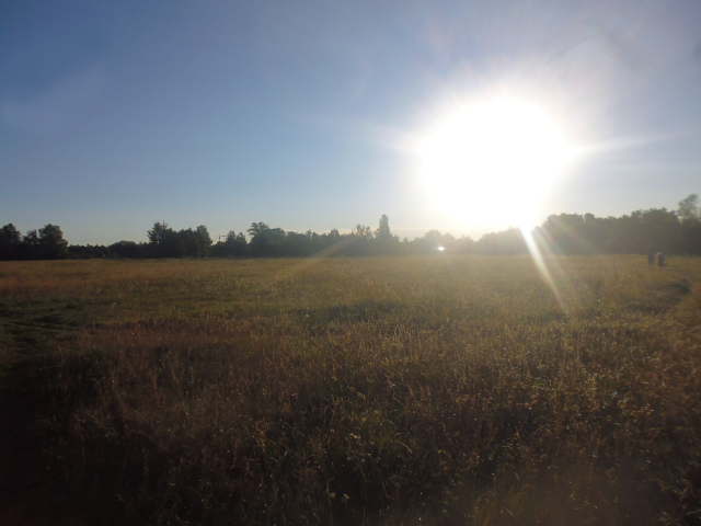
Once again, I start my ride early, such as to best avoid the heat that is still ever-prevalent in the summer. And since I'm headed north this time around, my first local landmark to cross should for once not be the Würm, but the Angerlohe ("Commons Grove").

My ride today should lead me north to Dachau ("Roof Meadow"), from where I'd follow the run of the Würm to the Amper, and eventually cross the latter. After that, I should head north into the hills to Petershausen ("Peter's Housing"), and then yet further north to Scheyern. Following that, I should turn west and head for my goal of today, the village of Aresing ("Ares Sing").

Radian has just yet risen, and since yesterday featured rain, it's actually still nice and cool just yet.
At first, my way leads across a field path near the local biotope…

…and then along a lone railway track lost in the midst of fields and forests.

Near Karlsfeld, I pass by the Eichinger Weiher ("Oaking Pond"), which is home to swans and geese alike.

Also, as is almost inevitable when cycling in this direction, I come across the Räuber Kneissl Gedenkweg once again.

This ride should be special in a variety of ways. For one, I should end up crossing the Würm an odd number of times. Actually, I should only really, really cross it once on the return ride, but since this here leg of my tour leads me by the Würm's side for some time, I inevitably end up stitching back and forth across it a couple of times.

Incidentally, this should also lead me right across the Konzentrationslager Dachau ("Concentration Camp Roof Meadow"), where over 200,000 Jews, communists, homosexuals, government opposers, and other dissidents and people inconsistent with Nazi ideology were imprisioned in the years between 1933 and 1945, about 40,000 of whom died either directly through execution or indirectly through the conditions in the camp. It's terrible to think that humans could do that to one another, especially considering that as a furry, I probably would have ended up in one of these camps myself, unless I had managed to get myself shot to death even sooner than that.

Moving on, I soon come past an area with small, as of yet unnamed lakes, and stand in marvel and wonder as I behold a mystic sight. Radian's rays just clearing the treetops and falling onto the cool lake cause the faintest sheets of mist to rise up from the waters, and continue to reflect on the underside of the pine trees, creating a caustic and ever-shifting pattern of light against the dark green of the needles.
Following that, I proceed to cross the Amper… or at least I would if the damn bridge would not be under construction!

As such, I end up having to follow the Amper downstream for a little while…

…before I manage to find another bridge that I can use to cross it.

Afterwards, I follow the run of the Amper just a little bit further, cycling through a green tunnel path of sorts…

…which soon leads me to the ford of dilemma, where I have to choose between cycling right throw a shallow brook with uncertain soil conditions and somehow trying to navigate my bike across a rustic old bridge that probably had been in its prime during the days of Charlemagne.

From there, I streak out inlands, and this is where I realize the fun stops starting, as I can see the first hills not far away. With this, I am out of the Munich gravelplane, and now the hard part of the ride begins.

On the other hand, this is where the fun place names begin, starting with one village where I visited a nice wolf many years ago. This is the first time that I actually manage to get here on my own strength, which is something I've always wanted to do. By now, said wolf no longer lives here, but I still remember the name of this place: Biberbach ("Beaver Brook").

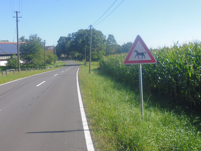
A little further along the road I come across the very rare "Horses Crossing" sign, which I believe is actually the first time I've ever seen it on all of my rides around Munich. Incidentally, this should also be the first such ride on which I should not encounter any horses at all.
It's around then that a pretty impressively-sized windmill comes into view to the north. Located between Lauterbach ("Loud Stream"), Kollbach ("Kale Stream"), Kammerberg ("Chamber Mountain") and Weissling ("White-ington"), the thing must be easily 150m high, judging from the trees near its base. As such, it should remain a landmark in my ride for some time. Incidentally, this windmill is standing just beyond the boundary of the Landkreis Freising ("Free Sing County").

Next up is the village of Giebing ("Give-ington")…

…where I leave the road behind in favour of a remarkably well-maintained dirt track…

…along the side of which I spot a pair of deer grazing near the edge of a maize field.

By now I have pretty much circled around aforementioned landmark windmill and am now viewing it from the West. Again, it impressively towers over the already quite tall trees by a generous margin. Incidentally, there's actually very little wind today, so the windmill turns only very slowly. In fact, I wouldn't even have noticed it if not for the fact that the rotor was positioned in a perfect "Y" shape when I stopped to take the picture, but had already moved just a little bit further by the time I had finally managed to get the camera ready.

By the way, I am naturally also collecting Geocaches as I go, and it is around here that I find one particularly well-disguised cache, though it should still not be the best one of this tour.

Just a little bit further down the road, I reach one of my major milestones for today: The town of Petershausen, terminus of the S2 line…

…bed of the river with the melodious name of Glonn…

…and also famous for its Alpaca ranch.

It is also here that I run into the clear winner of "Field path of the day" (but not of the tour)…

…featuring among more common obstacles such as waist-high grass, weeds and thorns also the brand-new and never-seen-before Arcturan Mega-Thistle, the tallest stalks of which reach up all the way to my face.

Again, I somehow manage to make my way through all that based on pure fury, and afterwards have to scale the other side of the Glonn valley, bringing me to the aptly named village of Oberhausen ("Upper Housing").

Up there, I also come across a Mahnkreuz ("Admonishing Cross"), which apparently has been standing here for 25 years already, admonishing the people to protect nature and the environment. I guess it's only a shame that so few people ever come past here.

The next place I pass through is the village of Steinkirchen ("Stone Churches")…

…which also serves as a gateway to a much more remote area, and before long I find myself cycling past fields that are almost completely surrounded by forest as opposed to the other way around.

Then, I arrive in Langwaid ("Long Pasture")…

…which true to its name features a long pasture with cows making long faces at me passing by.

By now, it's already sometime around noon, so I am keeping my eyes peeled for a nice and shady place to rest, which I eventually find literally in the middle of nowhere, on the porch of a cottage hidden in a shady pine grove. Again, it was a Geocache that led me here.

There, I have my traditional lunch of sandwiches, Müsli bars and water…

…all under the watchful eyes of a stuffed falcon posing beneath the roof.

As the day progresses, more and more clouds appear in the sky, granting blissful shade as they speckle the ground below in a motely of light and dark.

Next up is the village of Triefing ("Ooze-ington"), where an egg sale sign draws my attention. Looking at such signs, I always wonder what the equivalent in the chicken-verse would be. A woman holding a six-pack of foetuses in a box? You could even have mixed black and whites! It feels kinda perverse to just think about it, but then, why do we do essentially the same thing with chickens so readily?

And for once, just for once, I happen to approach one of these slopes from the right side.

At the bottom of this slope awaits a village with the amazing name of Ziegelnöbach ("Brick Nope Stream")…

However, naturally, what goes down must go up again, at least in these hill lands, and so I soon find myself pushing my bike up a rather steep slope in the middle of a nearby forest. But at least it's nice and cool and shady.

I realize I must have kept going for quite a while now, because the next thing I know I pass by Uranus and Neptune.

Turns out I have somehow ended up on the Planetenweg Scheyern ("Plant Way Slap"), which also nicely demonstrates the gravity well of the solar system in that it's downhill all the way to the sun. Next up is Saturn, which is located at the edge of the forest in a field…

…and yet a bit further I run into the Galilean Moons sitting peacefully by the side of a fishing pond.

Then, I zoom right by a couple of smaller planets (I mean, on a cosmological scale it's actually pretty unlikely to hit a planet unless you know exactly where it is) and next run into Venus…

…Mercury (which you're not allowed to climb because Mercury is toxic)…

…and ultimately, the Sun, which in this one case is nowhere near as deadly as it ought to be. All of these inner planets, by the way, are located within the Prielhof ("Tideway Farmyard").

After that, I backtrack a little bit to pick up Earth, Moon, Mars and the Asteroids, which consistently with the gravity-well model are located a little bit uphill from Venus…

…and then I'm off, cycling lengthwise through a valley for just a little bit…

…until I get to the village of Unterschnatterbach ("Lower Quacking Stream"), from where I take a left up into the hills once again.

By the way, have I mentioned that the harvest season has by now arrived? As such, wheat and barley have now been brought in, and pretty much all that's still left on the fields is maize. By the way, due to climate change, the farmers have suffered a devastating 5% crop failure this year. Way to compete with the 50% that some developing countries suffer. I'm afraid a famine might be just around the corner.

By now, I am slowly approaching the destination of today's trip, as I enter the Landkreis Neuburg-Schrobenhausen ("New Castle - Quirk Housing County").

The ridge atop which this boundary is situated should be the final major climb for today, and from there I look down on the relatively flat valley of the river Paar ("Pair"). In fact, I think the final line of hills before the horizon might already be on the other side of the great river Donau ("Danube").

Here, I notice there are quite a lot of (smaller) windmills around, and personally, I do find the sight quite enjoyable. Like some people actually took the advice from that admonary cross to heart.

I also finally learn which crops are being raised on these peculiar triangular fields as I pass by a sign explaining potato science on one of these (by now harvested) fields. Interestingly, none of the potato fields I worked on in New Zealand were shaped like this (see Book I ~ Chapter 19 ~ The Takaka Tales & Book I ~ Chapter 23 ~ The Critters of Carterton), but then I guess large-scale agriculture does have its own methods.

By now, I am almost at my stay place for this trip but then… just as I cycle down a field path between two maize fields, a little animal quickly crosses my path. It is a fox! The ninth wild fox I have seen in my life, active in the bright of day! It only takes it a few seconds to get out of one field and into the other, far too short for me to even react and grab for my camera, but the encounter remains real enough and should stay within my heart forever.

And then, I finally arrive in Aresing. All in all, this was a nice ride, with plenty of ups and downs, and the temperatures not rising too high. There's a bit of trouble with check in as I forgot to write down the exact address, only marking it down on my offline map, and my host is just a bit late, but with the help of a nice neighbour I eventually manage to check in. No thanks to the poor mobile data network out here though which spectacularly failed me as I tried to connect to the Airbnb app to download the rather essential details of host address and phone number.

Fortunately, it all worked out in the end and check-in works fine. But wait! I still have to go get supplies! So after I finish checking in and drop off my stuff, I saddle up again to go for a…
Bonus Round: Schrobenhausen Shopping
19-Aug-2020Distance: 8km
Ascents: 50m
Duration: 0.75h
Unfortunately, a side effect of my going into the wild green yonder is that there aren't any good shopping options reasonably nearby. The closest supermarkets (or even regular grocery markets beyond "we sell whatever our farm has produced, like, right now") is in the next town over, which is already about 20 STEPs away. That means it's even further away as the already pretty far-away supermarket that I frequented during my stay in Daisen (see Book II ~ Chapter 13 ~ Daring Daisen). While kinda inconvenient, this normally would not be much of a problem… if it had not been for the fact that I already covered, like, 67km today. However, even so my natural exploration impulse wins over laziness, and thus I compromise on a slight detour for the trip to the supermarket, and then the direct way back again.

As I should learn, said Detour has the crass disadvantage of taking me right over the very top of the hill chain separating Aresing from Schrobenhausen, but it compensates for that by taking me directly past a deer enclosure featuring deer of a variety of colors and patterns.

After crossing that ridge, I soon arrive in Schrobenhausen. According my host, there's supposed to be at least three different supermarkets in this area (cuz why spread them around the landscape when you can concentrate them in one spot?), and the first one I run into is the Kaufland ("Buy Country"). Figuring that I'll get everything I need for these next few days in there I just take it and within a short time emerge victorious, with a bag full of pasta, sauce, minced meat, sandwiches, and some baked goodies for breakfast.

Now, the way back is relatively straightforward. I just navigate through some side streets of Schrobenhausen to the next thoroughfare over, and then head into the direction of the three windmills until I'm back in Aresing. Simple as that.

With that, I now have 75km on my distance counter today. That's definitely enough for one day. Time to kick back and examine…
The Place
The Airbnb I'm staying in this time around is a modern house of reasonable proportions. Bigger than anything I stayed in in Japan, yet smaller than most houses in New Zealand. At any rate, it has more than enough space for me to feel comfortable.

My room is… kinda monochrome… but it features a laptop-friendly workspace and a comfortable bed, and that's all I really need (though curtains for some privacy would have been nice too).

Also, a nice little gesture that I really appreciate is the bottle of water and a few little snacks, which serve to feel me that much more welcome. That, and I should eventually also get provided with free tea.

One feature that's always quite important to me is a good kitchen, and I seem to be in luck here. There's plenty of space, pots and pans, dishes and utensils… in short, nothing left to be desired…

…and as such I quickly manage to whip up a simple yet filling and satisfying dish of Naleiayafero, making two servings, one for tonight and one for tomorrow night (actually, it's probably closer to three servings, but seeing as how my body worked hard today, I think he has deserved some extra rations =^,~'= ).

One nice thing to note here is the eco-friendly meat wrapping, the likes of which I have not ever seen anywhere before: Whereas most meat is simply wrapped in throw-away plastic containers that are relatively massive, this meat is contained within a fully recycled and recyclable paper box that is only covered by a thin layer of plastic, which in turn is made from 70% recycled plastic itself. Furthermore, the plastic-foil is designed to be easily separable from the paper, making recycling an absolute breeze. Kinda reminds me of the EZ-recycle bottles they have in Japan.

Anyway, that's clearly enough for today. Afterwards, I have a nice cool shower and go to bed as soon as the sun sets. Since I haven't quite reached my goal of Ehekirchen ("Marriage Churches") just yet, tomorrow holds another big trip in store for me that should revolve all around the one central question:
To Rain or not to Rain
20-Aug-2020Distance: 76km
Ascents: 420m
Duration: 8.25h
4/6🎁︎
I start the day with a cup of tea, a sausage in a roll, as well as an Olivenstange ("Olive Stick"). A good breakfast makes for a strong start into the day, after all, and today especially I can need all the energy I can get.

Knowing that today is going to get hotter than yesterday, I try to get an early start once more, and by 7:00 I am already out on the road again.

Today, my primary goal is the town of Ehekirchen, and beyond that I also have my sights set on making it all the way into the Landkreis Donau Ries ("Danube Ream County"). To get there, I first head northeast past Schrobenhausen and Langenmosen ("Long Mossing"), and then cross over the impressively wide valley of the very narrow Ach ("Oh"). My turning point should be the village of Gempfing ("Vaight-ington"), and after that I should head back again via Pöttmes ("Pot Mass") and Hörzhausen ("Hears Housing").

Today, it's supposed to get rather hot. However, right now it's still nice and cool, and there's even a very light cloud cover keeping away Radian's rays. In fact, I even wonder if I'm going to run into some rain during the morning hours.

With Radian hidden by the clouds, the light filtering through from above gives everything to the east a bright golden backdrop, against which especially the windmills look really, really nice.

Before long, my route leads me along a field track the likes of which I have not yet encountered: For some strange reason, instead of gravel, this one consists of sand, and as anyone who has ever tried traversing the Sahara cross-country on bike, cycling on sand is roughly as impossible as fitting a whale through a drainpipe.

However, I soon manage to make my way past this unexpected obstacle (mostly by cycling on the grass instead), and make my way to Mühlried ("Mill Reed"), which for all practical purposes can be considered to be a district of Schrobenhausen.

This is an interesting little town, where for some strange reason it is explicitly forbidden to have children wear helmets on playgrounds, or to… strangle them with a locked crowbar??? Huh… well, I guess I can see why that would be forbidden, but still… huh…

It is now five-to-eight, and the outside temperature is a pleasant 17°C. Nice and cool for a biking ride, especially if you go uphill and heat up a lot.

Shortly thereafter, pretty much exactly at 8:00, I cross the river Paar, and thus officially enter the town of Schrobenhausen.

Actually, come to think of it, I think I have crossed this river once before. And indeed, checking my maps, I can see that the Paar actually runs all the way to here from Kaltenberg ("Cold Mountain"), which interestingly lies right in the middle of the Rooster Petal, meaning that here's another river which I'm going to have crossed an odd number of times. Even more interesting is the fact that at its closest approach, the Paar actually gets within 2km of the Lech without actually flowing into it near the town of Kissing, which has the Paar on one side and the Lech on the other. There's not even a ridge separating the two or anything. The terrain between the rivers is almost perfectly level, with only a lower single-digit difference in meters. And yet, instead of taking the easy way into the Lech, WHOOMP goes the Paar straight into the hills of Swabia! I figure it's actually a lot like me in that regard.

But anyway, that's enough Geography. After Schrobenhausen comes the town of Steingriff ("Stone Hilt"), which again, for all practical purposes can be considered as much of a district of Schrobenhausen as Mühlried on the other side.

After that, the path starts leading uphill for a bit, until I eventually emerge on open plains under a threatening sky. Will it rain? Or won't it? As of yet, it seems like it could go either way.

Subsequently, I cross through the Hagenauer Forst ("Bull Meadow Forest"), which straddles the ridge between the Paar valley and the Ach Valley…

…and soon enough emerge on the other side, overlooking the Ach valley, and seeing rain fall in the distance.

Now, the Ach valley should contain the easy part of today's tour. For a reason that is not entirely clear, the tiny little river Ach has managed to carve out a broad, flat, triangular valley, which at the point where I cross it is already over 10km wide. This makes for easy going, and before long I pass through the community of Langenmosen.

It is there that I spot something else portending rain, a very faint rainbow in the western sky against a backdrop of dark clouds. The question is, is it coming, or is it going? And if it is going, is it going faster than I am coming? Once again, there's barely any wind in the air, and the clouds look pretty much stationary.

Also, I come across a noisy tree within Langenmosen where droves of tiny little birds are loudly proclaiming their presence to one another, generating a veritable cacophony of sound waves that can even stand up to the passing road traffic. Kinda reminds me of the screaming birds of Japan (see Book II ~ Chapter 3 ~ Living, Learning and Working).
I wonder what they have to say to one another. But wait… then again, I guess I already know.

Incidentally, by now the weather has ever-so-slightly warmed up to 18°C, which is still quite comfortable to cycle in.

Following Langenmosen, I start making my way across the aforementioned very comfortable plains of the Ach valley…

…and before long reach the mighty Ach itself…

…which apparently is lined with beaver dens to such an extent that a dedicated warning sign makes sense.

Next up is the village of Ludwigsmoos ("Louie's Moss") near Königsmoos ("King's Moss"). Now, I kinda do get the impression that they might have just a little bit of a moss fetish around these parts or something. =^,~'=

Interestingly, I also come across what I can only describe as "Nature Study to go", in the form of signs posted in fields educating me about how much tons of CO² a hectare of rye or meadow binds during a year, and how much oxygen they produce. Turns out the amount of oxygen produced is about the same, but rye still binds about 5% more CO². Now if only I were not allergic to it. Good thing the rye field is already harvested.

Still within the extended community of Königsmoos, I pass through the village of Achhäuser ("Oh Houses")…

…followed by Dinkelshausen ("Spelt Housing")…

…where I come across one of these old chewing gum machines that have been around since the days of my grandfather, and still seem to be quite successful, for this one is fully stocked and operational. More notable, however, is the choice of products they offer, and it goes without saying that I simply can't go past this one without buying a Fox Box for 50¢.

By now, I'm already within the extended community of Ehekirchen, and thus me reaching my big goal for today is only a matter of time. Now all that's left is passing through Seiboldsdorf ("Be Guy's Village"), which is also where Radian truly breaks through for the first time during this ride…

…and then I arrive at Ehekirchen, and with it the big target of the Boar Petal.

Now, since it's still not even 10:00, and I have packed supplies for a full-day trip, I figure I might as well go after my bonus goal of Donau Ries as well. In fact, I might even make it all the way to the town of Rain, located not far from the Conflux of Lech and Donau. Its only about the same distance as from Schrobenhausen to Ehekirchen, after all. However, unfortunately, this is where the Ach valley ends, and thus instead of a relaxed and rapid advance across open plains, I am faced with another slow ascent up into the next hills over.

The way that follows is pretty much a mix of up-and-straight, with a number of flat or at least relatively flat stretches… followed by ascents up hills that just make me go "OH DRAGON NO!!!".

And what do I find atop that particularly gruesome hill? A Book the size and shape of a village ("Buch" = "Book")!

By now, I must have cycled a total of over 100km since the beginning of the tour yesterday, and my legs make me feel every bit of it. Still, I carry on. At the very least until 11:00, I promise myself, I will keep going before turning back, and even if I do not make it to Rain by then, I hope that I will at least manage to make it into the Landkreis Donau Ries. As such, I carry on across the hilltops. At least, after Buch the worst is over, but the road still insists on tormenting me with frequent ups and downs.

Eventually, I reach yet another place called Holzkirchen ("Wood Churches"), which is actually about 20km closer to Petershausen than the Holzkirchen that used to mark the other end of the S2 when I was younger and learned all the S-Bahn routes by heart.

It is here that I have my closest approach to a pair of small windmills just atop a hill that I pass through, and if it was not for my legs screaming "Ah! Ah! I wanna die!" at me, I might actually have gone up and personal to them. As it is, however, I contend myself with passing within 300m.

Oh, and speaking of weird counterpoints, since I've already passed by alpacas in Petershausen, I guess it's only fitting that I should pass by some llamas here near Holzkirchen.

And then, just as the nearby church bell rings 11:00, I finally make it to the border of the Landkreis Donau Ries!

Again, I get a great view, and this time around I'm quite sure that the hills on the horizon are on the other side of the Donau. In fact, the village in the distance might very well be Marxheim ("Marx Home"), which would already be on said other side.

However, it looks like I won't be able to make it to Rain after all, since that's still about 5km off, and the conflux still about 10km. With my legs already rather tired, the temperatures gradually climbing to "uncomfortably warm", and me still having to cycle back all that way, I figure it's best to turn around soon… but not before enjoying a nice, rewarding ride down into the town of Gempfing.

And then I turn back, before even crossing the Kleine Paar ("Little Pair") that runs through Gempfing, and follow the run of the Haselbach ("Hazel Stream") back into the hills. At least this time around since the road is roughly following the run of the stream, there are not quite as many ups and downs, but they still exist. Also, since I'm cycling upstream towards the source of the Haselbach, the overall trend is naturally also upwards.

With the village of Etting ("One-ington"), I pass through one more place within the Landkreis Donau Rain…

…but then I'm already at the boundary again, re-entering the Landkreis Neuburg-Schrobenhausen.

Once again, I come across a few deer grazing in broad daylight by the side of a maize field, this time quite a safe distance away…

…and before long, I arrive at the eponymous village of Haselbach, which already belongs to the extended community of Ehekirchen again.

Afterwards, there's a bit of a climb as I cross the local watershed and reach the village of Weidorf ("Sacred Village"), from where on out I should follow the run of the Mühlbach ("Mill Stream") for some time, meaning that the overall tendency should now be downhill – at least for a time.

By now, the temperatures have gotten quite hot already, which also can be attested by the roadside… CACTI!??? Okay, I know we're having global warming and all, but I still think this is getting kinda out of hand.

Moving on, I make it just to the fringes of Walda ("Wall There")…

…and then take a right, which unfortunately takes me up another hill, but also allows me to add the Landkreis Aichach-Friedberg ("Oak Stream-Peace Mountain County") to the list of counties I've passed through today.

Following that climb is a downhill ride, followed by another climb, followed by Pöttmes, another milestone in today's ride.

Now, the good news is that now I'm in the Ach valley again, so the roads are mostly flat and open. The bad news is that the roads are open, and Radian has just finished vaporizing the last clouds in the sky. With that, the sunlight turns harsh, causing fire moves to deal double damage and allowing Solar Beam to be used every round. It also means I'm baking in the heat as I ride, and desperately slap on another layer of sunscreen, hoping that it will suffice and prevent me from being roasted alive.

Since the zenith hour is now rapidly approaching as well, I frantically look around for a shady place to stop for a lunch break, and eventually find one at least somewhat shady bench by the roadside that I figure will have to do for today. At least it has a nice view on the nearby Auwäldchen ("Meadow Grove").

Since I had not planned for today's trip to be this long (and since they didn't sell my favourite six-pack of Müsli bars where I was shopping), today's lunch only consists of the sandwich I bought at the Kaufland yesterday, as well as some good old water.

Incidentally, there is a German-Israeli joint airforce manoeuvre going on these days, and it appears to be taking place in these parts. Ever since yesterday, I have been noticing fighter jets of at least two different designs – black and white – roaring across the sky at dazzling speeds, and it is only now that I'm sitting down and having my break that I finally manage to capture one of the white ones on film… well… chip.

I extend my lunch break for a bit by doing a part of my daily Japanese learning regimen there in the shade, and once Radian is at least out of zenith, I apply another layer of sun screen and continue to the nearby village of Sandizell ("Sandy Cell").

From there, I continue along a road leading through the nice and shady Hagenauer Forst again and… what… wait… no, No, NO!!!

There! That's better! Let's try this again: After making a slight detour taking me off the main road, I continue along a path leading through the nice and shady Hagenauer Forst, and although the going is not quite as smooth as on the main road, the fact that the trees grant both shade and coolness makes more than up for it, even if it means I have to push my bike up some of the steeper hills here.

I guess it's reasonable that I should feel comfortable in here. After all, it's my forest ("Dein Wald" = "Your Forest").

And by the way, these are not mushrooms…

…those are mushrooms.

Next up is aforementioned town of Hörzhausen…

…where I finally become actively aware of an interesting custom practiced in this region of Bavaria. I have noticed these things before on my ride, but up until now dismissed them as scattered curiosities. With this, however, they have crossed my attention threshold: All over this area, people are setting up elaborate, personalized pole trees to celebrate milestone birthdays for their friends, starting with 16 and 18, then 30 and every ten more years thereafter. The trees usually contain references to central aspects of a person's life, as well as a short rhyme to commemorate them.

Following that, I cross over a more unruly part of the Paar…

and pass through Habertshausen ("Havers Housing").

By now, I have almost completed my great tour today. No all that's left is crossing the final ridge between the valley of the Paar and the valley of the Weilach ("Because Brook") running through Aresing…

…and then I'm back at Aresing again. Altogether, today's tour ended up to be much less of a "relaxing 40km ride with less than 100m of ascents" and much more of a "gruesome and scalding hot 76km ride with over 400m of ascents". In fact, adding up all the trips on my tour thus far, I am now already at over 150km, which is almost as much as the entire Goat Petal (see Book III ~ Chapter 14 ~ Project Petal Part 3 ~ A Verily Vulpine Voyage), ascents included! In fact, valuing in the excess ascents of this ride as extra distance, it might already be more! And tomorrow, I have at least another 60km to look forward to! I did not actually intend to break the psychologically important 200km mark for a tour, but it looks like it's gonna happen anyways.

Anyway, after returning, I update my maps, and then eat the second half of the Naleiayafero I prepared yesterday…

…before taking another cooling shower and then dropping into bed, exhausted, as early as 20:30. After all, tomorrow I plan to rise even earlier today in order to make it…
Through the Hellfire Mantle
21-Aug-2020Distance: 63km
Ascents: 430m
Duration: 8.75h
9/12🎁︎
Today is supposed to be the hottest day of August, which is just my luck. As such, I get up early. As in, really early. As in, really really early. As in, about as early as humanely possible. Or if you want me to be concrete about it: 4:30 in the morning.

I charge up by eating the by now rather crunchy baked goods I bought yesterday (note to self, these stay soft for longer if stored in the fridge), which take the form of a Salamistange ("Salami Stick") and a Pfefferbreze ("Pepper Pretzel"), as well as another cup of tea…

And then I'm off, at first light for the first time in a while. Even so, the temperatures are already higher than yesterday, featuring about 20°C even this early in the morning.

Today's route is relatively straightforward. First, I head roughly south until I hit Altomünster ("Old Priory") from there on roughly following the run of the legendary A-Line, until Bachern ("Brook-ington"), and after that south and east until I get back home.

First of all, I start out with crossing what clearly must be my favourite ridge, because this is now the third time on my ride that I cross over the hills separating the Weilach and the Paar. Still kinda exhausted from yesterday and the day before that, I end up having to push Jycily up some inclines, but in exchange I get to see a nice, rainbow-colored pre-dawn gradient on the western horizon.

I've barely made it to the other side and onto the road leading south when Radian rises in the east, glaring down without malice nor mercy, and clearly intent on painting the land the color of heat. I've already applied generous amounts of sunscreen, and I really hope it will be enough. After all, three days of full exposure to solar's searing rays can be quite damaging to me with my almost vampiric complexion.

All this happens even before I even make it to Rettenbach ("Saving Stream"), but fortunately, with Radian still low in the sky, pretty much all places to the west of a forest or a hill – such as this one – are still blissfully in the shade for just a little bit longer.

But unfortunately, that only works when there's hills and forests available. As I ride through more open country, I soon find Radian hitting me with a full broadside from the east. Interestingly, this sort of unilateral photon bombardment also causes interesting bar-code like patterns on the ground. In fact, let me just run my scanner over this real quick and… huh… interesting… Apparently what I'm looking at here is a 300g box of frozen broccoli for 1,36€.

Next up we have the village of Weilach, which is home to the stream of the same name…

…which where I find yet another of aforementioned birthday-poles.

From here, the going is actually quite good for a while, as I follow the run of the Weilach, albeit upstream, but through relatively flat terrain. Radian is also not too high in the sky just yet, so even the temperatures are still quite manageable.

Once more, I cross over into the Landkreis Aichach-Friedberg…

…where this time around, I spot a hot air balloon in the distant sky instead of fighter jets. I just hope it's not there for target practice.

Anyway, next is the town of Schiltberg ("Shield Mountain")…

…which wins the uncontested style award for this tour by being the partner community of Schwertberg ("Sword Mountain") in Upper Austria.

Apart from that, there's also a mystic little marsh that is as of yet covered in dense mist near the entrance of the village.

Now, in addition to the style award, Schiltberg is also the clear winner of the "Field Path of the Tour" award. Going after a Geocache atop the Hofberg ("Court Mountain"), I have to make my way along a path that is not only, steep, overgrown, wet and slippery, but also features obstacles such as nettles and brambles growing all over the path, as well mosquitoes eager to draw their own share of blood.

However, as I'm sure you know by now, I'm not the sort of fox who lets himself be deterred by such minor inconveniences as getting stung and bitten while pushing a bike up a slippery slope with a tumbly-fall to one side and figuring out creative ways to hold down brambles with one foot while somehow pushing his bike across and just sort of accepting the inevitable mosquito stings (even though any seasoned jungle explorer would have long since brandished his/her machete). The reward at the top is a Geocache hidden near the Dreifaltigkeitskapelle ("Trinity Chapel"), which has been standing here in one form or another for at least several hundred years.

Fortunately, the way down is significantly easier, as I manage to pick a considerably better maintained path. Once back down in Schiltberg, I notice a veritable jewel box of birthday poles and the likes. For example, here's a multicultural one…

…and here's one celebrating the 0th birthday, that is, the actual birth of a new baby.

Moving on, I next arrive at the village of Höfarten ("Farm Yards Types")…

…where I realize that apparently, my father Peter does not only feature a pony farm around these parts, but also seems to run a flourishing carpentry business together with someone by the name of Escher.

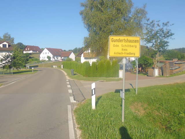
It is now 8:15 and I am just arriving at Gundertshausen ("Kors Housing")…
…and it is right about now that the temperatures start crossing the threshold from "comfortably warm" to "uncomfortably warm". Not a cloud in the sky nor a tree near the road cast shadows on this sunny road, leaving me to roast ruefully in Radian's relentless rage. Fortunately, the Altowald ("Old Forest") beckons promisingly on the distant horizon…

…but to get there, I first have to pass through Aufhausen ("Up Housing")…

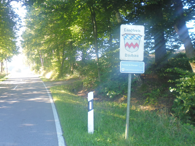
…enter the (actually rather extensive) Landkreis Dachau ("Roof Meadow County")…
…make my way around yet another Teufelsberg ("Devil's Mountain")…

…and finally cross the inaptly named Thalhausen ("Valley Housing"), which is located atop yet another hill.

There, I find yet another Mitfahrbankerl ("Ride Along Bench"), the likes of which I have last seen near Geltendorf on my return ride from the Lechtal in the Rooster Petal. This one even features physical destination signs as well as a manual.

Afterwards, there's some more gruelling ascents up the nearby hills, but then I finally arrive in the cool and shady Altowald, where a little poem reminds humans who enter to treat the forest and its animals with due respect.

Of course, being located on top of another hill, I end up having to push Jycily up the gravel paths again, but… have I mentioned how absolutely wonderful it is to slowly push your bike through a nice and cool and shady forest after cycling through the unrelenting summer heat?

Anyway, apart from escaping the summer heat (which incidentally is something that Japanese has a two-syllable word for: 避暑 "hisho"), I naturally also have another reason for coming to this forest of all the places, namely retrieving a Geocache from a local forest troll.

Trying to avoid a patch of nettles that has grown squat over the path that I was going to take, I end up having to navigate between the trees, and eventually run into a debris trailer standing squat in the forest just like that, with no trail leading to or fro.

However, I eventually manage to make my way back onto the trail again… well, at least a close semblance of a trail. Now, on any other tour this one would have won the "Field Path of the Tour" award, but this time around, it only manages to earn a meagre third place behind the Schiltberg Combined Horrors and the Petershausen Mega Thistle Patch.

After that last bit, it's only a little further until I reach the edge of the Altowald, and thus enter the Hellfire Mantle for good. By now, the temperatures are rapidly approaching 30°C, and Radian's orbital photon blaster is operating at nearly maximum capacity. But there's nothing to be done, and so I slap on another layer of sunscreen and am on my way.

Around here, I run into yet another variant of the birthday pole, namely the marriage pole, celebrating and announcing the joyful union of two loving turtle doves.

And then, I finally arrive at Altomünster…

…terminus of the legendary A-Line, as I still know it.

First constructed from 1910 to 1913, this local line is somewhat of a local celebrity. Also known by nicknames such as "Bummerl" ("Little Stroller") or "Bockerl" ("Little Bucker"), it is a branch line connecting the Dachau backcountry to the railway network. Originally operated with good old steam trains back in the day, it was eventually switched to rail cars and integrated into the official MVV network in 1994 as the A-Line as which I got to know it. Since it was the only track in the entire S-Bahn network that was not electrified, it held that special status for my entire childhood, until in 2014 it was finally completely refurbished and properly integrated into the S-Bahn system. Since it was now a fully-fledged S-Bahn of its own right and the current network did not feature an S5 due to several network shuffles, they renamed the A-Line to S5, and it has been running from Altomünster to Erding ever since… Hahah, just kidding! Actually, they also named this line S2, thus leading to the wonderful situation that you now no longer can no longer count on an westward-bound S2 to take you to Petershausen as it always did, because why go for an obvious and clear solution when you also have the wonderful option of confusing people?

Anyway, that's another S-Bahn terminus I can add to my book. Now, next I'm headed through Stumpfenbach ("Dull Stream")…

…which apparently serves as a nexus of sorts for all kinds of fancy hiking and/or cycling tours. Let's see what we have here…
- The Water Cycling Path Upper Bavaria
- The 7 Monasteries Path
- The Sun Path (oh yeah baby, I can totally feel that one right now!)
- A hiking path for cattle
- …and a hiking path for… cheerful ghosts???

Actually, the only thing I'm missing here is the Räuber Kneissl Gedenkpfad. After all, that one should also be somewhere in this general area. But oh well. Anyway, my way now leads me right next to the railroad tracks for a while, and I can almost picture how it must have been in the old days when there were still steam trains running through this idyllic landscape.

Next, I arrive at the village of Kleinberghofen ("Small Mountain Farmyarding"), which features a hill which at over 20m also adds substantially to my total ascents today. I only hope that I won't have to run into its big brother during this ride.

There, I find what is definitely the most cleverly concealed Geocache of this tour, hidden within a copse of birch trees.
After that, I pass through Eisenhofen ("Iron Farmyarding"), even though the buildings are still from stone there…

…and pass by the cows that must have taken the aforementioned hiking path for cattle, and are now taking a rest.

Next up is Erdweg (Earth Way)…

…and then my worst nightmares become reality, as against all hope, I end up running right into Großberghofen ("Big Mountain Farmyarding"), where the name says it all.

Again, on its own, this wouldn't be so bad since it's really just a tall hill and not a mountain. However, add to that the fact that I'm now rapidly approaching the psychologically important 200km mark for this ride, and that the temperatures are by now AHHHRGH I'M MELTING °C, and you get the ordeal I'm enduring now. Fortunately, even the tallest hill has a top, but that still doesn't help with the heat.

Next, I pass through the villages of Oberroth ("Upper Red"), Schwabhausen ("Swab Housing") and Puchschlagen ("Book Hitting") in rapid succession. Come to think of it, I think I've already passed through a different Schwabhausen on the Lechtal tour. That one must have been near Geltendorf.

Puchschlagen in particular is interesting for its church – the Filial Church St. Kastulus – which has a very slender tower that, in fact, looks like someone had modelled it in 3D and then vertically stretched it to 150% its original height.

Next up is the town of Oberbachern ("Upper Streaming")…

…after which the final substantial climb of the ride awaits me.

From there on, it's downhill until I reach Bergkirchen ("Mountain Churches"), where I notice that my good old camera seems to slowly but surely conk out.

Then, I cross the Maisach ("Maize Brook")…

…along the shore of which I once again find a cleverly disguised Geocache. Together with the troll and the birch one, that now makes three very clever Geocaches for this ride. I think that's a new record.

Anyway, this was the last hurrah! Now the hills are behind me, and all that's left is making my way through the Munich Gravelplane back home.

It is at the nearby town of Feldgeding ("Field Thingie") that I finally breach the psychologically important 200km mark for one trip. One day for 100km, three days for 200km… I suppose that means I would need 6 days for 300km and 10 days for 400km. However, I figure that at some point that sequence is going to taper off, because otherwise I'd arrive at only 8km per day at the 2400km landmark over 300 days, and I figure that even in my current hobbyist bicycler state I could sustain a pace of about 30km a day indefinitely.

Moving on, I still have to cross back over the Amper…

…and soon thereafter finally find a nice and shady spot where to have my lunch break.

Actually, from here it's only about 12km back home, so I briefly consider just cycling through without a break, but no… the zenith hour is upon me, and Radian is blasting down from his orbital vantage point like a rabid Charcliff Ferogryph. Also, my legs are dead tired, and I need to take a break to drink something and re-apply sunscreen anyway, so I sit down here and have my traditional lunch of Sandwiches and Müsli Bars.

Afterwards, I continue on my path, thankful for whoever allowed all these trees to grow that flank the Allacher Straße ("All Brook Street"), spending blissful shade as I rapidly approach my home.

With Eschenried ("Ash Reed"), I'm on familiar territory again…

And before long, I cross the Autobahnring again.

Now I'm almost home, which is good since the weather has gotten even hotter ever since Eschenried, where I could feel myself crossing a heat barrier. Munich must be under Föhn influence today, which would also explain why I can see the alps all the way from here.

Anyway, with this, I'm back in Munich, and from this side of the city, it's now only a short way until I'm back at the Fox Loft, and can relax after these last three days covering 200km.

With this, I have completed a milestone in the Project Petal: With five relatively regular petals in place, the map of all the petals I've completed is finally starting to resemble a flower. Five petals are down, seven more to go. But for now, I think this is a good intermediate state.

So, what's next? Well, I suppose it all depends on how the Green Shnolz is going to develop from here on out, and what restrictions the government is going to impose as a result. Thanks to a whole bunch of careless people, the numbers are on the rise once again, but not as bad as before. I suppose it all comes down to luck but…assuming that we don't get another lockdown, I may have made plans… and those plans might result in Book IV of the Travelling Fox Blog. So stay tuned, and we'll see together if at least this time around my plans manage to bear fruit.
No comments:
Post a Comment