Together, my friend Robert and I have been at the easternmost point of Germany in Sachsen near Görlitz...

...the northernmost point of Germany on Sylt in Schleswig-Holstein...

...and the westernmost point of Germany in Nordrhein-Westfalen near Geilenkirchen.

So, naturally that leaves us one cardinality short, but that's alright, because the final point just so happens to be here in...

Ever since we embarked on last year's tour, Robert and I have been conspiring to visit the southernmost point of Germany during a weekend trip, but then the second and third wave of the Green Shnolz happened, and these plans were stalled for a long time. Now, however, Robert is fully vaccinated and I just got my second shot a few days ago and have a negative test. Also, the travel restrictions have been loosened considerably for the summer, so we're good to go. Our destination these time lies reasonably high in the alps, at the corner of the German district of Oberallgäu ("Upper Mountain-Meadow Landscape") and the Austrian districts of Tirol ("Ground") and Vorarlberg ("Before Mountain-Pine Mountain").

Okay, wait, no. That map makes this look kinda harmless. This is what we're really up against.

Our plan is to arrive on the German side, then climb up the northern side of the mountains to the southernmost point, and then climb down again on the southernmost side in Austria. There, we will stay the night, and then return to Munich the next day. Thus, the first thing to do is take a train...
Across the Allgäu
Ride Duration: 2:19hApproximate Distance: 171km
Average Speed: 74km/h
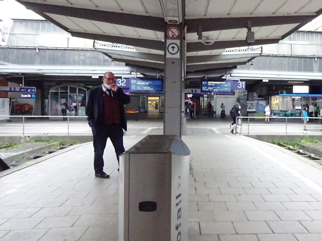
We've actually been planning to go on this trip a few weeks earlier, but back then the weather was not really agreeable, so we postponed it to this weekend. Today, however, the weather looks like it will turn sour in the evening, so we decide to get an early start. As such, I depart from home early to walk to the S-Bahn station...

...realize I forgot my tails, run back home, grab them, and then manage to make it to the bus stop just in time to catch the bus instead. At this time and day, the bus is quite empty.

After this initial excitement, I fortunately manage to make it to the S-Bahn station in time. The station, too, is quite empty save for some birds and a human at the far end.

Also, due to ongoing construction on the S-Bahn Stammstrecke ("Fast Train Trunk Track"), this time around the S2 skips the stations of Laim ("Glue"), Hirschgarten ("Stag Garden"), Donnersbergerbrücke ("Thunder's Mountain's Bridge") and Hackerbrücke ("Hacker Bridge"), proceeding straight to the central station instead. And since that's exactly where I need to go that's just plasmic with me.

The central station, too, is heavily affected by the construction. There's also quite a few people around here despite the early hour, and all of them wear masks...

...well, with the exception of a train driver smoking on the platform, right beneath the 🚭 sign! Talk about setting a bad example.
Eventually, this is where I meet up with Robert, who is coming from the other side of Munich, and together we get aboard the train that will take us as close to our destination as trains go. Surprisingly, this train is actually quite full, but at least most of the people are wearing masks.

And thus begins the first segment of our new short journey, taking us past many places starting with "K", such as Kaufering ("Buy Ring"), Kaufbeuren ("Buy Farmer") and Kempten ("Bend Castle"), and all the way to Oberstdorf ("Uppermost Village"), which, in spite of its name, is not the uppermost village in Germany. The first third of the ride until Kaufering also takes us through territory that I already covered during the Petal of the Rooster (see Interlude ~ Project Petal Part 4 ~ Lechtal Liveliness)

Along the way, we should pass through the fields surrounding Munich, and then traverse the Lechtal first east-to-west, and then head a good bit south near its western boundary too. As we cross the Lechtal I get to see the two windmills that I observed from the north during my ride here, this time from the south to put things into perspective. Afterwards, we enter the hills of the Allgäu, and soon thereafter pass by the Unterinselsee ("Lower Island Lake") and Oberinselsee ("Upper Island Lake"), the latter of which seamlessly transitions into the Niedersonthofener See ("Lower Sun Farm Yard's Lake") at the bend. Finally, the peaks of the alps start coming into view, with the lower mountains being forested all the way up, while the higher ones in the distance sport bare peaks.
Eventually, we arrive in Oberstdorf, which just like Westerland on Sylt to the far north is one of those definite terminus stations - only here you'd not fall into the sea if you continued much further but rather crash into a mountain.

From here, our destination is still about 23km away, which is a bit far considering there's a notable climb involved and we need to get down the other side too, all before the rain starts in the evening, so instead of walking all the way from here our next step is to take...
The Bus to Birgsau
Ride Duration: 0:20hApproximate Distance: 12km
Average Speed: 36km/h
The bus station is conveniently located just outside the train station, and appears to be a rather recent construction. At the very least it's not on G-Maps yet.

The bus is soon to arrive. Unfortunately, however, we learn that although we are clearly still in Bayern here, the Bayern-Ticket which we purchased for the ride is not valid on the local buses here, so we have to buy a separate bus ticket.
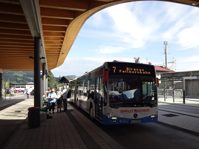
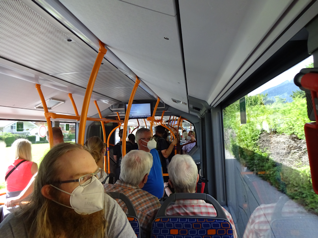
At first, the bus is rather full, but fortunately Robert and I still manage to get a seat each.
This ride takes us south into the southernmost valley of the Allgäuer Hochalpen ("Mountain-Meadow Landscape High Alps"), and we ride it all the way to its terminal stop at a little hamlet by the name of Birgsau ("Mountain Sow"), at which point we're surrounded by mountains on three sides. Along the way we pass Ziegelbach ("Brick Stream"), the Skiflugschanze ("Ski Flight Jump") and the Fellhornbahn ("Fur Horn Ropeway")

For the most part, the bus follows the Stillach ("Silent Stream") upstream, first through the open fields of the valley around Oberstdorf, and then up into the forested Stillachtal ("Silent Stream Valley"). As a result of that, we shouldn't actually get to see too much of the mountains until the very end, when we get a good view on the Alpgundkopf ("Mountain Meadow Ground Head") and the surrounding peaks.
Along the way we also pass by a very interesting Wild-O-Mat ("Game-O-Matic"), where you can apparently purchase fresh stag, deer and even chamois meat to go.

Incidentally, most of the people riding the bus got off at the Fellhornbahn. I suppose they are taking the easy way up the mountains, unlike us. A few hardened veterans, however, are still on the bus with us.

Shortly thereafter, we reach the terminus of this bus line at Birgsau ~ Alpe Eschbach ("Mountain Sow ~ Mountain Meadow Ash Stream"). This is where the comfortable part of today ends, but that's alright. I for my part am positively psyched about facing...
The Steep South Showdown
7-Aug-2021Distance: 16.6km
Ascents: 1,040m
Duration: 7.0h
4/6🎁︎
In essence, this stray should take us up first the remainder of the Stillachtal until near Einödsbach ("Solitude Stream") - at which the Stillach comes into being from a fusion of the Rappenalpbach ("Black Horse Mountain Meadow Stream") and the Bacherlochbach ("Stream Hole Stream") - and from then on the the Rappenalptal ("Black Horse Mountain Meadow Valley"). Eventually, the Rappenalpbach also splits up into the Seebach ("Lake Stream") and the Haldenwanger Bach ("Dump Cheek's Stream") which we then follow up all the way to southernmost point of Germany at the Haldenwanger Eck ("Dump Cheek's Corner"), where we cross over into Austria. After that, we should make our way down the Krumbachtal ("Crooked Stream Valley") and finally seek shelter for the night in a hotel in the hamlet of Hochkrumbach ("High Crooked Stream"). Sounds easy in theory, if there weren't over a thousand meters of altitude involved... among other things.

But all things in due time. For now, we are at the beginning of this stray, still full of energy and enthusiasm, and I for my part especially, after all the stress at work these last eight months, I needed this. I needed this so badly. The fresh mountain air, the anticipation of a great and kinda daring hike, having my best friend at my side... Right now, I couldn't be happier. Well, okay, so the sky is still overcast, which has me a bit worried, but I'm sure we'll be alright... right?

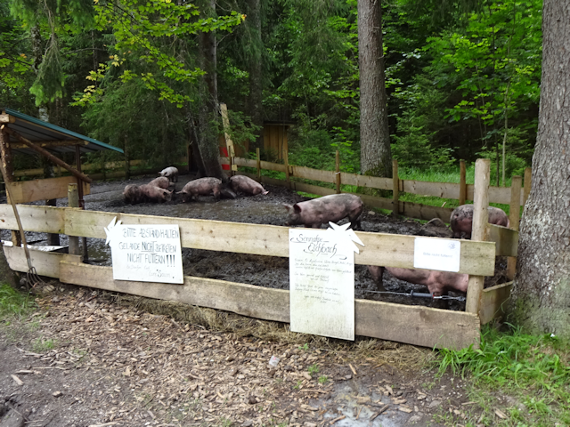
Now, before we leave Birgsau behind, we also come across the reason for its name. Or maybe it's more of a justification? At any rate, these mountain sows sure seem to be happy. Robert and I for our part hope that the mountain tracks will not be too muddy, what with there having been some rain these last few days.
At this point, we're still following the Stillach, which is a clear and kinda wild river, the likes of which we would not like to cross without a bridge.

Also, there's this.... thing... I really do not want to call it a blight, but at some level I find it deeply disturbing how many dozen people on E-Bikes pass us by, merrily riding up the mountain with barely any effort at all while honest-hard working cyclists pedal their tails off on routes like this. At least there's about one honest, hard-working cyclist among them for every 10 or 20 E-Bikers.

As we proceed into the forest, we should come across an interesting curiosity: Every once in a while, there is a peculiar tree-stump that has been carved into a mushroom like shape. We should encounter one of these every few kilometers all the way up the valley.

After the first bit of ascent, we emerge from the shade of the woods and suddenly find ourselves beneath a pristine white-and-blue sky. As such we do not neglect to put on generous amounts of sunscreen before stepping out onto the alp where carefree cows gratefully graze the day away.

It is also up here that we get a good view of the first very impressive mountain formation. These ones should be - from left to right, counting the four highest prominences - the Trettachspitze ("Kick Stream Peak"), the Mädelgabel ("Girlie Fork"), the Bockkarkopf ("Buck Cirque Head") and the Wilder Mann ("Wild Man").

And now: Ducks.

By now, we have left the Stillach behind and are following the Rappenalpbach. The weather forecast is: Sunny with a chance of E-Bikers.

Fortunately, the way here is relatively straightforward and clear, because the trail signs are just a little bit ambiguous.

For the most part the way is more or less the same, with the two of us walking for kilometers through an idyllic landscape along a gently ascending paved road. Though every once and so often we still come across a curiosity, such as the material ropeways which are solely used to transport goods up and down the mountains.

Eventually, we reach a high meadow of sorts, where the terrain levels out for some distance.

Here, there's the so-called Schwarze Hütte ("Black Hut"), a restaurant that serves as a pit stop for poor exhausted E-Bikers, who can rest for a bit here before continuing on their arduous journey. Oh well, at the very least the owners of this place will have no reason to complain, and neither will the people who rent out all those E-Bikes.

From here, we can finally see all the way to our milestone at the southernmost end of the valley. However, we can also see that the easy part of this hike is about to come to an end as the path only grows steeper from here on out. We also leave the Rappenalpbach behind around here and start following the Haldenwanger Bach.

Incidentally, at one point, the mushroom-stumps that are still accompanying our way experience an irregularity in the form of a very nice tractor stump. I wonder if what happened here is somewhat along the lines of: "Damn, my tractor broke down, the tow truck won't get here for another 8 hours, and all I have is this carving knife. What do I do?".

Anyway, by now the paved road has given way to a more rural dirt road, and as mentioned before the path is only growing more steep as we continue. As such, our progress slows down as the both of us note that our condition is no longer what it used to be before the Green Shnolz put a stop to many of our outdoor-activities.

...which would not be so bad per-se, if it weren't for the slight fact that I can't help but notice the clouds in the sky becoming progressively more numerous. We should still have until around 18:00 before the rain starts, but with the weather being kinda fickle in the mountains, I'd rather not count on it.

Oh, and by the way, if you somehow assumed that the E-Bikers would have stopped at the Schwarze Hütte, where the paved road ended, then... *beep*... sorry, but you're wrong. There may not be quite as many up here, but there's still quite a bunch of them passing us by in either direction. Looks like it's gonna be E-Biker all the way up.

Eventually, even the dirt trail ends and gives way to an even-steeper-yet rock trail...

...which passes over the Haldenwanger Bach as a ford. Fortunately, by now the stream is shallow enough that we can get over it by jumping from rock to rock.

And even here! All the way up here where the rocks are big enough to crush skulls with, there are still E-Bikes to be found! At the very least, however, this should finally be the absolute terminus for E-Bikes, because after this the terrain starts to get really rugged.

As I wait for Robert to catch up (I'm notably faster than him when it comes to negotiating climbs and descents) I have my lunch in form of an XXL Cheese-Bacon Bretze... well, make that actually half an XXL Cheese-Bacon Bretze. Turns out the thing is so big and mighty that half of it is all I manage to finish now. Plus I also don't want to dawdle for too long, what with the threat of rain hanging just behind the ridge.

Looking back, we've come quite a ways now. The hut below is where the track switched from dirt to stone. However, the sky is gradually starting to have me more and more worried.

This proves to be one of the factors I take into account when I now have to decide whether we should be taking the "easy" route, or go for the more "challenging" route across the Schrofenpass ("Rough Pass").

So, taking into account the increasingly overcast sky, our growing level of exhaustion, and the fact that I've already seen bits and pieces of the "challenging" route and they look like this...

...both Robert's and mine opinion about whether we should dare the challenging route converges somewhere along the lines of:

Thus, we continue along the rocky valley path, and Dragon knows this one is steep enough already, so we have to take regular breaks. But at the very least our milestone for today is now only about a kilometer away. The bad news is that over that kilometer we still have to cover about 300m in altitude, so that's an average gradient of about 30%, which is about three times as much as I can comfortably handle on a bike, and about twice my absolute limit on a good bike.

But at least the heights are not without their allure, because once we cross the magical line of 1,700m, all sorts of interesting things show up. For example, there are curious scintillating emerald beetles to be found on many plants up here...

...and we also run into a few Murmeltiere ("Marble Animals" = Marmots), who live up here by the score. Their bird-like squeaks can be heard all over the place, the ground is speckled with their tunnels, and some of them actually allow us to get quite close before darting away.

Also, looking east from here we can see the imposing Biberkopf ("Beaver Head"), the peak of which holds the second-southernmost point of Germany. Fortunately, the Haldenwanger Eck beats it by precisely 1.5'' of latitude (47° 16' 12.4" N VS 47° 16' 13.9" N), which equals not even 50m. I for my part am really grateful for that fact, because going up the Biberkopf would have meant scaling an additional 700m of altitude!

Anyway, by now we have reached an high alp of sorts, which features the Trifthütte ("Hits Hut"), the southernmost building of Germany. At this point the path levels out a bit, but we still have over a hundred meters to climb. Our exact milestone is located on the left of the two saddles seen in the distance, while the mound separating is the actual peak of the Haldenwanger Eck.

We also cross the Haldenwanger Bach one last time here, and by now it has grown so shallow that we don't even need to jump across stones anymore. The whole stream is only about as deep as a puddle up here near its source.

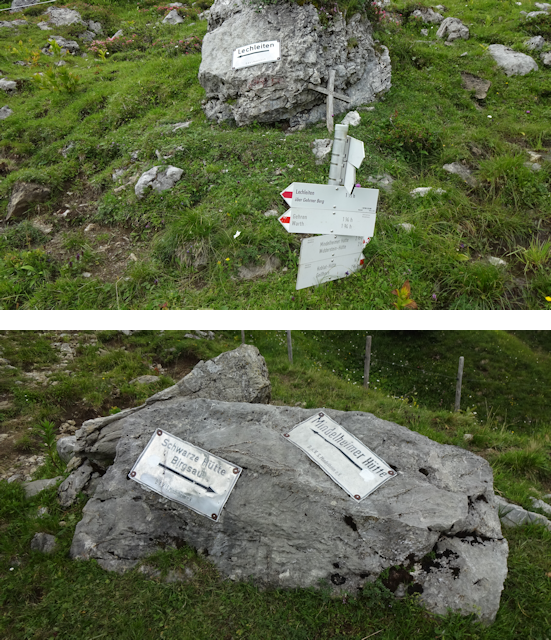
Moving on, we come at what I am going to call the Sign Sign Happy Crossroads, featuring modern guideposts along with more old-school signs that were bolted to boulders.
The path across the alp now takes a somewhat roundabout approach to our goal, but at least it's not very steep anymore. However, despite this (or maybe because of it) we are suffering additional delays as Robert's legs switch from "complaining" to "open rebellion" mode, striking him with not an extremely painful cramp each, thus forcing us to take two more rests...

...while the sky starts looking like this.

However, after recovering from this unexpected and notably untimely complication, we carry on. "Just as well!" goes the mountain path "Because just in case you manage to get all the way up here, I have prepared this!"

At this point, Robert and I pretty much carry on with courage born out of despair, scaling the rocky climb despite the pain in our legs, wondering how much longer it will be, and looking up in worry at the now completely overcast sky. However, once we have overcome this final hurdle, the mountain finally runs out of things to throw our way, and we finally come face to face with the prize of our heroic efforts.

Of all the four cardinalities, this was clearly the most harrowing to reach. But we've done it. We've really, really done it. This was a fitting finale, and now we have visited all the fourth cardinal extremities of Germany, together.

We are now at approximately 1,885m of altitude, which is a new record for a joined hike by the two of us, narrowly beating our previous record of 1,841m at the Zao Mountain Range in Touhoku, Japan (see Book II ~ Chapter 5 ~ A Trip Together). Also, over the course of our way "down" we should still ascend all the way to 1,910m, making this a more definite record. In fact, I can't remember when the last time was that I was on a higher peak than this, though since I know that as a child I was on the 3,718m high Teide on Tenerife, there was at the very least that. And since Robert already was on the Zugspitze ("Train Peak") - which at 2,962m is the highest point of Germany - it's not a new all-time record for him either. Anyway, being so far up naturally means we get a great panorama view... or at least it would if it weren't for all those clouds and the fact that the mountains all around us routinely exceed 2,000m in height.

After crossing over into Austria at this point, our next objective is getting down the mountain - ideally relatively uninjured. Now, the good thing is that we can actually already see our hotel from here...

...but the bad news is that it's still quite a ways off.

The worse news is that the rain is coming in early, so it's slowly starting to drizzle about two hours earlier than anticipated...

...and the worst news is that the way leading us around the Haldenwanger Eck is another of them "Are You Sure This Is A Path?"s.

Fortunately, we eventually manage to make our way back on a better-recognizable path, from where we get one last good view of the idyllic Krumbachtal...

...before the next wave of rain clouds hit us quite frontally, and the visibility drops to "a dozen meters, give or take". Our only solace at this point is that both of us had the foresight to pack rain coats for just such an occasion.

It is then that things start going from bad to worse. Not only are we getting buffeted by rain, but we also have to deal with the dirt paths growing progressively more and more muddy and thus slippery. This once again slows our progress to a crawl as we have to watch our footing, and especially Robert slips and falls several times, one of which should result in him getting another excruciating cramp, while another time he almost slides right into me, and even I can't avoid slipping once or twice.

However, after what seems like an eternity, the two of us finally manage to make it down the closest thing to a road we've seen for what feels like an eternity. The welcome sight of this road at the end of this ordeal at once makes me recall the time when I got lost on the Maungatua mountain range in Otago, New Zealand, and had to force my way back down the mountainside (see Book I ~ Chapter 14 ~ Out in Outram).

So, we made it through the most dangerous path, muddied, bruised, bent, but unbroken. Still, both of us are clearly in for a nice, long shower each when we finally reach the hotel later on.

The next most encouraging thing is that there's actually a signpost pointing to our destination conveniently placed down here...

...and in what seems like a rather bizarre business model, there are actually mountain-stream-cooled strawberry milkshakes for sale at this crossroads. I suppose in an alternate universe where instead of rain we would have suffered scorching 40°C temperatures today that would have been really welcome (although they probably would have been sold-out in that universe).

Anyway, now all that's left is literally walking down the road, and then a little bit up again to our hotel, which is located just to the right of the relatively small mound in the center of the valley, which is known as the Simmel.

Along the way we pass by a very dutiful farmer who even in this weather is working the fields with what we figure must be some sort of lawnmower specifically designed for relatively steep slopes...

...which in turn make great pastures for sheep, as I already know from my time in New Zealand.

For the final approach, we once again have two options. We could just walk the straight and direct path along the well-paved road, or we could take a slight detour to walk a muddy and more rural path. Now, considering what we've just been through, I don't think our choice here is going to be very surprising.

By the time we reach our destination, the Hotel Adler ("Hotel Eagle"), it is only 17:30, and as such half an hour before I expected the rain to start. And yet here we are, drenched and muddied, and ready to just drop dead. But in the end, we still made it, and both of us arequite glad we did not opt for the challenging route earlier on.

Thanks to Robert being fully vaccinated and me having a negative test in addition to an almost-complete full vaccination, check in is relatively uncomplicated. And so, we arrive in our room for the night, where we promptly collapse on the bed, and Robert swears he'll never again accompany me on another hike. But at least I for my part am glad we had this adventure. After eight months of stress in the office, I really needed something like this to put things into perspective. With our arrival here, we have finished the mandatory part of our adventure, and are now free to enjoy...
The Hospitality of Hochkrumbach
Our room here is nothing super fancy, but compared to some of the places we've been staying in during our earlier adventures it is really quite nice, and most importantly has the two things we most need after this harrowing hike: A comfy bed to collapse on and a shower to rinse off the dirt.

Next, we are looking forward to some dinner. However, there is a slight problem: On account of several mud-slide events, Robert's pants don't look all that restaurant-worthy, and since this trip was only planned for one night, neither of us thought to bring any spare pants. As such, while Robert is in the shower, I do my best to to dry off the still-wet mud using the local hairdryer.

Afterwards, Robert manages to scrape off enough of the mud to look at least halfway presentable, and afterwards we head down to the restaurant where I order a plate of mushrooms in cream sauce with Semmelknödeln ("Bread Roll Dumplings"), while Robert has the biggest and most amazing salad plate you have ever seen.

Among other things, this hotel also offers a sauna and other recreational facilities. However, for now Robert and I only want to lie down and sleep, so after dinner we return to our room, pausing only to note that this hotel seems to have a strange thing ongoing with hearts, some of which have spikes, some of which have holes, and some of which have rabbits.

It's not even dark outside yet, but the rain is pouring down, and the two of us are quite tired. So we close the curtains, open the window a bit, lie down and quickly fall asleep to the soothing rhythm of rain, from which we are now thankfully quite sheltered.

The next morning, we wake reasonably refreshed, though our legs still hurt from yesterday's hike. As such, the hearty breakfast buffet that comes with our hotel room is very much appreciated, and the both of us dig in heartily. Our choices for breakfast are including, but not limited to: Bread and bread rolls with all sorts of spread, Müsli, several dishes of egg, salad, bacon, ham, cheese, mini-donuts, and even honey melon. I am so having a slice of that!

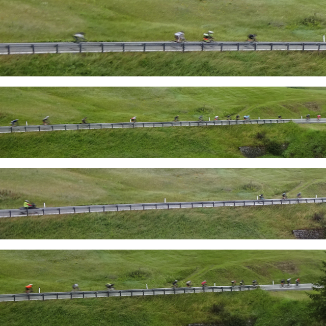
As we take our time eating breakfast, we observe a curiosity on the road outside: For some strange reason there are scores of cyclists passing by this entire time. Turns out we have arrived just on the date of the Highlander Bike Marathon of Vorarlberg, which covers a track of 187km and 4,040m of climbs, with an alternate "easy" route of "only" 146km and 2,400m. And it looks like the records for both of these tracks are somewhere around 5 and 3 hours. Respectively. See, this is why I refer to my "60-70km over 8 hours with maybe a few hundred meters of altitude tops" tours - which according to Robert are already "totally murderous" - as "relaxing bike trips".
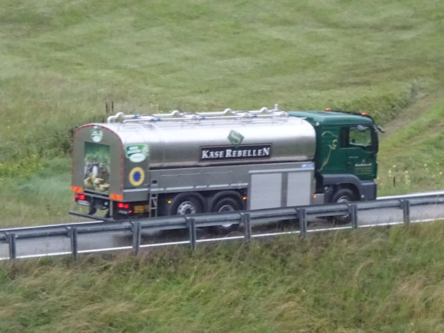
And as an added bonus, we also get to see a truck belonging to a company called the Käse-Rebellen ("Cheese Rebels").
With our bellies full, there's nothing that holds us here, and so we soon check out. We only stayed for one night, but I can say that it was definitely a good place. We had our own little room with bath, breakfast and dinner, both of which was tasty, comfortable beds, the staff was friendly, the place was quiet, and the panorama is beautiful. Sure, it's a bit out of the way, but at the very least there's a bus stop right in front of the door, and we got a free bus pass for all the buses of the area as part of the deal. The free WiFi worked nicely too, and the temperature was comfortable as well. The only downside, really, is that with this being a three-star hotel in a popular area, the price was kinda steep. At 77,70€ per night and nose, this one was the second-most expensive place we stayed in after the Suzukiya Ryokan near Shiroishi, and that one also featured Onsen and fancy traditional Japanese food served in the room.

And with that, we're off again, out on another day of adventure, during which we would be...
Scaling the Simmel
8-Aug-2021Distance: 1.3km
Ascents: 80m
Duration: 0.75h
1/1🎁︎
When I planned this tour, I originally intended for us to walk down to Warth today and catch the bus from there. However, Robert, ever-plucky, figured that it would be a waste to be there and not take advantage of the hiking opportunities, so I also prepared a more roundabout route along the flank of the nearby Karhorn ("Cirque Horn") that would achieve the same thing, but with a bit of bite to it.

However, seeing as how neither Robert and I today are in what you'd call "prime hiking condition", and the paths are likely still muddy from the rain that continued all through the night, and the weather looks like it could start raining again at any time, we actually scrap both of these plans, and instead contend ourselves with a very short stray up and down the nearby Simmel, so that we can at least boast to have scaled one actual peak on this hike.

The way starts out refreshingly comfortable, with a wide and slip-resistant gravel road leading up the hillside...

...all the way to the little St. Jakobus Kapelle ("St. Jacob Chapel"), where we find a Geocache. Actually, this sort of closes another great circle, since it was only a few dozen kilometers northeast of here that I was first introduced to Geocaching by a pack of wolves near Dornbirn (see Preamble ~ Therianthrope Adventures at the Bodensee).

Interestingly, this place also seems to be the home of the Metallo-Hobbits (not to be confused with Mecha-Gnomes).
As we continue scaling the Simmel along a slightly more narrow but still very negotiable path, we get to behold the curious curves which the Kuchlbach ("Cake-let Stream") draws into the grass of the Wasariead ("Water Reed") at the valley floor...

...and we can also observe one of the material ropeways, which are so abundant in these parts, in action.

It is not long before we reach the peak of the Simmel, where a great cross with the inscription "Frieden sei dieser Welt beschieden" ("Peace be granted to this world") is standing. However, looking at the current geopolitical situation, I'm afraid we're gonna need a bigger cross. Or put it on a higher mountain. Or maybe we should try and see if Shinto Shrines work better than crosses? I for my part would actively support that last one.

Afterwards, we proceed to descend on the opposing side of the Simmel. Unfortunately, while the path up here was pretty well-maintained, the path down on the other side is yet another "Are You Sure This Is A Path?".

Well, I mean, at the very least this one is clearly marked with white-red-white poles denoting it as a mountain hiking path, which in the local categorization of routes is the middle of three difficulties, but with the rain turning this path into a mud fest, I'd say it's at least a 2.5/3.

Thus, Robert and I get a bonus round of "Making your way down a mountain among muddy tracks", because we already had so much fun doing that yesterday, and while I can at the very least put some vulpine balancing talents to good use here, Robert - who thanks to three cramps and various falls clearly got the rough end of yesterday's stick - has a significantly harder time, and I once again feel sorry for inadvertently causing him to suffer as such.

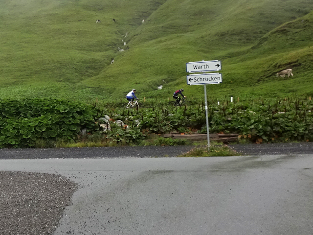
Fortunately, this time around the descent is relatively short, and before long we arrive on the car park atop the Hochtannbergpass ("High Fir Mountain Pass"), which interestingly is located between Warth ("Zron") and Schröcken ("Draed"). On another note, my father Peter, who is a dedicated alpine cyclist, did actually cycle across this very pass on one of his tours in 2019, just after I returned from my travels to Japan, Brazil and South Africa.
It is here that we finally call it absolute quits. There's a bus stop located up here, which also happens to have a good connection, and after suffering again today, neither of us (but especially not Robert) is in any mood whatsoever to take any more chances. As far as we are concerned, we'Ve had enough of an adventure by now and are ready to return home.

As such, our next course of action is to wait a little bit at this bus stop and then make good use of our free bus passes and...
Wing it to Warth
Ride Duration: 0:07hApproximate Distance: 4.5km
Average Speed: 39km/h
We are now on a pass in the middle of the alps, 1,675 above sea level, 4.5km away from the closest supermarket, and over 50km of a drive away from the nearest train station that can be reached without climbing across the freaking mountains. By any sensible means, this is about as remote an area as you can find a bus stop in, and yet...
And yet...
And yet, this remote bus stop in Austria still has a display more modern than anything I've seen on a bus station in Munich, where the best we have is still pixel displays from the last millennium, which also regularly break down.

Also, it has a modern, minimalist timetable that condenses all the important information down on an area of about a tenth of the size of normal timetables. I think the last time I've seen something like this was in Japan.

By contrast, there's the timetable of the Fahrradbus ("Bicycle Bus") - a bus featuring a bicycle trailer - which at the same time is more traditional, and yet isn't.

As it happens, this Fahrradbus should also be the first one to arrive as a consequence of the Line 3 bus never arriving for whatever reason, so we take one last look towards the Simmel that we so painfully descended from just before...

...and then we're on the road again, this time only a relatively short segment down to Warth, specifically the Warth ~ Steffisalpe ("Steffi's Mountain Meadow") station, which is a little bit before the town square where our hikes would have taken us.

This short ride takes us down the Krumbachtal, past the Hotel Adler and along the road that we walked the final bit of the path up along yesterday. We also pass by the last of the marathon-cyclists, because in Warth the route of the marathon turns south, while our next bus should take us east (we should, however, still encounter a number of non-marathon cyclists on our way to Reutte). Also, the clouds sort of give the whole place a mystic flair, even if it means that the majestic sight of distant mountaintops is going to be denied to us.
After only a few minutes of a ride, we arrive at the Warth ~ Steffisalpe bus stop...

...where there's also a pit stop for all the daring bikers braving the mountain marathon today.

We do not have to wait for long, and then our next bus arrives. This one is going to take us on a...
Riverside Ride to Reutte
Ride Duration: 1:31hApproximate Distance: 60.5km
Average Speed: 40km/h
Despite the fact that our destination of Reutte is over 60km away, the bus we take there looks like an ordinary city bus of the same make that traffic in Germany (yet a distinctively more yellow hue), this - as I should realize midway through the trip - is most likely due to the fact that the city buses are smaller and more navigable than the typical overland buses, and thus have an easier time negotiating the narrow streets of the villages that this line services. Another pleasant surprise is that our free bus ticket from the hotel is actually valid all the way to Reutte, despite the hotel staff having told us otherwise.

The route to Reutte takes mostly down the main road of the valley, where we follow the run of the Lech all the way down to our destination. For the most part the bus simply follows the main road, but occasionally it takes detours through nearby villages, the most scenic of which is the one through Vorderhornbach ("Front Horn Stream"). Other places we pass on this ride are Häselgehr ("Bunny Spear") and Weißenbach ("White Stream"). We also quickly leave Vorarlberg behind just after leaving Warth and make our way lengthwise through Tirol for the remainder of the ride.

This ride should take us through a pretty diverse landscape. At times were up one mountainside or the other, following zig-zagging roads, and then at others we just follow a straight road across the valley floor. However, quite definitely the most amazing thing about this ride is watchign the Lech grow: While it starts out as a swift little mountain stream barely 10m across near Warth, it very rapidly grows in size until its riverbed is almost 100m across near Reutte.
The bus is, by the way, surprisingly full, and most of the people aboard should actually ride it with us all the way to Reutte. I suppose we are not the only ones looking to catch the train.

By the way, technically, it's not accurate to say that this is just one bus ride, because as we get to Steeg ("Jeetyy") - still near the very beginning of the ride - the bus driver tells us to get off while he gets a new bus from the depot there, having to switch buses due to a technical defect. As a result, we get a short break there, during which we can enjoy the relatively clear view of the 2,406m high Pimig.

That kinda reminds me of the old times, when riders used to change horses at each station, only this time around we're changing buses.

Anyway, this fresh new bus should then serve us al the way to its terminal stop of Reutte...

...from where we continue on the final leg of this weekend trip, taking us back all the way to Munich...
Aboard the Außerfernbahn
Ride Duration: 2:18hApproximate Distance: 138km
Average Speed: 60km/h
In Reutte, we next proceed to the train station, which is conveniently located right next to the bus station. You can also tell we're in Austria here because the building is operated by the ÖBB ("Österreichische Bundesbahn" = "East National Federal Train" = "Austrian Feral Train") instead of the DB.

Unlike in Germany, where such things are rarely seen, this station has a rather relaxed attitude about people crossing the tracks.

And the station itself pretty much just consists of a single, looooong platform.

Since we have a bit of an overlay here and it's now about lunchtime, this is where I eat the other half of the XXL Cheese-Bacon Bretze that I started yesterday. Even just half of it is already quite a filling meal... at least after today's extensive breakfast.

While waiting, we take in the wonderful - if somewhat cloudy - alp panorama one last time, noticing the Burgruine Ehernberg ("Castle Ruins Honor Mountain") on a nearby mountain.

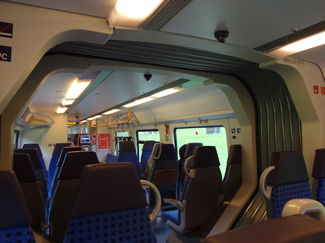
And then, our train arrives, which is notably a train of the DB, despite us being in Austria here.

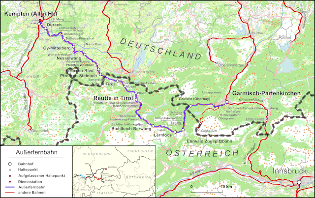
How come? Well, as it turns out, this particular train line is a rather special line. Known as the Außerfernbahn ("Outer Far Train"), it is a piece of track that is not directly connected at all to the remainder of the Austrian railroad network. Instead, it connects the German cities of Kempten and Garmisch-Partenkirchen through a part of Austria known as the Außerfern ("Outer Far"), which nowadays coincides with the Reutte District of Tirol.
As such, we now get the one-time chance to legally purchase and utilize a Bayern-Ticket while in Austria. Since there are no ticket vending machines on the station once again, we purchase the ticket aboard the train, which by the way is relatively empty.
While the train ride from Munich took us through the Petal of the Rooster, we are now returning through the Petal of the Goat (see Book III ~ Chapter 14 ~ Project Petal Part 3 ~ A Verily Vulpine Voyage). Along the way we also pass Lermoos ("Empty Moss") in Austria, Eschenlohe ("Ash Copse") at the border of the alps, and Huglfing ("Hill Caught") just before entering the Goat Petal.

This final ride takes us first through the valleys of Austria, and then over into Germany through a narrow, forested valley. From there, we pass through Garmisch-Partenkirchen at the foot of the Zugspitze. After that, the mountains continue for a bit, but eventually the land starts growing more and more flat, but in contrast the cloudscape starts getting more varied. Starting from shortly before our entry to Germany, the tracks also more or less follow the Loisach ("Silent Stream") - one of the main tributaries of the Isar, the big river of Munich - and we end up crossing back and forth over it a number of times. However, eventually we leave the Loisach behind, crossign the Ramsach ("Ram Stream") and heading for the Starnberger See next. Passing through Tutzing and Starnberg, we are pretty much already in the Munich Metropolitan area, and from there one the train doesn't even bother stopping, abut continues straight on to Pasing, where we get off.
Along the way, we also almost get to see the Zugspitze. Unfortunately, the clouds nicely obscure Germany's highest mountain, and as such we can barely even see the peak of the Waxenstein ("Waxing Stone") in front.

Whereas last time Robert and I parted ways in Pasing, this time Robert joins me on the way home, so we can celebrate our grand achievement with some legendary tri-Tail pizza. The bus which takes us home is about 50% full I'd say.

And with that, this taxing weekend trip is finally coming to an end. Now we have truly been to all the cardinal points of Germany, and are ready for new adventures. But first, let us look back on all that we experienced in and around Germany. That, however, is a different tale, and shall be told in the next chapter of the Travelling Fox Blog.