Sometimes, things just don't work out as planned. That is an universal truth of life. However, there's a clear distinction between when things just don't work out for one or a few person, and when things go awry for a whole species. Which is incidentally what happened at the dawn of the year, when someone opened the first can of wax a forth came a white board, and he that rode on it had a bow, and a crown was given unto him, and they really screwed up his surfing, but he cared not, for he was a sick jerk who made people ill just by looking at him.

'twas Plague, the first of the four apocalyptic surfers, and he had in store a new trick. It started as what the world at first discounted as a half-hearted continuation of the 2003 SARS and the 2012 MERS, none of which caused considerable damage. However, that had all been part of Plague's wily plan, for it was only due to the fact that no one took the threat for real during the first few months of the year that it was able to spread over the planet like pox.

The Green Shnolz
The spread of COVID 19, or as I like to call it, the Green Shnolz, can be roughly broken down into three phases: The first phase lasts until about Feb-23, and is the phase in which China contracted, and effective3ly beat the virus locally, by putting down their foot on the population. However, unfortunately be then, the virus had already spread to other parts of the world, and thus began phase two of the Green Shnolz, the global incubation. This phase lasted until the middle of March, and in retrospective was the timeframe that governments all over the globe would have had to act in order to prevent phase 3, the global, massive outbreak.

In those early days, there were three main approaches to handling the Green Shnolz. The first and in hindsight most effective one, employed only by totalitarian states such as China, was to massively restrict the liberty of the citizens, which proved to be brutal, but effective. The second one, employed by the vast majority of other states, including Germany, was to wait, see, and eventually react. The result of this is that we now already have over 50% more cases of the Green Shnolz in Germany than China, or to put it even further into perspective, Germany has about 24 deaths per million, while China only has 2.4 deaths per million. And then there's countries who clearly waited too long such as Italy who now pay the price for it with about 280 deaths per million.

And then there's my absolute two favourite countries:

If that wasn't so just I'd say he had it coming. But even better than that is still the approach of the world's scariest clown.

But enough about the world. Now here's a little outlook on how the Green Shnolz affects Germany. Since the beginning of March, the government repeatedly asked people to stay at home, and I myself started working from home on Mar-12.

However, most people still acted rather irresponsibly. Even with schools closing down on Mar-13, many people still met in parks despite the government's pleas and even went so far as to host "Corona Parties". A few particularly dastardly individuals even posted videos about how they were going to try and infect as many people as possible.

As a result of this level of irresponsibility, Bavaria was the first state to declare a state of emergency on Mar-16, and eventually, on Mar-20, introduced a curfew that now prevents me from meeting with my best friend Robert for the duration.

This curfew is actually still relatively mild compared to what other nations have to enforce. Effectively, it says you can only go outside to do essential shopping, perform essential work, visit your mate, or – and this is the most important part for me – get fresh air, as long as you keep your distance from other people. In effect, this gives the police the legal authority they so direly needed in order to break up groups of people standing together too closely and prevent Corona Parties. And as such, the streets quickly become relatively empty, their only occupants being cars that no longer serve any purpose.
Likewise vacant are the shopping centres, like the new Evers in Allach in which now only a few shops remain open. By decree of the government, only shops selling absolute essentials such as supermarkets and drug stores, as well as stores selling take-out food are allowed to remain open in these tight times.
And is it working? I'd say to a degree. Most importantly, the police now can punish inconsiderate people which helps slow down the spread. Much more importantly, however, is that the German health system turns out to be one of the best in the world, which greatly helps in keeping the Corona-Abrasion (CA) at a high level, the CA being an indicator of how effective a place is at fighting off the Green Shnolz. It can be calculated by dividing the number of cured people through the number of people who died. The higher this number is, the better. At a CA of 1, one person is cured for every person that dies. At a CA of 10, ten persons are cured per death. And at a CA of 0, everyone who contracts it dies.

Looking at the CA, it becomes apparent that only a few countries have managed to get that "healthcare" thing right, while an alarming number of "developed" countries are now going off the deep end. South Africa is also surprisingly far to the right, although that might be due to the fact that it's still starting there (then again, the deep-enders were pretty much at the left from the very start). Also, to put the change over time into perspective, Germany started off with a CA of about 9 back in mid-March, which worsened to a minimum of 2.6 by Mar-19, and eventually recovered to the stable float around 20 that it managed to maintain since Mar-26.
As for what it means to me, apart from me being worried about everything that feels wrong with my throat or chest (which I would have blamed on a cold, flu or allergy before), there are two notable setbacks that my plans experience because of this:
- My plan to re-visit Japan with Robert so that I could see if anyone got the secret message on the gift artworks and showed up at Anamori Inari Jinja on 5-May-2020 gets cancelled due to the airlines no longer servicing the flights
- My plans for another one of the Petal Rides (this one would have been the Petal of the Ram) also evaporates due to me no longer being allowed to visit Vulparion, a fellow fox I met at the Eurofurence who lives there
However, I am not about to let that stop me from going on a cycling tour altogether, and so after about three weeks of mostly just sitting at home, I eventually go out one morning and embark onto…
The Century Circadian Circuit
11-Mar-2020Distance: 127.0km
Ascents: 300m
Duration: 13.25h
7/10🎁︎
- In 2017, in New Zealand, I narrowly missed the psychologically important 100km mark on the Plucky Paparoa Pilgrimage (see Book I ~ Chapter 29 ~ Mangapai Mania) by 5km.
- In 2018, in Japan, what should become one big ride got split into two by an unexpected flat tire on the Odyssey Ride (see Book II ~ Chapter 13 ~ Daring Daisen).
- In 2019, in Germany, I just narrowly missed the mark again on my return ride from visiting my grandmother in Ruprechtsberg (see Book III ~ Chapter 11 ~ Project Petal Part 2 ~ The Ruprechtsberg Ride), again by 5km.
But this time around, I am sure to break that record and complete a ride of over 100km! To prevent a second debacle like the Odyssey Ride, I have equipped my bike with "unflattable" tires (which have an extra protective layer in the mantle that prevents minor sharp objects like tacks from piercing them), have chosen a day with nice weather, and mapped out a route in advance that should take me well over the 100km mark. And on top of that, I'm going on a day with 13 hours of sunlight, so the base conditions couldn't be more optimal.
And to make sure that I stay roughly on time, I have mapped out a schedule of 12 waypoints (which happen to be Geocache locations), spread as evenly as possible from one another, so that I can keep track of whether I'm ahead of or behind time and make adjustments if necessary. The theme for today's tour, by the way, is cycling once around Munich's incomplete highway circle, the Autobahnring.

I realize this is a big endeavour, and even with 13 hours of sunlight today, I figure it might be a close call. So, I get up at 5:30, during the fox hour (the hour before sunrise), determined to not let an hour of daylight slip through my paws.

Getting ready takes a bit of time. There's breakfast to be made (it's going to be a big day, after all) as well as some sandwiches for the road, and by the time I'm ready for departure, it's already 6:30.

And then I'm off, out onto what should become my greatest tour, starting with...
Leg 1: Onto the Orbit
Starting Time: 6:30Duration: 30 min
Length: 4.6 km

I depart at my favourite time for these tours, that is, at first light.

Naturally, at this time it's still pretty cool outside, so I set out with light armor, that is, my trusty coat Krevyasz equipped.

This early in the morning, even Mr. Shine is still out despite it being only a few days past full moon. I should chase him down for about 15 minutes or so, but after that, my way angles somewhat to the northwest and I lose track of him.

The first notable waypoint along my route is the Whoa-Fuck-Underpass just at the end of the Allacher Straße ("Allach Road"). This was once only a pedestrian & bicyclists' underpass, but eventually got converted into a car underpass. Today it is just barely wide enough for two regular-sized cars to pass side by side, and every time I drive my father's car through it while on a shopping trip, I simultaneously worry about using my right mirror to the wall and my left mirror to cars on the other lane. However, this early in the morning there's not a vehicle to be seen, and I'm riding my trusty old bike Jycily instead of a bulky car, so all is good.

Just after the Whoa-Fuck-Underpass, as I turn north, a glint of light catches my eye. It is Radian, the Solar Dragon, peeking just over the horizon, ready to hit the world with his orbital photon blaster, and as if by chance I am currently standing in one of the few positions that has a clear line of sight to the point on the horizon where he is emerging today.

After that encouraging sight, I make my way through Allach, which as of yet lies mostly untouched by the rays of rising Radian…

…across the Würm ("Worm")…
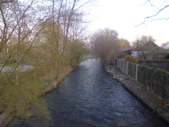
…and out into the countryside, leaving the city of Munich behind for the entire day.

There, I eventually reach a fantastic position, from which I'm able to see both Mr. Bright and Mr. Shine simultaneously, one to the east, and the other to the west. Good thing I'm not a walking marshmallow character, or I would now have to worry about them attacking me simultaneously.

Moving on, this leg soon enough comes to an end as I cross the Autobahnring…

…and manage to find not only the first Geocache of the ride, but also of the year upon that bridge.

With that, Leg 1 is complete.
Target Time: 7:00
Arrival Time: 7:00
Difference: ±0 min
Total Distance so far: 4.6 km
This is where the true circuit starts, and this is where I intend to return by the time the day is over. As such, I plant a stick by the road to serve as a mark…

…before continuing onto…
Leg 2: Animal Antics
Starting Time: 7:00Duration: 60 min
Length: 10.3 km

Still in the light of dawn, I now make my way through the rural area in the outskirts between Allach and Karlsfeld ("Carl's Field").

There, I am astounded by the number of pheasants present at this time. Sitting in the fields, crossing the road… up until now I wasn't really aware that this many of the colourful fowl existed this close to the city. During the days they must be hiding in the nearby woods.

Much more expectedly, there's an entire swarm of wild geese, browsing the fields, flying in, and announcing their presence loudly for everyone to hear.

Apart from birds, there's also a few deer sitting squat in the middle of the morning fields.

And is that little orange speck a fox lying in the field??? It would be the seventh wild fox I have seen in my life, and the fourth in Germany!

However, on closer inspection, it turns out to be only a very fluffy and foxy-looking ginger cat. Oh well. But for a moment, my heart skipped a beat right there and then.

This leg also takes me past a number of Baggerseen ("Digger Lakes"), which exist as the remnants of the many gravel quarries that once surrounded Munich. Some of them have yet to receive names, which does not prevent the rays of rising Radian to reflect on them majestically.

Further to the north, the Waldschwaigsee serves as my northwestern cornerstone for this ride. I've been here once before on a smaller tour, but that is now almost a full year in the past.

Something that's even further from the past is the Hallenbad Karlsfeld ("Indoor Pool Carl's Field"), which I pass only shortly after entering Karlsfeld proper. Back in the day, my Grandfather used to take me here on a weekly basis, and boy did I love to swim. As I grew older I also grew to like diving from the boards (but no higher than 3m). And behind the line of trees lies the Karlsfelder See ("Carl's Field Lake") which me and my family occasionally visited in the summer. All of this, however, is now already over 20 years in the past.

Following that, I cross the lazy streets of Karlsfeld…

Before eventually arriving at the school forest of the Karlsfeld elementary school, which is where the next Geocache is hidden. Turns out it's a barley 30m-wide strip of forestry that stretches over about half a kilometre, which features many-a lovingly handcrafted billboard about the trees that can be found within. Also, as it so happens, I'm headed straight towards Radian right now.

With that, the second leg comes to an end.
Target Time: 7:50
Arrival Time: 8:00
Difference: +10 min
Total Distance so far: 14.9 km
I'm a little bit behind time by now, but it's still within tolerable measures, and after (barely) having found the cache hidden here, I continue onto…
Leg 3: A Roundabout Regatta
Starting Time: 8:00Duration: 55 min
Length: 9.4 km
This next leg should end up being just a little bit crooked.

My goal for this lake is to reach the Rowing Regatta Race Track which I narrowly managed to miss both on the Schleißheim Hailstorm Ride (see Book III ~ Chapter 7 ~ Home) and the Ruprechtsberg Return Ride (see Book III ~ Chapter 11 ~ Project Petal Part 2 ~ The Ruprechtsberg Ride). And since there is no direct route I have to weave my way across various field tracks.

Among them is the one that wins the price for "Field Track of the Day". Fortunately it's only an 80m long segment connecting two somewhat parallel tracks at their closest point.

Afterwards, I end up following the Klaterbach ("Cold Stream") for quite some time, looking for a place to cross. However, a number of "crossings" marked on my bridge turn out to be fords that I don't really want to cross astride Jycily.

So instead I keep on going until I finally find a bridge across the stream, which just so happens at the junction with the Regattaweg ("Regatta Path"), that will finally lead me straight to the regatta track.

A short time later, I finally reach it-which-should-by-all-logical-means-be-to-big-to-miss-twice.

Built for the Olympic Summer Games in 1972, this 2.23 km long aquifer lake was actually made a local cultural heritage site in 2018, and although it is not exactly being used at maximum capacity, it's still a popular spot not only for rowing contests. The surrounding concrete track also makes a great track for biking and roller-skating.

Incidentally, this is also where it's getting warm enough for me to take off Krevyasz and continue with just a thin long-sleeve shirt.

Having finally checked a visit to this historic site off my list, I now continue onward towards the next waypoint. Unfortunately, I sort of take a wrong turn near the Würmkanal ("Worm Channel") and ending up in a dead end within Radian Forest, I am left with no choice but to backtrack.

However, eventually I still manage to reach the highway underpass that makes the end of this leg.

Target Time: 8:20
Arrival Time: 8:55
Difference: +35 min
Total Distance so far: 24.3 km
With the somewhat crooked path I've taken and my little involuntary side trip into Radian Forest, it is not very surprising that I've lost another 25 minutes of time here. But the day is still young, and I hope I'll be able to make up for it on the next, relatively straight leg. As for the geocache hidden on this waypoint, after reading the description I quickly decide to give it a pass on account of me being a fox and not a squirrel.

So, having just passed on 25m free-climbing, I now proceed straight onto…
Leg 4: Shooting past Schleißheim
Starting Time: 8:55Duration: 55 min
Length: 11.1 km
This next leg should be relatively straightforward.

After clearing the final field track for a while…

…I come across a farm that not only features a grossly oversized pitchfork, but also homage to the Bremer Stadtmusikanten ("Town Musicians of Bremen"). It's not quite the same though. Can you tell the differences without looking it up?

And now guess where I end up afterwards?

It's the Schloss Schleißheim ("Schleißheim Palace") that I visited last year during the Schleißheim hailstorm ride. Luckily for me, today there's not a cloud in the sky. And whereas last time I focused more on the new palace and its gardens, this time around my route takes me right through the extensive courtyard of the old palace. Actually, it's two separate courtyards: The bigger Wilhelmshof ("Wilhelm's Court") and the smaller Maximilianshof ("Maximilian's Court"), which together measure about 6 acres.

And beyond that, there's the new palace that I've already extensively covered before. This time around, however, there's not nearly as many people as the last time.

Following that is a great chance to make up for lost time, as I keep following the Freisinger Straße ("Free Singer Road") all the way to Hochbrück ("High Bridge").

There's nothing worth of particular note here, but if you've ever wondered about where to find a worldly Chinese Wok restaurant, there's one right here (even though the perfect cherry blossom here reminds me more of Japan).

On the other side of the road, meanwhile, I get a good view on Munich's one and only windmill on the mountain of Fröttmaning. I'll get there by bike one day, but for today it's out of bounds due to being located just inside the Autobahnring.

And then, I am already at my next waypoint.
Target Time: 9:40
Arrival Time: 9:50
Difference: +10 min
Total Distance so far: 35.4 km
I managed to make up quite some time on this leg, mostly due to it being predominantly on straight roads and with no detours, so that's definitely a good thing. As for the cache that's hidden here… this time around I have pretty much the opposite problem as last time, namely that I'm a fox and not a mole. The cache is hidden in a dark tunnel, which per so is not a problem. However, as I go to fetch my torch (since in there it's too dark for even me to see), I quickly realize that I left it in my other backpack.

Oh well. Too bad. Nice try though. I could probably still find it with enough time, but since time is something that I am already short on, I instead choose to pass on this one and continue on…
Leg 5: Aquatic Allure
Starting Time: 9:50Duration: 40 min
Length: 5.8 km
This next leg would take me over two bodies of water.

The first one being the good old Isar, which down here lazily follows its natural course.

Looking closely, I can even make out a fish swimming in the clear, shallow water.

After that, I follow a pretty straightforward path along a moderately busy rural road…

…and eventually come across a sign that is yet from an age long past. It says: "Depositing debris and dross of any kind strictly prohibited. Contraventions will be penalized with a sanction of up to 100,000 DM." DM, or Deutsche Mark… that used to be the currency of Germany before the introduction of the € in 2002, so it's already 18 years in the past now. Incidentally, 100,000 DM would have amounted to about 50,000 € at the day of the switch.

The second body of water is actually more of a collection leading up to the mighty Speichersee ("Reservoir Lake"). First, there's the Isar channels leading up to the upper of the two hydroelectric power plants on the Speichersee…

…and then there's a collection of fishing ponds in all sizes. Actually, most of them are no longer in use by now and serve as wildlife refuges.

My way across the bridge here is rather unusual as well, since the path on the side where I cross is just barely wide enough for Jycily and myself.

Once on the other side, however, I soon reach the next milestone, where I am quick to find a very convenient Type 5 Geocache (disguised as birdhouse).

Target Time: 10:20
Arrival Time: 10:30
Difference: +10 min
Total Distance so far: 41.2 km
So far, I'm still within time, more or less. Didn't catch up any, but also didn't lose any, so that's okay I guess. Either way, I continue without dawdling and proceed with:
Leg 6: The Edge of Green
Starting Time: 10:30Duration: 75 min
Length: 11.6 km
This leg should end up being somewhat crooked on account of there being no straight roads. Also, it is during this segment that I first leave my "territory" as I cross the path I took to Ruprechtsberg last year, and continue on into as of yet new lands.

First, however, I have to somehow make my way across a traffic circus that is truly deserving of its name, what with being on two levels and featuring grand total of seven exits.

After that, I cross my old path on a peaceful and straightforward field track that I last saw at the very end of October, over four months ago now.

There, I come across freshly tilled fields with unusually sharp, triangular trenches that make me wonder what they're going to plant here.

Also, there's this one field that the local farmer appears to have forgotten when bringing in the crops last fall.

I also make a very close approach to the Autobahnring here, but as soon as possible and feasible, I turn eastwards again and continue along the Abfanggraben ("Interception Trench"), which I guess might serve as a last line of defence in case the Isarkanal overflows, intercepting the flood before it reaches the nearby towns of Aschheim ("Ash Home") and Kirchheim ("Church Home").

Though on second thought, maybe it would have been better to wait for a more traversable path.

Eventually, however, I manage to make it to Kirchheim, which as the name suggests features a typical onion-domed church (but then again, all towns around here feature an onion-domed church). Incidentally, this is also where I cross the 50km mark, so I'm halfway there!

There, I see that the Green Shnolz also holds this little rural community tightly in its slimy grip. The billboard asks people to stay at home unless for absolutely necessary work, urgent shopping trips, as well as helping others. And I agree that these points are probably sensible and fair, but I think are missing a fourth point that is just as important for health, and that is going outside every once in a while, keeping generous distance to other people – which incidentally is what I'm doing right now.

Moving on, the path from there soon leads me to Grub ("Dug"), but even though I enter it via the Alpenblickstraße ("Alp View Road") I can't catch a glimpse of the mountains today due to the humidity being too high.

There, I first see a signpost pointing towards Baldham ("Soon Have") the town that I have marked as my halfway point for today's trip.

And just a little bit further, I finally reach the end of this leg.
Target Time: 11:25
Arrival Time: 11:45
Difference: +20 min
Total Distance so far: 52.8 km
Considering how zig-zagging this leg was and that I had to travel at reduced speed along the Abfanggraben, I am surprised that I lost only 10 minutes here. Either way, another cache awaits, and this one is quite artfully prepared, featuring dozens of little artificial bees to serve as a memorial for a former beehive in an abandoned shed in the woods.

So, no time to lose! Finding the cache took a little longer than expected (but that was definitely worth it), so I hurry onto…
Leg 7: Visiting from a Distance
Starting Time: 11:45Duration: 55 min
Length: 8 km
This next leg by contrast should be relatively straightforward again. It is also the easternmost leg of my ride today.

It is around here that it gets warm enough to switch to short sleeves… as well as apply another layer of sunscreen since Radian is getting quite intense by now…

…and with the exception of a little bit of forest near the beginning…

…the way leads mostly across open fields. And with the Zenith Hour rapidly approaching and me cycling in the full light of the heavens with my almost vampiric skin, I really don't want to take any chances. Odds are I'll get a sunburn anyway.

Anyway, sooner rather than later I arrive in Baldham…

…which not only features very animalistic road names (here we have the "Hare Way", "Hamster Way" and "Polecat Way")…

…but is also the home of my best friend Robert, with whom I travelled through Japan for several weeks (see Book II ~ Chapter 5 ~ A Trip Together). With the ongoing Green Shnolz, we haven't seen one another for weeks now, which admittedly is significantly shorter than the time apart when I was in New Zealand, yet still it feels different knowing we're only an hour apart by train and still can't meet. I'm pretty much sure that he's at home with the situation as it is, but since every contact is a risk right now, I only drop him a card in the mailbox and proceed on my way. Also, I guess doing it sneaky like this satisfies Fox. =^,^=

It must have been over ten years since I've last been here. As such, I am amazed myself that I managed to find the place on second try. A lot has changed since then in Baldham. For example, I am almost certain that the last time around they didn't have these cute mini-recycling containers around.

Since getting here was my biggest secondary goal for today, I suppose it doesn't come as a surprise that I've also placed the waypoint for this leg within Baldham, so after paying Robert an indirect visit, it's only a few hundred more meters to the end of this leg.
Target Time: 12:15
Arrival Time: 12:40
Difference: +25 min
Total Distance so far: 60.8 km
I suppose looking for Robert's house cost me another five minutes here, but that's okay. This is the halfway point, and while I'm behind target time, I'm still about 20 minutes ahead of midday and just passed my halfway milestone, so I'm confident I'll be able to make up for it. However, the geocache at this location should end up regrettably undiscovered. Either way, with no time to waste, I swiftly continue with…
Leg 8: Into the Woodlands
Starting Time: 12:40Duration: 50 min
Length: 3.6 km
This leg should mark my transition from the farmland belt into the forest belt, and also be the shortest leg of the entire ride.

Almost as if I had planned it, I enter the woodlands south of Munich only shortly after the beginning of the Zenith Hour. Unfortunately, due to the rather chilly March, the foliage on the trees is as of yet very limited, so the forest does only provide a modicum of shade.

It gets a little bit better as soon as I depart from the main thoroughfare and continue on a smaller track, even if that results in the ride becoming… uhhh… "kinda bumpy".

Either way, this relatively shady forest is just the place I've been looking for, and in absence of a bank I contend myself with a little tree stump to make my lunch break, which consists of the pair of hearty ham-and-cheese sandwiches I prepared in the morning, as well as an energy bar that expired four years ago. However, since it passes the sight, sniff and taste-tests successively (and since I was really looking forward to it), I still decided to ingest it. In retrospective I can now say that it was save to do so (after all, taste and smell pretty much evolved in order to keep our ancestors safe from rotten food for thousands of years before use-by dates were introduced). Incidentally, it should turn out that this should be pretty much exactly my halfway point.

Following that little break, there's only a bit more woodland to cover along the evergreen monoculture divide with coniferous trees on the left and deciduous trees on the right…

…and then I reach my next milestone.
Target Time: 12:45
Arrival Time: 13:30
Difference: +45 min
Total Distance so far: 64.4 km
With the target time not accounting for the lunch break, I suppose it does not come as a surprise that I'm way behind time now. Hopefully, I'll be able to catch up on my next leg. After all, up to now my route has ever-so-slightly uphill thus far, and I am now gradually approaching the highest point of my ride, from where on out it will be mostly ever-so-slightly downhill, so that will hopefully give me a bit of a boost. The geocache here is a quick find, and after that I proceed on…
Leg 9: The Woodland Thoroughfare
Starting Time: 13:30Duration: 55 min
Length: 10.6 km
The next leg should take me through a long, straight stretch of woodland.

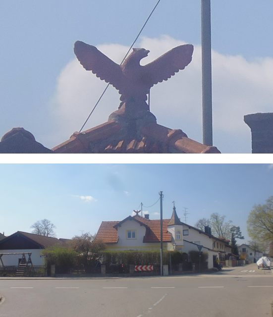
But before that, I have to pass through Harthausen ("Hard Housing"), where wild placarding is explicitly forbidden. I'm sure with a name like this, violators can expect harsh punishment.

This place also holds an unexpected surprise, for it is at the central crossroads of Harthausen that I find a majestic Phoenix perched at the top of an old house, just like that.
Afterwards, I soon enough enter the thoroughfare leading through the forest… and realize that my plan to spend the second, hotter half of the day cycling in the shade of the forests south of Munich is not quite working out as expected.

Interestingly, somewhere along the line I come across a more recent version of the "depositing debris forbidden" sign that I saw earlier, and just as I estimated, they did indeed translate the 100,000 DM into 50,000 € (though I suppose accounting for inflation since then, 60,000 € would probably be more appropriate by now).

Speaking of keeping pace, there's also this interesting anti-war float that I ride past just after leaving the woods. Guess English wasn't their major though. The German message reads "No peace through war!"

The next town I come across is Höhenkirchen-Siegertsbrunn ("Heights Church-Victor's Well"), where apparently road cleanings are announced one week in advance. This is also a notable minor milestone since it is here that I re-enter the territory I circumscribed during my ride to the Thalhäusl ten months ago (see Book III ~ Chapter 8 ~ Project Petal Part 1 ~ To The Thalhäusl).

A little further, I reach a meadow orchard created by the joint efforts of the kids of Höhenkirchen-Siegertsbrunn in order to do their own little part in saving the climate.

This meadow incidentally also marks the terminus of this particular leg.
Target Time: 14:00
Arrival Time: 14:25
Difference: +25 min
Total Distance so far: 75.0 km
I managed to make up quite some time on this leg, probably mostly due to the fact that it was pretty straightforward. I also find a Geocache here, as well as a rather unusual statue wooden that seems to have recently lost face, as well as a rather colourful bench.

I'm still behind time, but I'm sure I'll be fine. As such, I now continue on…
Leg 10: Fox Encounters of the Seventh Count
Starting Time: 14:25Duration: 60 min
Length: 9.6 km
This next leg should be very special. Not only does it contain the southernmost point of my tour as well as the highest point, but I should also have a very special encounter here, but more on that soon.

Even though I'm now in the forest belt, there are still long stretches around the cities where trees are rather sparse, such as this one.

Soon enough, I arrive at the aforementioned southernmost point of the ride, which is located within the town of Otterloh ("Otter Blaze")…

…where I can observe the restrictions placed upon the community due to the Green Shnolz as a restaurant is serving take-away meals in a fashion that ensures the proper distance is maintained between patrons.

The aforementioned fateful encounter happens shortly after I leave Otterloh. There, in the field, not far away from the forest, I glimpse something that catches my eye right away and makes my heart skip a beat

And this time there can be no mistaking it! The color, the face, the ears, and most importantly, the tail! For the seventh time in my life, I am beholding a wild fox, and right in the middle of the day, in the full light of the heavens. I cherish every moment of this encounter. Every last second. Taking pictures of the beautiful vulpine as it obviously enjoys the warming rays of the sun. And then, just as I move to continue, the fox gets up and runs back into the woods at a comfortable and energetic lope. It's as if it had waited there at this spot specifically for me.

Invigorated by this amazing encounter, I make my way past a hamlet with the interesting name of Lanzenhaar ("Lance Hair")…

…followed by another road through the forest, which this time around at least features a little bit of shade. It is also along this stretch that I cross the apex of today's ride at about 609m of altitude.

Once out of the forest, I take to the field paths again – at least for a short while – and while thus far the only other mounted riders I've come across were other bicyclists like myself, this time around I cross paths with a 100% organic couple.

Right there and then, this leg comes to an end as I reach the next milestone.
Target Time: 15:00
Arrival Time: 15:25
Difference: +25 min
Total Distance so far: 84.4 km
Amazingly, I didn't lose any time despite spending several minutes marvelling at my four-pawed vulpine cousin, but then again since it's downhill from here on out, I suppose my progress is going to be a bit faster by default now. A geocache also lies hidden within an ecological compensation area on this very field, but regrettably, I should not have any luck in finding it.

By now, it's already afternoon, but I'm also already at about two-thirds around the circuit. No reason to dawdle, but I also don't have to rush. Anyway, let's now continue with…
Leg 11: The Great Divide
Starting Time: 15:25Duration: 55 min
Length: 9.4 km
This leg should contain the last great obstacle of this ride: The bridge of Grünwald ("Green Wood"), which I last crossed returning from the Thalhäusl. It is also on this leg that I leave my territory again for a spell.

Right near the beginning of the ride, I come across something that is a rare sight around Munich: A continuous slope. This is a sure sign that I'm right now at or already past the edge of the Munich Gravel Plain.

And as I cross Oberhaching, I quickly realize that I am very definitely past the edge. Fortunately, the number of inclines that I have to ascend remains within reasonable limits.

Once past Oberhaching, I pass through the slightly shady Grünwalder Forst ("Green Wood Forest")…

Once in Grünwald, I join the ranks of countless other bicyclists intent on using this bottleneck of a bridge to cross to the other side of the Isar valley. And it really is a bottleneck. The next bridge upstream is the 8km away bridge in Dürnstein ("Meagre Stone"), and the next one downstream is the 4km away Großhesseloher bridge that I last crossed even more recently off-screen while returning from a visit to my friend Siggi.

The bridge itself is scenic as ever and offers a great view on the Isar…

…as well as the droves of humans faithfully upholding the contact restrictions sanctioned by the government by congregating on the gravel beaches below.

After that follows the most brutal stretch of the right, and that is the ascent out of the Isar valley. This ascent is only about 500m long, but since it features a maximum gradient of about 10%, I still have to stop and catch my breath several times along the way. However, unlike the last time, this time around I actually manage to make it all the way to the top without pushing!

After that, getting the rest of the way to the next milestone is laughably easy.
Target Time: 16:10
Arrival Time: 16:20
Difference: +10 min
Total Distance so far: 93.8 km
Interestingly, despite the challenging ascent, I managed to make up even more time, though I figure this might be due to me cycling closer to the centre of the fictive dial right now. Anyway, after a bit of searching I find what appears to be a classical 16:00-cache hidden in the woods around here.

So far so good. With the biggest obstacle behind me and with me catching up on the target time, I now continue optimistically onto…
Leg 12: Breaking the Limit
Starting Time: 16:20Duration: 55 min
Length: 9.3 km
This next leg should be the one in which I should finally manage to exceed the psychologically important 100 km mark, and is an almost perfectly straight route through the Forstenrieder Park ("Forest Reed Park").

This is also right in the gap of the Autobahnring, which was never finished, and with the age of cars drawing to a close likely never will be, but plans to close it were made, and according to a paper from 2010, my route takes me at the very least outside of the two most recommended routes for closing the circle.

Anyway, in I go into the Forstenrieder Park, which is the closest thing to a national park that Munich has…

…and having learned from my last visit, this time I make sure to find a proper gate to enter through.

At long last, I finally am entering a bit of a shady forest…

…although there are also a number of open stretches within the Forstenrieder Park.

Eventually, I pass beneath the A95, which is the only highway to Munich that is not connected to the Autobahnring, and leads out towards the popular ski resort of Garmisch-Partenkirchen. This highway pretty much cuts straight through the Forstenrieder Park like a knife, dividing it into an eastern and a western part. I wonder where they got that from.

Once in the West Forstenrieder Park, I quickly come across a number of people equipped with the latest technology, such as electric skateboards. I guess after all these E-Scooters and E-Bikes that was only a question of time. I wonder when they're going to make E-Roller-Skates.

I continue on through the park along a pretty straight track, and it is about exactly when I leave it (and enter a regular forest that looks very much the same) that I finally hit the mark that I've been trying to clear for so long.

100 km down, and still quite some more to go until I finally return home. For now, I'm still in the midst of the forest between Neuried ("New Reed") and Gauting, and with the shadows getting longer I realize that my time is beginning to run out.

However, I am also pretty much at my next waypoint, which is also the last waypoint that I have not yet visited today.
Target Time: 17:20
Arrival Time: 17:20
Difference: ±0 min
Total Distance so far: 103.1 km
Incredibly, I have managed to make up all lost time by now (which I guess is largely due to the fact that this last leg was pretty much straight and slightly downhill all the way. There's also a Geocache hidden around here which earns an entry into my list of least helpful hints. The hint goes like this: "Located in a hollow on the ground next to a tree stump. Should be an easy find."

I check out the most prominent locations, but after not finding it around there and somehow managing to get some really painful dry pine needle into my shoes, I decide to give it a rest and rather continue with…
Leg 13: The Final Push
Starting Time: 17:20Duration: 110 min
Length: 19.1 km
The last leg to close the circle should also be the longest one, beating most other legs by a factor of 2. A particularly tricky part should be not accidentally crossing the Autobahnring during its underground segment near the very end of the circuit near the Teufelsberg ("Devil Mountain").

After about 10km of largely uninterrupted forestry, I enter the town of Stockdorf ("Stick Village")…

…where I cross the Würm for the third time today (the second crossing near Karlsfeld went largely unnoticed), this time around by means of a little wooden bridge.

In Krailling – the next town over – I pass a little fitness park that has been closed by curtesy of the Green Shnolz…

…before entering the last forested segment for today.

There, I manage to get just a little bit lost, resulting in me making a little bit of a dent in an otherwise straight path, but eventually I manage to make it across the A96 and into the large circle city of Germering.

It is there that something unprecedented happens to me! My big green water bottle that has accompanied me on all my bigger bicycling tours in Germany… it gets empty. Never before, not even on the hottest of days, have I managed to drain the whole bottle of liquid. But then again, this is a record-breaking ride, so I suppose something similar was to be expected. Anyway, I guess it's a good thing that I'm not far away from home now.
However, by now it's a race against time, and Radian is already getting dangerously close to the horizon by now, the shadows getting longer and longer.

And yet, I am within strike distance. But on the other hand, I am beginning to feel fatigue overwhelming me. After over 12 hours on the road, I guess that's only to be expected. I am already fearing the consequences of what I'm pretty certain is a Shadow move on my side. With dread, I think back on my lunatic trip in Numazu to the foot of Mt. Fuji, where I spent the following day being dead (see Book II ~ Chapter 22 ~ Nutty Numazu), and fear that the same fate will befall me again tomorrow. But what choice do I have? I push on, and my body complies with that grim feeling that seems to say: "Okay, but don't tell me I didn't warn you."

And finally, after a long and exhausting leg, I get back where I started the circuit.

Target Time: 19:00
Arrival Time: 19:10
Difference: +10 min
Total Distance so far: 122.2 km
The stick I put into the ground is still where I left it, only this time around it casts its shadow the other way, illuminated by the rays of the setting sun instead of rising Radian. It took me only 10 minutes longer than anticipated (quite possibly due to me getting slightly lost between Krailling and Germering), but I've managed to do it. Once around Munich, over 100km, and all within a day, and almost within 12 hours too. I am exhausted like Dragon, but I am also quite proud of what I've accomplished here today.
However, as much as I just want to lie down and die here, this is not yet the end. Before I can finally rest, I yet have to complete…
Leg 14: The Way Back Home
Starting Time: 19:00Duration: 45 min
Length: 4.8 km
All that remains now is getting back home, and exhausted though I might be, I try to go at least a slightly different way than the one I already covered in the morning.

Crossing back over the A99, Radian at my back once more it fills my heart with sunshine to finally see the houses of Allach again in the distance.

And only a little bit later, I finally see a sign pointing to my home district of Untermenzing just as I re-enter the city boundaries of Munich again.

Now all I have to do is make my way through the quiet back roads of Allach as the shadows of dusk swallow up more and more of the houses.

In an occurrence of almost perfect symmetry, sunset occurs at pretty exactly the same distance from the "Whoa Fuck"-underpass that I experienced sunrise from, and since that underpass marks the boundary between Allach and Untermenzing, I suppose that means that I left Untermenzing just before sunrise, and returned just after sunset.

Saying goodbye to Radian for the day and thanking him for watching over me all the time today, I proceed through the underpass once again…

And then, I'm finally back home, after a total of over 13 hours, and the most harrowing ride of my life.
Target Time: 20:00
Arrival Time: 19:45
Difference: -15 min
Total Distance so far: 127.0 km
My final target time was to be home in time for dinner, which would be 20:00 in my home, and despite this last leg taking 50% longer than the first one due to my increasing fatigue, I somehow managed to hold that promise and make it in time. A tasty dinner follows, as does a nice, hot bath to calm my muscles and mitigate the feedback my body is sure to give me tomorrow.
Reflecting on the day, I still can't believe how accurately I managed to estimate the time it would take me to complete this circuit, even if some of the exact estimates were just a little bit off.

So far for my epic ride round Munich that I've been wanting to do for so long. However, this is by far not the end of the current situation, because…
The Shnolz must go on!
And now?
Well, the Green Shnolz is still on the loose, and I haven't seen my best friend Robert in over a month. Even so, by now Germany has the worldwide highest number of recovered people (106,800 of 153,584 as of 24-Apr 2020), and only 5,577 causalities, which is roughly 20% of Italy, 25% of Great Britain, and 10% of the USA. As such, sanctions are slowly but carefully being lifted again, and the number of people on the streets slowly increases, many of them wearing masks. Actually, that reminds me just a little bit of Japan.

Speaking of which… I was actually planning to be en-route to Japan right now, travelling there together with my best friend Robert in order to visit many Shrines again, show him Fushimi Inari in Kyoto, and pay a visit to the Wakayama peninsula – one of the few places that I missed during my year in Japan. Most importantly, however, I had planned to meet up with whoever of my Japanese hosts had figured out the secret message on my gift artworks and could make time. I had planned to meet with them at 15:00 on 05-Mai-2020 (a date that falls within Golden Week) in front of Anamori Inari, the very first Golden Fox Shrine I found and one of the most meaningful places in the world to me, located in Koto-Ku, Tokyo. The flights were booked, our travel route from Kyoto to Tokyo laid out in detail, and all AirBnb places booked and paid. All the pieces were in place for a reunion that I had planned for over two years… but alas, it should not be. With the countries on lockdown and the flights getting cancelled, there's no (legal) way for me to get there in time for the reunion.

Oh well, I suppose I should be happy that I'm good and healthy in this time of uncertainty, at least according to the full medical checkup I did last week. Many people are worse off than me and are either physically or legally incapable of leaving their homes, so I guess that's good, even though seeing my plans destroyed like this still causes considerable emotional discomfort to me.
On a more positive note, and to put the Green into the Shnolz, the Green Shnolz is turning out to have a remarkably positive effect on the climate, possibly giving our planet the shortest of breathers. We must still follow up on this, but with crazy things happening like the "price" of oil falling into the negative numbers (so you actually get money if you buy oil), who knows what will happen next? Maybe the Green Shnolz was even some sort of immune reaction of our human-plagued planet? Who knows? Seeing it from that angle, my flights getting cancelled is probably me getting just dessert for me flying too much the last few years. I hope other people will be getting a similar dose of karma.

One final word to put it all into perspective: Though definitely the most serious threat of the 21st century thus far, the Green Shnolz still pales in comparison to the Black Plague of the middle ages. With modern medicine and people being reasonably healthy and well-nourished, thus far, the Green Shnolz reduced the population of Europe by not even 0.2%. Back in the middle ages, the Black Plague took over 70%! Can you imagine that? Having a 70% chance of not making it through the decade? And knowing that 7 of 10 people you know will die?

Compared to those odds, the Green Shnolz is nothing! It will not even make a visible dent in the population charts. But we mustn't be careless. Until we have a vaccine any safety measures are surely justified, even if they mean that the Eurofurence, the Oktoberfest, and probably also the Spielwiesn will get cancelled this year.
With that, this chapter comes to a close, and although my trip to Japan this year was cancelled, I'll make sure to yet provide you with more Tales from the Travelling Fox, so stay tuned!
Coole Tour Kira, schön geplant und gut durchgezogen. 120km + ist nicht so einfach :) Top!
ReplyDelete