Whereas the last chapter was about my uncle Jörg, this one is dedicated to my grandmother Mieke. At 91 years of age, she is by far the oldest member of my family, and the only one of my grandparents still alive. You might recall her from when I mentioned her in Book III ~ Chapter 7 ~ Home.

As you might recall, she lives out on the countryside, to the northeast of Munich, and as it happens, her place is located just within what I consider my maximum bicycling range (actually, just a little bit outside, but oh well…). Thus far, I've only ever gotten there by car, and yet it has always been my intent to visit her relying only on my own strength one day. Now, that time has arrived, and it is time for…
Part 2 ~ The Petal of the Tiger

This should be my most ambitious bike ride yet, but I'm sure I'll be able to pull it off, one way or another. Either way, I should have a tour ahead of me that would have…
Heaps of Hills
31-Oct-2019Distance: 85,0km
Ascents: 400m
Duration: 9.25h
6/10🎁︎
Since it's well into autumn by now, and equinox is already over a month in the past, that means that once again, I will have to face my old enemy, daylight. As such, I get up at 5:45, just as astronomical twilight gives way to nautical twilight…

…and the outside temperature equals pleasant 3°C.

By the time I am all set and out of the door, it's already 7:00, and thus a few minutes past daybreak. Thus, I ride into the sunrise, or at least I would if it wasn't completely overcast. Some people would describe that as bad weather, but for me it's actually fine since that means I won't have to worry about the sun blinding me, what with me heading east and all.

My route today should take me through Munich, and then to the Speichersee ("Reservoir Lake"). From there I continue towards Erding ("Earthing"), across the Fuchsberg ("Fox Mountain"), and eventually make my way to Dorfen ("Villageton"). Finally, the last stretch of the way should lead me through Großkatzbach ("Great Cat Stream"), Grüntegernbach ("Greened Glad Stream"), Gebensbach ("Giving Stream") and finally Velden ("Fieldton"), before finally taking me to Ruprechtsberg ("Ruprecht's Mountain"). Along the way, I should cross two boundaries, one geographical and one political. The political one is the boundary between Upper and Lower Bavaria, and should not have any impact on my progress, unlike the much more significant other boundary, but I'll tell you more about that when we get to it.

For now, the first part of my ride should take me through the different districts of Munich. Starting in my home district of Untermenzing, I first pass through the neighbouring district of Moosach, then Milbertshofen, and finally Freimann. I can complete a part of the ride on scenic cycling paths, but for a big stretch, the fastest way is simply along one of the major thoroughfares.

However, soon enough I reach the English Garden, and with that I leave the busy city traffic behind for the remainder of this trip.

Today, I cross the Isar at the Saint Emmeram Bridge, a pedestrian and bicycle bridge that was named after a 6th century gyrovague, originally from Aquitania, who eventually came to Franconia on his travels, and ended up becoming rather violently dismembered after choosing what in retrospective turned out to be definitely the wrong answer to a request for counsel. You can read the full story here. Incidentally, the Oberföhring floodgate, where I crossed the Isar on the last petal ride to the Thalhäusl (see Book III ~ Chapter 8 ~ Project Petal Part 1 ~ To The Thalhäusl) is visible just in the distance from here.

From there on, I continue north, following the course of the looooooong peninsula between the Isar and the Isar Channel. Although barely 50m wide along the majority of its length, this fluvial peninsula is a total of 4km long, making for a length-to-width ratio that is the next best thing to Spaghetti.

Near Unterföhring, I decide it's finally time to cross the Isar Channel as well, and get on the other side of the rivers. I know that there's a pedestrian bridge there, so I figure I should be able to cross it by bike as well. Unfortunately, however, there should be some slight complications to that endeavour.

One lovely experience of lugging my bike up three flights of stairs later, I am atop the little bridge spanning the Isar Channel. An integral part of a hydroelectric superstructure that should yet play a big role in today's ride, the Isar Channel at this point lies already a notable amount of metres higher than both the Isar, and also the surrounding landscape. Since its primary purpose is to carry water to where it's used, the whole structure is pretty functional, unadorned and actually pretty barren.

After leaving Unterföhring behind, I am now beginning the larger, rural part of the ride, making my way past bare, harvested fields, across roads scattered with fallen leaves, the more hardy specimens of which are still stubbornly sticking to the trees. It's autumn, alright, and I personally find the colourful contrasts of this season most appealing.

Before long, I also come across what I can only describe as a "Bicyclist's Abreuvoir", and although I have brought plenty of fresh water with me, this little installation is too thoughtful for me to pass up at least a little sip.

Incidentally, I'm also hunting for Geocaches along the ride once again as usual. As you know, they come in all sizes and colours, ranging from huge to tiny. As for what qualifies as tiny, it is right here and now that I discover a cache of the category "It doesn't get any tinier than this". This it what is also known as a Nano Cache, and the hardest part is always rolling the teeny-tiny scroll of log back up again so it fits the container.

What follows now is the beginning of the lake part of today's tour, starting with the Feringasee just east of Unterföhring. In the summer this is probably a pretty popular spot, and it even features its own naturalist peninsula in the middle. Around this time of the year, however, there's scarcely a person other than me to be found around.

The sky remains a mottled grey as I ride through fields that obviously lay bare this year and are as thus covered with a diverse mixture of green grasses…

…and before long, I come across a hidden gemstone – a little sheltered biotope featuring a variety of different habitats and homes to all sorts of fish, fowl and amphibians.

After that, I am in for a bit of a scare as I run across a rugged stick on the dirt paths that are my roads out here, and for a moment I think I've contracted a flat tyre. Sure, I have repair kits and all with me, but since I'm on a tight schedule, having to mount an emergency repair right now would be a real hassle. Fortunately, however, it turns out to be false alarm, and after double-checking both of my tyres, I continue on my way.
Said way should, before long, lead me to my primary milestone for today's ride. You see, there's this "mysterious" place that everyone who has ever looked at a map of Munich knows, but very few people have ever visited: The Speichersee. This roughly 6km² hydroelectric reservoir pales in comparison with, say, the Itaipu reservoir (see Book III ~ Chapter 2 ~ Brazilian Bolero), but it's still impressive considering that it was not built in a valley, but rather onto a freaking flat plane using dams on all the sides. Also, it was built in 1929, so it pretty much did that "green energy" thing way before it got cool. One common misconception people have, by the way, is that the Speichersee stores drinking water for Munich, which is simply wrong. The water for the Speichersee actually comes from Munich, and the Speichersee also doubles as a natural sedimentation tank for some of Munich's sewage. Eventually, the water continues past Erding and rejoins the Isar near Landshut. One of the most notable features of the Speichersee is its unique structure: The main part is divided into two halves by a traversable thoroughfare, and south of that a series of (now mostly abandoned) fish farm lakes seam the frills of the Isarkanal.

Apart from its functional component, the Speichersee also serves as a sanctuary for pretty colossal amounts of waterfowl that crowd the lake's surface. Standing on the causeway, watching, barely a minute goes by in which I don't see one flock departing, or another arriving. Unsurprisingly, the biggest concentration of birds can be found in the middle of the lake, far away from the corners where people walk their dogs.
The Speichersee eventually terminates at the Speicherseekraftwerk Ismaining ("Ismaning reservoir lake power plant"), which is one of those old-style hydroelectric power plants that were built quite often all around Germany back in the first half of the 20th century, before they were replaced by more convenient coal, oil, gas and nuclear power plants.

For now, I continue along the Isarkanal for a little bit further – up to Neuching ("Newing") to be exact…

…and eventually arrive in Erding, which up until now I only know as one of Munich's ten satellite cities (the others being Ebersberg ("Boar Mountain"), Holzkirchen ("Wood Churchen"), Wolfratshausen ("Wulf Council Homen"), Tutzing ("Doesing"), Herrsching ("Ruleing"), Geltendorf ("Pertain Village"), Mammendorf, Petershausen ("Peter's Homen") and Freising ("Freeing")) that mark the perimeter of Munich's public transportation network. Also, there's a famous thermal bath here which I might have visited a couple of lives ago (think school time, probably even before my semester in the USA).

The following minor milestone should mark my passing across THE BOUNDARY, which I mentioned before. It is the very imposing Fuchsberg, which while not all that high is as of yet steep enough that I prefer to push my bike up the incline. At the very least, I get a nice panorama from the… uhh… "summit" (481m! That's almost 20m above the surrounding landscape!).

Now, as for THE BOUNDARY… up until now, my route has been mostly flat, and my progress swift. However, as so often, I am now reminded that one can't possibly truly know an area until one has cycled in it. Thus far, I had envisioned the area around Munich to be mostly flat, with maybe a few stray hills. And that's actually the truth, only that flat area is not anywhere as big as I somehow had envisioned it. Measuring around 1,500km² and stretching between 30km and 40km across, the Munich Gravel Plane is a roughly triangular geologic structure that is surrounded by rather hilly hills on all the sides. THE BOUNDARY marks the point where my ride should abruptly transform from "easy going planey ridey" to "uppey downy bumpy slowy".

This is also reflected nicely by the height profile of my ride, which very rapidly transitions from "zzzzzzz…" to "AAAAAAAAAAA!!!!!!"

Since by now it's already well into the day, I start looking for a nice place to take a break… only to find that benches or other sitting opportunities are about as much of a rarity around here as drinking fountains in the Sahara. You'd think that there would be at least some bus stops with benches around, but apparently these, too, have all been rationalized away by rampant short-sighted austerity measures, so instead, I eventually simply sit down on a road-grit container in front of the church of Kirchasch ("Church Ash"), where I have a humble lunch break with sandwiches, some Müsli bars, and good old water under the first instance of a blue sky I should witness on this ride. And with no public garbage bins to be found around, I have no choice but to take my trash with me, Japanese style.

After that, I continue on my ride, and shortly after leaving Kirchasch behind, I reach the highest point of today's ride at 516m. Here, I am pretty much at the top of the local world of hills, and the next bit should be a pleasant rush of downhill rides across fields under a sky that is once again grey.

After that rush, a valiant attempt to continue across field paths along the railroad tracks should slow me down considerably, for while some of the path is relatively nice and even, it should also lead me through some rather muddy terrain (particularly in the hollows) where I would be forced to push my bike. Also, this part should already contain considerable sequences of ups and downs.

As such, I should eventually abandon the direct field path and cross over onto a more roundabout but significantly better traversable route at the bridge of the little village of Thann.

From here, the going is pretty easy and straightforward, and I also experience more blue skies. It doesn't take long now for me to arrive at the lowest point of today's ride, which at 438m is the city of Dorfen.

It's now about 14:30, and time for the ultimate ordeal of today's ride to begin, pretty much starting in Großkatzbach. With Dorfen having been the lowest point of my ride, and my destination lying at 465m, it's obvious that I'll have to climb some altitude in order to reach it. However, owing to the crass hilliness of the terrain in between, there is a significant discrepancy between the mathematical difference in altitude of 27m, and the actual sum of ascents that I have yet to scale, which comes to a total of 181m, and is thus almost half of the entirety of today's ascents.

The apex of this ordeal is reached in Grüntegernbach, after which the going gets easier once again as the road finally makes up its mind about whether it wants to run along a ridge or the valley floor, instead of alternating between hilltop and valley every freaking 5 minutes.

It is in a little hamlet by the name of Loiperstätt that I finally find a signpost pointing towards… well, not my final destination, but the next biggest thing near it, the village of Velden.

Just a little bit later, I finally arrive in Velden, which means that I've pretty much reached my goal. From here, I'd be able to walk even if my bike were to break down on me. Incidentally, I also learn that apparently, Velden is a partner city of the world-famous cities of Aigrefeuille in France and Roana in Italy.

Here, I continue along a nice cycling highway, which I sadly have to learn is yet another deprecated railroad track. Even though the tracks are gone, the station is still standing in Velden (as is a lone wagon that now serves as a novelty restaurant), a testimony to a time when I would have been able to visit my grandmother by train.

Velden itself turns out to be a good deal hillier than I realized before, but eventually, I manage to make it to the other side, and am rewarded with the first signpost reading the name of my final destination for today.

And then, all that's left is the final ascent up the eponymous Ruprechtsberg, and then I'm there.

Words cannot adequately describe the sense of accomplishment I feel right there and then. Up until now, Ruprechtsberg has been like a sort of satellite in my life, orbiting Munich, loosely disconnected, a place you go by in a vehicle. But now that I've gotten here using my own power, it feels like it has been connected to my world, grounded by some sort of anchor, the land between having become a part of my world, my territory, if you like. This has been one of my goals for so long, and now I've done it. I've really, really done it.

I let this sink in for a little bit longer before turning into the driveway that leads to my grandmother's country house. It is now 16:15, and despite me taking a scenic route with lots of hilly obstacles, I still have over half an hour of daylight left. Still, I can already tell that night is going to fall somewhat soon, and thus I am glad I managed to make it in time, and continue to greet my grandmother, tired but accomplished.

Just like I'm glad to have arrived and see my grandmother in good health and spirits, Mieke is happy to see me safe and sound as well, and soon shows me to the rooms that she prepared for me. In such a big old house there's ample space, and as such I have both a comfy bedroom…

…as well as a room that I can use as a makeshift office. Altogether, this wonderful big house could probably house two or three generations without anyone wanting for space.

Dinner consists of a tasty cheese casserole that is very satisfying after the physical efforts of today, and after finally getting to show my grandmother some of the videos of my journey of Japan (with no internet out here, up until now all I could send here were printed versions of my accounts), I soon enough retire to my fluffy bed, happy to grant my weary limbs some well-earned rest.
Ruprechtsberg Rest Day
1-Nov-2019The next day should be mostly R&R for me. Nothing big, nothing fancy, and yet it's also a holy day – Allerheiligen ("All Saints'") – that I am observing with my grandmother today. Befitting the first of November, the weather is somewhat gloomy.

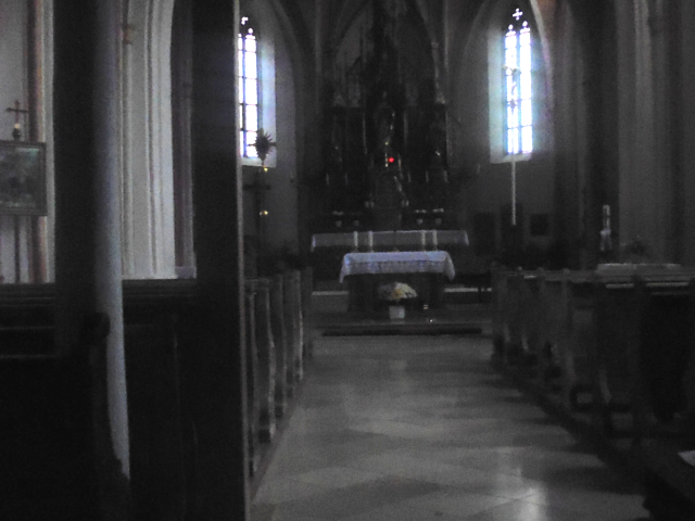
Together, we visit the church of Ruprechtsberg, where on this occasion a service is held. With Ruprechtsberg being such a small place, the village doesn't have its own pastor, but is instead serviced by a chaplain who takes care of a number of rural churches like this. Back in the day, each village had its own priest, but these days we can count ourselves lucky to receive a service even on a holy day like this.

Still, on this day the church fills up full. This has actually been the first service I've attended ever since my other grandmother died, and… well, to be honest, after experiencing Shinto and Buddhist ceremonies, I realize for the first time just how incredibly depressive Christian services are. All this talk about death, and how this world is bad and all we can do is hope for salvation after death… suffice it to say that I would not exactly call this as very life-affirming.
While we're there, we also pay a visit to my late grandfather Anton "Toni", who was put to rest here. Deceased before the turn of the millennium, I only got to know him while I was still a little child, and yet I remember him fondly. A big man, tall enough to be at odds with most doors, he was the very archetype of a gentle giant.

In fact, in my Mieke's house, there's still a picture to be found depicting me as a little boy together with both of my mother's side grandparents.

After Allerheiligen, my grandmother and I drive to a restaurant in the next village over – one of the few that remain out here – and have a hearty meal together. In that place, I also notice the proof of an ancient Bavarian tradition still being actively practiced in the form of framed Sies. It is based on the popular Bavarian trick-taking card game of Schafkopf. In this game, which is played with 32 cards of 4 suits, the Sie is the highest possible hand, consisting of the highest eight cards in the game and ensuring a perfect victory. Of course, it is incredibly unlikely that these eight cards are all dealt to the same person, the exact probability being 1:10,518,300 per hand. That is about 1:2,500,000 per game with four players, and assuming you play 25 games per night, 1:100,000 per night. Assuming you get together for Schafkopf once a week, that would still be 1:2,000 per year, or summed up, not something that happens every life. As such, tradition holds it that whenever a Sie is dealt, the eight cards have to be framed and put onto the wall with the date dealt and name of players, and the rest of the deck burnt. It's remarkable to see three of those rare Sies hung on the wall here, and one even relatively recently (eight years ago).

For the remainder of the day, Mieke and I mostly relax at the big old house. At her age, I can perfectly understand that she needs some rest after walking to and from the church with me and then driving to the next village, and I myself am quite happy to get some rest as well in anticipation of tomorrow's return ride.

Resting my weary legs, I instead put my hands to good use and draw the foundations of two more creatures of Ceal: Lycro Flirials and Rouieans. I should eventually colour them upon returning home, yet I would always remember that these two critters were birthed here in Ruprechtsberg.

In the evening, I'm happy to make myself useful by fetching a generous amount of coal briquettes from the basement and carrying them up to the kitchen, where they are used to fire a rustic old metal stove, and a little bit after that we share another satisfying dinner together.

Finally, I show Mieke some final Japan videos before we both retire to our respective bedrooms. After all, I have to leave early again tomorrow since the return ride is going to take me all the way…
Around the Airport
2-Nov-2019Distance: 95,0km
Ascents: 400m
Duration: 11.00h
9/11🎁︎
The way back home should be no shorter than the way to get here, and thus, it's still early in the morning by the time I leave, having shared one last breakfast with my grandmother.

Once again, daylight should be my primary resource, and this time around the path I should take would be even longer than the way here. My route should first take me west through the hill hill happy land, and eventually all the way to Munich Airport, which along with the Speichersee was the second man-made superstructure that I wanted to include in this circuit. From there, I would make a beeline-ish way back home, going up the ever-so-slightly inclining the Munich Gravel Plane until I eventually arrive back home.

First of all is crossing through Ruprechtsberg proper, which considering that the hamlet is only about a dozen or so houses big does not take all that long. Much more of a challenge is the fact that the weather is not exactly amicable today, and while it's not raining all of the time, I should still get to enjoy the occasional November shower to complete the experience.

After that, I first cross the relatively narrow Vilstal ("Vils Valley", named after the small river Vils)…

…and cross aforementioned next village over (the one with the restaurant), which goes by the name of Obervilslern ("Upper Vilslern"). There, the local church was just renovated and blooms with a pristine white shine. Interestingly, this church seems to be standing on the other side of the "tower shape"-divide: Whereas in Upper Bavaria you mostly see onion domes, "normal" roofs are more common in Lower Bavaria.

After that, I leave the (not so busy) main roads behind, and take to the quiet back field roads which take me along forests, and up gently sloping hills.

From up there, I look back down on Ruprechtsberg, which is located more or less in the direction of the left of the bright holes in the clouds.

My first adventure today is a little side trip in which I'm going to see the Burglochschanze ("Castle Hole Rampart") (and certainly not only because there's a Geocache hidden there). The tricky part is negotiating the bumpy path there with my bike, and for the most part I just end up pushing it. In the end, I arrive at an area that nature has reclaimed so thoroughly over the course of the centuries that there's barely anything left of the original structure, save for maybe a few trenches, and even those are hard to make out.

Moving on, I head east along what I like to call the "direct path", cuz paved roads are for wimps.

Soon enough I pass through a little hamlet by the name of Vielberg ("Many Mountain"), which actually sounds a lot more challenging than it is. Make no mistake, however: The path is still going upwards at a steady gradient that is notable, but tolerable.

It is around 8:30 and some time after I pass through the villages of Neufraunhofen ("New Women Farm") and Bach ("Stream") that something happens: One after another, all the bells of the many little town churches all around me start ringing in celebration of Allerseelen ("All Souls' Day"). And it's only after having been all around the world that I can really appreciate how special an experience this is. Not in New Zealand, not in Japan, not in Brazil and not in South Africa will you ever experience bells resounding in unison throughout the entire landscape like this.
The bells keep on ringing for easily five minutes, accompanying my journey for some time before falling silent again, and eventually I find myself looking at the very curiously named village of Hofstarring ("Farm Staring").

It is around here that I first notice that I happen to be directly between the two approach corridors to Munich Airport, which is a very reassuring feeling since it means that I just have to follow the landing airplanes to get my major waypoint destination for today. The air corridors are quite busy too, and at times I can see up to three airplanes on their landing approach at a time.

Much more interesting than the airplanes that keep on passing me by on both sides are the names of the villages that I pass by, such as Lindegraß ("Limetree Grass"), the trademark of which is very fittingly a big limetree standing on the grass.

However, my personal all-ride favourite is still Vorder-Hinterbaumberg ("Front Behind Tree Mountain").

This place should also be a lesser milestone in my ride, for not long after it there's one final downhill ride, and then I pass THE BOUNDARY again. From here on out there should be no more hills as I re-enter the great Munich Gravel Plane.

That, however, is apparently no reason for the funny place names to stop, as I realize while passing a hamlet called Moos ("Moss"), the fully qualified name of which is actually Moos an der Wall ("Moss at the Wall").

Up until now, the rain has always been more or less tolerable. However, after crossing back into the Munich Gravel Plane I should be buffeted by two showers strong enough to make me temporarily seek refuge in convenient little roadside shelters such as bus stations.

Not long after, I finally reach my major waypoint for the day, namely Munich Airport, where planes aplenty are landing and taking off.

There, I make my way along the northern runway until I reach the northern vista hill, which as a direct result of its rather remote location (one hour on foot from the nearest station) is usually not very crowded on the best of days, and today and in this weather I have it pretty much all to myself.

Since it's around noon now and the rain has stopped I decide this is as good a time and place as any to make my lunch break, even, though the options of places for where to lean my bike on are absolute garbage.

As for what lunch entails… half of it is the remaining Müsli bars, and the other half is a home-made sandwich I prepared at my grandmother's place.

During lunch, I watch many a plane take off on this here northern runway. The smaller planes naturally get airborne earlier, but the big jumbo jets need almost the entire length of the runway. It's a bit unusual for me, filming the planes take off from this perspective, because over the last three years, whenever I was filming a plane takeoff, it was from the inside.
Before I manage to move on, I witness another thing happening: All of a sudden, I can see all the way to the alps, and that can only mean one thing: Föhn. It is a regular weather phenomenon in these parts where warm and dry air blows over the mountains, leaving the air with little moisture and creating atmospheric conditions where it's possible to see all the way to the 100km away peaks. A very pleasant side effect of that is I know I won't have to worry about any more rain for today.

Now, for the next part of my ride, I first have to cross the Isar at the next opportunity. Turns out that is easier said than done, and for the next half hour or so I am busy trying to find my way through the forests flanking the river, cycling over rather muddy pathways.

Eventually, however, I manage to find a bridge for pedestrians and cyclists such as myself near a little town by the way of Achering, and thus get to make my way over onto the correct side of the river.

Only a short time after I have crossed over the Isar, I experience something unprecedented in this ride so far: A clear blue sky! Unfortunately, however, the field paths that my road takes me across are still muddy with moisture, and the going is accordingly tough.

For the next part, my way should take me more or less parallel to the A92 highway. Interestingly, there are quite a few lakes along this route, such as the Neufahrner Mühlseen ("New Driver Mill Lakes")…

…or the Oberer Moosweiher ("Upper Moss Pond").

The latter already contains a little hint about the reason why I've chosen this particular route, which should become apparent momentarily. From where I am now it only takes me a few more minutes to reach a little river by the name of Moosach, and following it upstream is going to take me all the way to… well… Moosach, which as you might recall is right next to my home district of Untermenzing. Or at least so it would have, had not a certain king built the Schleißheimer Schloss (see Book III ~ Chapter 7 ~ Home) in its path and redirected the rivers in the area quite profoundly. Today, the name is all that remains to remind us that one day the Moosach must have flown all the way from Moosach.

The next lake I come across is the Unterschleißheimer See ("Lower Strip Home Lake"), and already I can see that time is once again going to be against me. The sun is already quite close to the horizon, and I still have at least 20km ahead of me. Will I be able to make it before night falls?

Well, I think we don't really need to make this any more suspenseful than it is, because the short answer is simply "no". Owing to a really inauspicious combination of my chosen route turning out to consist mostly of dirt paths, the rainfalls of the last few days, my route being almost 100km long, and this being the freaking winter semester with only 10 hours of daylight at present, I shouldn't even manage to cover half that distance before the sun sets. Fortunately there's still a good bit of twilight left around that time of the year: Civil twilight lasts for over one hour, with another hour of nautical twilight to follow before it gets really dark.

Which is how I'm able to go and see the final milestone of today: The water bridge of Feldmoching. This very unusual construct directs the Würmkanal ("Worm Channel", headed for Schloss Schleißheim) above the Würmholzgraben ("Worm Wood Trench"), and also features a spillover waterfall for excess water from the Würmkanal to run down into the Würmholzgraben. An interesting piece of infrastructure if I've ever seen one. Viewing it comes at a price though: Since no path leads there, I have to cross a field, and while doing so my bike's chain fender snags on a branch and breaks off. Peace to its ashes.

Moving on, I proceed to cover the remaining kilometres of this ride, bent, but unbroken…

…and at the onset of nautical dusk, I finally reach the city border of Munich.

It is only now that I cross the highway again, and technically it's not the same anymore, the A92 having merged into the A99, Munich's highway three-quarter ring. Standing on a pedestrian's and cycler's bridge, I take this opportunity to make a nice long-exposure picture of the cars rushing by below.

After that, I cross over into the Allacher Forst…

…where the visibility instantly takes a massive dip southwards. Fortunately, this time around my bike has a functional ✨L*A*M*P✨.

Second to last, I cross the Rangierbahnhof ("Shunting Station"), which is at least reasonably well lit…

…and then just for the heck of it I complete the circuit by going through the Angerloh forest, which is even less well-illuminated than the Allacher Forst.

By the time I finally arrive it's… well, actually only 18:00, but around this time of the year that means it's already pretty dark, as I think became adequately apparent. Once again, I did not quite manage to crack the psychologically important 100km mark, but I came adequately close, and most importantly, I managed to fulfil my primary goal of visiting my grandmother all on my own, without relying on anyone else's strength. As such, I feel happy and fulfilled, but also very, very exhausted. For now, I rest, but there is more yet to come, so by all means, I encourage you to look forward to the next chapter of the Travelling Fox Blog!
No comments:
Post a Comment