- Part 8 ~ Alpine Abortion
- Isar Insanity
- The Guest of Geretsried
- Woe at the Walchensee
- Kneecapped at Kochel
- A Lakeshore Lap
- The Rueful Return
- The Road Ahead
After having returned from the Philippines alive, I am quite happy to be back in a country where I feel comfortable doing extended cycling tours. As such, I am very much forward to the next part of the Petal Project. However, yet unbeknownst to me, this should turn into a frustrating failure which I would forever remember as...
Part 8 ~ The Broken Horse Petal
12-Sep-2022 - 14-Sep-2022
Just like my last ride took me north off the map (see Book V ~ Chapter 6 ~ Project Petal Part 7 ~ Into Ingolstadt), this one should take me south off the map. This is, for me, a very meaningful ride, because it is not only the final one of the four major cardinal directions, but because it should also take me to a place that I've been wanting to reach by bike ever since I've espied it from the top of the Fröttmaninger Müllberg many months ago: The Walchensee! (see Book IV ~ Final Chapter ~ Catty Company)

Now, roughly 16 months after I first set my sights on that target, the time is right to reach it. Upstream all the way lies my goal, so it should not come as a surprise that the first part of my ride there includes some...
Isar Insanity
12-Sep-2022Distance: 57.0km
Ascents: 310m
Duration: 8.5h
7/13🎁︎ (+1 passed)
I start reasonably early in the morning. The sun has already risen, but not yet cleared the rooftops, so for now, only the canopies of the tries get to bask in the morning sun.

I am literally just around the corner at the end of the courtyard when I notice something is amiss. Jycily's brakes are not reacting very well, and considering that I'm going on an alpine tour, that is a considerable problem. So I turn around right there and then, run back into the Fox Loft to fetch my Allen keys and spend a bit of quality time adjusting the brakes until they are okay-ish. Somehow, I never seem to be able to get quite the right balance of "too tight" and "too lose", so in the end I settle on a setting where the brakes brush against the wheel rims a little and yet somehow still don't quite react sharply enough for my taste. Oh well, it'll do.

As a result of this little delay, Radian is already some distance into the sky by the time I actually get going. Anyway, at least as a result of that I now have my Allen keys with me as well.

This tour should be a little bit different from the other Petal Rides. Whereas normally I pick a stay place in my target area for two nights, then spend the first day cycling there, the second day exploring the area, and the third day cycling back, this Petal is so extensive that it requires a three-step-slice. That is, instead of one stay place where I'll stay two nights, I have two stay places for one night each, with medium-long legs in between. One distinct disadvantage of that is that I have to lug my luggage around on all of the three days, but it can't be helped.
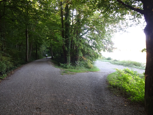
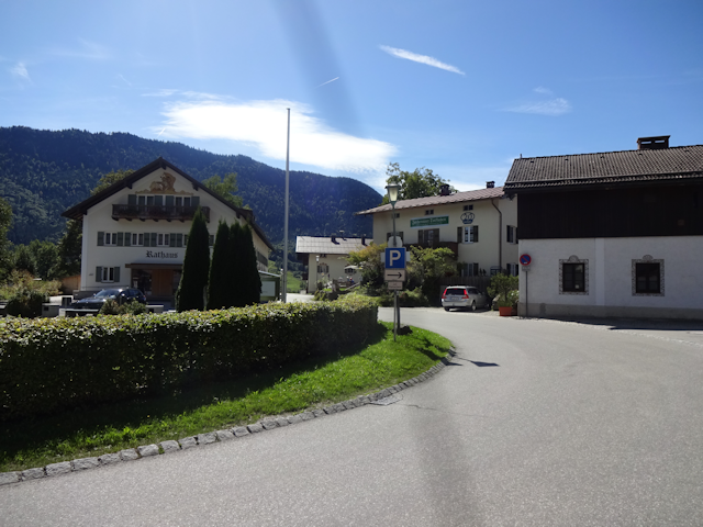
To compensate for that, the three segments are roughly equal in length, the first one taking me first south and a bit east through Munich until I hit and cross the Isar near Thalkirchen ("Valley Churches"). After that, I stay on the east bank of the Isar at any cost until I reach the area of Wolfratshausen ("Wolf Council's Housing"), where I cross over to the west bank again via one of the few bridges in that area in order to reach the town where my first stay place is located, that being the town of Geretsried ("Spear Lord's Reed"). Also note how my overall travel direction for today ends up being almost exactly south.

As far as ups and downs are concerned, since I'm travelling towards the Alps, it should come as no surprise that the general direction is up. However, interestingly, the steepest climbs actually happen while I cycle near the Isar, as the cycleway there routinely leads me up and down the escarpment - occasionally via rather steep slopes.

However, before I venture out towards the Alps along the Isar, I first need to make my way through Munich, starting with cycling by my favorite local palace, the Nymphenburger Schloss ("Nymph Castle Palace").

After that, I make my way through the district of Laim ("Glue") by means of less busy backroads...

...and then get just a tiny bit lost crossing over the Westpark. The bike path routing there is just a little bit confusing.

Back on the right track, I continue for some time along the straight streets of Sendling ("Small Slope")...

...and eventually manage to make my way onto less-trafficked paths even before I cross the Isar, or even ride down aforementioned slope.

Most people picture Munich as a flat city, and while that's largely true, one must not forget that the valley of the Isar is cutting straight through the city. And while not very large or steep, it was likely for this escarpment that Sendling was named. Anyway, before much longer my route takes me down the slope, and as much as I would have liked to just keep on rolling with that momentum for a distance, I just have to stop at the bottom and take a picture of this royal excuse for a car!

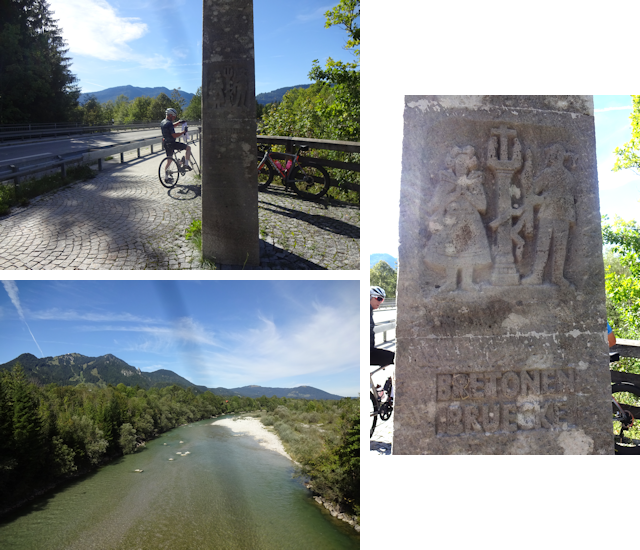
After that, I soon reach the Isar, and have naturally aimed my course so that it cross it right away via the Marienklausebrücke ("Mary Hermitage Bridge"), which is literally the only bridge across the Isar in the south of Munich that I had not yet crossed. There's more bridges towards the north, but in the south the bridges get more scarce as the Isar valley grows deeper. From here, it's 2km south to the next bridge, and then another 4km to the next bridge beyond that. Following that, it's over 8km to the next bridge, anyone notice a trend?

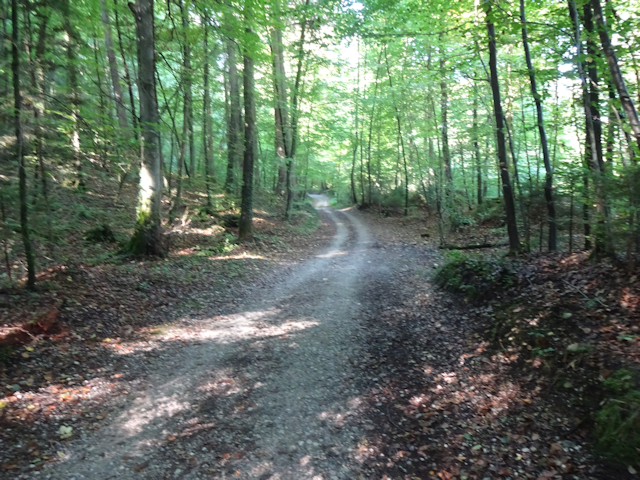
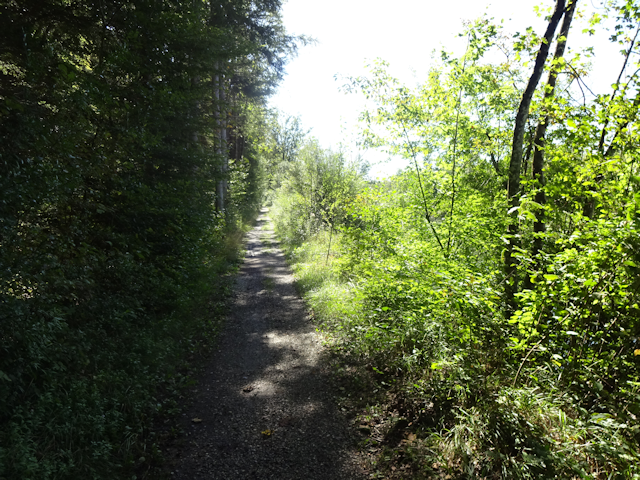
On the other side, I happily follow the Isarside cycleway up the river. Here, that one takes the form of a wide and well-maintained gravel road under the shade of the trees. It's not very busy today and makes for relaxed cycling.
Questing for the odd Geocache along the way, I come by a curious little cave-tunnel cut into the rock of the escarpment. I should not find the cache here, but am still grateful that my search for it resulted in me finding this curious little place.

...even though it caused me to leave the main cycleway behind and continue on somewhat more... adventurous paths.

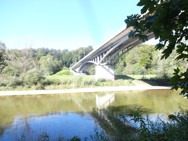
Eventually, I pass beneath the Großhesseloher Brücke ("Great Shrubbery Copse Bridge"), which is a combined railway and pedestrian bridge, with the railway on top, and the pedestrian walkway in the cage beneath.

At that point, I am back on the main cycleway again. However, that does not necessarily make things much easier, since by now the escarpment is starting to get rather steep, and instead of following the Isar directly, the cycleway runs some distance away, and as such ends up leading up and down the escarpment quite a lot. In fact, this segment of the way should include some of the steepest climbs of today's leg.
Next, I reach the Grünwalder Brücke ("Green Forest Bridge"), and it is here that things start getting "ultimately interesting".

You see, the official cycling route leads up into Grünwald by means of a kinda busy road here, and I very much do not feel like doing that. However, the alternative to that is this:
2

One failed lunacy check later I find myself... uhh... painfully pushing down Jycily on a slippery slope, one inch at a time, half expecting to slip any moment and find both me and my bike being unceremoniously jettisoned into the Isar. However, be it by luck or maybe because I've racked up some skill levels in navigating impossible paths by now, I eventually manage to safely make my way down the path, which puts me right down at the shore of the Isar on the south side of the bridge.
So, the good news is that I managed to make my way down to the shore. The better news is that there even is a path along the shore here. However, that's where the good news end, because the path does not only look like this...

...but it also features occasional sand patches, which always slow me down to a stop in a matter of seconds.

Eventually, the path even "thins out" to what I can only call "New Zealandic Proportions". Fortunately, since I have the Isar on one side and the escarpment on the other, my options for getting lost are rather limited.
Things continue to be interesting for some while. For example, at one point, I have to heave Jycily over a small brook, and once again miraculously avoid getting wet myself.

Eventually, however, I manage to reach more civilized regions again, and the adventurous path gets replaced by a boardwalk, which, while a bit narrow, is still a lot easier to cycle on.

Next, I pass by the Georgenstein ("George's Rock"). Back in the days when the Isar was still routinely being navigated by rafts, this was a dreaded obstacle that rafts sometimes collided with. In 1805, the rafter Georg Müller violently collided with the rock aboard his raft, and in his hour of need called out to his patron saint, St. George. After a miraculous rescue, he was so grateful that he had an image of St. George erected atop the rock. The image persists until today, and the rock was called Georgenstein ever since. Eventually, a training wall was erected between the eastern bank and the Georgenstein, diverting the water's flow around its left side, thus avoiding this dangerous obstacle.

After that, the track takes me quite some distance uphill again to a local maximum that I should not beat until near the very end of the ride.

There, I notice quite a number of gossamer webs in the high grass, remnants of spider parachutes which they used to travel quite some distance from their home nets. Known as a telltale sign of the last warm and dry period before autumn turns rainy and then into winter, I now realize that it has been quite some time since I've last seen such webs, and have never really paid them much attention until now. In German, this time of the year is named "Altweibersommer" ("Old Wifes' Summer"), named after the gossamer threads which look like long, white, fallen-out hairs.

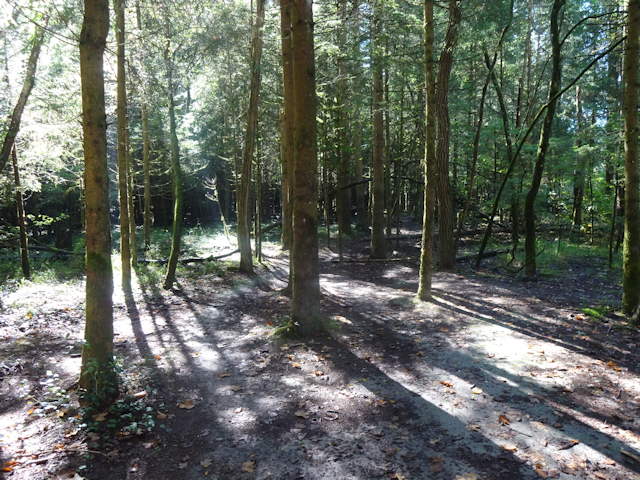
The path beyond that is a reasonably well-maintained trail that is neither wide nor narrow. It's actually quite an unusual size for paths, which normally are either wide enough for a car, or a person, with little in between. However, this one is roughly wide enough for two people to walk side by side, and no wider.
It is here that I notice that something appears to be missing: The escarpments that have been flanking the Isar to either side for some time now are suddenly gone. Apparently, I have now passed through the Isar's narrow drainage valley south of Munich and am now in an area that probably was once a lake before the Isar eroded an outlet through said valley.

By now, it is just about lunchtime, and conveniently, there's a bench right next to the path with a beautiful view on the Isar, which flows by rather calmly, with barely a ripple on its surface. For lunch, I have my usual combination of a sandwich and Müsli bars.

Oh, and speaking of lunchtime... with my almost vampiric sensitivity to sunlight I naturally take precautions to protect myself from Radian's wrath. One of those is the liberal application of sunscreen. However, ever since I got that sunburn in the rain while cycling to Ingolstadt (see A Song of Rain and Sunburn), I have taken additional precautions and equipped some Cycling Gloves of Sunlight Protection +5.

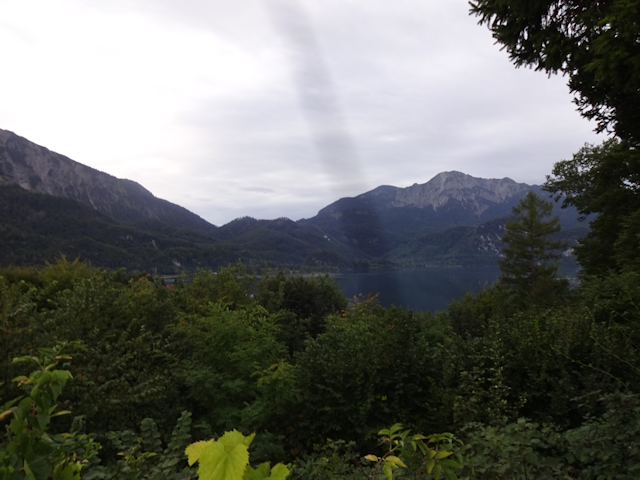
A wise precaution, for soon enough the path leaves the protection of the trees, and I find myself out in the open, cycling along the Isarkanal (well, one of many thusly named stretches with the same name) near the Floßrutsche Mühltal ("Raft Slide Mill Valley"). It is here that this arm of the Isar is dammed up to a sort of narrow lake, and it is here that I finally get to see my ultimate destination in the distance: The Alps!

From here, the going becomes easy for some while as I get to follow the Isarkanal by a straight and level paved road for approximately 8km, and while such a straight path might be boring to follow all day, after what I've been through today already it makes for a welcome and refreshing change of pace.

Along the way, I come post a signpost pointing towards the famous "Draussen" ("Outside")...

...as well as the Ickinger Wehr ("Cornery Weiry"), which is where this particular Isarkanal branches off of the main river. Interestingly, part of the weir is boarded-off in a rather ramshackle way. I also like the "entry prohibited" roadsign above.

After that, the road turns left into the forest, cutting off a meander of the Isar, and I subsequently achieve my greatest distance from the river ever since coming down the slope of Sendling this morning. Incidentally, I also realize that apparently this particular route is very popular with inline skaters, because I see almost as many of them as E-Bikers.

A short time later, my time at the eastern bank of the Isar is coming to an end as I approach my destination for the day. I cross over the Isar by means of the Marienbrücke ("Mary Bridge"), which is adorned by an Indic-seeming statue that presumably is supposed to depict Mary and an infant Jesus.

It is also from atop that bridge that I espy the first, last and only windmills I should see on my entire ride. Have I lately complained about how Bavaria clearly has too few of those?

Having crossed over the Isar, I am now in a V-shaped wedge of land demarcated by the Isar, and its largest tributary, the Loisach ("Stream of Lugus"), with the confluence being just a short distance to the north. The Loisach, by the way, should yet be of relevance later during this petal.

Anyway, right after crossing the Isar I take a left and head into the forest following the river on its western bank.

Some distance into the forest, this sign gives me pause, warning of 300m of rough terrain ahead for bicyclists.

However, after seeing the path ahead, I can only chuckle and say: That's not rough terrain...

...that's rough terrain! (see Interlude ~ Project Petal Part 5 ~ The Tri-day Two-hundred Tour)

In fact, the narrow bridge across the (kinda pointless) Loiasch-Isar-Kanal slows me down more than all of that "rough terrain".

After that, I enter Waldram ("Forest Raven"), and with it the first town ever since I started cycling along the Isar (which was another reason why I wanted to avoid Grünwald).

There, I pass by the Hotel Mama, which is not only always open, but also has a very interesting fence.

From Waldram, it's only a short bit through the forest...

...and then I reach Geretsried, where I promptly come across an interesting gate-house.

Now, since it's still only 15:30 in the afternoon, I have some time to kill before I can check into my Airbnb place, so I spend that time looking for Geocaches around Geretsried. Knowing I might get here somewhat early, I literally saved every single Geocache in the area in my app for just that occasion. The search quickly leads me into the nearby forest...

...which very quickly turns into another very good instance of that's rough terrain!

After making my way through there, I am quite happy to see the straight roads of Geretsried again.

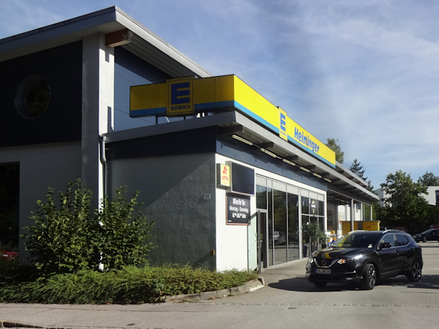
Still having some time, I drop by an Edeka supermarket along the way to gather supplies for tonight and tomorrow...
...and on my way from there to the Airbnb, I come past a humorous fence sign that translates into "Beware of the bitty dog".

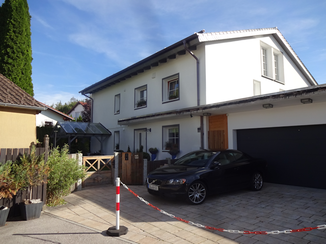
After that, I arrive at my Airbnb place for the night, which takes the form of a big single-family house (which probably explains why they have rooms to spare).
Thus, my ride to get here now has come to an end, and until I depart again the next morning I should be...
The Guest of Geretsried
12-Sep-2022 - 13-Sep-2022
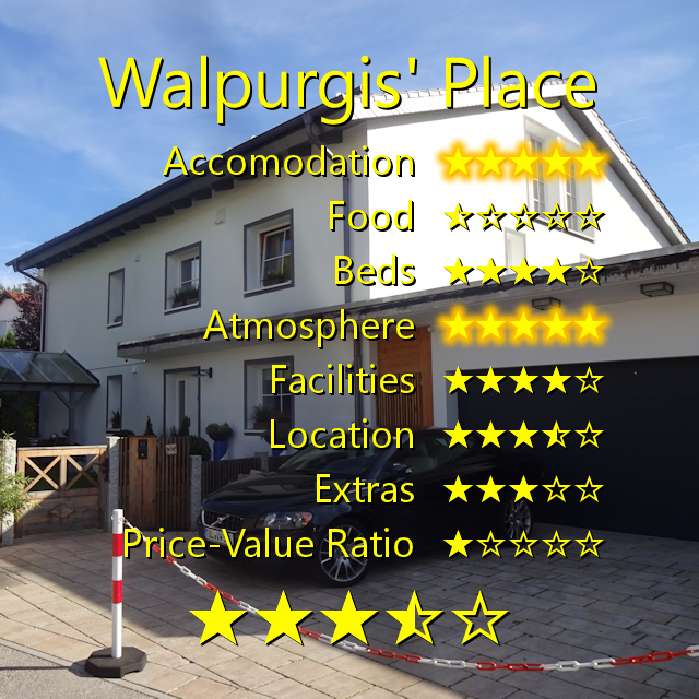
My host - a nice elderly lady with the quite epic name of Walpurgis - greets me at the door, and we end up having a nice chat about my travels before she shows me to my room, which is neat and of decent size.

I also have my own private little bathroom...

...as well as a kitchen. Unfortunately, that one is currently out of order, because apparently it only gets "booted up" for guests staying longer than one day.

That is quite unfortunate, because I already bought myself some canned food that I was planning to warm up and looking forward to for dinner. Luckily, Walpurgis is quite agreeable, and after I explain the situation to her allows me to use the upstairs kitchen instead.

Another nice gesture is the welcome biscuit. It's such a little thing, but such tiny courtesies make me feel very welcome and at home. As so often, it's the little things that can make a lot of difference.

This place also has character! For example, it has a really old-looking map of Prussia hanging on one of the walls. Originally associated with Germany, the area depicted on the map is today part of Poland, Russia and Lithuania.

Anyway, before long I come back to my host's offer and use the upstairs kitchen to warm up my can of Hungarian goulash soup. Normally I like to cook for two days on my Petal Rides, but this time around I can't very well lug the fridge around as I cycle to my next destination, so one meal per stay place it is.

Afterwards, I set up my trusty laptop Liete on the table in my room and log the day's ride before going to bed in preparation for tomorrow's ride.

The next morning, I get up early, by breakfast taking the form of a Zimtschnecke ("Cinnamon Snail") and a Laugeneck ("Lye Corner"). The latter is a novelty to me, and not a bad one. It's made of brioche dough and covered in lye, making the ultimate result seem like a mix of croissant and pretzel that is triangular in shape.

Altogether, this was a nice place to stay. I had my own private mini-apartment with a bathroom, the bed was comfy, and the free WiFi worked. Food was not included as is usual for Airbnbs (why do they then call it "Air Bed and Breakfast though?), but I'm giving a few points for the complimentary biscuit. The atmosphere was very familiar, and the area, while somewhat remote, very nice. Maybe it was just a little bit too cool for my taste (for some reason, I always end up feeling quite cold after cooling down after a tour like this), but at least I was able to warm myself up with some warm goulash from the upstairs kitchen. All in all, this was clearly one of the nicer places that I stayed at.
And then, not even 16 hours after my arrival, it is already time to bid this place farewell, and be on my way. A shame, really, because neither the next day nor night should be very pleasant for me.

At this time, I am yet cheerful and optimistic, looking forward to finally attaining my long-kept ambition today. Little should I anticipate that what will wait for me is...
Woe at the Walchensee
13-Sep-2022Distance: 69.0km
Ascents: 540m
Duration: 8.25h
6/8🎁︎
I get a relatively early start, with the sun not yet risen, and the moon still out as I depart from Walpurgis' place at 7:00 in the morning.

Today, my plan is to cycle up the Isar all the way to Lenggries ("Long Gravel"), and from there up one of its smaller tributaries, the Jachen ("Water") through its valley, which is known as the Jachenau ("Water Meadow"). Since the Jachen's origin is the Walchensee ("Foreigners' Lake"), that should inevitably lead me to my major goal for this petal. After that, I plan to cycle around the southern corner of the Walchensee, so that it's included in the petal, and then head north over the Kesselbergpass ("Kettle Mountain Pass"), and then down to the Kochelsee ("Simmer Lake"), where my next night quarter awaits. At least that's the plan.

On my way out of Geretsried, I pass through a strip of forest next to the main road...

...and then pass over the Isar by means of the Tattenkofner Brücker ("People's Farmyard Bridge"). Now, whereas yesterday, I only crossed the Isar twice all day, today, I should weave back and forth across the Isar a number of times in a relatively short amount of time. This is the first.

After that, I follow the road for some time. Fortunately, there's a well-paved foot- and cycling path right next to the busy road.

However, before long, I reach a Wasteland where the said roadside path abruptly ends ("Einöd" = "Wasteland").

Eventually, Radian's rays rise over the eastern forest...

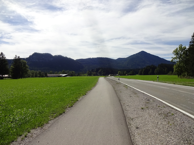
...and on the other side, I see the telltale Walchensee valley being illuminated. This particular valley is always pretty easy to make out, because the valley between the two wooded green mountains towards either side is terminated by bare grey mountains on the far end, making for a nice contrast. My way today should lead me around the forested mountains to the left, and then down the pass between the two forested mountains.

Eventually, I leave the main road behind and continue along an offside-road...

...which leads me up a ledge in the landscape, meaning this is my first major ascent today.

Afterwards, I pass a curious little place named Ratznwinkl ("Rat Corner")...

...and before long reach the locally famous spa town of Bad Tölz ("Bath Valley").

However, both its name and initial appearance are deceiving, for in order to enter it I have to climb one of the steepest hills of this entire ride today.

What's worse: I don't even get to stay at that height, but have to go downhill to the side of the Isar again, which means I'll have to climb for that same amount and more later on. At least the river looks nice here.

At the south of Bad Tölz, I cross the Isar again by means of a bridge that's kinda under construction...

...and on the other side, I finally say goodbye to busy roads as I embark on a scenic part of the Isar-Radweg ("Isar Cycleway") that runs just by the riverside.

The cycleway does not always cling directly to the riverside, however. Sometimes it also cuts through the heaths nearby.

Near Arzbach ("Ore Stream"), I cross over the Isar for the third time, this time via a small cyclist and pedestrian bridge...

...and following the river up the other side, I come by some minor rapids...

...as well as a curious stone circle in the water.

Eventually, I reach Lenggries, and my route leads me through the town for a bit.

And then, I make my way across the Isar a fourth and last time, this time by means of the Bretonenbrücke ("Breton Bridge").
But that should not be my last river crossing for the day. Not by a long shot. Next, I cross over the Schwarzenbach ("Black Stream") while still being within eyeshot of the Isar...

...and only a short time later, I cross over the Jachen, which I should follow for its entire length, all the way to the Walchensee from here.

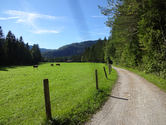
Starting there, the way is pretty idyllic, with quiet rural gravel roads and cows grazing on pastures between green forests in the valley.
Much like the Isarradweg before, the cycling path into the Jachenau also loosely follows the river, sometimes coming directly up to the Jachen...

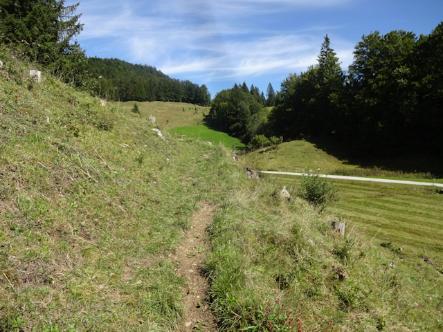
...and sometimes cutting through the forests next to the river. One one such occasion, the path for some reason goes up almost perpendicular to the valleyside slope, resulting in what is officially the most brutal ascent in this entire ride today.

Eventually, the path leads me across the Jachen for the second time...

...and from there, the cycling path continues by the roadside, where it also is commendably well-paved.

Naturally, that also means that it is frequented by e-bikers, even all the way out here.

Around these parts, there's plenty of cows on the slopes, grazing the day away, and filling the air with the sound of cowbells, as is quite typical for alpine valleys such as this one.

Less typical, however, is the fact that the horses, too, are wearing bells. There's not many of those, but I spot two, one in plain sight, and another hiding behind a hedge.
(Click here to view the video if the website fails to load it)
It is around here that I find a nice place to have lunch: A little shady bus stop shelter with a nice view down the valley, as well as the grazing cows. There, I can sit down, safe from Radian's raging rays, and eat my lunch for the day. This time, it should consist of a chocolate croissant, a good old pretzel, and another Müsli bar.

Naturally, I apply copious amounts of sunscreen, and for a good reason too, because it is only a short ways further that I learn that the Jachenau officially bears the cognomen of "Sonnental" ("Sunny Valley").

That name could scarcely be more fitting, for not only is there barely a cloud in the sky, but there's also not single tree along the road for miles at a time.
Moving on, I pass by a farm where clearly someone's offspring arrived recently...

...and then continue further up the Jachenau, this time without a dedicated bike path. Fortunately, the number of cars using this road is blissfully small.

After quite some time out in the blazing sunlight, I finally arrive at a few trees providing a little bit of shade.

Only a short ways from there, there's a little hill with a chapel on top.

Since there's a Geocache on top, I park Jycily at the bottom and then make my way up the totally not bike-worthy path on foot.
At the top, I am not only lucky enough to find the cache, but also get the closest thing to a panorama view that I'm gonna get while cycling through valleys.

Moving on, I cycle through the town centre of the Jachenau...
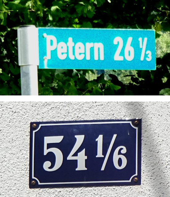
...where I then notice that they have kinda unusual, but also practical house numbers.
Also, I notice a signpost to Venice, which is only roughly 400km that's-a-way.

After that, it's back into the forest, and up the final ascent before the Walchensee. Cycling up the side of the Fischberg ("Fish Mountain") - which restricts the drainage options for the Walchensee to the Jachen - is exhausting, but also kind of exciting, as it symbolized the final push before I reach the main goal of this ride.

Eventually, I reach kilometer 0.0 of this road, which is kinda interesting, because the road clearly continues beyond this point. Does that mean I'm going into the negative now?

After clearing that final ascent, I cross the Jachen for the third and last time, though there's so much reed that you wouldn't even know it's there if not for the bridge. And there, in the distance, I can already see the shore of the Walchensee!

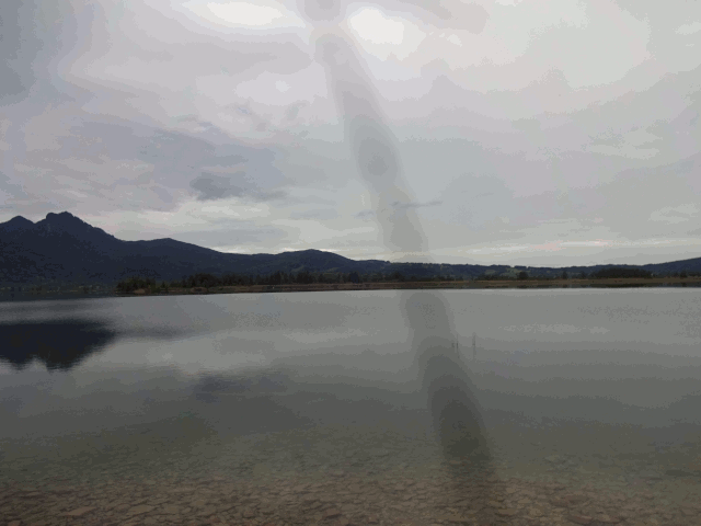
And then, I'm finally at the shore of the Walchensee! A clear, azure lake nested between the mountains, and even though I'm not that high up (around 800m), it still somehow feels like the sky is noticeably closer here.

From here, I follow the road around the south side of the lake, and for once, the road clings to the lakeshore pretty continuously.

Roughly halfway around the azure lake, I get a reasonably good view of the Kesselbergpass on the northern end. I plan for this to be my final ascent for the day, and then it's down all the way to Kochel. I am already looking forward to "caching in" all the meters of altitude that I have worked so hard to "save up" until now.

At the southernmost tip of the Walchensee, I come across the Obernachkraftwerk ("Upper Stream Power Plant") of the Bayerische Landeselektrizitätsversorgung ("Bavarian National Electricity Supplier"), which is one of the two power plants connected to the Walchensee (the other being the Walchenseekraftwerk, which is located at the northern shore and generates its power by diverting water from the Walchensee to the Kochelsee).

It is only there that I officially leave the Jachenau, which is kinda strange because it feels like I've left it when I arrived at the Kochelsee. But apparently, the geopolitical boundary of the Jachenau stretches all the way out here, just before the road from Wallgau ("Wall Meadow").

That road is a big and busy road, but fortunately, there's a little path by the lakeshore that I can follow. It's a bit bumpy, but I'm sure it will be fine.

Whereas the main road takes a more direct route and passes over a pass to the left of a hill known as the Katzenkopf ("Cat Head"), this path passes the Katzenkopf to the right, and only cuts off a small bit of the peninsula, leading me through a few more idyllic meadows.

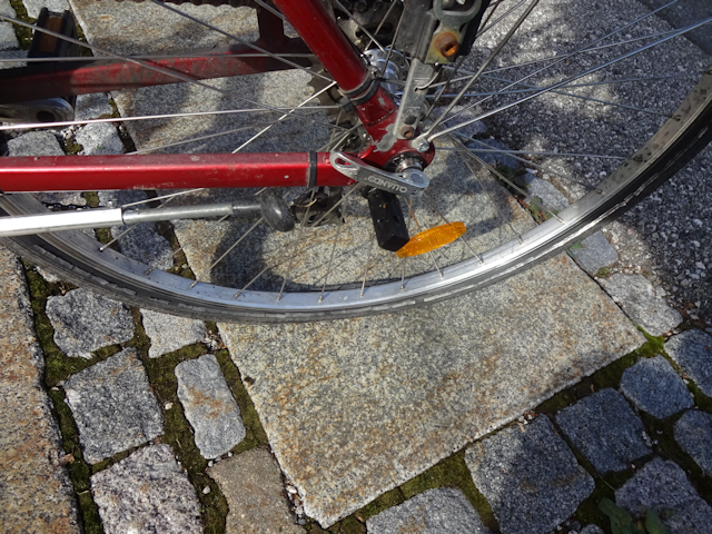
And that should be the final pleasant experience for the ride, because as I return back to the main road I notice that I have contracted the biker's bane: A flat tire! And in the notoriously difficult-to-repair back tire too!

Fortunately, I was prepared for just such an eventuality, and have brought all the essentials to fix this: A can of puncture repair spray, manual repair materials, as well as a compact hand pump. The repair spray is the first thing I try, and at first it seems like it worked.

As such, I manage to get as far as the very nearby town border of Walchensee...

...aaaaand then the tire is flat again. So much for that fancy repair spray. I knew it sounded too good to be true.
Now, fortunately I managed to make it far enough to be close to the local tourist information, and fortunately I come calling during it's opening hours. It's clearly Tuesday, and it's 15:20 now, which falls exactly within opening hours. So I hope they'll be able to help me out.

However, unfortunately, there's another notice saying that precisely today, the tourist info is closed, and only during the afternoon hours for reasons of "the universe clearly hates my tail".

Fortunately, there's a bike repair station just outside of the tourist information, and while I am of limited confidence that I'll be able to repair a puncture in the back tire on my own, I figure that with the options being as limited as they are, I might as well try.

And so, I get started with my valiant, yet ultimately futile repair attempt, adding screams of rage and shouts of frustration to the wonderful ambient scenery of the Walchensee.

Unfortunately, it turns out that the puncture is in the single worst possible place, namely at the base of the valve, where it is notoriously difficult to fix. Somehow, my tires always end up getting a puncture there. I wonder if I'm doing something wrong. Now, normally, this would be where I'd either let a professional handle this, or change the whole tire, the problems with those things being:
- There is no bike repair shop up here in Walchensee
- I don't have a spare tire, and there's no place that sells them here (at least that I know of or can find on my map, and the tourist info is valiciously closed)
- And even if I had a spare tire, I wouldn't have the courage to unhinge my back tire from the chain-and-gear, because I just know I wouldn't be able to get it back on again
So, I just try to get it fixed the old-fashioned way, with a patch. Looking at the result, I just know that it's not gonna work, but it is also the best that I can do.

And not work it does. Fortunately, I have yet one last trump card that I can play, and that is my ADFC-Membership Card (ADFC = Allgemeiner Deutscher Fahrrad Club = Common German Cycling Club). That one features and emergency number to call, and since I tried everything within my power and am as such officially stranded here, I figure this qualifies as an emergency.

Unfortunately, it turns out that my phone has different plans, and refuses to patch through the call. That is, I can start the call, but it immediately hangs up upon dialing for some strange reason. This is even more annoying since the tourist information is regrettably closed, so I can't ask them to call for me either, and once again I become painfully aware of my social limitations as I can't bring myself to just ask a passersby.
The only helpful thing about the tourist information, really, is that it provides free WiFi, so I can at least patch through and S.O.S. message to my father. Not wanting to hang out here, I write that I'll try to reach my night quarter in Kochel somehow, and that if he doesn't hear again from me until 19:00 I'll probably be in need of help.
With these words sent, I head out on the road again, this time pushing my bike through the town at a crawling pace.

As I do, I pass by a Viking village which was used as backdrop in the 2009 movie "Vicky the Viking". I hadn't know that was here, and if things had gone one or two less degrees of wrong today, I might have even found it interesting. As things are, however, I only take it in stride as I push poor injured Jycily past.

Eventually, I reach the bus stop, where there's already a bunch of people waiting. This fills me with confidence that a bus is soon to arrive.

And arrive it does, albeit with considerate delay if the timetable at the bus stop is still up to date.

Next, I need to convince the bus driver to let me take my bike down to Kochel. Fortunately, after detailing my plight, he allows me to ride, and I can jam in my bike into the space for wheelchairs. With nothing to secure it, however, I have to stand next to it to keep it from falling over for the whole ride.

Meanwhile, the bus is rather full, and most seats are taken anyway.

Thus begins the last leg of today's trip, albeit in a wholly unplanned manner. Instead of taking the final climb over the Kesselbergpass and then enjoying a 3km-long downhill segment, I have to stand in the bus and keep my disabled bike from falling over. At least I have one hand free, so I can take a video of the ride. At first, we ride along the lakeshore until we reach Urfeld ("Ancient Field"), the village at the northernmost point of the Walchensee. Then the road takes us up the Kesselbergpass, giving us brief glimpses of the Walchensee from above through the trees. The pass itself is mostly covered by trees, and once on the other side we also get only a few short glimpses of the Kochelsee below through the foliage. There's a lot of zigs and zags on the way down, but eventually we arrive in Kochel, and I've managed to avoid falling over even once.
(Click here to view the video if the website fails to load it)
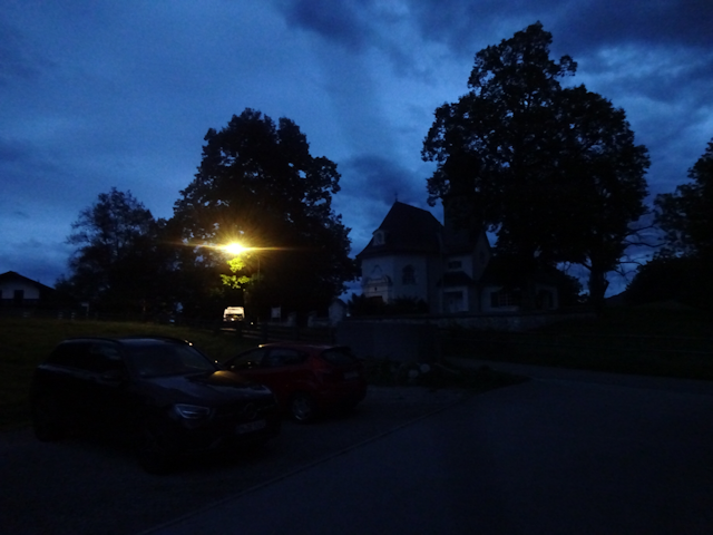
Once in Kochel, I am in luck insofar that the bus has a stop right across from my stay place for tonight: The Cafe & Hostel Berg Blick ("Mountain View").

And thus, my ill-fated ride today comes to an end. I still covered the whole distance and even managed to stick to my precise route, but could not do it all by bike as planned. Also, the bus ride meant I had to skip out on all Geocaches on the last segment.

As such, my height profile is woefully incomplete, lacking the climatic final climb to the Kesselbergpass, and the subsequent blissful downhill ride to Kochel.

By contrast, here's how I intended for it to look, but that will now forever remain a dream. Even if I should ever intend to complete this petal now, I will not do it by the same route. It will be a different ride. And this one shall forever remain broken.

At this point, I still have vague hopes that I will somehow be able to resume my ride tomorrow. However, as fate would have it, I should remain...
Kneecapped at Kochel
13-Sep-2022 - 14-Sep-2022
My check-in is already a bad beginning. First off, my host isn't even there in person. Instead, there's only an employee of the hostel, and she asks me if I have completed the online check-in. What online check-in I wonder? Not only is that spectacularly unusual for an Airbnb, but I also didn't get a message about that, contrary what the employee insists on. In the end, there's a lot of back and forth, with the employee texting my host and all, and after roughly half an hour, she finally allows me to check in. Fortunately, I am allowed to use the WiFi before that, so I can tell my father that I arrived in Kochel safely.

With this being a hostel, the accommodation naturally only consists of a bunk bed in a dorm, but I figure for one night that's enough.

However, as it turns out, the whole place is kinda ratty, which first becomes apparent through the bedsheets, which have holes in them.

Next, the eject slot for my coin locker is missing its floor, which means that every time I open my locker the coin falls to the floor and goes on an exciting journey all across the dorm floor.

The toilets sport a bit of humor, or at least they would, if the writing hadn't come off partially.

And finally, there's the laptop-friendly workspace. Since the hostel doesn't even have a common room, I have to settle for a table-bench on the patio.

Oh well, at least it's not raining, and this is clearly the best view I've ever had while updating my maps.

The hostel also features dinner options with tasty burgers... or at least it would if it wasn't Tuesday and as such "the universe clearly hates my tail"-day. Come to think of it, the last time such a fiasco happened was also on the second Tuesday in September, and there were lakes involved as well (see Book II ~ Chapter 13 ~ Daring Daisen). In the future, I should probably be more careful about that combination.
Anyway, dinner! With the hostel having blooped out as an option, I head into town...

...aiming for an Italian restaurant that's only a few minutes' walk away. Unfortunately, it turns out that it's full on account of today still being "the universe clearly hates my tail"-day.

Fortunately, there's a small diner by the name of s'Hütterl ("The Cottage") right across from the restaurant, and they even still have free seats.

Not only that, but they also win several points of flair, first for their cool menu...

...and secondly for the animal company. Not only is there a cool cat straying around the tables...

...but they also have a little dog who is eager for scritchies.

And to make a good dinner perfect, they even have the burger that I've been looking forward to all day.

Back in the hostel, things become more frustrating again. First, I organize a call with my father, and it turns out that while I can't make outgoing calls for some reason, I can still receive incoming calls. Knowing as much, we organize for the ADFC to call me. Unfortunately, it turns out that they are unable to help me on such short notice, and since I am now "safe" for the night, they say they are going to take care of it tomorrow, as in, around 9:00 in the morning, which is already about two hours after I intended to depart.
As such, I go to bed with a sinking feeling. At it should get worse from there. My roommates, all older than 50, turn out to be a challenge worse than anything I've ever faced in any dorm I've stayed in all of my travels. Specifically, they neglect to turn their phones to silent for the night, and so, every few minutes there's a loud "PLING" resounding through the dorm, paired with a vibration-on-desk noise. I ask them to turn it off, but am simply ignored. Frustrated and angry, I end up prowling the dark dorm, poised and ready to brutally massacre whoever is responsible for that, but naturally, the sounds stay silent precisely until I return to my bunk and can no longer pinpoint the precise location.

Somehow, I manage to make it through the night without murdering anyone. Yet the next morning, I get woken by another PLING-vibration sound while it's still dark outside.
I'm still tired, and I want to sleep. But I know fully well that that won't be possible with those valicious people in the dorm, so I get up and dressed in the dark, then head out for...
A Lakeshore Lap
14-Sep-2022Distance: 3.5km
Ascents: 80m
Duration: 1.25h
It's 6 in the morning, which means I have 3 hours upwards to kill before I'll hear back from the ADFC. I could have been out on the road in less than one hour, but alas, circumstances should not permit it. As such, I know I can take my time for a short lap around Kochel, starting with a bakery to get breakfast, then climbing the Aspenstein ("Aspen Stone"), and finally walking back along the shore of the Kochelsee.

Just outside of the hostel, there's what I assume to be the coat of arms of Kochel depicted as a colorful glass shard arrangement.

After that, I make my way through a few dark backroads...

...and then arrive at the Brotschmiede ("Bread Smithy").

There, I pick a Butterbretze ("Butter Pretzel") and Quarktasche ("Curd Cheese Turnover") for breakfast while admiring the stylish furnishings.

By the time I am finished with breakfast and continue on my lap, it's already bright outside.

Also, rainy. Fortunately, it's only Lv2 rain, so I am confident that I can weather that much. Also, it sort of fits my current mood.

Despite being a resort town of sorts, Kochel is still very much a village, and as such a more rural part of Kochel is only a few minutes' walk away.

As I walk through these parts at the foot of the Aspenstein, I meet a number of sheep and goats...

...and then proceed to climb the hill by means of an idyllic staircase.

I figure if I can't use Jycily, then I might as well walk paths that would otherwise be closed to me, and although the staircase eventually gives way to a road, the gradient of said road makes me very glad that I'm not on my bike right now.

At the top of the Aspenstein, there's the eponymous Schloss Aspenstein ("Aspen Stone Palace"), which presently houses the Georg von Vollmar academy for civic education.

From there, I can get a view on the Kochelsee and the Kesselbergpass in the distance. The lake is barely visible since it only reflects the greenery of the forest on the far shore.
Looking closely, I can also make out the buildings of the Walchenseekraftwerk on the side of the Kesselberg. I still remember that my grandfather once took me on a sightseeing tour here, though I can't really recall anything of the tour itself. That must have been almost 30 years ago now.

After taking a well-maintained road to get up the mountain, I now seek balance by choosing a more adventurous way down on the other side. This takes me through the forest, and while definitely not bike-worthy, on foot the path is easy enough to traverse.

When I emerge from the woods, I find myself right outside of the Kristalltherme ("Crystal Spa"), which I suppose is a local attraction of sorts.

Yet it holds little attraction for me, and I rather prefer to go down to the lakeshore, and let my gaze wander over the Kochelsee. The Walchensee up beyond the mountains on my left, the outlet feeding the Loisach beyond the bend on my right, and me in the middle by the rainy lakeshore, stranded. It has a certain kind of sad and solemn beauty to it.
Idyllic though the lakeshore path might have been, it is rudely interrupted by the Kristalltherme standing squat in the way. Fortunately, there's a tunnel taking the track through the Therme's testines.

Emerging from the far side, I notice that the rain is getting somewhat stronger. Neither I nor the lake birds mind that a lot, however.

Turning my back towards the lake, I next walk a narrow path between a kindergarten and a pasture, which will eventually take me back to the hostel, and as I do, the rain gradually lets up.

Said pasture, by the way, is quite populated. A whole herd of goats is easily visible, as well as audible, because they, too, wear bells. And as the goats are quite active, the air is filled with the jingling of goat bells for quite some distance all around.
(Click here to view the video if the website fails to load it)
A short time later, I arrive back at the hostel, and it's barely 8:00 in the morning yet. Thus, I make myself comfortable in a chair on the front porch and kill some more time by learning Japanese while waiting for the call from the ADFC.

It takes until 9:15 before the ADFC finally calls, and by then, I am reasonably edgy. And as feared, they have bad news for me. Pathetically, they have failed to organize a repair mission. Makes me wonder why I even pay my membership dues. Where's bicycle repair fox when you need him?

So, here I am, with my trusty bike Jycily still incapacitated...

...and me having nothing to show for my repair efforts but a pair of stained pants. Incidentally, I also got some of that puncture repair spray on my pants, and the stains from that should henceforth valiantly defy any rain, so I suppose I got at least something good out of it.

But as it is, I am now out of options for continuing my trip, and that means the second half of the horse petal is now officially...

And with that, all that's left for me to do is tuck in my tail and embark on...
The Rueful Return
14-Sep-2022Before I leave this place, let me quickly pass judgement on it. For some reason, that's the only term that comes to mind.
The accommodation was clearly the worst, a dorm with noisy roommates and no proper workspace anywhere in the whole hostel. I've had better accommodations on Japanese ferries! Food was not only not included, but the advertised burger bar was closed as well. The bed itself was okay, but the sheets had holes in them. The atmosphere in this place in general was not very pleasant. The bathroom was shared and also kinda crappy, as were the lockers, and then there were the completely pointless check-in complications. On the plus side, the free WiFi worked, the area was definitely nice, and there was a bus stop right outside the hostel. The price, meanwhile, was a total rip-off for what was offered. All of that makes this place the third-worst I've ever stayed at, surpassed only by the Nikko Park Lodge and the Ishinomaki Long Beach House (both see Book II ~ Chapter 5 ~ A Trip Together). I sure wish I had been able to find a place as nice as Walpurgis' place around here...

It goes without saying that I'm quite happy to depart, even if that means I have to push my bike all the way to the station. Before I do, though, I drop a message to my father, asking if he can pick Jycily and me up at the Pasing station of Munich.

Fortunately, that's not very far. It's basically just down the main road for about a kilometre or so, and then I'll be at the station.

Along the way, I happen to push Jycily past a bicycle shop. It goes without saying that it's closed today, because apparently "The Universe Clearly Hates My Tail"-day begins and ends at noon rather than midnight. It does feature an inner tube vending machine, but I still don't feel confident enough to change the inner tube of the back tire. I do make a mental note about increasing my bicycle repair skill the next time I level up though.

Shortly thereafter, I arrive at the Kochel train station, which looks fairly new, yet still has a rustic charm to it.

This is one of those definite terminal stations, though there's still plenty of buffer between the bumper and the lakeshore.

And now, I am in luck for once, though I should not realize how much so until my father tells me later. Not only do I arrive right in time to comfortably buy a ticket for both Jycily and myself and still catch the train with ease...

...but I also arrive just one day after the railway line's re-opening following extensive repairs to the tracks after a major railway accident in this area. Having had no intent to take the train I had not paid any attention to its availability whatsoever, but with things turning out as they did, this is a real stroke of luck.

And thus it happens that Jycily gets to ride the train for a change, and since this train was designed for carrying bikes in addition to passengers, it even features a designated bike space where I can secure Jycily with just a little bit of creativity.

The train is relatively empty at first, and should not get much fuller all the way to Munich. I suppose there aren't many people who need to get from out here to the big city at 9:45 on a Wednesday morning.

This train ride should first take me north to Bichl ("Stream-let"), and then northwest Seeshaupt ("Lake's Head"), where I last crossed through on my ride to visit Vulparion (see Book III ~ Chapter 14 ~ Project Petal Part 3 ~ A Verily Vulpine Voyage). After that, it's only a little bit further north till we hit Tutzing ("Point Kin"), and from there on we only stop in Starnberg ("Starling Mountain") before arriving in Pasing.

Riding the train, we soon leave the wedge of mountains separating the Isar from the Loisach behind, and then cross the latter as we head for the Starnberger See. Forests, fields and pastures - some of them with cows - dominate the landscape, and before we reach the big lake. We also pass the Au-Weiher ("Oh Dear") along the way, and then the Starnberger See finally comes into view in the distance. The train doesn't actually get close to it until all the way to Starnberg, and after that it doesn't take long before we reach Munich.
(Click here to view the video if the website fails to load it)
At the Pasing station, my father already stands ready to take me and Jycily to my local trusted bicycle repair shop, and after that, he drops me off back home. Slinking back to the Fox Loft without a bike was not the plan, but I suppose it can't be helped.

And thus, this failure of a ride comes to an end, and whereas I had hoped
to return physically exhausted but mentally refreshed, I now find myself
mentally exhausted instead, even if I'm physically okay. All in all, this
was definitely not an enjoyable experience, but at least I managed to
attain my goal of reaching the Walchensee by bike, even though getting
back was another matter entirely?
The Road Ahead
And now? Well, stuff should happen, but more about that in the next chapter. However, let one thing be said, namely that I make good on my resolution to improve my bike repair skills: Useless thought the ADFC might have been out in the field, at least it offers nice DIY courses on how to fix and maintain your bike, and so I book one of them almost right away, and participate a few weeks thereafter.
The takeaways from there? For one, I know now how to change a back tire, but I also know what likely caused this particular type of puncture: Namely too-low air pressure. If the air pressure in the tire is too low, the bike might still run fine, but every time you brake, the inner tube slips a little, yet the valve remains in its hole, getting more and more skewed over time. Eventually, the stress becomes too much, and a hard-to-fix puncture ensues. Knowing that much, I now put a monthly Jycily-maintenance-day in my calendar, where I not only check the air pressure in the tires (4.5-6 bar is recommended), but also grease the chain. Let's see if that helps. And if not, I'll be even better prepared the next time something like this happens.
Anyway, future rides are one thing, but there's also another. I'll tell you about it soon, so stay tuned for the next chapter of the Travelling Fox Blog!
No comments:
Post a Comment