Originally, I had planned to go back to Honshu after my month in Hokkaido. I had planned to go straight there, not to go past the eastern Cape of Nossappu, and not to incur 30,000¥ in rental car charges. However, all that changed for reasons which are to become apparent Real Soon Now™. So get ready for…
The Eastern Escapade
With my plans changed, I am now on the verge of embarking on an extended four-leg trip all the way to the eastern tip of Hokkaido and back again.

To do so, I rent a car near Shin-Sapporo Eki. This time my supplier is a company by the name of Orix.

My ride this time is a cute little Daihatsu Move, which – just like the car Robert and I rented in Shiroishi (see Book II ~ Chapter 5 ~ A Trip Together) – is a special class of car known as Keijidousha (軽自動車 “light automobile”). These cute little cars receive tax and other benefits in exchange for complying with certain regulations: They may only be 3,40m long, 1,48m wide, 2m high and have at the biggest a 660cc motor with 64 PS. They are also notably fuel-efficient. For example, on my entire 1338 km long trip I should only use 48.29 litres of regular fuel, and incur a total of 7,321¥ in fuel costs. That’s an amazing 27 km/l, or 3.6 litres per 100 km, and through mountainous terrain too! Put in financial terms, that amounts to not even 6¥/km.

And all that considering that this car has a good AC, and all sorts of fancy on-board electronics! I already know today that I'm going to miss this degree of efficiency when I'm back in Germany. The drawbacks are that you can’t go too fast or accelerate too quickly with this vehicle, but since the speed limit on Japanese country road is 60 km/h (100 km/h on expressways) and since I'm a rather jovial driver anyways, neither of these drawbacks particularly bother me.

One thing I had to keep in mind while making plans for this trip, however, is that with a speed limit of 60 km/h, the legs of my journey are going to take quite some while to complete. As such, I have made detailed time plans for each part of this journey, the first one taking me…
Leg 1: Through the Mountains
30-Jun-2018
By the end of the first day, I plan to make it all the way to Kitami (北見 “North View”). This 285 km long trip should take me past Asahikawa, and right through the very heart of the mountains of Hokkaido, from almost ocean level up to 1,053 m and then down again on the other side.

Up until Asahikawa I elect to take the scenic Route 12 as opposed to the expressway, not only because the expressway costs money to use, but also since this way I am travelling from Sapporo to Asahikawa on a third route, the first having been the railroad and the second the expressway via coach on my trip to and from Wakkanai (see Book II ~ Chapter 6 ~ A Hokkaido Homerun).

While still inside the city boundaries of Sapporo, I don’t make a lot of progress, and it feels like I'm standing still more often than not.

However, eventually I leave the city behind me and the going gets more smooth from there, although the roads are still crowded compared to what I’m used to from either New Zealand or Shiroishi.

My first break should be after about 2 at the Michi-no Eki Takikawa (道の駅 たきかわ “Road Station ‘Takikawa’”) in Ebeotsu (江部乙 “Bay Section Hook”), located in the Subprefecture of Sorachi (空知 “Heaven’s Wisdom”)…

..where they not only have a pair of casual naked statues standing around…

…but also a Shrine within walking distance of the rest stop – the perfect opportunity to stretch my legs and observe some genuine Hokkaido architecture at Ebeotsu Jinja (江部乙神社 “Bay Section Hook Shrine”).

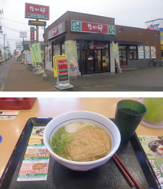
I had originally planned to stop for lunch in Asahikawa, but before I know it I am on a bypass taking me north around the city, and onto Route 39 for Kitami. I pass a Nakau on the other side of the road hoping for an opportunity on my side of the road, but none arises, and eventually I leave the urban area of Asahikawa still hungry. As towns gradually become more sparse as I get closer to the mountains, I eventually decide to stop at the next best Konbini, which just so happens to be a Seicomart, a chain of Konbinis exclusive to Hokkaido.

From my stay in Hokkaido thus far I am used to Seicomarts having a “Hot Chef” feature, but this one apparently is so remote that it lacks even this, and so I settle for a portion of cold but filling soba noodles, which I eat in the car.

Afterwards, the road takes me straight into the heart of the mountains…

…through some rather long tunnels…

…and eventually in the absolutely epic valley of Souunkyou (Sou-Un-Kyou層雲峡 ”Cloud Layer Ravine”). Pictures don’t do this place justice, which looks like it was taken right out of a picture book, movie set, or inspired by some of the more breathtaking Minecraft landscapes.

Even further up, I pass Taisetsuko (大雪湖 “Large Snow Lake”)…

…and finally cross over into the subprefecture of Ohoutsuku (オホーツク “Okhotsk”) at over a thousand metres of altitude.

From there, the road leads rapidly down the mountain, most notably featuring some rather excessive bridge construction that seems to say “we don’t care about the lay of the land, we’re going to build the road here and nowhere else!” Or maybe someone just had a few extra bridges to sell.

And now, I believe I have kept you waiting long enough. It’s time to reveal what Arasawa-san told me back in Asahikawa. I welcome you to…
Kitami Kitakitsune Bokujou
30-Jun-2018
When I told Arasawa-san that I’d been to Zao Kitsune Mura (see Book II ~ Chapter 5 ~ A Trip Together), she told me that there was a place like that in Hokkaido too. At first, I couldn’t believe it. Not one but two fox sanctuaries to await me? But I checked, and it was true. Another such place exists near the city of Kitami, near the heart of Hokkaido.

Back then it was too late to make changes to my plans, so I plotted this very trip as an extension to my stay in Hokkaido for all of June, and now I'm finally here, at the Kitakitsune Bokujou (北きつね牧場 “north fox farm”) of Kitami!

It’s a real shame that it apparently closed down years ago.

So I continue along the vacant valley road until I hit the town of Onneyuonsen (温根湯温泉 “Warm Root Bath Onsen”)…

…which is not only home to a very interesting kind of clock tower…

…but also the new and improved Kitakitsune Bokujou.

And so, without any further ado, I now present to you: The second-foxiest place on earth!
At the entrance, I am greeted by Superfox and a cute fox mascot. It takes me a while to get the attention of someone at the ticket counter since this place is not quite as famous as Zao Kitsune Mura, but on the upside that means that the tickets are even more stupendously cheap at only 500¥ a piece.

And then, without any further ado or lengthy safety briefings, I am admitted to the open fox range. One thing that becomes apparent right away is that the fox density is significantly lower, and as a result the foxes here seem a lot more relaxed and happy.

Naturally, there’s also an Inari Shrine near the entrance.

It comes as a delightful surprise that there are not only foxes around here. Mixed in with the vulpines is also a Tanuki-quartet who more or less get along with their mythological counterparts.
As I walk around, it becomes increasingly clear that both the foxes and Tanukis are quite happy to be here in this little sanctuary, and I can totally understand that. Were I a fox, I would choose this place with its peaceful and relaxed atmosphere of this little plot next to the river over the hectic Zao Kitsune Mura every day.

Maybe most importantly, there are lots of feeding stations all over the place, and the foxes only have to share their food with the Tanukis, and maybe the occasional raven or two. That alone makes for a much more relaxed atmosphere.

Size-wise, the areal of the Kitami Kitakitsune Bokujou is not quite as big as that of Zao Kitsune Mura. It’s on a narrow strip of land next to the river that is between 20m and 40m wide, and maybe 200m long, making for an areal of maybe half a hectare in size. On the plus side, the fact that it’s so long means that the foxes have quite some space to run around.

In fact, since it’s not all that big, I might as well give you a tour of the entire place, foxes, Tanukis and all.
For those who know at least a bit of Japanese, there is also a nice alliteration to be found within the fox run, namely the Kitakitsune no Ki (北きつねの木 “Tree of the North Foxes”).

And for those of you wondering, yes, there is a notable difference between normal red foxes and these North Foxes. Most notably, the North Foxes are significantly smaller – only about the size of cats – which might be a form of island dwarfism. Also their colour is somewhat brighter, and their slender build sometimes makes them look almost like Shiba-Inu. In fact, I probably won’t ever be able to look at a Shiba-Inu again without being reminded about this place.

Eventually, I have to say goodbye to these adorably cute foxes (and Tanukis) however, but not before observing a vixen very energetically licking out an ant colony in one of the tree barriers at the side of the footpath.
Anyway, I’m going to miss being this close to the foxes, but on the other hand I feel like I’ve seen everything there is for me to see around here, so it’s time to move on.

But not without first ransacking the Souvenir Shop that sells everything good and foxy.

This should cost me a little bit over 8,000¥, and if it wasn’t for the fact that all that money ultimately helps maintain this foxy place, I would never have spent that much. However, as it is I walk out with a huge fox plushie by the name of Konda-Chan, a long-sleeve shirt, a shopping bag, as well as a collection of smaller stuff.

From there, it’s only a one-hour drive down the road to reach Kitami. It’s only 33km, but with the traffic getting progressively thicker as I approach the big city in these parts, the going eventually gets rather slow.

Still, that leaves me time to look at my surroundings while I wait at traffic lights. On one such occasion I should take note that the vulpine presence in this region has apparently influenced some of the stores to follow suit…

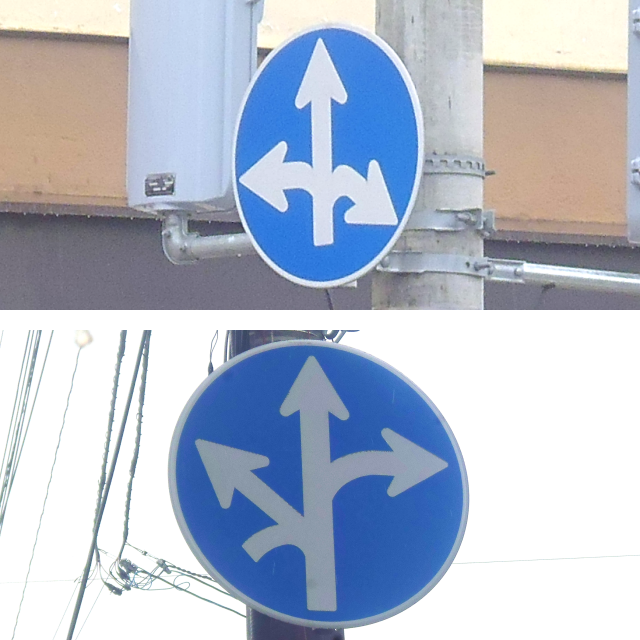
…and on another, I take note of another funny Japanese place name: Kitami-Kitagami (北見北上 “North View North Above”). Maybe I should submit my own name suggestions next time, such as Kitami-Kitagami-Kami-Ookami-Ki-Tami (北見北上神狼木民” North View North Above God Wolf Tree People”) or maybe Minami-Touhoku-Nishi (南東北西 “South Northeast West”). By the way, here in Japan, green signs are for expressways, and blue signs are for country roads.

Either way, it should not take me much longer to reach the city of…
Kitami, the City of Mint
30-Jun-2018 – 1-Jul-2018
At one point, Kitami was a centre of mint export – known locally as Hakka (薄荷 “Diluted Load”) – supplying over 70% of the world’s consumption, and today it is still at the very least a local centre of trade. This should also be the only place of my round-trip through eastern Hokkaido in which I should stay for more than one night. Since I have to pay for my car by the day, I did not want this trip to take longer than absolutely necessary. However, since I really wanted to go and visit Kitami Kitakitsune Bokujou, I planned in a buffer day here, just in case the weather should turn out to not be in my favour.
Anyway, the place I should spend these two nights is the Hotel Crown Hills Kitami, which doesn’t look like anything special from the outside…

…but my room is actually quite nice, featuring a good work space, and the first proper bed I’ve seen since departing from the Hotel Simplicity in Morioka in May (see Book II ~ Chapter 5 ~ A Trip Together).

Like most Japanese hotel rooms, it comes equipped with a “bath unit”, which features a sealed environment for toilet, sink, shower and bathtub. I should make good use of the latter later on.

After making myself comfortable there, I head out right away, not only to visit the nearby Kitami Inari Shrine…

…but also to look for a place to have dinner since it’s already getting quite late by now. There’s quite a selection of bars and taverns around, but nothing quite strikes my fancy. Not even the German Kneipe.

So I continue my search, and find among other things the local manhole cover designs, which are once again different from all others.

Eventually it starts getting dark, and without having found an interesting-looking place around, I eventually turn into the nearest Mos-Burger.

There, I order something that at least sound interesting: The Mos Rice Burger, which uses rice patties in place of bread and features Tenpura and kelp inside.

If you wonder how that’s supposed to work… it just doesn’t. The rice patties break apart as soon as you touch them, and to make a long story short, this was simply the messiest fast food I’ve ever eaten (the taste was okay though).

After that, I return to my room, which has but one minor annoyance: For some reason or another, you have to put part of your key into a slot in the wall in order to enable the lights in the room.

It took me a while to figure that one out, even though it clearly states so on the Engrish instruction sheet I was given.

The next day should start with the above mentioned included breakfast. This time it’s a buffet, so I end ups spending at least 15 minutes deciding what to get since Japanese breakfast buffets offer a somewhat wider selection than their western counterparts.

In the end I use a tactical manoeuvre that I like to call “take a bit of everything”. Not a bad choice, since that nets me a portion of… something… but something tasty. I have no idea what it is, but if I had to hazard a guess, I would say it’s some sort of pickled squid. It’s slimy, somewhat salty-spicy, and runs down the throat like silk. I really wonder what it is called.

Since I already managed to tick the Kitami Kitakitsune Bokujou off the list yesterday, that leaves me with all of today to explore Kitami (and yes, I considered going to see the foxes again, but the weather doesn’t look so bright today, it’s a one-hour drive either way, and I don’t know if my budget can take yet another visit to the souvenir store). And so, I depart on a stray around the city right after breakfast, intending to visit a handful of Shrines and Temples scattered through the city.

Since the souvenirs I’ve bought at the Kitami Kitakitsune Bokujou clearly exceed my inventory capacity and I don’t have a convenient best friend around to carry them to Germany for me this time around, my first stop is the local post office where it barely takes me half an hour to get all the necessary paperwork done to send them home. In the end, sending them should cost me yet another 4,000¥, and I definitely would have been lost in this situation without Japanese skills since the office clerks speak no English at all.

I should spend the following weeks in worry about whether Konda-Chan made it home safely. Even though I paid extra for air mail, it should take over two weeks for them to get to Germany However, in the end, they should arrive safely, and Konda-Chan should get a place of honour next to some older Japan souvenirs of my family brought back by my mother’s biological mother, who passed away before I was even born.

Anyway, continuing on my stray, I should quickly find that the gas pipe covers have cute individual designs as well here. This cute critter must be the mascot of Kitami City, for I should encounter it on all sorts of places around here.

The main focus of my stray is once again to visit Shrines and Temples, and although there are not terribly many of those around here in Kitami, I am nonetheless pleased with what I manage to find.

On the way I also cross a pedestrian’s bridge beneath some precariously low-hanging wires. I could have touched one of them simply by reaching up.

The alternative would be crossing the road at traffic lights, on some of which you have to push the button and wait for green. Knowing if the button has already been pushed is one of those tasks that is not all that easy unless you’re proficient in Japanese. Fortunately my skills are just good enough to decipher that the bottom light is reading “Batan-wo oshite kudasai” (“please press the button”). After that it switches to the top light which reads “O-machi kudasai” (“please wait”).

Eventually, I walk all the way to the outskirts of the city, where houses are gradually replaced by fields. By now the sky has become quite threatening, and I'm glad that my walk is already halfway over.

As I walk along the wooded green banks of the somewhat incorrectly Mukagawa (無加川 “never-joining river”) which joins the Tokorogawa (常呂川 “ordinary spine river”) not even a kilometre downstream, it starts to rain ever so slightly, and I am quite happy that I saw that coming and brought my coat just in case.

With the weather turning ugly and lunchtime approaching, I decide to make an early stop at a store of a chain I’ve been wanting to try out for some time: Hotto Motto.

However, since it turns out they’re only selling Bento for takeout, and the weather really isn’t screaming for takeout, I decide to go to the Nakau across the street and order a good old bowl of Kitsune Udon instead.
While I'm eating there I notice that they seem to have their own superhero mango featuring bowl-wielding warriors fighting against… evil zombie customers with chopsticks???

On the way back, the rain has thankfully mostly let up, which is not only good for me, but also for the parents and children celebrating a festival at a nearby Kindergarten in spite of the weather.

Another thing worth of notice is this interesting bridge-square combination that probably made some architects very happy, as in: I heard you like bridges, so I put some bridges on your bridges so you can bridge while on bridges.

The railway tracks eventually disappear underground, and in their place there is a little park featuring among more park-like elements such as grass, bushes and trees also an exhibit of three old engines.

Moving on, here’s an interesting combination of business ideas…

…and normally I find pubs rather uncanny, but this one clearly is different.

The last things I should come across on my way to the hostel are some really Tex-Avery-esque traffic signs that made driving my rented car here yesterday quite a nightmare in the first place.
I should sit out the rest of this rather rainy day thankful for the comfort of my hotel room and work on my blog. Only in the evening I should go out one last time to get a bite to eat, and – since the rain has somewhat let up by then – also explore a little bit more of Kitami before moving on tomorrow.

Along the way I admire the Japanese’s dedication for putting up signs for what should be obvious, such as this sign reading “no cars”.

Another curiosity are the traffic lights, which not only have a shade-cap, but are entirely covered with a goggle-like glass case. As a result of the reflection, you can also see the colour of lights facing away from you.

I should also come across a few more Buddhist Temples on the way. No Shinto Shrines though.

My destination for Dinner is the closest Sukiya, where I eat a bowl of delicious cheese curry rice. I make a mistake when ordering though and initially order it for takeout. Fortunately, my Japanese (and courage) is sufficient to tell the shop clerks I messed up and actually want to eat in. By the way, I can now say with certainty that Sukiya stores all over Japan have this characteristic “clock tower” shape that makes them easy to spot wherever you go (just in case you somehow miss the bright and colourful displays in the neon jungle of a big city).

Following that, I should return back to the hotel with only a minor detour past a park in order to walk a different way back (and visit another of aforementioned Temples), for tomorrow I should embark early on my trip…
Leg 2: To the Bay of Mists
2-Jul-2018
My day starts with one more breakfast buffet here in the hotel. Unfortunately, there’s nothing of that tasty mystery food on the menu today, so I make do with what I have, and knowing how hungry I got midway through yesterday, I make sure to eat an extra-large portion before I set out.

Before I set out, however, I have to stop at a local gas station to feed my trusty car. It may not consume much, but as a consequence it also only has a 25 litre tank, and while in theory that means I could have gotten away with only two gas station visits, I decide to play it safe and refuel my car whenever the tank gets more than half empty. As a result, I should get to visit a number of gas stations, at all of which I get served by an attendant . There are also self-serve gas stations, but since they are not significantly cheaper (and since I’d probably lose quite some time trying to figure out how to use the automatic pay gas pumps), I choose to go to a station with attendants every time. After all, that’s not something you’re gonna find in Germany either.
Also, in case you are in Japan and wondering about the vigorously blinking price displays at the gas stations: Don’t worry, that’s just another marketing thing to generate attention and pretty much just means “hey, look at me!” The three types of fuel typically sold at these stations are Regyuraa (レギュラー”regular”) in red, Haioku (ハイオク”high octane”) in yellow and Keiyu (軽油 “diesel”) in green.
With my metal mule’s belly full of fuel again, I am then ready to hit the road again.

At first, I should continue along the route 39 for some more time, speaking of which: An interesting relic from olden times is that the distance on all of those roads is measured in kilometres from the local administrative city, in this case Asahikawa.

Whereas my last route was rather straightforward, this leg should be a bit more exciting, taking me first to Abashiri (網走 “Netting Run”) via Route 39, then to Shari (斜里 “Slanting Village”) via Route 244, across the peninsula of Rausu (羅臼 “Spread Mortar”) via Routes 334 and 335 onwards to Attoko (厚床 “Thick Bed”) via Route 244 again, and finally to Nemuro (根室 “Root Chamber”) via Route 44. This leg should be a total of 350km long, and take me 10 hours to complete (including breaks, of course).

On my way to Abashiri, I should encounter a group of maybe twelve bicyclers coming the other way. It makes me wonder what kind of tour they’re on.

Abashiri should also be my first stopover. During the Meiji period, this place used to be a jail for political prisoners. Today, the old prison has been turned into a museum, but there’s still a modern high-security prison around. Since I’ve still got quite a way ahead of me, I don’t have time to visit the museum, but I make a quick stopover to grab a local Geocache.

Also, as long as I'm around I also manage to drop by a pair of Shrines in the area.

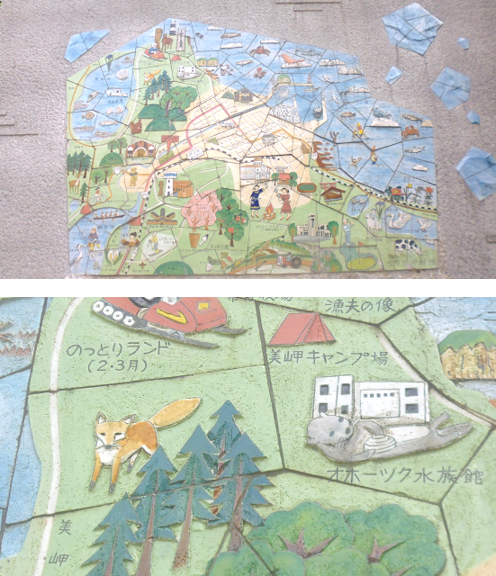
There’s also a really artful area map on the side of the rest stop bathroom. It’s really a shame I don’t have time to explore this area any further.
The next part of this leg takes me along a coastal road along Masuura (鱒浦 “Salmon Trout Bay”)…

…where I should get a good look on the peninsula of Shiretoko (知床 “Wisdom Bed”) and the road leading there which is known as Ryuuhyoukaidou (流氷街道 “Drift Ice Highway”).

From Shari on, my trip continues along Route 334, taking me up to the tip of Shiretoko Peninsula….

…or at the very least within 25km of the tip, since that part of the peninsula is a nature reserve, and the only way you can get there is by boat.

Whereas the road up until here today was rather uneventful, this route should turn out to have all sorts of interesting places, such as the Oshin-Koshin Falls, one of Japan’s 100 most beautiful waterfalls. Its name comes from the Ainu Language and means “Ezo-Spruce Place”.

Not a clearly defined stream running over a precipice, but rather a fan of streams running over a slanting rock face, I don’t think I’ve ever seen a waterfall such as this. Even more amazingly: in total defiance of the laws of nature, this waterfall actually flows upwards, emerging from the ocean and being sucked up the mountainside by some invisible force (just kidding =^,~’= ).
Next up is Utoro, the final town on this side of the peninsula, where they not only have massive rocks all around the town, each dotted with hundreds of seagulls…

…but also the one and only Godzilla Rock!

Also, there’s some really good advice for what to do if you encounter a bear on the mountain road that is to come.

One lone cycler braves the mountain road in spite of the ursine threat. He has my respect, especially considering that this pass is a whopping 738m high, and you have to go all the way up there from sea level.

Along the way I get a great view of Mt. Rausu, it’s 1661m high peak ever-shrouded in clouds…

…and before long, I reach the Shiretoko pass – and with it the Nemuro Subprefecture – from where I get an absolutely magical view of the mist-covered Nemuro Bay, and the contested island of Kunashiri (国後 “Land Behind”) that lies within it.

I say contested, because the island of Kunashiri, as well as three other nearby islands, are claimed by both Japan and Russia. Just like Sakhalin/Karafuto, these four islands of the South Kuril Islands were conquered by the Soviet Union in the final days of World War II. Ever since, Japan has been demanding the return of the four islands from Russia, who holds administrative control over them. In 1956, a peaceful resolution was almost achieved by the Soviet Union agreeing to return Habomai (歯舞 “Tooth Wheel”) and Shikotan (色丹 “Rust Color”) in exchange for Japan surrendering its claim on Kunashiri and Etorofu (択捉 “Preferred Catch”). However, in the wake of the cold war the US intervened and threatened that if Japan were to accept these terms then the US would not return the islands of Okinawa in the south to them. As a consequence, there is no permanent peace treaty between Japan and Russia up to this day, and the South Kuril Dispute remains unsettled.

The road down the other side is quite steep, and although it’s only 14km down, the trip should take quite some while considering that – unlike other drivers who recklessly pass me by – I actually obey the speed limit on what I consider a rather treacherous road.

Once down at the bottom of the mountain, I should totally inadvertently run into yet another spectacle of nature: The Rausu Geyser!

Per so, it doesn’t look very interesting, and since I don’t know when it might erupt and I really don’t have much extra time left on my schedule, I turn around and leave, dropping by the visitor centre, which among other things features a model of the peninsula…

…as well as a list of spouting predictions for the geyser.

And that is when I turn around, run out of the visitor centre, and up the forest path back to the geyser as fast as my legs will carry me, for it’s exactly 12:59 now. Back in High School, I was the fastest sprinter in class, and that trait should pay off now, for I should arrive just in time to see they geyser erupt in all its steaming glory, shooting jets of hot water into the air.
Moving on after this spectacle of nature, I drive ride into the middle of a Matsuri going on at the one day I'm driving through this region. Now I really wish I had the time to stop and have a better look at this, but due to all the stops I made thus far, my schedule is already at its limit.

At the very least I stop for a quick bite to eat, the place being a roadside rest area at the edge of Rausu…

…and the bite to eat being something called a Zangi-Burger, which turns out to be a rather tasty chicken burger.

From there on out, the road should be swallowed up by mists rolling in from the sea in huge waves. Fortunately the visibility should not drop too far for too long.

Also, while I’ve driven through many tunnels at the bottoms of hills during my life using a variety of vehicles, this is the first time I’m driving through a tunnel at the top of a hill.

A little bit further along, the mists should temporarily clear, just in time for me to make a short stop at a roadside rest area, which prominently features a monument thematising the lost four islands.

As for the men’s room, this one is also kinda special, allowing you a view as you go. It’s certainly beats looking at a bland wall.

The road from there on out should hold yet another few curiosities in store for me, such as overly cute wildlife warning displays. The text on this reads somewhat like “Please watch out for field-living animals jumping out”.

And then there’s the place where one of those roadside work organizers asked his boss “Hey, I have one thousand three hundred and seventy eight Kitsune roadside stands in the inventory, what should I do with them?” and that guy replied “Oh just put them somewhere to the east of Hokkaido, plenty of space there”. Much to my delight, as I might add. Especially since this is already on route 44, meaning that I should pass the 1378 foxies on my way back from Nemuro once again.

Eventually, I should pass Nemuro and continue on the road to the easternmost point of de-facto Japanese controlled territory (simply referred to as “Japan” from here on out), and the mists start rolling in once again precisely on time.

As a result, the view on Nosappu Misaki (納沙布岬 “Obtained Sand Cloth Cape”) should be somewhat limited. By the way, if that name sounds familiar, that is because due to some freak coincidence, this place has almost exactly the same name as the northernmost point of Japan I visited, which would have been Nosshappu Misaki in Wakkanai (see Book II ~ Chapter 6 ~ A Hokkaido Homerun).

In spite of the mists, I continue on to the Cape Nosappu Lighthouse…

…and just a little bit past it, to the easternmost end of Japan. Depending on which side of the story you believe, I may be as close as one kilometre to the Russian border at this point.

It’s a peaceful situation. No tourists around, and only a lone cat keeping me company as I take in the serenity of the moment.

Apart from the lighthouse, there is also a number of other things to be seen around here, such as a view spots detailing which items can not be seen in which direction…

…and the Boukyou-no-Tou (望郷の塔 “Tower of Nostalgia”), which probably is not worth its price in these weather conditions.

As for the things that can be seen, there’s this really massive metal arc monument with a flame in the middle symbolizing the burning hope that one day the four islands will be returned…

…Nosappu Kotohira Jinja (納沙布金刀比羅神社 “Obtained Sand Cloth Gold Sword Comparison Arrangement Shrine”), Japan’s easternmost Shrine…

…and what probably is the most unusual phone booth I’ve seen so far.

Now it’s already getting quite late however, and the sun is approaching the western horizon. Thus, I set out on my way back to Nemuro. It goes without saying that the mists should clear about halfway there.

But oh well, there’s nothing that can be done about that I guess. For now, I should look forward to…
A Night in Nemuro
2-Jul-2018
Nemuro is the easternmost city of Japan, and home to about 30.000 people. There, I should stay in a little guest house by the name of Tomaya (苫屋 “Rush-Tatched House”). It’s actually much more of a modern building though.

It turns out to be a primary Share House, and all the other people there are actually staying for a much longer time. Meanwhile I should keep my somewhat sparsely furnished room for only a single night.

My room also comes equipped with a veranda of sorts. However, since it is old and dangerous, I decide not to take it. It wouldn’t have fit into my luggage anyway.

Instead, I scramble and embark on a tour around the city while the sunlight lasts. After all, there I have Shrines to visit, Geocaches to find and food to buy.

This Shrine… is not one of them. It’s located on a barrier island in the harbour of Nemuro and is kinda impossible to reach without a boat.

Instead, I should go and visit Nemuro Kotohira Jinja, which is located on a forested hill just east of the harbour. This Shrine bears the same name as the Shrine at Nosappu Misaki, and that is no coincidence: In Shinto mythology a Kami (神 “god/spirit”) is thought to be enshrined bound to a physical object, and it is possible to “clone” that object, thus creating another instance of that Kami that can then be carried to another Shrine, which is then given the same name as the original Shrine. By the same logic, there are a number of Fushimi Inari Shrines scattered around Japan, each of which are instances of the original Fushimi Inari Shrine in Kyoto.

As it progressively gets darker, I proceed southeast through streets and parks in this small city…

…and eventually arrive at Higashi Nemuro Eki (東根室駅 “East Root Chamber Station”), where I should find my easternmost Geocache of Japan. I also went after two at Nosappu Misaki, but had no luck there. Incidentally, this is also the easternmost train station in all of Japan

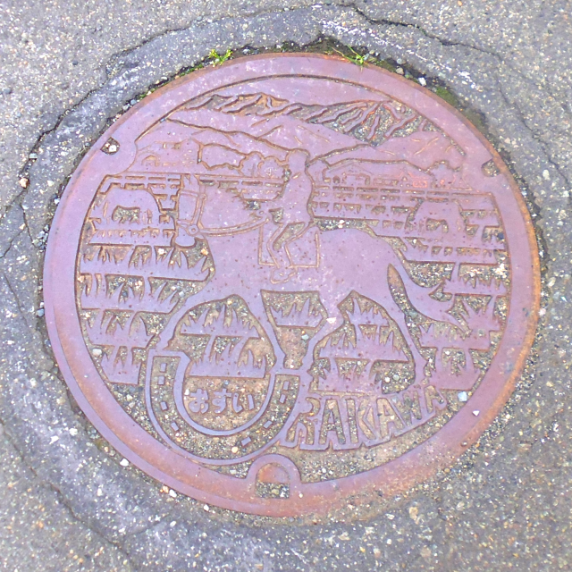
Heading from there to the main station of Nemuro, I come both across a generic Hokkaido manhole cover…

…as well as a more dedicated Nemuro gas pipe cover. It would seem that the mascot of Nemuro is… a toucan of sorts?

Also, it probably does not come as a surprise that – just like in Wakkanai – the road signs are also localized in Russian this close to the border.

By the time I reach the station, it’s already dark, and a number of cats are hanging around what I figure must be a fish restaurant of sorts. Unfortunately, I do not find the Geocache hidden around here either.

I should, however, find a Buddhist Temple by the name of Seiryuji (清隆寺 “Pure Prosperity Temple”) on the way back. Unfortunately, it’s not exactly what you’d call brightly illuminated…

…unlike the road I should take from there to get back to the guest house.

Finally, I should drop by a local Kombini by the name of Taiee (タイエー)…

…where I find something old yet new: Kitsune Soba as cup noodles. I’ve bought and eaten Kitsune Udon from the Aruchan-brand many times before, but this is the first time ever that I see these cup noodles as a Soba variant.

Either way, it’s the perfect dinner for now, and preparing them in the kitchen of the guest house, I’m quite pleased with how the rich, savoury taste of the Soba noodles mixes with the sweetness of the Inari-Age.

Afterwards, I spend some time getting all my maps up to date, and then go straight to bed. Tomorrow should be an early start on a trip…
Leg 3: Along the Long Coast
3-Jul-2018
Today is a rainy day, so I should once again outfit my backpack with the anti-rain cover and hope it goes away.

Since today should feature the longest leg of my trip, I make a point of getting up rather early, namely at 5AM. Not a problem, since the sun rises at 3:42 this far east. Afterwards I eat a quick breakfast in the form of a sandwich, and then I'm already on my way again.

This time, I’m driving through the rain, quite happy to be sitting safe and sheltered inside a car, and not, for example, on a bicycle.

This time around, the route should be a total of 365 km long, and take me 10,5 hours to complete in spite of me not making all that many side stops this time around. My path should take me along Route 44 all the way to Kushiro (釧路 “Bracelet Path”), then Route 38 to Urahoro (浦幌 “Bay Canopy”), and finally Route 336 all the way to Urakawa (浦河 “Bay River”).

Having mentioned the cute Kitsune roadside barrier stands before, I should probably also mention the Hello Kitty versions, as well as whatever those red and green munchkins are supposed to be.

Also, there’s these “Caution Lightning Advisory” warnings all over the place, which I guess make sense per se, but since I’ve been seeing them for the entire 4 days of driving without ever witnessing as much as a single lightning strike, I’ve kinda started to tune them out, which probably defeats their purpose.

As a result of the weather, I should keep on driving for quite a while before making my first stopover during a short break in the rain at Koitoi Beach (which is an Ainu place name, the meaning of which is unknown to me) in the Kushiro Subprefecture, where I would not only not find a geocache, but also take a picture of myself against the sea using a curious fish-shaped camera stand. Also, there are some notably big moths to be found around here.

Not much later, I should make a rather reckless parking manoeuvre in order to visit a Fushimi Inari Shrine by the side of the road. As fate would have it, I also manage to find a Geocache skilfully hidden beneath the Shrine. Inari be praised! =^,^=
Having departed pretty early in the morning, I manage to cover quite some distance before lunchtime. Fortunately, the rain – which I should later on learn caused serious flooding back in Asahikawa – seems to have passed almost completely by the time I reach the Road Station in Urahoro, just after crossing into the Subprefecture of Tokachi (十勝 “Ten Victories”). Much to my delight, there are a number of Shrines within walking distance of the Station, among them another Fushimi Inari Shrine, and this one with foxes!

Once again, this area looks rather interesting, and it's really a shame that I don’t have more time to properly explore it.

Back at the Roadside Station, I am surprised to find proper German baking goods, and am almost tempted to buy one. Almost!

But since I know that this kind of food isn’t really good to eat for lunch, I instead go with a hearty hotdog and fries combo. One of these days, someone should probably tell the Japanese that a proper hot dog is supposed to be inside a bun, and not on top of it. That would make it significantly easier to eat too. As it is, the sausage constantly slides off the bread. However, inconvenience aside, it’s quite tasty, as are the fries.

One thing I might want to mention at this point is the military presence here in Japan. Unlike in Germany, where you hardly if ever see military cars around, in Japan, they are all over the place. Or maybe it's just in Hokkaido due to the proximity of Russia (and let me tell you, those Russians are not joking around either on their side of the water, having stationed advanced anti-air missiles systems on the islands).

Speaking of missiles, there is also a privately-funded space programme going on in Hokkaido. However, it looks like they still have a bit of work ahead of them, as this video from a failed launch as recently as 30-Jun-2018 shows.
My father linked me this recording of the failed rocket start just yesterday, and now guess where I end up completely by chance today?

That’s right. Without planning it, I pass right by the launch site of the failed rocket start from just three days ago, the town of Taiki (大樹 “Large Tree”). At first I can’t believe it as I drive past, and then I turn around and have a look. I can’t get too close, but wonder if that’s what’s left of the launch site there in the distance.

Something more concrete is the Taiki Kuukou Uchou Jokkenjou (大樹航空宇宙実験場 “Large Tree Aviation Space Proving Ground” = “Taiki Aerospace Test Site”)…

…where there’s a little museum about aviation and space technology that’s completely free of charge.

From there, I continue along Route 336 which takes me along an epic seaside road, and eventually into the Subprefecture of Hidaka (日高 “Day High”).

The road also goes through a number of tunnels, all of which exhibit the interesting wet tunnel syndrome. More often than not, as soon as you enter a tunnel, the road turns wet. At first I had thought that this is another curious Japanese custom, but now I realize that this is due to a natural phenomenon: The air in the tunnels is naturally cooler, and since Japan is a very humid country, that causes the water vapour to condensate exclusively inside the tunnels and make the road surface wet. Or put more bluntly: It's actually raining inside the tunnels. Normally, this is barely noticeable, but right here and now the humidity is so high and the temperature so low that I actually have to switch on my windshield wipers whenever I'm driving through a tunnel.

Now it's not much longer until I reach the tip of the southern fin of the Hokkaido-Ray: Erimo Misaki (襟裳岬 “Skirt Collar Cape”).

This place is quite windy, and also free of fog, so I actually get to see a great panorama this time around.
There’s also a rather minimalistic Shrine right at the cape, and conveniently, it’s simply named Erimo Jinja.

Apart from that, there’s the obligatory lighthouse…

…and the somewhat less obligatory underground wind tunnel, simulating the top wind speeds that sometimes ravage the cape.

I also manage to find a Geocache cleverly hidden inside an old wall here, but then it’s time to move on since it’s starting to rain again. Interestingly, the “Animals Crossing” signs around these parts are a little bit different from what I'm used to.

And before long I understand why: As I drive along the road up north, I see an animal by the roadside. At first, I think it is a ginger cat, but then the vixen turns her pointy head my way, and rushes across the street right between me and a truck coming the other way. This would be the fifth time that I've seen a wild fox in my life, and I’m so happy that she managed to get away unharmed. It happens too quickly for me to reach for my camera, but it was somewhere around this road.

Be it by coincidence or fate, I come across Utabetsu Inari Jinja (歌別稲荷神社 “Separate Song Inari Shrine”) only a short while later, where I thank Inari-sama for the safety of the young vixen.

Now all that’s left is to follow the sun the rest of the way to Urakawa, which is the closest I could find affordable accommodation.

Since I departed early, it’s not all that late yet. However, I am still tired after this long trip, which makes me glad that I can now…
Unwind in Urakawa
3-Jul-2018
My accommodation for tonight is the Guesthouse Masago (真砂 “Sand”), which is part of a really cool “family-cuboid”, featuring an Onsen run by the mother, a Ramen-Ya run by the father, and finally the guest house run by the son. I get to meet all three of them right away as I come in the Onsen-entrance to ask for directions to the guest house, which prompts the mother to get her husband from the Ramen-Ya next door to show me the way to the guest house entrance, which is right around the corner.

There, I have a single room with a comfortable bed that would be perfect, if it wasn’t for two little things:
1.) The workspace in there is somewhat adventurous and not very comfortable.
2.) Even with the AC and the fan running, the room is hot. As in “I hate clothes”-hot. I attribute this due to the room being either above the Onsen or the kitchen of the Ramen-Ya below.

Not wanting to spend too much time looking for a place to eat here, I go for the obvious choice and eat at the Masago Ramen-Ya. An excellent decision, since I get treated to a palette of free Gyouza (餃子 “Food Child”) as a service. Those are crescent-shaped fired dough packages similar to tortellini, but differ slightly in the consistency of the dough, and radically in the fillings, which may include, garlic, ginger, cabbage or Asian chives. Either way, they are quite delicious.

Unlike in Nemuro, there isn’t really much to see around here, but nonetheless I decide to stretch my legs after dinner and take a walk to the nearest Konbini, and the on around the block.

One thing I learned while talking with the father at the Ramen-Ya using what little Japanese I could muster is that this area is famous for its horses, and true enough, the manhole covers around her reflect that.
Apart from that, however there’s not really much to be found around here. No geocaches, no Shrine, no nothing. Which is good, because it forces this over-zealous fox to actually take an evening off to relax (or catch up with his blog, for that matter).

I would also have had the option to go take a bath in the Onsen as yet another free service. However, since it’s so fricking hot in my room already, there are only a few things that I desire less than a traditional Japanese hot bath at the moment, and they all include molten lava streams or getting uncomfortably close to the sun. So instead, I choose to make for an early night so that tomorrow I would be well-rested for…
Leg 4: A Roundabout Return
4-Jul-2018
Once again, my departure should be early, rainy and foggy, my breakfast having been another set of humble sandwiches.

This time around, I make a beeline straight to Sapporo, without any further detours.

Okay, actually no. Since I don’t have to return the car until 16:00 and I am on the road before 7:00 once more, that gives me plenty of time to take not only the scenic, but the scenic scenic route, making this last leg another 338 km long and take up almost the entire 9 hours at my disposal. It should start out along Route 235 all the way to Tomakomai (苫小牧 “Small Rush Matting Pasture”), then southwest along Route 36 to and Route 37 from Muroran (室蘭 “Room Orchid”), and finally all the way through the mountains to Sapporo along Route 230. One of the reasons why I can afford this roundabout way is that this leg is pretty much a straight road without any interesting things to see along the way…

…except maybe this highway crossing map, which at the very least isn’t something I've seen before in Germany, or anywhere else for that matter.

Since I've only had a light breakfast, I stop by a Konbini in Tomakomai to help myself to a very affordable snack in the form of Chokostikku (チョコsチック “Choco Sticks”).

After that, it’s onwards along yet another misty, rainy straight road, this time with giant bears!

In the city of Muroran, they have yet another Golden Gate-like bridge, which unfortunately is hiding behind the fumes of one of Muroran’s many factories right now. This one is called Shirajima Oobashi (白島大橋 “White Island Large Bridge”).

The main event of this little detour, however, should clearly be Touya-Ko (洞爺湖 “Cave Grandfather Lake”/”Lake Toya”), a majestic caldera-lake that is remarkably circular and 10km in diameter.

The island in the middle is creatively named Nakajima (中島 “Middle Island”) and is actually a lava dome, making it one of the top places I would not invest in real estate in. The surrounding area in general is volcanically rather active, as a nearby billboard illustrates.

For me, the main challenge at this place should be not to spend too much money at the nearby souvenir shop.

Fortunately, I make my common sense save and thus manage to avoid buying anything too fragile. However, in the end I still walk out with a cute keychain and a Kitakitsune notebook.

After getting an overview from high up, I also take a somewhat curvy road down to Touya-Ko’s shore…

…certainly not only because there’s a Shrine to be found there. This one – a Hachiman Shrine – turns out to be quite unique as it does not feature any paths or gravel patches. Instead, the entire Shrine grounds are covered in lush, green grass.

Originally, I was planning to eat lunch at Lake Toya too. However, neither up at the souvenir shop nor down at the lake shore did they have anything that appealed to me, so eventually I just continue on my way and turn in at the Rusutsu Roadside Station.

Astoundingly, this place seems to have German roots, as the somewhat curious pizza menu strongly implies.

Even at that price, I would love to try one out. However, time starts to elude me, and since I know from my stay with Seina and Kouji how long it takes to get through Sapporo by car, I elect to take a more faster and portable meal in the form of Orange and Walnut Bread. One thing these “German Specialties” appear to have in common is that they would be something special even in Germany.

From here on out, I race down Route 230 almost nonstop, only taking a little break at a rest station at the pass across Hourai-San (蓬莱山 “Wormwood Goosefoot Mountain”), which incidentally marks the western border of Sapporo’s excessively big Minami-Ku. Incidentally, by now it has also started raining once more.

The rest of the trip to Sapporo should be a familiar route, for it is the very same road that I took with Seina and her family when they took me to the Jouzankei Nature Village. In fact, my way from here on out should almost exactly be the same way I took with Seina when returning from the farm during the last month. For a moment I consider stopping by since they should probably be at the farm at this time, but when I see the traffic I have to reconsider: With this many cars on the road I don’t want to take any chances.

In the end, I manage to make it back to the car rental agency with half an hour to spare, which is more than I hoped for, yet still less than I feel comfortable with. Anyway, I thank Vröttviött, the god of motorvehicles, for a safe journey, and am happy to leave the responsibility over my trusty ride behind me at this point.

And that concludes my 5-day round-trip of Hokkaido. What remains now is the journey to my next host, the first step of which should be…
Checking into Chitose
4-Jul-2018
Since my next host is located in the Tohoku Region, this is where I have to say goodbye to Hokkaido. Now, I could just go back the same way that I came, but that would not only be boring, but also rather expensive. Instead, I elect to leave this island by ship, using the ferry from Tomakomai to Hachinohe. Originally, I was planning to stay the night in Tomakomai, but the prices there are…

…so instead I have found myself an affordable hostel in Chitose, not far from the airport where I saw off Robert almost exactly six weeks ago when I first came to Hokkaido. Getting to Chitose is simply a matter of using my Kitaca to purchase a ride on the JR Chitose Line, and for the first time in over a month do I get to enjoy a relaxing train ride. It's nice to be able to just sit back and look out of the window as the landscape, fields and towns of Hokkaido pass me by, even if it's only a short ride. I'm especially impressed with the progress the rice fields have made in this last month.
One station along that ride that is definitely notable is Sapporo Beer Teien (サッポロビール庭園 “Sapporo Beer Garden”), which is right across from the Sapporo Breweries. Apparently, Sapporo Beer is the best beer in Japan. Now, I can neither confirm nor deny that since I don’t drink, but other travellers have ensured me that it’s true, with the addendum that Japanese beer in general is not very enjoyable.

In Chitose (千歳 “Thousand Ages”), I am staying in what apparently once was another Khaosan Family Hostel, like the one I stayed in with Robert in Sapporo (see Book II ~ Chapter 5 ~ A Trip Together), but is now called the Air Hostel LCC. I actually arrive in the afternoon, but I wouldn’t remember to take a picture of this place until later in the evening.

Anyway, in there, I have booked a dorm room, and much to my delight I only have to share it with one other person, a nice guy from South Korea roughly my own age whose name I shamefully forgot to write down.

It probably won’t surprise anyone to hear that I should go out on a stray around the town as soon as I finished unloading my stuff and check out where the nearest Shrines are located…

…and it's probably also not surprising that Chitose has its own artful manhole cover design. This one features fishes, airplanes, mountains and the sea.

Unlike in Urakawa, there are quite a few Shrines and Temples around for me to visit. Most notably, the Chitose Shrine itself is guarded by a pair of foxes despite not being an Inari Shrine. Also, since I would leave Hokkaido tomorrow, these should be the final classical Hokkaido-Style shrines I would see.

On top of the foxes, the Chitose Shrine also features an interesting woven rice straw circle that apparently is supposed to bring good luck or something if you pass through it three times in a figure-eight manner.

The Chitose Shrine is right next to the aptly named Chitose Aoba Kouen (千歳青葉公園 “Thousand Ages Fresh Leaves Park”)…

…which among a number of statues also features a “Whatever thee hell that is”-monument.

And then there’s the Happy Science building, because why not?

As it starts to get late, I stop by the Tenpura Club Chitose (天ぷら倶楽部千歳), a cosy little store by the roadside…

…where I have a tasty bowl of Kanitendon (カニ天丼 “Crab Tenpura Bowl”).

After that, I return to the hostel, which also turns out to be the first place ever to appreciate my habit of not using the elevator.

And with that, I should call it a night, for tomorrow I should have to get up early. At this point, I do not yet know that what awaits me would turn out to be…
A Cyclonic Crossing
5-Jul-2018
Being one of the subtropical west-coast countries, Japan has the pleasure of being pelted with tropical cyclones during the summer months. These storms – which you might now as hurricanes – are locally known as Taifuu (台風 “Pedestal Wind”), which got imported into the English language as “Typhoon”. The north of New Zealand, by the way, also gets hit by these excessively fun natural spectacles, which are simply known as cyclones over there. The most fitting name I have heard for them thus far, however, is “Ocean Death”.

Now, normally these storms unleash their fury more on the south-eastern parts of Japan, which is precisely why I avoided being there around this time of year. However, just in time for my trip back to Honshu, the very sneaky Typhoon No°7 (台風7号)–also known as Florita or Prapiroon, depending on which naming conventions you use (in Japan they are simply using ascending numbers, which I feel is a very logical way to go about it) – should finish its highly unusual route around Kyushu, through the Korea Strait, all the way northeast over the Sea of Japan, and finally into the Tsugaru Strait.

As a consequence of this, the weather should be extremely rainy this morning – and that was only from the outskirts of a dissipating Typhoon. I certainly don’t wish to experience the full brunt of one.

I depart from the hostel at 6 in the morning, all geared up for the rain as best as I can. But it's no use. With the rain at level 4.5, I get a breach after 2 minutes, which is barely a tenth of the time it takes me to reach the station. I arrive there dripping wet and miserable. However, at the very least the rain and the air are reasonably warm, so at least I'm not cold.

Anyway, my Journey today should take me from Chitose to the Port of Tomakomai, and then across the Pacific Ocean – which at this point is already several hundred meters deep – in nearly a perfectly straight line, past Shimokita Hantou (下北半島 “Lower North Half-Island”), and then to Hachinohe.

The train ride to Tomakomai should be remarkably unremarkable, mostly due to the waves of heavy rain continuously pelting the train, so I just relax for the most part, and maybe learn a little bit of Japanese using apps on my tri-Comm.

After arriving in Tomakomai, I am faced with another problem. The ferry terminal is a good hour’s walk away, and the bus connection there is quite inconveniently timed, to the point where I fear that I wont be able to complete the ticket purchase process and board the ferry if I wait for the bus. I briefly consider walking but in this weather…

So, with no other options left, I elect to take a Taxi, hoping that my Japanese is good enough to make sure the driver does not accidentally drop me off in the middle of nowhere.

But I am in luck, and maybe ten minutes later I arrive at the ferry terminal without having to set foot into the rain once. There, I somehow manage to purchase a ticket at the counter (I actually have to fill out a passenger registration form for some reason), and then proceed to the waiting hall where I resume drying.

Eventually, it's time to board my ship, the Silver Eight (シルバーエイト Shirubaa Eito), which is a reference to the fact that Hachinohe means “Eight House”. My next host should actually tell me about the origins of these names: In the Edo era, Touhoku was famous for its horses, and the eight “–nohe”-places were actually the prolific horse stable towns. Also, my guess about why there is no Shinohe (四戸 “Fourth House”) was correct: It's because 4 is considered an unlucky number because it's pronounced the same as death (死 Shi). It might seem silly, but then again, just think about whether you would like to get a horse from the “Death Stable”.

Boarding the Ferry is actually not unlike boarding a plane – except without all the security. There is a long walkway form the terminal and escalators. Different from a plane, however, the escalators are actually aboard the ship.

I've been on a ferry this size twice before when crossing over from Wellington to Picton and vice versa back in New Zealand (see Book I ~ Chapter 8 ~ Straying in Wellington and Book I ~ Chapter 22 ~ The Three-Fold Journey). However, here in Japan, things are handled a bit differently. Unlike in New Zealand, where I could check in my luggage similar to an airplane, here I have to take my entire luggage on board with me. Also, whereas in New Zealand the entire ferry was pretty much a common area, here even second-class passengers like me have an assigned bunk in a dormitory of sorts, of which there is an entire hallway.

In fact, there are so many dormitories and so few passengers that I have the entire dormitory to myself (good thing I made a reservation in advance with Seina's help!). Passengers with higher class tickets actually get their own private rooms, but I really don’t see the point of that.

Apart from the dormitories and private rooms, the ferry also features a games room…

…a public bath (not an Onsen, those are by definition only from natural hot springs; this one is called an Ofuro (お風呂 “Wind Spine” = “Bath”)…

…as well as a canteen where vending machines have replaced the chefs.

There is also a conveniently located workstation for laptops that I should make use of. With the entire 240km journey taking a whopping 9 hours by ship, I should have ample time to get some blogging done… or so I though.

However, the aftermath of Typhoon N°7 should end up making this sea journey the least enjoyable one of my life. Not only do we have very limited visibility, but the sea state is… considerable. On a clear day I might have been able to see the coast of Shimokita Hantou, but like this, the most exciting things to see are a couple of other ships in the distance.

Added up, that means I'm in for a rough ride without any sights along the way, and would be glad to finally see the docks of Hachinohe in the end.
The main problem are the powerful lateral waves that make the ship sway left and right at least 15° either way, and before long I end up getting quite queasy and have to put Liete away. I eventually figure out two great ways of dealing with my seasickness however: One being just looking out of the window at the ocean. Since seasickness arises from the dissonance of the eyes seeing a static environment and the ears reporting constant swaying, looking out at the sea and consciously registering the source of the swaying actually helps a lot. The other way is lying down and closing your eyes, which will also eliminate the dissonance. Fortunately, the seat cushions in the dorm turn out to actually be unfoldable sleeping mats, and as a result I should spend the majority of the voyage sleeping through the worst of it all.

Eventually, I recover to the point where I feel confident enough to try out that thing.

So get this: This is actually a combination machine of a vending machine and a microwave. When you order a dish here it will automatically be cooked inside the machine, and then dispensed to you once it’s ready. Naturally, I have to try it out and order a Hamburger Combo, which turns out not to be too good, but not too bad either (although the French fry is a titbit disappointing). Naturally, I eat it next to a window to employ anti-seasickness trick N°1.

We arrive at the Hachinohe Ferry Terminal at 18:00 in the evening…

…which just so happens to be 20 minutes after the bus to the city centre departs. The Sage Gethnaya alone may know what they thought when making those timetables.

So, it’s another Taxi ride for me since my destination is once again too far to walk to, especially in this weather.

However, the punchline is that even with both taxi fares included, the entire journey from Tomakomai to Hachinohe only cost me a total of 8,490¥, whereas a train ticket would have cost a whopping 15,560¥, and the journey would still have taken four and a half hours. Granted, I would not have gotten seasick, but all things considered, I'm happy I made the voyage this way. But for now, I'm glad that it's over, and I can look forward to…
A Hotel in Hachinohe
5-Jul-2018
The taxi driver drops me off right outside the main entrance to the Hotel Tetora, which is where I am going to spend the night before continuing my journey tomorrow.

Thanks to an informative sign on the door, I have no problems getting into my room. Really, I would not have known what I would have done had they not posted it there.

The hotel may not look like much from the outside, but the room is actually quite nice and meets all my requirements…

…even if it does have another one of those annoying wall key plugs. I still wonder what their purpose is supposed to be.

One amenity I have not seen before is the free smartphone, which I guess is a nice gesture, but since I already have my trusty tri-Comm, I don’t really need it.

However, the most unusual thing clearly is the poem on the disinfected cups. I wonder what the artist was trying to tell us with this.

Although it’s already late, I still go out on a stray around Hachinohe, primarily to go and get something to eat, but also to check if I can find any of the Geocaches hidden in the vicinity.

One of the first things I should come across my stray is an unsurprisingly horse-themed gas pipe cover…

…followed by roadside barriers with little metal birds perched on them.

Also, you can say what you want about the impracticability of the Japanese language using over 2000 different Kanji, but you still got to admire how that enables them to say “Land for Sale” using only two characters (売地 Urichi).

Then there’s what I’d like to call the Bicycle Death Bridge. The whole project probably started as a bicycle friendly bridge until the main architect got run over by a bicycler and had to spend three months in a hospital, at which point he decided to substitute the planned straight end of the bridge for a murderous switchback that is impossibly steep to climb on a cycle and the curves of which are so narrow that trying to run down by bike will almost certainly guarantee an accident.

Fortunately, I am on foot, and so the only thing I get from this bridge is a nice view over the station and the city of Hachinohe.

Eventually, I stop at a restaurant at the station, where I order a dish by the name of Umi no Sachi (海の幸 “Fortune of the Sea”), which turns out to be a very yummy mix of curry rice and Tenpura.

By the time I finish my meal it's already dark outside, and so I return to the hotel almost directly. Almost! I take a little detour to look for some more Geocaches along the way. Altogether, I managed to find 3 of the 5 caches I attempted here, which is more than my average rate for Japan thus far. Regrettably, however, I shouldn't be able to find a single Shrine or Temple during my short stay here.

After returning to the Hotel I spend some more time updating my blog and all my maps before going to bed in anticipation of…
A Scenic Sidetrip Around Aomori
6-Jul-2018
The next day begins with a yummy traditional Japanese breakfast.

And then I'm already on my way again, walking the relatively short distance…

…to Hachinohe Station, thankfully without getting wet at all this time.

On the way I find yet another design of manhole cover. You really got to admire the Japanese’ love for these little artful details.

Speaking of art, in front of the station there is also a statue of a… uhhh… male-friendly mermaid.

Now, since my next host in waiting for me in Appi-Kogen, I could have taken the direct way there, which would bring me close to Morioka once again…

…but that would be boring since I already was that way. Instead, I opt to take a little detour and visit Aomori (青森 “Blue Forest) –the northernmost big city of Honshu – and then looping around and coming in to Appi-Kogen from the west Florita-style.

A word and a blow, I get myself a cute little ticket for the Aomori Railway…

…and then get into the equally cute Aomori Railway train.

Unlike the Shinkansen that just cuts straight through the landscape, the Aomori Railway takes a more scenic approach through villages and fields, along the coastline and whatnot. One particular thing about this trip should also be the multitude of short tunnels along the line, most of which do not even take us a minute to pass.
After about two hours, I arrive at the Aomori Station, which is another very definite end of the line.

I've planned my trip so that I have a three-hour stopover here, enough to explore the city at least a little bit. Using only moderate levels of violence, I manage to stuff my luggage in the biggest available coin locker (for 600¥)…

…and then I embark on a hastened stray around Aomori, aiming to find as many Geocaches, Shrines and Temples as I can in the time that I have.

So, here we go for my marathon around Aomori. First there is this really unusual clock, because why make a boring old clock to tell the time when you can have art?

Behind it, there’s the Hakkoda Maru (八甲田丸 “Eight Shell Field Turtle”), which nowadays is a museum ship. Unfortunately I don’t have the time to take a look, but then again, I might not be an authoriaed person anyway.

There’s also a pair of wagons from the first Aomori Railway on display here. Makes me wonder if this is the “outdated vehicles” peninsula or something.

Following the course of the promenade, I run into a statue of the Han Solo boys – also known as Akai Ito no Monyumento (赤い絲のモニュメント “Red Thread Monument”) – as well as a shipwheel…

…and since we didn’t rip off Egypt yet during our Journey, here’s a pyramid to go!

Moving on, there’s a pack of stone sea lion statues on what must be a seasonal cascade of sorts…

…as well as the first Geocache I should find here in Aomori. This one is actually iconic for Geocaches in Japan, since about 90% of all Geocaches I found here so far were hidden in exactly this kind of sliding container. I wonder what the story with that is.

After that, I have to make a decision. Should I go straight south from here and make a short, relaxed circuit, or should I run all the way east to visit at least one more Shrine? One failed lunacy-test later, I find myself running down the street to the east, and eventually visiting not only one, but quite a number of Shinto Shrines and Buddhist Temples along this extended route.

The absolute highlight of this tour, however, should be Utou Jinja (善知鳥神社 “Virtuous Knowledge Bird Shrine”), which not only has a large number of Side Shrines, but also a tranquil pond with a rock-carved dragon fountain next to it.

Afterwards, I eat a bowl of Niboshi Tyu-Ka Soba at a little Shokudou (食堂 “Food Hall” = “Canteen”) nearby…

…and then hurry back to the station past a very interesting spiral fountain. My time here in Aomori is almost up by now.

Getting my luggage out of the locker turns out to be easier than expected, as opposed to buying the ticket. Fancy though the ticket machines might be, they prove to be incapable of selling me the 3,020¥ ticket I need to get to Appi-Kogen. So what a fun way to spend the last half hour before my train departs by getting in an ever-so-slowly moving line at the ticket office to buy the ticket that I need.

Fortunately, I manage to get my ticket in time. It's a bit embarrassing though that the ticket machines don’t provide an option for making custom-prized tickets like this.

Also, since I'm taking a JR line now, that means that I'm once again doing train-hopping, changing from one train to another at Hirosaki (弘前 “Spacious Before”) and then Odate (大館 “Large Hall”) because that’s just how JR handles things. Either way, the journey per se should be quite scenic, taking me across the mountains to rice-farm-filled basin of Hirosaki, then across another mountain range to the basin of Odate, and finally into the mountains of Iwate, that would become my home for the month to come.
On the first part of this three-leg ride I come across a cute house that unites almost all the major mascot characters of Japan in its windows: Hello Kitty, Doraemon, Anpanman, and also Winnie The Pooh and Snoopy…

…and on the last leg I ride the JR Hanewa Line, which as a pleasant surprise has the unusual-for-JR-lines horizontal seats that make looking out of the windows just so much more enjoyable.

After a journey that should take almost 4 hours, I eventually arrive at the stop of Appi-Kogen, which quite literally is just that: A little train stop with an unstaffed waiting room.

Since it's already getting late and misty, I’m grateful that my next host is waiting to pick me up at the station, which saves me a 45-minute walk up the hillside. As it is, it only takes us 5 minutes to reach my next place, a rustic little mountain pension.

And there, I should happily settle into a basement den room, glad that after all the travelling of the last week I would finally be staying in one place for some time.

What experiences would await me here? Find out, in the next chapter of the Travelling Fox Blog!
No comments:
Post a Comment