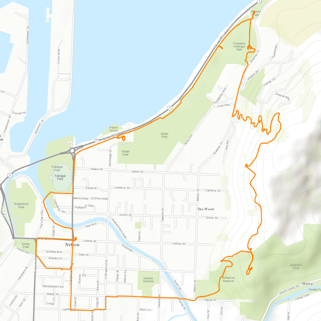
The Tasman Area is the northernmost area of the South Island, covering an area of roughly 10,000km² on the northwestern coast, including the famous Golden Bay, and the 40km long Farewell Spit, which is a long and slender sand beach jutting out into the ocean for apparently no reason. However, there's more to this area than just the bay: The Tasman Area is also a quite mountainous place, and features a number of prominent ranges, some of which are over 2,000m high. Although its less than half the size of the West Coast Area, the Tasman Area houses almost twice as many people, resulting in a population density of 5.1 people per square kilometer (which is roughly that of Kazakhstan).

I'm staying in Takaka, which is just past the Takaka Mountains, in the Takaka Valley formed by the Takaka River (notice a pattern here?). Located at the southeastern end of Golden Bay, this small town is home to just over a thousand people, and is famous for its rock climbing venues.

To be exact, the place I'm staying in is a little ways south of town, on the Central Takaka Road, and only a short walk away from Paynes Ford, which is where many of the famous climbs are located.

This place would be the stage of my...
Autumn Adventure
Three people are already there when I arrive: My new hosts Peter and Pete, as well as Socks, who happens to be another helper like me - or if I should name them from left to right: Peter, Socks and Pete.

During my stay I should also get to meet two other helpers who arrived after me, namely Enrique from Mexico...

...and Hermann, an English-speaking Canadian with a Spanish background (but a German name).

Also, due to the nature of this place, I get to meet a large number of other people, which leads us directly to our next subject...
The Place
I've been in all sorts of places so far. I've stayed in hostels, worked on farms, helped out on private properties as well as lifestyle blocks, a community centre, a tavern, and even a logistics centre for a short time. Yet once again, this place should be completely different, and would probably be outside of some people's comfort zones. Being the crazy fox that I am, however, I don't have a problem helping out here in Autumn Farm, which happens to be a clothes-optional gaymale retreat.

Located on three hectares of land, this place includes several buildings and cabins, as well as a little stream, orchards and a garden. Allow me to show you around.
We the helpers stay in the 6-bed dormitory in the loft, which is occasionally also used by some of the guests(though most of the guests stay in rooms inside the main house, or one of the cabins).

And there's also a number of non-human companions around, for example Missy the duck...
...and a tame eel living in the river. I briefly consider capturing it for my hovercraft, but perish the thought, figuring that Pete would probably be angry with me.
But the most amazing animals inn this place are without a doubt the Fantails. Also known as Piwakawaka in the Māori language, these agile airborne insectivores flit all over the place at ridiculous speeds, and even into the house, where they are welcome guests since they take care of pesky insects.
Occasionally, we get really amazing sunsets over the western mountaintops...

...but we also have our fair share of rainy - and I do mean rainy - days. As a tropical cyclone decides it has seen its share of Australia and continues on to New Zealand, flooding the North Island in the process, we are pelted with several days of bad weather.
Just how bad? Well, there's drizzles and showers; drizzles downpours and showers; drizzles and rain; drizzles showers and rain; drizzles showers downpours and rain; rain showers downpours and rain; rain drizzles rain rain showers and rain; rain downpours rain rain showers rain deluges and rain ...rain rain rain drizzles and rain; rain rain rain rain rain rain percipation rain rain rain, or slightly overcast skies with a lofty warm breeze hailing from temperate northerly winds served with rays of sunlight occasionally filtering through the clouds in a tempting manner and rain. This is especially annoying since the composting toilet is in the next building over.
Fortunately, we have a warm fire going inside most of the time.

After three days straight of rain, the rivers in the area are nearing their capacity limit, and even the little stream in our backyard has more than doubled in width.

But in the end, the persistent rain stops, and a beautiful rainbow arcs across the valley.

Interlude: The Cardinal Strays ~ North to Takaka
During my stay in the Tanaka Valley I should complete a total of four strays - one into each of the four cardinal directions. The first of the four cardinal strays takes me north into the town of Tanaka and back again, with a little sidetracking along the way.

It's a nice day for a walk. It's not too cold, yet the clouds ar blocking out the fiercest rays of the sun while playing whimsically around the peaks of the mountains.

Along the way, I pass a certain red-nosed reindeer sculpture...

...and cross the rushing Takaka River...

...as well as the worlds most pointless pedestrians bridge (now I'll just have to find the world's most pointless car bridge, and we'll call it a set).

It doesn't take me long to reach the town of Takaka...

...where one of my scheduled stops is the local supermarket, since I direly need to restock on some supplies. This time, however, it's not a NewWorld, nor is it a CountDown. It's not a 4Square, and not even a Pack'n'Save, which would be the local chain of discounters. No, the lone super market in this place is a chain by the name of FreshChoice, which I have not seen in any other place so far.

...by the way, has anyone stopped to notice that no matter where you go, the majority of supermarkets always have names that are exactly two syllables long? NewWorld, CountDown, 4Square, FreshChoice, WalMart, Rewe, Lidl, Aldi... Is it the same where you live?
Anyway, on my way through town, I pass a number of interesting places, such as the Dangerous Kitchen (witch regrettably is not ext to a Mad Butcher)...

...as well as the Traders of the Lost Arts.

Eventually, my stray finds its turning point at the banks of the Takaka River, where it merges with the Anatoki River. Here, I do not only find a Geocache, but also a quite majestic tree.

On my way back, I pick a slightly different route, and before long my vulpine curiosity finds a way to sidetrack me as I come across a sign by the side of the road.

Even though I have no intention of going for a dip, my curiosity requires me to investigate anyway, so I follow the path across fields and fences, until I eventually arrive at a sheltered little river bay. I can see how this might be a nice place for a swim, especially if the sun is out to heat up the water.

After that, it's only a short walk back to Autumn Farm. This one might not have been too long of a stray, but it was a nice start.
The Job
There's plenty for me to do here at Autumn Farm, and not all of it is quite so exhausting as splitting firewood with an axe.

For example, I get to harvest apples and quinces...

...before cutting them up...

...and finally cooking them into a lovely compote and putting them into jars.

Then, there's also the combined task of harvesting tasty black potatoes, and re-plating the bed with silverbeet...

...followed by washing them. Neat fox that I am, I also take this opportunity to grade them, while I'm at it.

Next, there's raspberries to be picked and cooked...

...as well as macadamias to be cracked.

The wading pool also needs to be disassembled and cleaned...

...and with this being a hospitality business and all, there are naturally rooms to prepare as well.

And finally, I am sent on a crusade to sally forth and destroy all the cobwebs. Jolly-ho!

Interlude: The Cardinal Strays ~ South across Paynes Ford
The second of my strays should lead me around a circuit starting with Paynes Ford, continuing with a trek across the fields, and finishing with a walk up the East Takaka Road. Curiously, of all the cardinal strays, this should be the lone circular stray, with all the other strays more or less following a back-and-forth pattern.

It starts off by walking down the Central Takaka Road right until the bridge across the Takaka River, where the Panyes Ford Scenic Reserve branches off.

I might already have mentioned it above, but this place is particularly renown among climbers for its paynefully tricky climbs...

...the names of which were obviously devised by the marketing department of the Sirius Cybernetics Corporation (Apart from that, we also have climbs as diverse as the Creese Wall, the Rata Wall, the Rat Trap Wall, the Stone Symposium Wall, the Pantechicon Wall, the Carnage Wall, the Slave Wall, the Little Lost Wall, the Wall of Thugs, the Red Wall, the Fish Wall, the Rhinoceros Wall, and the Happy Hour Boulder). Well, climb and enjoy!

It's not all about the climbs though (which are just a bit to breakneck for me to attempt - after all, I've still got a world to create). The nearby river occasionally forms some interesting inlets...

...and the walk through the unforgettable nostalgic greenery itself is already quite relaxing.

Eventually, I cross a bridge across an endangered wetland...

...and follow a trail between fields and river, which I eventually should learn was created by a local community project, in which among others my hosts Peter and Pete participated.

However, after a while the path simply terminates, and leaves me stranded in the middle of the valley.

So I have little choice but to hike straight across the pastures until I manage to find an overgrown old farm road...

...which eventually takes me to the significantly more well-maintained East Takaka Road.

From here, it's pretty much a straight path back to Autumn Farm, and the only obstacle on my way is a hill crest which needs to be scaled, but in turn gives me a nice overview of the surrounding valley.

The Food
The days at Autumn Farm routinely start with a pretty little bowl of porridge.

Well, it's not all that bad - especially after you pimp my porridge up with some brown sugar, quince-and-apple pickles and cream.

Apart from that, there's a healthy mix of food for lunch an dinner, most of which have in common the inclusion of one of Pete's fabled salads. I'd especially like to praise the tasty Shetland Black Potatoes, which I find to be quite savoury. I'll have to keep a lookout for them in the future.

And then, there's also the opportunity for me to prepare delicious Naleiayafero not only for my hots and the other helpers, but also for some of our guests...

...not to mention my legendary tri-Tail Pizza, which once again delights the taste buds of my companions.

Interlude: The Cardinal Strays ~ West into Rainbow Valley
For my third stray, I set my sights all across the Takaka Valley to the west. I should cross the Takaka River once again, pass by the township of Kotinga, and eventually venture into the Rainbow Valley.

It's a beautiful day for a stray, and the Takaka River shines with the blue of the sky above.

After that, my route leads me down the Long Plains Road...

...and towards the Rainbow Valley in the distance.

On my way there, however, I am unexpectedly confronted with traffic so heavy I have little choice but to pull over and let it pass.
As I walk into Rainbow Valley, I notice how some people have devised adventurous ways to access their properties on the far side of the Anatoki River...

...and others have some unusual free-roaming pets.

Eventually, I reach the end of pavement...

...and proceed into the valley with ..EXTREME CARE!

From here, it's not much further until I reach my turning point. Since I'll have to walk back the entire way, I can go only so far, and even though I didn't get to see a rainbow in the valley, it's nonetheless a beautiful sight to behold - certainly more pretty than certain over-hyped glaciers.

It's about time too, since the sky is closing up, and the sunlight is ever-so-gradually waning.

...so I pass through a number of green tunnels...

...and manage to return to Autumn Farm before the mighty deluge commences.
The Flair
It's not all about the work here on Autumn Farm. For example, every so often we do sit down for a game of Rummikub...

...and I do manage to get not only Peter & Pete to take an interest in Ecchnasi, but also some of our guests.

Unlike me, Enrique travels with his own self-contained van. It my not be a banana-flower van, but it's pretty damn close.

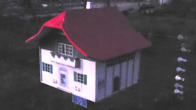
They said the Aytonshaw Family could never use an old microwave as their mailbox. They were wrong!

Although one day, late at night, I discover that someone has quite the opposite approach regarding mailboxes.
At one point as I stray around the landscape, I find myself watched from a fencepost by a little seal...

...and not far from there, I come across what I fancy might be Donald Trump's garden chair - complete with red button.

Interlude: The Cardinal Strays ~ East up Rameka Track
My final stray during my stay on Autumn Farm - and clearly the longest - should take me into the Rameka Valleys, and on an Odyssey up into the mountains.

It starts out by leading me onto a road which is a fine example of New Zealand road design: Up and down the hills in a straight line 'cuz we've got motorized cars, but only one-lane bridges 'cuz we ain't got many of 'em. This mindset results in many roads having an attractive hourglass-figure.

And as I approach the eastern mountains, I once again stop to marvel at the amazing patterns which the clouds paint in the skies at these latitudes - like an artist's feathered brush drawn across an endless canvas of light blue.

Eventually, I reach the beginning of the Rameka Track...

...which among other things is a famous accumulation of mountain bike routes, some of which are apparently spectacularly unsafe.

True enough, I soon come across some of the infamous routes...

...which more often than not have telltale names assigned to them.

On a whim, I choose to follow a trail with a particularly inviting name...

...and soon find myself toiling up the sides of the valley in the full light of the heavens...

...before finally diving into the sweet shade of the trees further up the mountain.

As I ascend further up the track, I eventually catch a glimpse of the Takaka Valley in the distance, although I can never actually see all of it since I'm effectively one row of mountains into the Takaka Range at this point.

Now that I'm almost at the top, I make my way past a lovely thicket of Death Stars, quite grateful that the road is wide enough for me to avoid it...

...and eventually meet with a local, whom I should later also encounter down at Autumn Farm. He gives me directions to a nice vista point with a bench, where I run into a pair of girls.

The introduce themselves as Lana and Grace (who is awesome), and tell me that they were the ones who put up the bench up here in memory of their friend, who died in a tragic hiking accident.

I stay and chat with them for a while before deciding to return back to Autumn Farm, since the photon blaster is already low in the western sky.

Since there are many tracks to choose from, I am able to pick a slightly different route downhill, and soon come across a dangerous tomo, which is the Māori name for a sinkhole. This area is littered with them, since New Zealand's most extensive cave network runs just under these limestone mountains.

Further down the valley, the way back takes me across a little ford, which fortunately is yet quite passable since I've wisely chosen to undertake this particular hike just before the massive rainfalls should strike.

It turns out that I have chosen to turn back not an hour to soon, for the sunlight is gradually fading, casting the valley into darkness...

...and by the time I emerge from the valley's mouth, only a lone, glowing cloud remains as a trace of the mighty orb which used to illuminate the heavens and earth alike.

As night gradually falls, I determinedly make my way across the fields of the valley...

...and eventually, they great orbital sunlight reflector rises across the mountaintops in the east to light my way.

Fortunately, Autumn Farm is not far away, and since my vulpine eyes are quite adept at at seeing in the twilight, I do not even need to retrieve my torchlight, which I wisely packed in my daypack, and manage to safely make my way down the road, and back to my current home.

The Retrospective
Once again, I managed to find a nice enough place to spend my time. Although we had to use a composting toilet and the accommodation was only a shared, cold sleep-out dormitory, the food was regular and plentiful, and the work was varied and interesting. Moreover, Peter and Pete were good hosts, and this time around I didn't run into trouble with any of the other helpers. The facilities were good, and I was able to have a nice bath again for the first time since Outram.

The Road Ahead
Once again, I take the time to prepare a piece of gift artwork for Peter and Pete. One of the rainy days provides me with the perfect opportunity to do so.

As you may know, I tend to discretely inquire about my host's favourite animals during my stay, so that I might use them for my gift artwork. This time, however, something curious has occurred: For the first time since I started this trip, both of my hosts have independently told me their favourite animals - and it turned out to be exactly the same: the cute Fantail. I guess the two of them really are birds of a feather, which provides me with the perfect inspiration to draw this picture, which I present to them shortly prior to my departure.

This time, the journey to my next destination is a trip of extraordinary magnitude.

Just short of 3km, this hike should not even take me a full hour to complete, and as such is by far the shortest leg of my journey thus far.

...although I still manage to run into the day's one and only rain shower along the way. One way or another, I arrive at the place I was summoned to...

...and make myself at home in the caravan which should be my lair for the days to come, eagerly awaiting the things this place should have in store for me.